
English: Maps with some non-language-specific annotation (symbols, numbers, etc.) should also be categorized in Category:Language-neutral maps.
👁 Image
Other blank maps :
- English: You can also find blank maps in the category:SVG maps : by easily deleting the additional SVG format information of those maps you will get rapidly a blank map. See Commons:File types#SVG for more info.
- Español: Pueden encontrar otros mapas mudos en la categoría category:SVG maps. Borrando la información adicional en formato SVG de esos mapas, conseguirán rápidamente un mapa mudo.
- Deutsch: In der Kategorie category:SVG maps findet man ebenfalls eine Reihe von Karten, die nach dem Entfernen der entsprechenden Elemente, sehr einfach in unbeschriftete bzw. leere Karten umgewandet werden können
- Français : Vous pouvez aussi trouver d'autres cartes muettes dans la category:SVG maps : en supprimant facilement les informations additionnelles au format SVG de ces cartes vous obtiendrez rapidement une carte vierge.
- Italiano: È possibile trovare altre cartine mute nella categoria category:SVG maps : eliminando le informazioni aggiuntive del formato SVG (format SVG oppure SVG format) di queste carte otterrete facilmente una cartina muta.
Subcategories
This category has the following 12 subcategories, out of 12 total.
- Blank maps by region (12 C, 2 P)
- Blank maps of the world (11 C, 57 F)
- Blank maps by country (140 C)
- Location maps (10 C, 5 F)
!
- SVG blank maps (10 C, 15 F)
B
- Blank maps by continent (7 C)
- Blank maps of cities (1 C, 78 F)
E
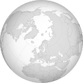
- Maps of Earth's hemispheres – orthographic (5 C, 40 F)
H
- Blank maps showing history (2 C, 1 F)
M
O
- Outline maps (6 C, 22 F)
Pages in category "Blank maps"
This category contains only the following page.
Media in category "Blank maps"
The following 14 files are in this category, out of 14 total.
-
2020 Nagorno-Karabakh war Blank.png 2,560 × 2,024; 672 KB
-
Australasian Antarctic Expedition no lang.png 1,806 × 2,126; 1.25 MB
-
Black Sea map blank.png 2,006 × 1,541; 574 KB
-
BlankMap-World-Atlantic-(1949-1990).svg 553 × 553; 340 KB
-
BlankMap-World-Atlantic.svg 553 × 553; 373 KB
-
Empty Map Pixelart.png 128 × 72; 11 KB
-
EmptyMapsPanel.png 701 × 838; 19 KB
-
Eurasia-centered blank de facto political world map.png 3,367 × 1,176; 86 KB
-
Image of poorly zoomed map in infobox on Larsen Ice Shelf.png 775 × 627; 42 KB
-
Ptolemys first projection.png 1,205 × 997; 2.02 MB
-
Ptolemys second projection.png 1,156 × 1,270; 1.98 MB
-
US-centered blank world map.png 3,878 × 1,176; 102 KB
.jpg)
.jpg)
.svg)