
<nowiki>Heythrop; Heythrop; Heythrop; Heythrop; هیثورپ; Хейтхроп; Heythrop; ہئتھروپ; Heythrop; Heythrop; Heythrop; Heythrop; Heythrop; Heythrop; Heythrop; Heythrop; Heythrop; luech te la Nghiltiera; যুক্তরাজ্যের একটি গ্রাম; localité britannique du comté anglais d'Oxfordshire; plaats in Oxfordshire; Gemeinde in der englischen Grafschaft Oxfordshire; οικισμός του Ηνωμένου Βασιλείου; village and civil parish in West Oxfordshire, England; قرية في المملكة المتحدة; sídlo v hrabství Oxfordshire ve Velké Británii; دوّار ف لمملكة لمتاحدة; Heythrop, Oxfordshire; Heythrop, Oxon</nowiki>
village and civil parish in West Oxfordshire, England | |||||
| Upload media | |||||
| Instance of | |||||
|---|---|---|---|---|---|
| Location | West Oxfordshire, Oxfordshire, South East England, England | ||||
| Population |
| ||||
| 51° 57′ 00″ N, 1° 29′ 27.6″ W | |||||
| |||||
| 👁 Edit infobox data on Wikidata | |||||
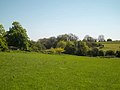
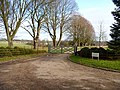
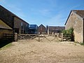
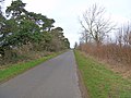
English: Heythrop is a village and civil parish just over east of Chipping Norton. The parish includes the hamlet of Dunthrop.
Subcategories
This category has the following 3 subcategories, out of 3 total.
H
- Heythrop Park (51 F)
N
Media in category "Heythrop"
The following 149 files are in this category, out of 149 total.
-
A tree of two halves on Green Lane - geograph.org.uk - 7853206.jpg 1,066 × 1,600; 648 KB
-
Across the course - geograph.org.uk - 2441908.jpg 4,288 × 3,216; 4.3 MB
-
Along the byway - geograph.org.uk - 2441977.jpg 4,288 × 3,216; 2.11 MB
-
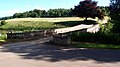
Archer Bridge - geograph.org.uk - 6888779.jpg 1,024 × 576; 178 KB
-
Avenue at Heythrop - geograph.org.uk - 2442207.jpg 4,288 × 3,216; 2.59 MB
-
Back to the edge - geograph.org.uk - 2442065.jpg 4,288 × 3,216; 3.88 MB
-
Black Knap - geograph.org.uk - 2438654.jpg 4,288 × 3,216; 3.76 MB
-
Bridleway leaving Green Lane - geograph.org.uk - 7853069.jpg 1,600 × 1,066; 460 KB
-
Bridleway to Little Tew - geograph.org.uk - 6888712.jpg 1,024 × 576; 180 KB
-
Buggies at Heythrop Park Golf Course - geograph.org.uk - 7453079.jpg 1,024 × 683; 1.07 MB
-
Byway is just a footpath - geograph.org.uk - 2441988.jpg 4,288 × 3,216; 2.88 MB
-
Chivel Farm - geograph.org.uk - 2828404.jpg 4,320 × 3,240; 5.12 MB
-
Cottages at Heythrop - geograph.org.uk - 2442176.jpg 4,288 × 3,216; 2.68 MB
-
Crop spraying - geograph.org.uk - 419277.jpg 640 × 480; 95 KB
-
Down the field - geograph.org.uk - 2440907.jpg 4,288 × 3,216; 4.41 MB
-
Drive up to Heythrop Park Hotel - geograph.org.uk - 6888830.jpg 1,024 × 576; 165 KB
-
Driveway and path - geograph.org.uk - 2828231.jpg 4,320 × 3,240; 4.99 MB
-
Driveway to the smallholding - geograph.org.uk - 2440932.jpg 4,288 × 3,216; 1.97 MB
-
Dunthrop - geograph.org.uk - 350637.jpg 640 × 427; 52 KB
-
Dunthrop Farm (1) - geograph.org.uk - 2442119.jpg 4,288 × 3,216; 955 KB
-
Dunthrop Farm (2) - geograph.org.uk - 2442126.jpg 4,288 × 3,216; 1.28 MB
-
Dunthrop Farm Cottages - geograph.org.uk - 2442146.jpg 4,288 × 3,216; 2.76 MB
-
Dunthrop Road, Heythrop - geograph.org.uk - 7929277.jpg 1,024 × 768; 245 KB
-
Farm track near Park Farm, Heythrop - geograph.org.uk - 7882347.jpg 1,024 × 768; 203 KB
-
Field edge path - geograph.org.uk - 2438632.jpg 4,288 × 3,216; 1.67 MB
-
Five ways to go (4) - geograph.org.uk - 2034330.jpg 4,288 × 3,216; 1.64 MB
-
Five ways to go (5) - geograph.org.uk - 2034333.jpg 4,288 × 3,216; 2.57 MB
-
Footpath meets road - geograph.org.uk - 2440913.jpg 4,288 × 3,216; 2.77 MB
-
Footpath through Fattingfield Copse - geograph.org.uk - 7853203.jpg 1,600 × 1,067; 1.01 MB
-
Footpath to Enstone - geograph.org.uk - 7853058.jpg 1,600 × 1,066; 736 KB
-
Footpath to Enstone - geograph.org.uk - 7853196.jpg 1,600 × 1,066; 617 KB
-
Glyme Farm - geograph.org.uk - 340346.jpg 640 × 427; 115 KB
-
Green and rust - geograph.org.uk - 2440922.jpg 4,288 × 3,216; 1.89 MB
-
Green Lane - geograph.org.uk - 2828377.jpg 4,320 × 3,240; 5.34 MB
-
Green Lane, East Lodge Cottage - geograph.org.uk - 7453097.jpg 1,024 × 683; 1.09 MB
-
Heavy roller - geograph.org.uk - 2441943.jpg 4,288 × 3,216; 1.43 MB
-
Heythrop avenue - geograph.org.uk - 2438164.jpg 4,288 × 3,216; 2.42 MB
-
Heythrop Manor Garden - geograph.org.uk - 7446628.jpg 2,166 × 1,444; 709 KB
-
Heythrop Park - geograph.org.uk - 5027712.jpg 1,600 × 900; 443 KB
-
Heythrop Park golf course (2) - geograph.org.uk - 2756663.jpg 4,320 × 3,240; 4.68 MB
-
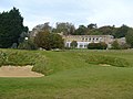
Heythrop Park golf course - geograph.org.uk - 5027705.jpg 1,600 × 900; 540 KB
-
Heythrop Park Golf Course - geograph.org.uk - 7449078.jpg 2,048 × 1,536; 1.05 MB
-
Heythrop Park golf course - geograph.org.uk - 7853054.jpg 1,600 × 1,066; 502 KB
-
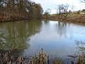
Heythrop Park Lake - geograph.org.uk - 6888793.jpg 1,024 × 576; 148 KB
-
Heythrop Park, East Lodge Cottage - geograph.org.uk - 7453094.jpg 1,024 × 683; 1.13 MB
-
Hide Wood - geograph.org.uk - 2442027.jpg 4,288 × 3,216; 2.73 MB
-
Horse jump - geograph.org.uk - 2442049.jpg 4,288 × 3,216; 1.82 MB
-
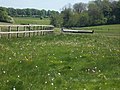
Horse racing circuit - geograph.org.uk - 2441922.jpg 4,288 × 3,216; 4.32 MB
-
House in the wood - geograph.org.uk - 2439438.jpg 4,288 × 3,216; 3.33 MB
-
In Heythrop Park (7) - geograph.org.uk - 2825414.jpg 4,320 × 3,240; 4.87 MB
-
In Heythrop Park (8) - geograph.org.uk - 2826720.jpg 4,320 × 3,240; 4.76 MB
-
In Heythrop Park (9) - geograph.org.uk - 2826722.jpg 4,320 × 3,240; 4.79 MB
-
In the valley - geograph.org.uk - 2439907.jpg 4,288 × 3,216; 1.8 MB
-
In the valley bottom - geograph.org.uk - 2439901.jpg 4,288 × 3,216; 3.28 MB
-
Iron's Copse - geograph.org.uk - 2826744.jpg 4,320 × 3,240; 4.65 MB
-
Lake by the farm - geograph.org.uk - 2439951.jpg 4,288 × 3,216; 4.17 MB
-
Little Tew Grounds Farm - geograph.org.uk - 2828262.jpg 4,320 × 3,240; 4.76 MB
-
Llamas by the footpath - geograph.org.uk - 7853212.jpg 1,600 × 1,066; 476 KB
-
Lonely building (1) - geograph.org.uk - 2442006.jpg 4,288 × 3,216; 4.65 MB
-
Lonely building (2) - geograph.org.uk - 2442018.jpg 4,288 × 3,216; 1.63 MB
-
New construction imminent^ - geograph.org.uk - 2828338.jpg 4,320 × 3,240; 5.13 MB
-
New plantings - geograph.org.uk - 2438670.jpg 4,288 × 3,216; 2.34 MB
-
No way through - geograph.org.uk - 2828349.jpg 4,320 × 3,240; 5.5 MB
-
Out of the park - geograph.org.uk - 2756672.jpg 4,320 × 3,240; 5.23 MB
-
Over the stream - geograph.org.uk - 2756712.jpg 4,320 × 3,240; 5.21 MB
-
Over the stream - geograph.org.uk - 2825242.jpg 4,320 × 3,240; 4.96 MB
-
Oxfordshire countryside - geograph.org.uk - 2442160.jpg 4,288 × 3,216; 2.35 MB
-
Oxfordshire farmland - geograph.org.uk - 2752957.jpg 4,320 × 3,240; 4.91 MB
-
Park Farm (1) - geograph.org.uk - 2438177.jpg 4,288 × 3,216; 1.66 MB
-
Park Farm (2) - geograph.org.uk - 2438181.jpg 4,288 × 3,216; 2.32 MB
-
Park Farm (3) - geograph.org.uk - 2438188.jpg 4,288 × 3,216; 1.29 MB
-
Path and Drive Through Industrial Estate - geograph.org.uk - 6888733.jpg 1,024 × 576; 202 KB
-
Path in the wood - geograph.org.uk - 2438687.jpg 4,288 × 3,216; 3.14 MB
-
Path meets the road - geograph.org.uk - 2828162.jpg 4,320 × 3,240; 5.12 MB
-
Path through Heythrop Park - geograph.org.uk - 7853065.jpg 1,600 × 1,066; 576 KB
-
Path through Heythrop Park, near Chipping Norton - geograph.org.uk - 6568679.jpg 1,024 × 768; 174 KB
-
Path through Heythrop Park, near Chipping Norton - geograph.org.uk - 6568684.jpg 1,024 × 768; 201 KB
-
Path through Heythrop Park, near Chipping Norton - geograph.org.uk - 6568693.jpg 1,024 × 768; 272 KB
-
Path to Southcombe - geograph.org.uk - 6889022.jpg 1,024 × 576; 175 KB
-
Path up to Green Lane - geograph.org.uk - 6888746.jpg 1,024 × 576; 201 KB
-
Priory Cottages - geograph.org.uk - 2440918.jpg 4,288 × 3,216; 2.37 MB
-
Priory Farm - geograph.org.uk - 2439949.jpg 4,288 × 3,216; 1.36 MB
-
Priory Road - geograph.org.uk - 6888996.jpg 1,024 × 576; 167 KB
-
Public footpath near Chipping Norton - geograph.org.uk - 6568669.jpg 1,024 × 768; 321 KB
-
Restricted Byway heading to the Banbury Road - geograph.org.uk - 6889056.jpg 1,024 × 576; 198 KB
-
Road junction - geograph.org.uk - 1323957.jpg 640 × 480; 63 KB
-
Road to Chipping Norton close to Black Knap - geograph.org.uk - 7929292.jpg 1,024 × 768; 265 KB
-
Road to Heythrop - geograph.org.uk - 6889009.jpg 1,024 × 576; 182 KB
-
Road to Heythrop with wide verge - geograph.org.uk - 7882343.jpg 1,024 × 768; 200 KB
-
Road to Heythrop Zoo - geograph.org.uk - 7449152.jpg 2,048 × 1,536; 1.04 MB
-
Start of bridleway - geograph.org.uk - 2828387.jpg 4,320 × 3,240; 4.92 MB
-
Start of footpath - geograph.org.uk - 2438184.jpg 4,288 × 3,216; 2.41 MB
-
Start of path (1) - geograph.org.uk - 2828413.jpg 4,320 × 3,240; 4.98 MB
-
Start of path (2) - geograph.org.uk - 2828421.jpg 4,320 × 3,240; 5.03 MB
-
Straight avenue - geograph.org.uk - 2438170.jpg 4,288 × 3,216; 2.43 MB
-
Straight line missions Banner.jpg 4,221 × 603; 652 KB
-
Straight road - geograph.org.uk - 2442212.jpg 4,221 × 2,693; 2.12 MB
-
Talbot Hall - geograph.org.uk - 5027691.jpg 1,600 × 900; 470 KB
-
The Lodge, Heythrop - geograph.org.uk - 7882327.jpg 1,024 × 768; 180 KB
-
The road to Heythrop - geograph.org.uk - 2442156.jpg 4,288 × 3,216; 2.77 MB
-
Three ways to go (1) - geograph.org.uk - 2825251.jpg 4,320 × 3,240; 4.96 MB
-
Three ways to go (2) - geograph.org.uk - 2825253.jpg 3,240 × 4,320; 4.76 MB
-
Three ways to go (3) - geograph.org.uk - 2825357.jpg 4,320 × 3,240; 4.97 MB
-
Three ways to go (4) - geograph.org.uk - 2825362.jpg 4,320 × 3,240; 5.11 MB
-
Towards the woodland - geograph.org.uk - 2438677.jpg 4,288 × 3,216; 3.58 MB
-
Towards the Zoological Gardens - geograph.org.uk - 2826753.jpg 4,320 × 3,240; 4.69 MB
-
Track down to the lake - geograph.org.uk - 7853208.jpg 1,600 × 1,066; 443 KB
-
Track near Heythrop Park, near Chipping Norton - geograph.org.uk - 6558541.jpg 1,024 × 768; 182 KB
-
Track near Heythrop Park, near Chipping Norton - geograph.org.uk - 6558543.jpg 1,024 × 768; 201 KB
-
Track to Heythrop Park - geograph.org.uk - 7929284.jpg 1,024 × 768; 142 KB
-
Track to Heythrop Park Hotel - geograph.org.uk - 7853056.jpg 1,600 × 1,067; 808 KB
-
Track to the park - geograph.org.uk - 2438159.jpg 4,288 × 3,216; 1.59 MB
-
Tree Lined Avenue - geograph.org.uk - 6889042.jpg 1,024 × 576; 218 KB
-
Up the valley - geograph.org.uk - 2439931.jpg 4,288 × 3,216; 4.82 MB
-
View from the Heythrop Park hill - geograph.org.uk - 6647352.jpg 1,833 × 1,031; 288 KB
-
View of Priory Wood - geograph.org.uk - 7929293.jpg 1,024 × 768; 187 KB
-
View towards Heythrop Park - geograph.org.uk - 5027720.jpg 1,600 × 900; 529 KB
-
Village phone box - geograph.org.uk - 2442183.jpg 3,216 × 4,288; 2.18 MB
-
Vista from the house at Heythrop Park - geograph.org.uk - 4775684.jpg 6,000 × 4,000; 3.41 MB
-
Wall rebuild - geograph.org.uk - 2438662.jpg 4,288 × 3,216; 1.69 MB
-
West Wood - geograph.org.uk - 2826740.jpg 4,320 × 3,240; 4.72 MB
-
Westwood House - geograph.org.uk - 7853060.jpg 1,600 × 1,066; 475 KB
-
Westwood House, Heythrop Park - geograph.org.uk - 7449144.jpg 2,048 × 1,536; 1.09 MB
-
Westwood in the park - geograph.org.uk - 2826746.jpg 4,320 × 3,240; 4.83 MB
-
Wheat field near Southcoombe - geograph.org.uk - 31432.jpg 640 × 480; 157 KB
-
Wheatfield Copse - geograph.org.uk - 2828358.jpg 4,320 × 3,240; 4.44 MB
-
Windrush Hall (1) - geograph.org.uk - 2825248.jpg 4,320 × 3,240; 5.09 MB
-
Windrush Hall (2) - geograph.org.uk - 2825249.jpg 4,320 × 3,240; 5.78 MB
-
A361 two-mile straight - geograph.org.uk - 350530.jpg 640 × 427; 90 KB
-
Bend in track near Miller's Barn - geograph.org.uk - 340352.jpg 640 × 427; 73 KB
-
Chivel Farm - geograph.org.uk - 419295.jpg 640 × 480; 104 KB
-
Dead tree - geograph.org.uk - 419287.jpg 480 × 640; 102 KB
-
Foxberry Wood - geograph.org.uk - 419280.jpg 640 × 480; 119 KB
-
Golf Course at Southcoombe - geograph.org.uk - 31435.jpg 640 × 480; 144 KB
-
Harris's Bottom - geograph.org.uk - 415556.jpg 640 × 480; 139 KB
-
Looking towards Park Farm - geograph.org.uk - 415554.jpg 640 × 480; 123 KB
-
Old Chalford - geograph.org.uk - 340358.jpg 640 × 427; 67 KB
-
Ride, with horserider - geograph.org.uk - 415553.jpg 480 × 640; 145 KB
-
Road near Black Knap wood - geograph.org.uk - 350532.jpg 640 × 427; 91 KB
-
Road to Dunthrop - geograph.org.uk - 350626.jpg 640 × 427; 45 KB
-
Ruin in copse - geograph.org.uk - 340349.jpg 640 × 427; 91 KB
-
Track to Magpie Farm - geograph.org.uk - 390235.jpg 640 × 427; 132 KB
-
Valley between Heythrop and Dunthrop - geograph.org.uk - 419294.jpg 640 × 480; 118 KB
-
Wheatfield Copse - geograph.org.uk - 415560.jpg 640 × 480; 89 KB
_-_geograph.org.uk_-_2442119.jpg)
_-_geograph.org.uk_-_2442126.jpg)
_-_geograph.org.uk_-_2034330.jpg)
_-_geograph.org.uk_-_2034333.jpg)
_-_geograph.org.uk_-_2756663.jpg)
_-_geograph.org.uk_-_2825414.jpg)
_-_geograph.org.uk_-_2826720.jpg)
_-_geograph.org.uk_-_2826722.jpg)
_-_geograph.org.uk_-_2442006.jpg)
_-_geograph.org.uk_-_2442018.jpg)
_-_geograph.org.uk_-_2438177.jpg)
_-_geograph.org.uk_-_2438181.jpg)
_-_geograph.org.uk_-_2438188.jpg)
_-_geograph.org.uk_-_2828413.jpg)
_-_geograph.org.uk_-_2828421.jpg)
_-_geograph.org.uk_-_2825251.jpg)
_-_geograph.org.uk_-_2825253.jpg)
_-_geograph.org.uk_-_2825357.jpg)
_-_geograph.org.uk_-_2825362.jpg)
_-_geograph.org.uk_-_2825248.jpg)
_-_geograph.org.uk_-_2825249.jpg)