
English: Ible (pronounced 'eyebull', or 'ib-ull') is a hamlet and civil parish in Derbyshire, England, just within the Peak District National Park.
<nowiki>Ible; Ible; Ible; Ible; Ible; Ible; Ible; Ible; Ible; Ибле; Ible; Weiler im Vereinigten Königreich; hamlet and civil parish in Derbyshire Dales district, Derbyshire, England; hameau britannique; hamlet and civil parish in Derbyshire Dales district, Derbyshire, England; plaats in Derbyshire; Ible, Derbyshire</nowiki>
hamlet and civil parish in Derbyshire Dales district, Derbyshire, England | |||||
| Upload media | |||||
| Instance of | |||||
|---|---|---|---|---|---|
| Location | Derbyshire Dales, Derbyshire, East Midlands, England | ||||
| Population |
| ||||
| 53° 06′ 39.6″ N, 1° 37′ 48″ W | |||||
| |||||
| 👁 Edit infobox data on Wikidata | |||||
.jpg)
Subcategories
This category has only the following subcategory.
G
- Grangemill, Derbyshire (1 C, 26 F)
Media in category "Ible"
The following 67 files are in this category, out of 67 total.
-
A5012 in Hopton Wood - geograph.org.uk - 8045693.jpg 1,024 × 768; 197 KB
-
A5012 towards Grangemill - geograph.org.uk - 3997017.jpg 640 × 480; 126 KB
-
Across the fields to Ible - geograph.org.uk - 1625278.jpg 640 × 479; 88 KB
-
At Whitelow Farm - geograph.org.uk - 4076587.jpg 2,592 × 1,944; 2.73 MB
-
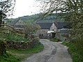
Beeches Farm, Ible - geograph.org.uk - 4964254.jpg 1,800 × 1,350; 618 KB
-
Butterfly and Thistles - geograph.org.uk - 4076604.jpg 2,300 × 1,880; 1.23 MB
-
Cottage on the A5012 - geograph.org.uk - 3997020.jpg 640 × 480; 77 KB
-
Countryside north of Ible - geograph.org.uk - 2894502.jpg 1,024 × 757; 225 KB
-
Cow Pasture near Ible - geograph.org.uk - 3157699.jpg 640 × 427; 220 KB
-
Derbyshire UK parish map highlighting Ible.svg 888 × 1,308; 2.34 MB
-
Derelict Farmhouse - geograph.org.uk - 7029311.jpg 1,024 × 1,024; 486 KB
-
Farm buildings above Grange Dale - geograph.org.uk - 7703308.jpg 1,024 × 768; 278 KB
-
Farmland north of Ible - geograph.org.uk - 2894488.jpg 1,024 × 741; 234 KB
-
Grange Dale - geograph.org.uk - 7702984.jpg 1,024 × 768; 329 KB
-
Grange Dale - geograph.org.uk - 7703307.jpg 1,024 × 768; 344 KB
-
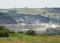
Grange Mill Quarry from the air - geograph.org.uk - 4601095.jpg 640 × 480; 143 KB
-
Grange Mill Quarry from the air - geograph.org.uk - 4601096.jpg 480 × 640; 141 KB
-
Grangemill from the east - geograph.org.uk - 4964251.jpg 1,800 × 1,350; 569 KB
-
Grangemill Quarry viewed from Whitelow Farm - geograph.org.uk - 4076595.jpg 2,504 × 1,789; 1.66 MB
-
Grass field near Whitecliife Farm - geograph.org.uk - 7703263.jpg 1,024 × 768; 197 KB
-
Highland cattle in a muddy field - geograph.org.uk - 3266974.jpg 800 × 533; 131 KB
-
Hollowchurch Way - geograph.org.uk - 5182674.jpg 1,280 × 960; 773 KB
-
Hopping - geograph.org.uk - 5017985.jpg 4,780 × 3,375; 1.52 MB
-
House in Ible - geograph.org.uk - 4076607.jpg 2,592 × 1,944; 2.31 MB
-
Idle in Ible - geograph.org.uk - 4076615.jpg 1,944 × 2,592; 2.74 MB
-
In Griffe Grange Valley - geograph.org.uk - 4077271.jpg 2,592 × 1,944; 2.96 MB
-
Junction at the end of Tophill Lane - geograph.org.uk - 1393291.jpg 640 × 480; 58 KB
-
Lane junction for Ible - geograph.org.uk - 2894518.jpg 1,024 × 692; 265 KB
-
Lane passing Whitelow Farm - geograph.org.uk - 1392708.jpg 640 × 480; 80 KB
-
Lane through Ible (geograph 2894505).jpg 1,024 × 768; 279 KB
-
Old troughs, Ible - geograph.org.uk - 4964256.jpg 1,800 × 1,350; 732 KB
-
Path into Via Gellia - geograph.org.uk - 4964265.jpg 1,800 × 1,350; 480 KB
-
Path to Via Gellia - geograph.org.uk - 4964279.jpg 1,800 × 1,350; 925 KB
-
Pond at Leys Farm - geograph.org.uk - 7393078.jpg 1,600 × 1,200; 759 KB
-
Prospect Quarry - geograph.org.uk - 3266967.jpg 800 × 533; 89 KB
-
Remains of Lode Mill - geograph.org.uk - 1183788.jpg 640 × 480; 111 KB
-
Roadside pond near Whitecliffe Farm - geograph.org.uk - 7703306.jpg 1,024 × 768; 317 KB
-
Ruined barn near Leys - geograph.org.uk - 272407.jpg 640 × 480; 119 KB
-
Stream beside the A5012 - geograph.org.uk - 3997016.jpg 480 × 640; 140 KB
-
Stream discharge point - geograph.org.uk - 7944972.jpg 1,024 × 768; 394 KB
-
The A5018 by Hopton Wood - geograph.org.uk - 1951904.jpg 4,592 × 3,056; 4.17 MB
-
The Twelve Apostles - geograph.org.uk - 5771659.jpg 2,048 × 1,536; 1.58 MB
-
Tophill Farm - geograph.org.uk - 2894492.jpg 1,024 × 768; 250 KB
-
Tophill Farm - geograph.org.uk - 5017984.jpg 5,184 × 3,456; 1.68 MB
-
Tophill Lane - geograph.org.uk - 1393094.jpg 640 × 480; 133 KB
-
Tophill Lane below the farm - geograph.org.uk - 2894494.jpg 1,024 × 768; 320 KB
-
Tophill Lane view of Whitelow Farm - geograph.org.uk - 1393283.jpg 640 × 480; 97 KB
-
Towards Whitelow Farm - geograph.org.uk - 1529697.jpg 640 × 480; 152 KB
-
Track to Whitecliffe Farm - geograph.org.uk - 7702989.jpg 1,024 × 768; 258 KB
-
Twelve Apostles - geograph.org.uk - 5771655.jpg 2,048 × 1,536; 1.56 MB
-
Valley side fields below Ible - geograph.org.uk - 2894510.jpg 1,024 × 768; 346 KB
-
Via Gellia - geograph.org.uk - 4964286.jpg 1,800 × 1,350; 605 KB
-
Via Gellia through the trees - geograph.org.uk - 3266979.jpg 533 × 800; 142 KB
-
Walking in the rain.... - geograph.org.uk - 3265784.jpg 4,000 × 2,248; 1.79 MB
-
Whitelow Farm - geograph.org.uk - 1413820.jpg 640 × 480; 75 KB
-
Whitelow Farm - geograph.org.uk - 3157739.jpg 640 × 427; 280 KB
-
Whitelow Farm - geograph.org.uk - 5018415.jpg 5,109 × 3,095; 1.94 MB
-
Whitelow Farm - geograph.org.uk - 814634.jpg 640 × 480; 107 KB
-
Whitelow Farm seen from Tophill Lane - geograph.org.uk - 3445827.jpg 3,806 × 2,720; 2.87 MB
-
Whitelows Farm - geograph.org.uk - 7029304.jpg 768 × 1,024; 314 KB
-
Winter tree - geograph.org.uk - 3266978.jpg 600 × 800; 121 KB
-
Woodland, Griffe Grange Valley - geograph.org.uk - 3997009.jpg 478 × 640; 133 KB
-
Woodside - geograph.org.uk - 3266977.jpg 800 × 533; 86 KB
-
Woodside Farm - geograph.org.uk - 3265778.jpg 4,000 × 2,248; 1.57 MB
-
Woodside Farm, Ible - geograph.org.uk - 4964271.jpg 1,800 × 1,350; 560 KB
_-_Passing_through_Hopton_Wood_-_geograph.org.uk_-_1000627.jpg)