
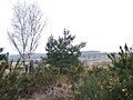
English: Longcross is a small village in Surrey, England. Situated between Virginia Water, Chertsey and Chobham, it consists of a number of houses spread out along Longcross Road (the B386) and a few subsidiary roads. It formed part of the former Chertsey Urban District.
<nowiki>ロングクロス; Longcross; Longcross; Longcross; Longcross; Longcross; Longcross; যুক্তরাজ্যের একটি গ্রাম; village britannique; dorp in Verenigd Koninkrijk; селище в Обединено кралство Великобритания и Северна Ирландия; kylä Yhdistyneessä kuningaskunnassa; village in Surrey, England, UK; قرية في المملكة المتحدة; οικισμός του Ηνωμένου Βασιλείου; دوّار ف لمملكة لمتاحدة; Longcross, Surrey</nowiki>
village in Surrey, England, UK | |||||
| Upload media | |||||
| Instance of | |||||
|---|---|---|---|---|---|
| Location | Runnymede, Surrey, South East England, England | ||||
| Population |
| ||||
| 51° 22′ 40.8″ N, 0° 35′ 06″ W | |||||
| |||||
| 👁 Edit infobox data on Wikidata | |||||
Subcategories
This category has the following 4 subcategories, out of 4 total.
B
L
- Christ Church, Longcross (1 C, 7 F)
- Longcross railway station (12 F)
Media in category "Longcross"
The following 21 files are in this category, out of 21 total.
-
Chobham Common - geograph.org.uk - 137444.jpg 640 × 480; 78 KB
-
Chobham Common - geograph.org.uk - 137445.jpg 640 × 480; 69 KB
-
Chobham Common - geograph.org.uk - 137447.jpg 640 × 480; 71 KB
-
Emmett's Mill - geograph.org.uk - 166257.jpg 640 × 480; 473 KB
-
Fan Court Farm - geograph.org.uk - 131358.jpg 480 × 640; 90 KB
-
Southern Vectis 710 TIL 6710.JPG 1,734 × 1,152; 1.86 MB
-
The entrance to Queenwood - geograph.org.uk - 73390.jpg 640 × 480; 134 KB
-
Burma Road - geograph.org.uk - 73334.jpg 640 × 480; 145 KB
-
Chobham Common - geograph.org.uk - 137446.jpg 640 × 480; 63 KB
-
Chobham Common - geograph.org.uk - 137449.jpg 480 × 640; 112 KB
-
Chobham Common - geograph.org.uk - 140875.jpg 640 × 480; 129 KB
-
Dunstall Green - geograph.org.uk - 166238.jpg 640 × 480; 324 KB
-
Entrance to MOD Chertsey - geograph.org.uk - 73331.jpg 640 × 480; 111 KB
-
Footpath to Harrow Bottom - geograph.org.uk - 133577.jpg 540 × 640; 191 KB
-
Gracious Pond Road - geograph.org.uk - 73381.jpg 640 × 480; 163 KB
-
Larkenshaw - geograph.org.uk - 166148.jpg 640 × 480; 308 KB
-
Westways Farm - geograph.org.uk - 73379.jpg 640 × 480; 151 KB
-
Woodland at Stanners Hill - geograph.org.uk - 166235.jpg 640 × 480; 496 KB