|
|
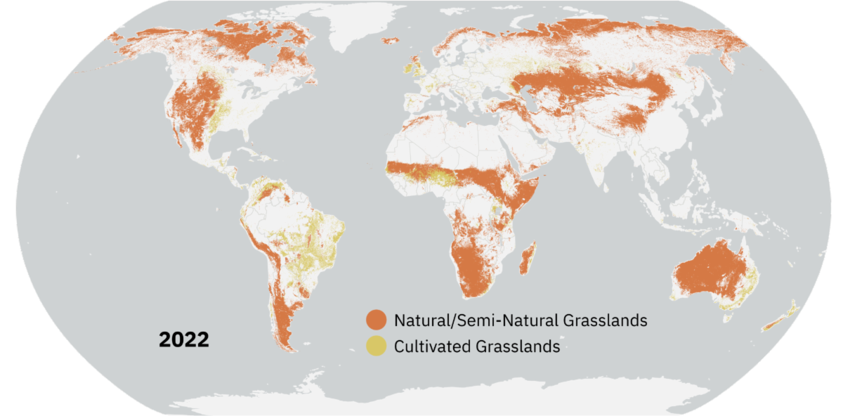
Grasslands tend to get left out of conservation discussions. New research from the World Resources Institute maps how they’ve changed over the past 20 years. | | |
|
|
February 21, 2021
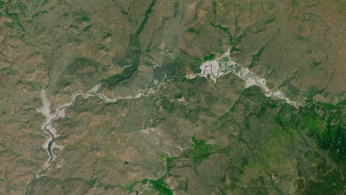
Undamming the Klamath
Between October 2023 and October 2024, the four dams of the Klamath Hydroelectric Project were taken down, opening more than 400 miles of salmon habitat.
| | |
|
|
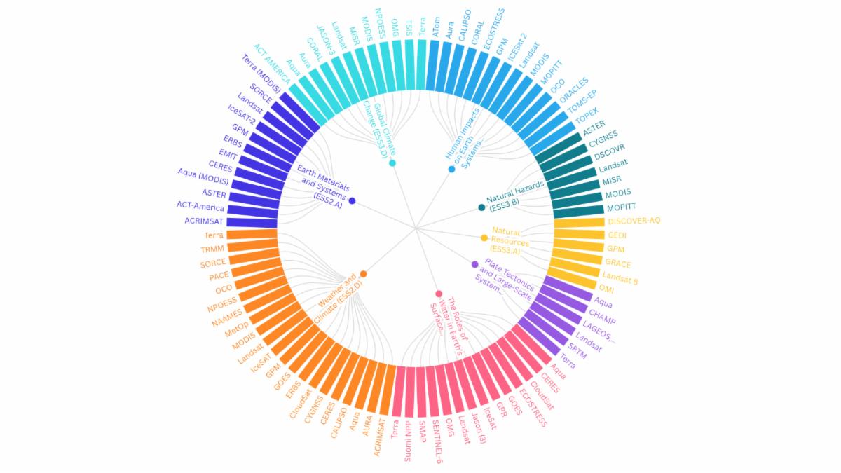
February 20, 2025
Landsat for the Next Generation
NASA’s Science Activation team has created a graphic to help K-12 teachers find out which NASA Earth Science missions can provide real-world data most relevant to their Next Generation Science-based lessons.
| |
|
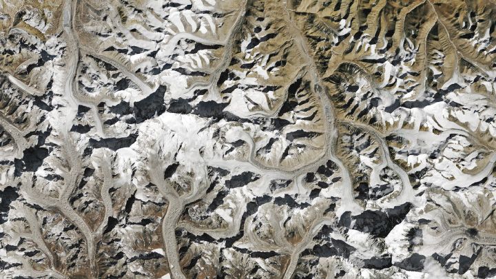
PUBLICATION SPOTLIGHT
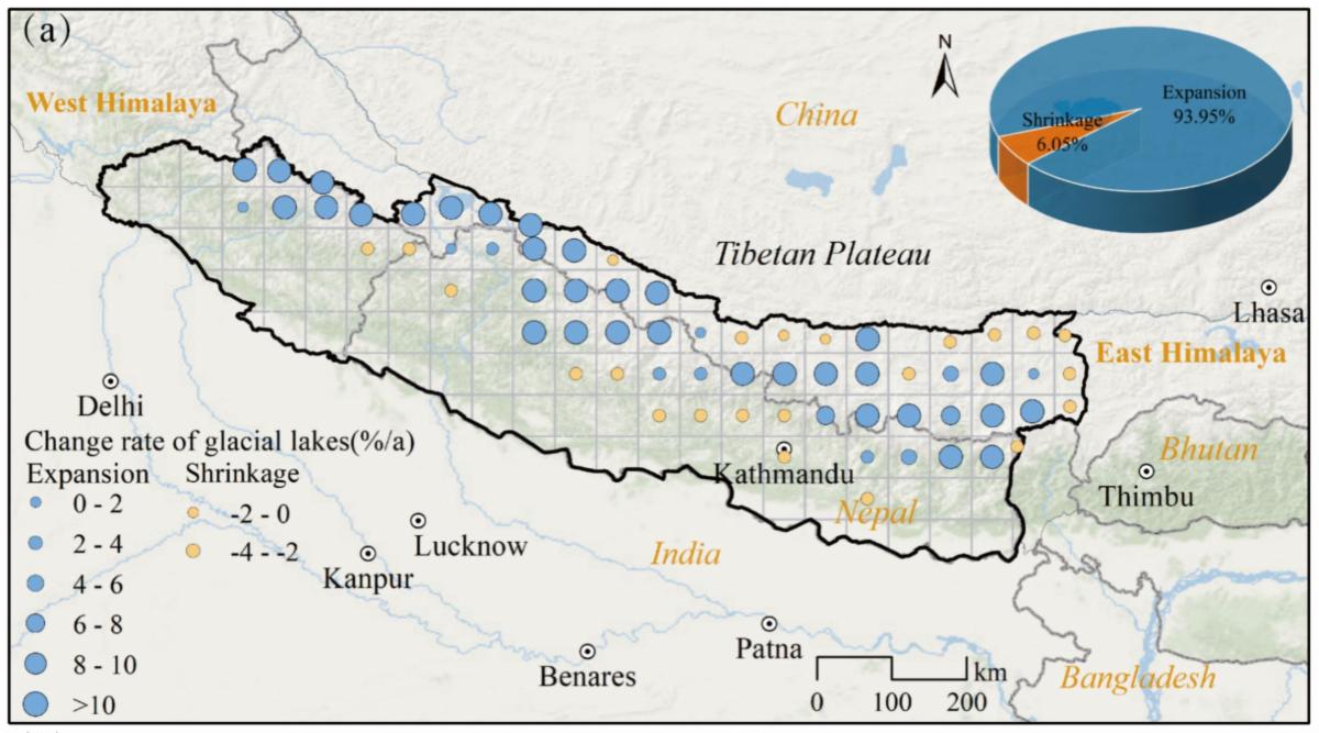
|Cheng et al. 2025
The central Himalayas is a land of towering glacier-clad mountains, a cold, high-elevation portion of the Tibetan Plateau, or “third pole.” Warming temperatures associated with global climate change have recently accelerated glacier retreat in the region resulting in an expansion of glacial lakes. This shift has increased the risk of disasters caused by ice and rock avalanches and glacial lake outburst floods. Using Landsat and Sentinel-2 data within Google Earth Engine, Cheng et al. have documented the shifts in geographical distribution, growth, and flood risks associated with these glacial lakes between 1990 and 2020. Their innovative methodology uses the enhanced normalized difference water index and dynamic thresholding to define glacial lake boundaries automatically and precisely, mitigating problems associated with cloud cover and other data noise sources. Findings show that most glacial lakes in this region are on the China-Nepal border at an elevation of 3600–5900 meters. There has been a proliferation of small glacier lake formation since the 1990s, with 847 new lakes formed by glacial meltwater. Flood events caused by glacial lakes outbursts (which occur most frequently in June and August and have been increasing since 1950) show an accelerated incidence rate since 1990. The researchers found a correlation between the rate of glacial lake expansion and the likelihood of a flooding event—an important hazard assessment variable that can inform the development of mitigation strategies to protect downstream populations.
| A map of the central Himalayas showing where glacial lakes have expanded and where they have contracted between 1990 to 2020. Image credit:Cheng et al., 2025 | | |
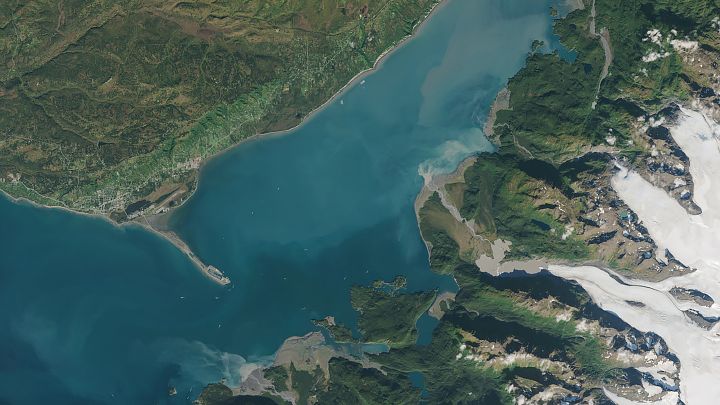
February 25, 2025
The Cloudy Waters of Kachemak Bay
Bits of pulverized rock carried by Alaska’s glacial streams into the shallow, productive estuary transform the bay’s color and can affect some types of marine life.
| |
|
February 19, 2025
Floods Swamp Tennessee
A storm system that swept through the U.S. Southeast brought damaging winds, torrential rain, and destructive flash floods to several communities in the region.
| |
|
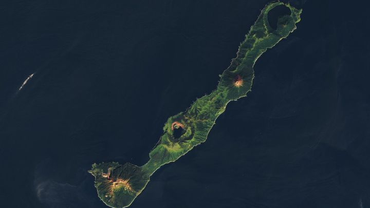
February 5, 2025
Nested Calderas of Zavaritskogo
Tucked away on a remote island in the Pacific, the volcano has recently been pinpointed as the likely source of a sunlight-dimming eruption.
| |
| |
|
|
The annual NASA Spinoff publication created by the Technology Transfer Program highlights how new NASA technologies and innovations benefit society.
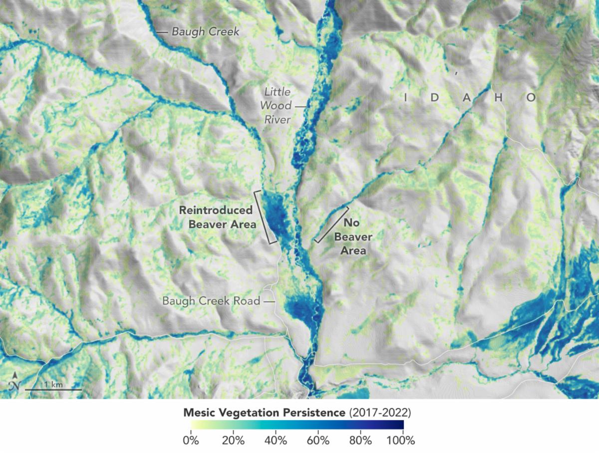
An article in Spinoff 2025 explores how beavers and scientists work together to mitigate drought and wildfire. Researchers used NASA Earth observations from Landsat to monitor impacts of beaver restoration on water availability in drought-prone ecosystems.
+ Eager Beavers
| | | | |
