|
|
The iconic trees and shrubs of the Florida Everglades are under increased stress due to more frequent, intense hurricanes. A team of researchers (Yang et al., 2024) used Landsat to analyze over 20 years of mangrove condition data, tracking how their ability to recover has declined. | | |
|
|
January 2, 2025
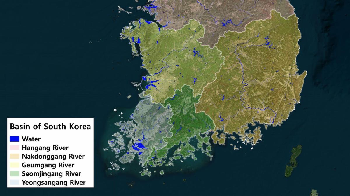
Monitoring Water Quality in South Korea
South Korea is facing a water quality problem. Researchers Hyunglok Kim and Seongjun Lee from the Gwangju Institute of Science and Technology (GIST) embarked on developing a model to predict water quality indicators in near real-time.
| | |
|
|
December 2, 2024
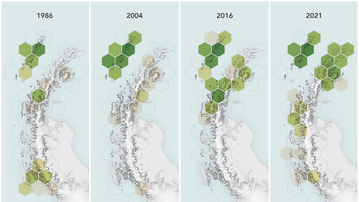
Satellites Reveal a Greener Antarctic Peninsula
Source: Lindsey Doermann, NASA's Earth Observatory
An analysis of 35 years of Landsat data (Roland et al., 2024) shows an Antarctic with far more greenery than it had in the past. Scientists are beginning to unravel what comes next, after the ice moves out and vegetation moves in.
| | |
|
|
December 20, 2024
SPACE OUTwith Landsat
In this new special from NASA+, sit back and relax as Landsat takes you around the world. Soar above the towering cliffs of the Grand Canyon, catch the seasons changing in the Appalachian Mountains and watch as the Indus River crests its banks, all part of the vast archive of Landsat imagery.
| | |
|
|
December 24, 2024
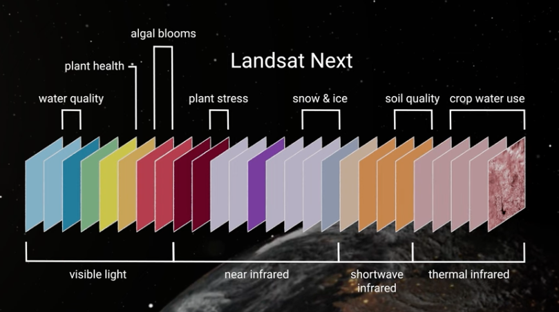
Landsat at AGU24
At AGU24, NASA and USGS Project Scientists convened two sessions on “Emerging Science Applications of Landsat Data,” which explored potential uses of Landsat Next's 26 bands. At the NASA booth, the Landsat Outreach team educated attendees about the benefits of Landsat data.
| |
|
PUBLICATION SPOTLIGHT
Multi-Decadal Collapse of East Antarctica’s Conger–Glenzer Ice Shelf
|Walker et al., 2024
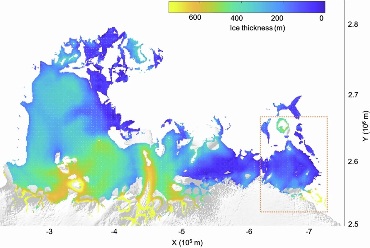
Antarctica is rapidly melting into the ocean. Thus far, most of that melting has come from West Antarctica and the Antarctic Peninsula, which together have the potential to raise sea level by about 5.5 m (or 18 feet). The East Antarctic Ice Sheet, meanwhile, holds 10 times as much ice, and its melting adds a lot of uncertainty to sea level rise predictions. Walker et. altracked the evolution and eventual collapse of the Conger-Glenzer Ice Shelf in East Antarctica from 1997-2000 using data from several satellites including Landsat 1-9. Researchers used imagery from Landsat 1-9 and Sentinel 1-3 to visually inspect the extent of the ice shelf, and used ICESat to track surface elevation, helping to measure thinning over time. The collapse of the Conger-Glezer Ice Shelf in 2022 was the first major ice shelf collapse observed in East Antarctica.
| Shackleton Ice Shelf (SIS) thickness from 1994-1995, prior to the Conger-Glenzer Ice Shelf separating from the main SIS. The location of the Conger-Glenzer Ice Shelf is shown in orange box. Image credit:Walker et al., 2024 | | |
December 31, 2024
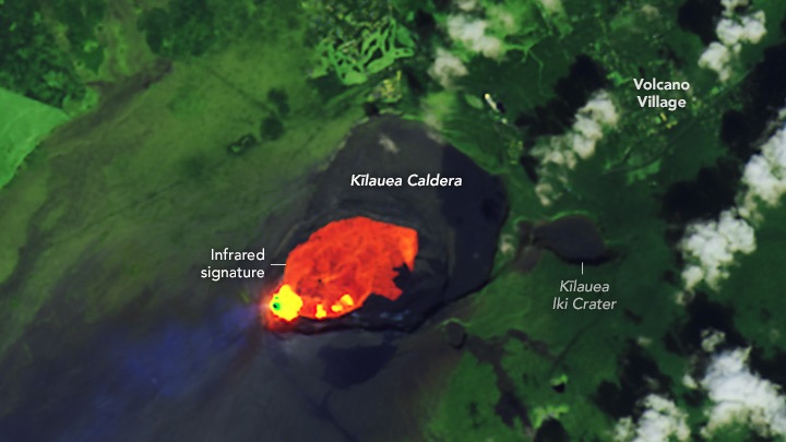
A Fiery Display at Kīlauea
Fountains of lava burst from the Hawaiian volcano’s summit caldera during a December 2024 eruption.
| |
|
December 24, 2024
Caving Clouds
Airplanes passing through supercooled water droplets cause cavum, or hole-punch clouds.
| |
| |
|
|
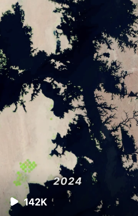
Landsat & Lake Nasser
An Instagram reel posted on the @nasaearthaccount highlighted Egypt's Lake Nasser, one of the world’s largest man-made lakes. The time series of Landsat satellite images shows Lake Nasser’s transformation between 1972 and 2024.
The lake’s water levels fluctuate dramatically due to the region’s arid climate and seasonal rainfall. High evaporation rates in the dry season can cause the lake to shrink, while flooding seasons can bring the water levels to a high point.
+Get reel
| | | | |
