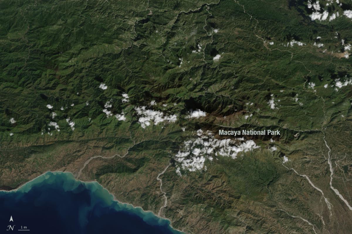
| | Haiti lost nearly half of its primary forests—often called old-growth forests—between 1996 and 2022, according to Hong et al., 2025, published in Remote Sensing of Environment that analyzed nearly 30 years of Landsat imagery. The Dominican Republic, which shares an island with Haiti, lost around 20.5% of its primary forest during the same period. | | | | |
April 9, 2025
Data Wrangling with Dana Ostrenga
Data interoperability expert Dana Ostrenga explains how government and commercial Earth observation satellites provide broader support to the scientific community when used together.
| | The Landsat Public Engagement Team will be participating in the following event in May 2025: | | |
PUBLICATION SPOTLIGHT
The Harmonized Landsat and Sentinel-2 version 2.0 surface reflectance dataset
|Ju et al., 2025
In the July issue of Remote Sensing of Environment, a team of researchers unveiled the Harmonized Landsat and Sentinel-2 (HLS) version 2.0 surface reflectance dataset and algorithms (Ju et al., 2025). The team included seven NASA co-authors, members of the 2018-2023 Landsat Science Team, and the European Space Agency. HLS V2.0 was completed in summer 2023 and now the full dataset is available in Google Earth Engine and AWS, offering 30m data at near-global coverage from 2013. Compared with HLS V1.4, the most recent publicly available HLS product, HLS V2.0 has improvements in atmospheric correction, cloud masking, and bidirectional reflectance distribution function (BRDF) correction. HLS V2.0 also extends to near-global coverage (excluding Antarctica)—as compared with V1.4, which covered only about 30% of the land surface—and integrates Landsat 8, 9, and Senintel-2 A, B and C. In 2022, the first whole year where two Landsat and two Sentinel-2 satellites were collecting data, HLS data had a 1.6 day repeat frequency and a global median of 66 cloud-free observations, a substantial improvement on using data from only Landsat or only Sentinel satellites.
| Quarterly and annual number of cloud-free 30-m Harmonized Landsat and Sentinel-2 (HLS) observations in 2022. On average, the area with the lowest observations is around the equator. Credit:Ju et al., 2025 | | |
April 19, 2025
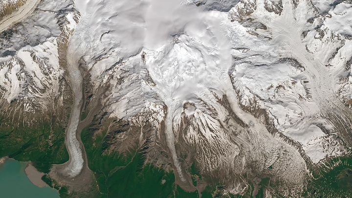
Stirrings at Mount Spurr
Despite its stately and serene appearance, the Alaskan volcano has shown signs of activity since spring 2024.
| | |
April 10, 2025
Building out Chattanooga
Signs of urban expansion cover parts of Tennessee’s “scenic city,” which is nestled along the meandering Tennessee River.
| | | | | |
William T. Pecora award nominations are now being accepted until May 30, 2025.
Sponsored jointly by the DOI and NASA, the Pecora Award is presented annually to individuals or teams using satellite or aerial remote sensing that make outstanding contributions toward understanding the Earth.
The award was established in 1974 to honor the memory of Dr. William T. Pecora, former Director of the U.S. Geological Survey and Under Secretary, Department of the Interior.
+ Submit a nomination
| | | | |
