|
|
March 31, 2024
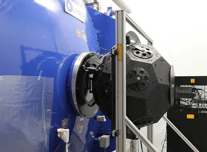
Landsat 9's OLI-2 instrument was characterized in unprecedented detail using a new laser-based method of in-band spectral response testing. The relative spectral response dataset and pre-launch testing details have been published in Barsi et al., 2024.
| | |
|
March 29, 2024
Landsat outreach supported the NASA booth at the National Science Teacher's Association annual meeting in Denver.
| | |
|
March 21, 2024
Landsat was part of the NASA Earth Science presence at the 2024 Commodity Classic in Houston this year.
| |
|
PUBLICATION SPOTLIGHT
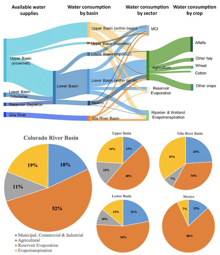
New Water Accounting Reveals Why the Colorado River No Longer Reaches the Sea
| Richter et al., 2024
Following up on groundbreaking research from 2020, this paper provides the most comprehensive accounting to-date of how the Colorado River Basin's water supply is consumed—an average of 23.7 billion cubic meters each year. Landsat-based information provided key inputs for riparian and wetland evapotranspiration (OpenET), crop cover (USDA Cropland Data Layer), and crop irrigation (Landsat-based National Irrigation Dataset).
| Graphical representations of how the Colorado River Basin's water supply is consumed within each sub-basin and by sector (Richter et al., 2024). | | 👁 Image
|
| |
March 21, 2024
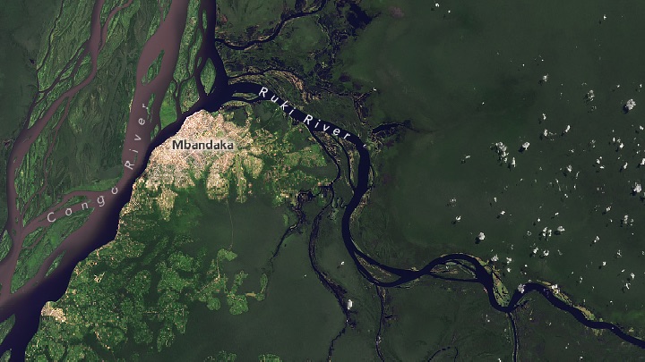
Recent data from the previously unstudied Ruki River in the Congo Basin shows that it carries a heavy load of carbon in its dark water.
| |
|
March 20, 2024
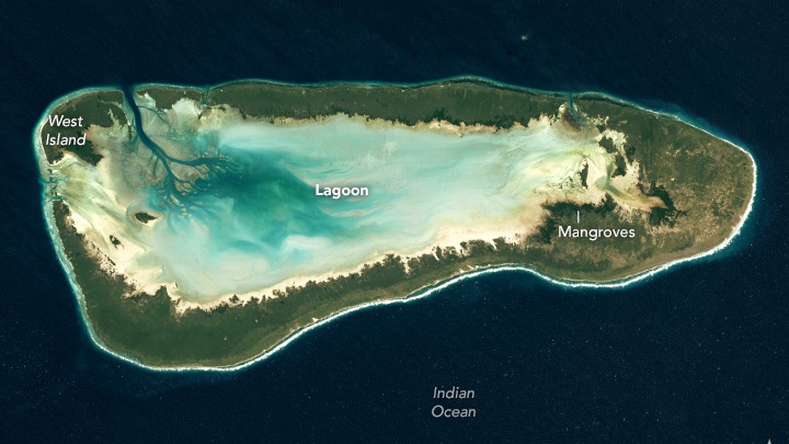
The large coral islands off the African coast are home to giant tortoises and unique birdlife.
| |
|
March 9, 2014
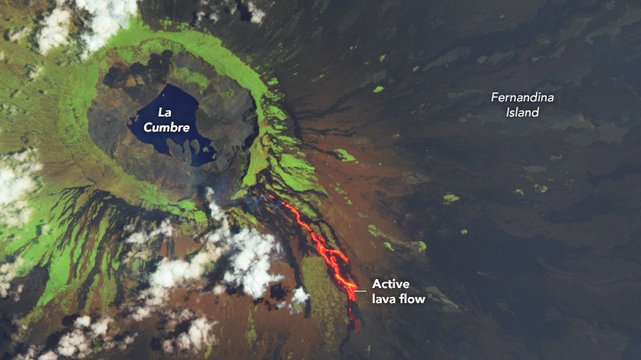
A volcano on Fernandina, an uninhabited island dense with wildlife, is lighting up the night sky with the glow of lava.
| |
👁 An infrared-color satellite image captured on March 7, 2024 displays an active lava flow on Fernandina Island. The image shows green vegetation encircling the caldera. Bare earth is represented by dark brown tones, while healthy vegetation stands out in light green. Clouds are depicted in white, contrasting with the bright red of the active lava flow. The active lava flow, vividly bright red, travels down the volcano's side, starting from the center of the image and extending towards the bottom. The image is a composite, crafted from shortwave infrared, near infrared, and green light wavelengths. A scale marker, indicating 2 km, is positioned in the bottom right corner for reference.
| |
March 2, 2024
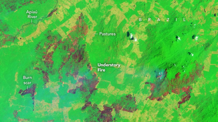
Huge understory fires spread throughout the state in northern Brazil as drought and heat turned the rainforest into tinder.
| |
|
|
|
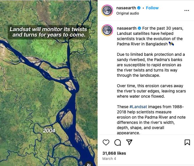
Padma River Unrivaled
A March 4 Landsat-based @nasaearth reel featuring Bangladesh's Padma River has garnered more than one million views on Instagram.
The river can be seen moving and meandering over three decades thanks to an animated series of Landsat images (1988–2018).
Landsat has helped scientists measure erosion along the Padma River and document differences in the river’s width, depth, shape, and overall appearance over time.
+ Get reel
| | | | | | |
