
This article needs additional citations for verification. Please help improve this article by adding citations to reliable sources. Unsourced material may be challenged and removed. Find sources: "Bassenge" – news · newspapers · books · scholar · JSTOR (March 2013) (Learn how and when to remove this message) |
Bassenge
Bassindje (Walloon)
| |
|---|---|
| 👁 Image | |
|
👁 Coat of arms of Bassenge Coat of arms | |
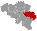
| 👁 Location of Bassenge in Liège province Location of Bassenge in Liège province | |
Interactive map of Bassenge | |
Location in Belgium | |
| Coordinates: 50°46′N 05°36′E / 50.767°N 5.600°E / 50.767; 5.600 | |
| Country | Belgium |
| Community | French Community |
| Region | Wallonia |
| Province | Liège |
| Arrondissement | Liège |
| Government | |
| • Mayor | Valérie Hiance |
| • Governing party | Bassenge Demain (CDH/MR) |
| Area | |
• Total | 38.21 km2 (14.75 sq mi) |
| Population (2018-01-01)[1] | |
• Total | 8,986 |
| • Density | 235.2/km2 (609.1/sq mi) |
| Postal codes | 4690 |
| NIS code | 62011 |
| Area codes | 04 |
| Website | www.bassenge.be |
Bassenge (French pronunciation: [basɑ̃ʒ]; Dutch: Bitsingen, Dutch pronunciation: [ˈbɪtsɪŋə(n)] ⓘ; Walloon: Bassindje) is a municipality of Wallonia located in the province of liège, Belgium.
On 1 January 2006 Bassenge had a total population of 8,335. The total area is 38.17 km2 which gives a population density of 218 inhabitants per km2.
The municipality consists of the following districts: Bassenge, Boirs, Ében-Émael, Glons, Roclenge-sur-Geer, and Wonck.
Gallery
[edit]-
Bassenge, church: l'église Saint-Pierre
-
Bassenge, la chapelle du Vi Mosti
-
Roclenge sur Geer, l'église Saint-Remy
-
Wonck, chapel in the hills
Historic sites
[edit]- Fort Eben-Emael was a major fortress intended to defend Belgium against attack from Germany. Built in the 1930s, it was swiftly captured by German forces in May 1940 during the Belgian Campaign of the Second World War.
- Eben-Ezer Tower, also known as le musée du silex (the museum of flint) is a fantastical tower built of flint rubble in the 1960s by Robert Garcet and decorated with mystical and religious symbols.[2]
- Wonck Airfield was a small runway for ultralight aviation in use by Aeroclub Bassange. It closed around 2006. [3]
See also
[edit]References
[edit]- ^ "Wettelijke Bevolking per gemeente op 1 januari 2018". Statbel. Retrieved 9 March 2019.
- ^ "Tower of Eben-Ezer". Atlas Obscura. Retrieved 2015-06-28.
- ^ "Wonck Airport". www.forgottenairfields.com. Retrieved 2024-03-08.
External links
[edit]- 👁 Wikimedia Commons logo
Media related to Bassenge at Wikimedia Commons
Retrieved from "https://en.wikipedia.org/w/index.php?title=Bassenge&oldid=1311809593"
Hidden categories:
- Pages using gadget WikiMiniAtlas
- Pages using the Phonos extension
- Articles with short description
- Short description is different from Wikidata
- Articles needing additional references from March 2013
- All articles needing additional references
- Articles containing Walloon-language text
- Articles containing Dutch-language text
- Coordinates on Wikidata
- Pages using infobox settlement with potentially too many maps
- Pages with French IPA
- Pages with Dutch IPA
- Pages including recorded pronunciations
- Commons category link from Wikidata
- All stub articles
- Pages using the Kartographer extension