
This article needs additional citations for verification. Please help improve this article by adding citations to reliable sources. Unsourced material may be challenged and removed. Find sources: "Chikugo River" – news · newspapers · books · scholar · JSTOR (January 2024) (Learn how and when to remove this message) |
| Chikugo River | |
|---|---|
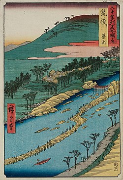
| 👁 Image Chikugo River at Ukiha-Hita | |
| Native name | 筑後川 (Japanese) |
| Location | |
| Country | Japan |
| Physical characteristics | |
| Source | |
| • location | Mount Aso, Kyūshū |
| • coordinates | 33°05′12″N 131°09′56″E / 33.0866°N 131.1656°E / 33.0866; 131.1656 |
| Mouth | |
• location | Ariake Sea |
• coordinates | 33°08′23″N 130°20′27″E / 33.1398°N 130.3408°E / 33.1398; 130.3408} |
• elevation | 0 m (0 ft) |
| Length | 143 km (89 mi) |
| Basin size | 2,860 km2 (1,100 sq mi) |
| Discharge | |
| • average | 94.09 m3/s (3,323 cu ft/s) |
| Basin features | |
| River system | Chikugo River |
The Chikugo River (筑後川, Chikugo-gawa) flows through Kumamoto, Ōita, Fukuoka and Saga prefectures in Japan.[1][2] With a total length of 143 kilometres (89 mi), it is the longest river on Kyūshū.[3][4][5][4][6] It flows from Mount Aso and empties into the Ariake Sea.[1][4][6] It is also nicknamed "Tsukushi Jirō".
The upper reaches of the river are important to forestry, and the middle and lower reaches are important to local agriculture, providing irrigation to some 400 square kilometres (154 mi2) of rice fields on the Tsukushi Plain. The river is also important to industry, with twenty electrical power plants located along its banks, as well as the major city of Kurume in Fukuoka Prefecture. Recognizing the requirement to satisfy divergent needs of various communities along the river, the Japanese Ministry of Land, Infrastructure, Transport and Tourism designated the Chikugo River (along with six other river systems in Japan) as a "Water Resources Development River System" with a comprehensive utilization plan to develop the river's resources.[7]
The Chikugogawa Onsen Fireworks, held annually on July 28, are the largest fireworks display in Kyūshū. The event has been held since 1650 on the riverbanks at Kurume.
See also
[edit]References
[edit]- de Graaf, Rutger. Urban Water in Japan. CRC Press (2008). ISBN 0-415-45360-7
- Japan Water Agency map[permanent dead link]
- Chikugogawa Onsen Fireworks
Notes
[edit]- ^ a b "Chikugo River" (PDF). Chikugo River construction office. 2018-09-26. Retrieved 2021-01-01.
{{cite web}}: CS1 maint: url-status (link) - ^ "筑後川の概要" (in Japanese). 国土交通省 九州地方整備局 筑後川河川事務所. Archived from the original on 2019-09-10. Retrieved 2021-01-01.
- ^ "Chikugo River". Retrieved 2021-01-01.
{{cite web}}: CS1 maint: url-status (link) - ^ a b c "筑後川". kotobank.jp (in Japanese). Archived from the original on 2023-01-26. Retrieved 2023-01-26.
- ^ "筑後川水系河川整備基本方針" (PDF). www.mlit.go.jp (in Japanese). Archived (PDF) from the original on 2022-12-08. Retrieved 2023-01-24.
- ^ a b A. W. Jayawardena, K. Takeuchi, and B. Machbub, ed. (1997). CATALOGUE OF RIVERS FOR SOUTHEAST ASIA AND THE PACIFIC, Volume II (PDF). Hong Kong. pp. 101–114. ISBN 962-8014-09-9. Archived from the original (PDF) on 2021-12-05.
{{cite book}}: CS1 maint: location missing publisher (link) CS1 maint: multiple names: editors list (link) - ^ de Graaf, Urban Water in Japan. page 8
- CS1 maint: url-status
- CS1 Japanese-language sources (ja)
- CS1 maint: location missing publisher
- CS1 maint: multiple names: editors list
- Articles with short description
- Short description is different from Wikidata
- Articles needing additional references from January 2024
- All articles needing additional references
- Articles containing Japanese-language text
- Pages using gadget WikiMiniAtlas
- All articles with dead external links
- Articles with dead external links from November 2016
- Articles with permanently dead external links
- All stub articles
- Pages using the Kartographer extension