
You can help expand this article with text translated from the corresponding article in German. (September 2011) Click [show] for important translation instructions.
|
| Este | |
|---|---|
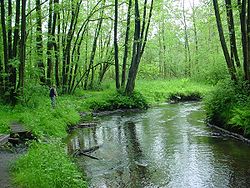
| 👁 Image The Este near Kakenstorf | |
| Location | |
| Country | Germany |
| States | Lower Saxony, Hamburg |
| Physical characteristics | |
| Mouth | |
• location | joins Elbe at Cranz, Hamburg |
• coordinates | 53°32′10″N 9°47′28″E / 53.5362°N 9.7911°E / 53.5362; 9.7911 |
| Length | 63.6 km (39.5 mi) [1] |
| Basin size | 361 km2 (139 sq mi) [1] |
| Discharge | |
| • average | 3.21 m3/s (113 cu ft/s) |
| Basin features | |
| Progression | Elbe→ North Sea |
| Tributaries | |
| • left | Goldbach |
The Este (German pronunciation: [ˈɛstə] ⓘ; Low Saxon: Eest) is a 63.6-kilometre-long (39.5 mi) left-bank tributary of the river Elbe that flows through Lower Saxony and Hamburg, Germany.
See also
[edit]References
[edit]
Hidden categories:
- Pages using gadget WikiMiniAtlas
- Pages using the Phonos extension
- Articles with short description
- Short description is different from Wikidata
- Geography articles needing translation from German Wikipedia
- Coordinates on Wikidata
- Pages using infobox river with mapframe
- Pages with German IPA
- Pages including recorded pronunciations
- All stub articles
- Pages using the Kartographer extension