
👁 File:I-405.svg
Size of this PNG preview of this SVG file: 749 × 599 pixels. Other resolutions: 300 × 240 pixels | 600 × 480 pixels | 960 × 768 pixels | 1,280 × 1,024 pixels | 2,559 × 2,048 pixels | 751 × 601 pixels.
Original file (SVG file, nominally 751 × 601 pixels, file size: 14 KB)
This is a file from the Wikimedia Commons. Information from its description page there is shown below.
Commons is a freely licensed media file repository. You can help.
Commons is a freely licensed media file repository. You can help.
| 👁 Public domain |
This file is in the public domain because it comes from the Manual on Uniform Traffic Control Devices, sign number M1-1, which states specifically on page I-1 that:
|
.svg)
| 👁 Trademarked |
This work includes material that may be protected as a trademark in some jurisdictions. If you want to use it, you have to ensure that you have the legal right to do so and that you do not infringe any trademark rights. See our general disclaimer. This tag does not indicate the copyright status of the attached work. A normal copyright tag is still required. See Commons:Licensing. |
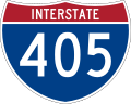
750 mm by 600 mm (30 in by 24 in) Interstate shield, made to the specifications of the 2004 edition of Standard Highway Signs (sign M1-1). Uses the Roadgeek 2005 fonts archive copy at the Wayback Machine. (United States law does not permit the copyrighting of typeface designs, and the fonts are meant to be copies of a U.S. Government-produced work anyway.) Colors are from [1] (Pantone Red 187 and Blue 294), converted to RGB by [2]. The outside border has a width of 1 (1 mm) and a color of black so it shows up; in reality, signs have no outside border.
File history
Click on a date/time to view the file as it appeared at that time.
| Date/Time | Thumbnail | Dimensions | User | Comment | |
|---|---|---|---|---|---|
| current | 05:16, 20 May 2007 | 👁 Thumbnail for version as of 05:16, 20 May 2007 | 751 × 601 (14 KB) | Ltljltlj | |
| 05:53, 5 April 2006 | 👁 Thumbnail for version as of 05:53, 5 April 2006 | 751 × 601 (12 KB) | SPUI~commonswiki | {{spuiother}} 750 mm by 600 mm (30 in by 24 in) Interstate shield, made to the specifications of the [http://mutcd.fhwa.dot.gov/SHSm/Guide.pdf 2004 edition of Standard Highway Signs] (sign M1-1). Uses the [http://www.triskele.com/fonts/index.html Roadgeek |
File usage
The following 93 pages use this file:
- 1964 state highway renumbering (Washington)
- Fremont Bridge (Portland, Oregon)
- Interstate 405 (Oregon)
- Interstate 405 (Washington)
- Interstate 5
- Interstate 5 in Oregon
- Interstate 5 in Washington
- Interstate 90
- Interstate 90 in Washington
- King County, Washington
- List of Interstate Highways in Oregon
- List of Interstate Highways in Washington
- List of auxiliary Interstate Highways
- List of bridges documented by the Historic American Engineering Record in Oregon
- List of bridges in Portland, Oregon
- List of bridges in the United States
- List of crossings of the Willamette River
- List of highways numbered 405
- List of toll roads in the United States
- MAX Blue Line
- MAX Red Line
- MAX Yellow Line (TriMet)
- Multnomah County, Oregon
- NS Line
- Oregon Route 10
- Oregon Route 402
- Oregon Route 410
- Portland Vintage Trolley
- Portland metropolitan area
- RapidRide B Line
- RapidRide F Line
- Snohomish County, Washington
- Transportation in Portland, Oregon
- U.S. Route 101
- U.S. Route 26
- U.S. Route 26 in Oregon
- U.S. Route 30
- U.S. Route 30 in Oregon
- Washington State Route 167
- Washington State Route 169
- Washington State Route 181
- Washington State Route 202
- Washington State Route 401
- Washington State Route 403
- Washington State Route 409
- Washington State Route 509
- Washington State Route 515
- Washington State Route 518
- Washington State Route 520
- Washington State Route 522
- Washington State Route 525
- Washington State Route 527
- Washington State Route 599
- Washington State Route 900
- Washington State Route 908
- Washington State Route 99
- Talk:Interstate 5/Archive 1
- Talk:List of auxiliary Interstate Highways/Archive 1
- Talk:Washington State Route 524
- User:Amateria1121/sandbox
- User:CouvGeek/sandbox/List of Interstate Highways in Oregon
- User:Dawginroswell/Travel/Interstate
- User:DeFaultRyan/Travels
- User:MPD01605/Roads
- User:MattEditor02
- User:Nsd2018966/sandbox
- User:O/Sandbox/S1
- User:Quadrangle6000000
- User:RickyCourtney/sandbox/RapidRide B Line
- User:RickyCourtney/sandbox/RapidRide F Line
- User:SounderBruce/Sandbox/Freeways
- User:SounderBruce/Sandbox/Interstate
- User:SounderBruce/Sandbox/Streets
- User:Truflip99/sandbox/Archive 1
- User:Truflip99/sandbox/Archive 2
- User:Truflip99/sandbox/MAX Blue Line
- User:Truflip99/sandbox/MAX RDT
- User:Yourpalbill/Rail Diagrams/MAX Lines
- Wikipedia:WikiProject U.S. Roads/Interstate RJL compliance
- Wikipedia:WikiProject U.S. Roads/Newsletter/Issues/Volume08/Issue04
- Wikipedia:WikiProject U.S. Roads/Redirects/Interstate Highways
- Wikipedia:WikiProject U.S. Roads/Redirects/Oregon
- Wikipedia:WikiProject U.S. Roads/Redirects/Washington
- Template:Hawthorn Farm–I-205
- Template:MAX Blue Line
- Template:MAX Red Line
- Template:MAX Yellow Line
- Template:Portland Streetcar NS Line
- Template:Portland Vintage Trolley
- Template:RapidRide B Line
- Template:RapidRide F Line
- Template:Southwest Corridor light rail project
- Draft:Capitol Highway
Global file usage
The following other wikis use this file:
- Usage on bn.wikipedia.org
- Usage on bn.wikivoyage.org
- Usage on de.wikipedia.org
- Los Angeles International Airport
- Interstate 5
- Interstate 10
- U.S. Highway 101
- South Coast Plaza
- Interstate 90
- John Wayne Airport
- Interstate 710
- Interstate 105 (Kalifornien)
- California State Route 118
- California State Route 2
- Interstate 110 (Kalifornien)
- El Toro Y
- Interstate 405 (Oregon)
- California State Route 55
- California State Route 73
- California State Route 133
- Long Beach Airport
- Diskussion:Interstate 105 (Kalifornien)
- Diskussion:Long Beach Airport
- Interstate 605 (Kalifornien)
- Irvine Spectrum Center
- Flughafen Van Nuys
- Fremont Bridge (Portland, Oregon)
- Benutzer:Pilgerobst/Interstate 5
- Usage on de.wikivoyage.org
- Usage on en.wikivoyage.org
View more global usage of this file.
Retrieved from "https://en.wikipedia.org/wiki/File:I-405.svg"