
Laurenan
Lanreunan | |
|---|---|
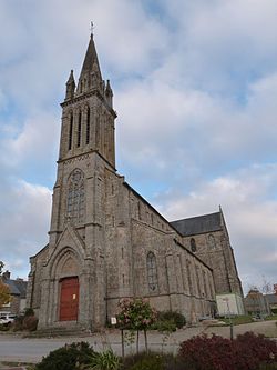
| 👁 The church of Saint-Ronan, in Laurenan The church of Saint-Ronan, in Laurenan | |
|
👁 Coat of arms of Laurenan Coat of arms | |
Location of Laurenan | |
| Coordinates: 48°12′00″N 2°32′03″W / 48.2°N 2.5342°W / 48.2; -2.5342 | |
| Country | France |
| Region | Brittany |
| Department | Côtes-d'Armor |
| Arrondissement | Saint-Brieuc |
| Canton | Broons |
| Intercommunality | Loudéac Communauté - Bretagne Centre |
| Government | |
| • Mayor (2023–2026) | Olivier Rivallan[1] |
Area 1 | 30.90 km2 (11.93 sq mi) |
| Population (2023)[2] | 744 |
| • Density | 24.1/km2 (62.4/sq mi) |
| Time zone | UTC+01:00 (CET) |
| • Summer (DST) | UTC+02:00 (CEST) |
| INSEE/Postal code | 22122 /22230 |
| Elevation | 120–295 m (394–968 ft) |
| 1 French Land Register data, which excludes lakes, ponds, glaciers > 1 km2 (0.386 sq mi or 247 acres) and river estuaries. | |
.jpg)
Laurenan (French pronunciation: [loʁnɑ̃]; Breton: Lanreunan) is a commune in the Côtes-d'Armor department of Brittany in northwestern France.
Population
[edit]| Year | Pop. | ±% |
|---|---|---|
| 1962 | 860 | — |
| 1968 | 976 | +13.5% |
| 1975 | 869 | −11.0% |
| 1982 | 822 | −5.4% |
| 1990 | 791 | −3.8% |
| 1999 | 733 | −7.3% |
| 2008 | 716 | −2.3% |
Inhabitants of Laurenan are called laurenanais in French.
See also
[edit]References
[edit]- ^ "Répertoire national des élus: les maires" (in French). data.gouv.fr, Plateforme ouverte des données publiques françaises. 30 November 2023.
- ^ "Populations de référence 2023" (in French). National Institute of Statistics and Economic Studies. 18 December 2025.
Wikimedia Commons has media related to Laurenan.
Retrieved from "https://en.wikipedia.org/w/index.php?title=Laurenan&oldid=1291347285"
Hidden categories:
- Pages using gadget WikiMiniAtlas
- CS1 French-language sources (fr)
- Use dmy dates from August 2023
- Articles with short description
- Short description is different from Wikidata
- Coordinates on Wikidata
- Pages with French IPA
- Articles containing Breton-language text
- Commons category link from Wikidata
- All stub articles
- Pages using the Kartographer extension