
Le Mesnillard | |
|---|---|
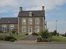
| 👁 Town hall Town hall | |
Location of Le Mesnillard | |
👁 Le Mesnillard is located in France Le Mesnillard | |
| Coordinates: 48°37′41″N 1°04′18″W / 48.6281°N 1.0717°W / 48.6281; -1.0717 | |
| Country | France |
| Region | Normandy |
| Department | Manche |
| Arrondissement | Avranches |
| Canton | Saint-Hilaire-du-Harcouët |
| Intercommunality | CA Mont-Saint-Michel-Normandie |
| Government | |
| • Mayor (2024–2026) | Christian Dunaud[1] |
Area 1 | 9.75 km2 (3.76 sq mi) |
| Population (2023)[2] | 257 |
| • Density | 26.4/km2 (68.3/sq mi) |
| Time zone | UTC+01:00 (CET) |
| • Summer (DST) | UTC+02:00 (CEST) |
| INSEE/Postal code | 50315 /50600 |
| Elevation | 72–205 m (236–673 ft) (avg. 96 m or 315 ft) |
| 1 French Land Register data, which excludes lakes, ponds, glaciers > 1 km2 (0.386 sq mi or 247 acres) and river estuaries. | |
Le Mesnillard (French pronunciation: [ləmɛnilaʁ]) is a commune in the Manche department in Normandy in north-western France.
See also
[edit]References
[edit]- ^ "Répertoire national des élus: les maires" (in French). data.gouv.fr, Plateforme ouverte des données publiques françaises. 12 March 2025.
- ^ "Populations de référence 2023" (in French). National Institute of Statistics and Economic Studies. 18 December 2025.
Wikimedia Commons has media related to Le Mesnillard.
Hidden categories:
- Pages using gadget WikiMiniAtlas
- CS1 French-language sources (fr)
- Use dmy dates from August 2023
- Articles with short description
- Short description is different from Wikidata
- Coordinates on Wikidata
- Pages with French IPA
- Commons category link from Wikidata
- All stub articles
- Pages using the Kartographer extension