
Middle Franconia
Mittelfranken (German) | |
|---|---|
|
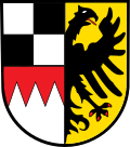
👁 Coat of arms of Middle Franconia Coat of arms | |
| 👁 Map of Bavaria highlighting Middle Franconia (district) Map of Bavaria highlighting Middle Franconia (district) | |
| Country | Germany |
| State | Bavaria |
| Region seat | Ansbach |
| Government | |
| • District President | Kerstin Engelhardt-Blum |
| Area | |
• Total | 7,245.70 km2 (2,797.58 sq mi) |
| Population (31 December 2024)[1] | |
• Total | 1,795,909 |
| • Density | 247.859/km2 (641.951/sq mi) |
| GDP | |
| • Total | €86.003 billion (2021) |
| Website | regierung.mittelfranken.bayern.de |
Middle Franconia (German: Mittelfranken, pronounced [ˈmɪtl̩ˌfʁaŋkŋ̍] ⓘ) is one of the three administrative regions of Franconia, Germany,[3] in the west of Bavaria bordering the state of Baden-Württemberg. The administrative seat is Ansbach; the most populous and largest city is Nuremberg.[4]
Subdivisions
[edit]The region is divided into seven districts ('Landkreise') and five independent cities ('Kreisfreie Städte'). The lowest level is divided into 210 municipalities (including five cities).[5]
Independent cities
[edit]Districts
[edit]- Ansbach
- Erlangen-Höchstadt
- Fürth
- Neustadt (Aisch)-Bad Windsheim
- Nürnberger Land
- Roth
- Weißenburg-Gunzenhausen
History
[edit]This section needs additional citations for verification. Please help improve this article by adding citations to reliable sources in this section. Unsourced material may be challenged and removed. (March 2023) (Learn how and when to remove this message) |
After the founding of the Kingdom of Bavaria the state was totally reorganised and, in 1808, divided into 15 administrative government regions (German: Regierungsbezirke (singular Regierungsbezirk)), in Bavaria called Kreise (singular: Kreis). They were created in the fashion of the French departements, quite even in size and population, and named after their main rivers.
In the following years, due to territorial changes (e. g. loss of Tyrol, addition of the Palatinate), the number of Kreise was reduced to eight. One of these was the Rezatkreis (Rezat District). In 1837 king Ludwig I of Bavaria renamed the Kreise after historical territorial names and tribes of the area. This also involved some border changes or territorial swaps. Thus the district name of Rezatkreis changed to Middle Franconia.
Main sights
[edit]Next to the major city Nuremberg, the capital Ansbach and the former residence city Erlangen, the towns of the Romantic Road Rothenburg ob der Tauber and Dinkelsbühl are major tourist attractions. The Lichtenau Fortress, Rothenberg Fortress, Hohenstein and Cadolzburg are the most important castles of Middle Franconia. The Franconian Jura and the northern valley of the River Altmühl are among the scenic attractions.
Coat of arms
[edit]For the German Imperial Eagle, see Reichsadler
The coat of arms displays:
|
Population
[edit]| Year | Inhabitants |
|---|---|
| 1900 | 815,895 |
| 1910 | 930,868 |
| 1939 | 1,065,122 |
| 1950 | 1,273,030 |
| 1961 | 1,371,144 |
| 1970 | 1,486,389 |
| 1987 | 1,521,484 |
| 2002 | 1,703,869 |
| 2005 | 1,712,275 |
| 2006 | 1,712,622 |
| 2008 | 1,714,453 |
| 2010 | 1,710,876 |
| 2015 | 1,738,686 |
| 2019 | 1,775,169 |
Economy
[edit]The Gross domestic product (GDP) of the region was 78.6 billion € in 2018, accounting for 2.4% of German economic output. GDP per capita adjusted for purchasing power was 40,900 € or 136% of the EU27 average in the same year. The GDP per employee was 105% of the EU average.[9]
See also
[edit]
Other Franconian Districts:
- Upper Franconia (Oberfranken)
- Lower Franconia (Unterfranken)
Political party that is in Franconia:
- Party for Franconia (Frankenpartei)
References
[edit]- ^ "Gemeinden, Kreise und Regierungsbezirke in Bayern, Einwohnerzahlen am 31. Dezember 2024; Basis Zensus 2022" [Municipalities, counties, and administrative districts in Bavaria; Based on the 2022 Census] (CSV) (in German). Bayerisches Landesamt für Statistik.
- ^ "EU regions by GDP, Eurostat". Retrieved 18 September 2023.
- ^ Berg-Schlosser, Dirk (1993). Political Culture in Germany. p. 102. ISBN 978-1-349-22767-9.
- ^ "Allgerman.com - Middle Franconia (Mittelfranken)". allgerman.com. 2018-10-27.
- ^ Pressestelle, Regierung von Mittelfranken. "Regierung von Mittelfranken". www.regierung.mittelfranken.bayern.de (in German). Archived from the original on 2019-03-10. Retrieved 2018-10-27.
- ^ County of Hohenzollern
- ^ Franconia
- ^ File:Wappen Deutscher Bund.svg
- ^ "Regional GDP per capita ranged from 30% to 263% of the EU average in 2018". Eurostat.
External links
[edit]- (Middle Franconia State Government; Regierung von Mittelfranken (in English)
- Bezirk Mittelfranken (in German)
- Pages using the Phonos extension
- CS1 German-language sources (de)
- Articles with short description
- Short description is different from Wikidata
- Articles containing German-language text
- Pages using infobox settlement with no coordinates
- Pages with German IPA
- Pages including recorded pronunciations
- Articles needing additional references from March 2023
- All articles needing additional references
- Articles with German-language sources (de)