
Miyagi Prefecture
宮城県 | |
|---|---|
| Japanese transcription(s) | |
| • Japanese | 宮城県 |
| • Rōmaji | Miyagi-ken |
Sendai Street Tanabata on August Sky line of Sendai city First Glance Thousand Tree of Cherry blossoms in Ōkawara Autumn colour in Mount Kurikoma | |
| Anthem: Kagayaku Kyōdo | |
| 👁 Location of Miyagi Prefecture | |
| Country | 👁 Image Japan |
| Region | Tōhoku |
| Island | Honshu |
| Capital | Sendai |
| Subdivisions | Districts: 10, Municipalities: 35 |
| Government | |
| • Governor | Yoshihiro Murai |
| Area | |
• Total | 7,282.22 km2 (2,811.68 sq mi) |
| • Rank | 16th |
| Population (August 1, 2023) | |
• Total | 2,265,724 |
| • Rank | 15th |
| • Density | 311.131/km2 (805.825/sq mi) |
| GDP | |
| • Total | JP¥ 9,615 billion US$ 71 billion (2022) |
| ISO 3166 code | JP-04 |
| Website | www.pref.miyagi.jp |
| Symbols of Japan | |
| Bird | Wild goose |
| Flower | Miyagi bush clover (Lespedeza thunbergii) |
| Tree | Japanese zelkova (Zelkova serrata) |
,_Miyagi_03.jpg)
.jpg)
Miyagi Prefecture (宮城県, Miyagi-ken; Japanese pronunciation: [mʲiꜜ.ja.ɡʲi,-ŋʲi,mʲi.ja.ɡʲiꜜ.keɴ,-ŋʲiꜜ-][2]) is a prefecture of Japan located in the Tōhoku region of Honshu.[3] Miyagi Prefecture has a population of 2,265,724 (1 August 2023) and has a geographic area of 7,282 km2 (2,812 sq mi). Miyagi Prefecture borders Iwate Prefecture to the north, Akita Prefecture to the northwest, Yamagata Prefecture to the west, and Fukushima Prefecture to the south.
Sendai is the capital and largest city of Miyagi Prefecture, and the largest city in the Tōhoku region, with other major cities including Ishinomaki, Ōsaki, and Tome.[4] Miyagi Prefecture is located on Japan's eastern Pacific coast and bounded to the west by the Ōu Mountains, the longest mountain range in Japan, with 24% of its total land area being designated as Natural Parks. Miyagi Prefecture is home to Matsushima Islands, a group of islands ranked as one of the Three Views of Japan, near the town of Matsushima.
History
[edit]Miyagi Prefecture was formerly part of the province of Mutsu.[5]
2011 Tōhoku earthquake and tsunami
[edit]
On March 11, 2011, a 9.0 magnitude earthquake and a subsequent major tsunami hit Miyagi Prefecture, causing major damage to the area.[6] The tsunami was estimated to be approximately 10 metres (33 ft) high in Miyagi Prefecture.[7]
On April 7, 2011, a magnitude 7.4 earthquake struck off the coast of Miyagi, Japan. Workers were then evacuated from the nearby troubled Fukushima Daiichi Nuclear Power Plant once again, as a tsunami warning was issued for the coastline. Residents were told to flee inland at that time.
In 2013, Crown Prince Naruhito and Crown Princess Masako visited the prefecture to see the progress made since the tsunami.[8]
Geography
[edit]
Government Ordinance Designated City City Town Village
Miyagi Prefecture is in the central part of Tōhoku, facing the Pacific Ocean, and contains Tōhoku's largest city, Sendai. There are high mountains on the west and along the northeast coast, but the central plain around Sendai is fairly large.
Matsushima is known as one of the three most scenic views of Japan, with a bay full of 260 small islands covered in pine groves.
Oshika Peninsula projects from the northern coastline of the prefecture.
As of 31 March 2019, 24% of the total land area of the prefecture was designated as Natural Parks, namely the Sanriku Fukkō National Park; Kurikoma and Zaō Quasi-National Parks; and Abukuma Keikoku, Asahiyama, Funagata Renpō, Futakuchi Kyōkoku, Kenjōsan Mangokuura, Kesennuma, Matsushima, and Zaō Kōgen Prefectural Natural Parks.[9][10]
In addition, Miyagi Prefecture is a prefecture that is particularly prone to earthquakes even in Japan, which is an earthquake-prone country. Large earthquakes occur frequently Miyagi offshore, and earthquakes also occur frequently inland. In the 2011 Tohoku earthquake that occurred Miyagi offshore, Miyagi Prefecture suffered the most damage nationwide.
Cities
[edit]Fourteen cities are located in Miyagi Prefecture:
| Name | Area (km2) | Population | Population density (per km2) | Map | |
|---|---|---|---|---|---|
| Rōmaji | Kanji | ||||
| 👁 Image Higashimatsushima |
東松島市 | 101.36 | 39,098 | 385.73 | 👁 Image |
| 👁 Image Ishinomaki |
石巻市 | 554.55 | 140,151 | 252.73 | 👁 Image |
| 👁 Image Iwanuma |
岩沼市 | 60.45 | 44,068 | 729.00 | 👁 Image |
| 👁 Image Kakuda |
角田市 | 147.53 | 27,976 | 189.63 | 👁 Image |
| 👁 Image Kesennuma |
気仙沼市 | 332.44 | 61,147 | 183.93 | 👁 Image |
| 👁 Image Kurihara |
栗原市 | 804.97 | 64,637 | 80.30 | 👁 Image |
| 👁 Image Natori |
名取市 | 98.17 | 78,718 | 801.85 | 👁 Image |
| 👁 Image Ōsaki |
大崎市 | 796.76 | 127,330 | 159.81 | 👁 Image |
| 👁 Image Sendai (capital) |
仙台市 | 786.3 | 1,096,704 | 1394.77 | 👁 Image |
| 👁 Image Shiogama |
塩竈市 | 17.37 | 52,203 | 3005.35 | 👁 Image |
| 👁 Image Shiroishi |
白石市 | 286.48 | 32,758 | 114.35 | 👁 Image |
| 👁 Image Tagajō |
多賀城市 | 19.69 | 62,827 | 3190.81 | 👁 Image |
| 👁 Image Tome |
登米市 | 536.12 | 76,037 | 141.83 | 👁 Image |
| 👁 Image Tomiya |
富谷市 | 49.18 | 51,651 | 1050.24 | 👁 Image |
Towns and villages
[edit]These are the towns and villages in each district:
Mergers
[edit]Economy
[edit]Although Miyagi has a good deal of fishing and agriculture, producing a great deal of rice and livestock, it is dominated by the manufacturing industries around Sendai, particularly electronics, appliances, and food processing.
As of March 2011, the prefecture produced 4.7% of Japan's rice, 23% of oysters, and 15.9% of sauries.[11]
In July 2011, the Japanese government decided to ban all shipments of beef cattle from northeast Miyagi Prefecture over fears of radioactive contamination.[12] This has since been rescinded.
Demographics
[edit]
According to Japanese census data, Miyagi prefecture experienced its greatest period of growth from 1940 to 1950 and continued to exhibit growth up until the 21st century.[13] Nevertheless, like the majority of Japan, the population of Miyagi has begun to slowly decline. The prefectural capital of Sendai, however, has seen a moderate, but steady rise in population over the past twenty years.[14]
| Year | Pop. | ±% |
|---|---|---|
| 1890 | 735,100 | — |
| 1920 | 962,000 | +30.9% |
| 1930 | 1,143,000 | +18.8% |
| 1940 | 1,271,000 | +11.2% |
| 1950 | 1,663,000 | +30.8% |
| 1960 | 1,743,000 | +4.8% |
| 1970 | 1,819,000 | +4.4% |
| 1980 | 2,082,000 | +14.5% |
| 1990 | 2,249,000 | +8.0% |
| 2000 | 2,365,320 | +5.2% |
| 2010 | 2,348,165 | −0.7% |
| 2020 | 2,301,996 | −2.0% |
Education
[edit]University
[edit]- Miyagi University
- Miyagi University of Education
- Miyagi Gakuin Women's University
- Sendai University
- Sendai Shirayuri Women's College
- Tohoku University
- Tohoku Gakuin University
- Tohoku Bunka Gakuen University
- Tohoku Institute of Technology
- Tohoku Fukushi University
- Tohoku Seikatsu Bunka College
- Tohoku Pharmaceutical University
- Shokei Gakuin University
- Ishinomaki Senshu University
Transportation
[edit]
Rail
[edit]Roads
[edit]Expressways and toll roads
[edit]- 👁 Image
Tōhoku Expressway - Yamagata Expressway
- Sanriku Expressway
- Sendai-Hokubu Road
- Sendai-Nanbu Road
- Sendai-Tōbu Road
National highways
[edit]- 👁 Image
National Route 4 (Nihonbashi of Tokyo–Kasukabe–Utsunomiya–Koriyama–Sendai–Furukawa–Ichinoseki–Morioka–Towada–Aomori) - 👁 Image
National Route 6 (Nihonbashi of Tokyo–Mito–Iwaki–Soma–Sendai) - 👁 Image
National Route 45 (Sendai–Ishinomaki–Ofunato–Kamaishi–Kuji–Hachinohe–Towada) - 👁 Image
National Route 47 (Furukawa–Narugo–Shinjyo–Sakata) - 👁 Image
National Route 48 (Sendai–Yamagata) - 👁 Image
National Route 108 - 👁 Image
National Route 113 - 👁 Image
National Route 286 - 👁 Image
National Route 342 - 👁 Image
National Route 346 - 👁 Image
National Route 347 - 👁 Image
National Route 349 - 👁 Image
National Route 398 - 👁 Image
National Route 399 - 👁 Image
National Route 456 - 👁 Image
National Route 457
Ports
[edit]
- Sendai Port – Ferry route to Tomakomai, Hokkaido and Nagoya, container hub port
- Ishinomaki Port – Ferry route to Mount Kinka and Tashiro Island.
- Matsushima Bay
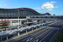
Airports
[edit]Sports
[edit].jpg)
The sports teams listed below are based in Miyagi Prefecture.
- Baseball
- Football (soccer)
- Vegalta Sendai (Yurtec Stadium Sendai, Sendai)
- Sony Sendai F.C. (Yurtec Stadium Sendai, Sendai)
- Vegalta Sendai Ladies (Yurtec Stadium Sendai, Sendai)
- Basketball
- Volleyball
- Futsal
- Professional wrestling
Also, the Sendai Hi-Land Raceway hosts motorsport road races.
Visitor attractions
[edit]Sendai was the castle town of the daimyō Date Masamune. The remains of Sendai Castle stand on a hill above the city.
Miyagi Prefecture boasts one of Japan's three greatest sights. Matsushima, the pine-clad islands, dot the waters off the coast of the prefecture.
The following are also noted as attractions:
|
Famous festivals and events
[edit]
- Sendai New Year's traditional Sale on January 2
- Shiroishi Kokeshi Exhibition, May 3–5
- Aoba Festival, Suzume Odori traditional Japanese dance event in May
- Shiogama Port Festival in July
- Sendai Tanabata Festival, August 6–8
- Sendai Pageant of Starlight in December
Popular culture
[edit]Miyagi Prefecture is one of the main settings of the manga and anime series Haikyū!!. The most well-known fictional schools located there are Karasuno High School, Aoba Johsai High School, Date Tech High and Shiratorizawa Academy, as well as Sendai City Gymnasium. Another anime series Wake Up, Girls! is also set in Miyagi Prefecture.
Notes
[edit]- ^ "2020年度国民経済計算(2015年基準・2008SNA) : 経済社会総合研究所 - 内閣府". 内閣府ホームページ (in Japanese). Retrieved 2023-05-18.
- ^ NHK Broadcasting Culture Research Institute, ed. (24 May 2016). NHK日本語発音アクセント新辞典 (in Japanese). NHK Publishing.
- ^ Nussbaum, Louis-Frédéric. (2005). "Miyagi prefecture" in Japan Encyclopedia, p. 648, p. 648, at Google Books; "Tōhoku" in p. 970, p. 970, at Google Books.
- ^ Nussbaum, "Sendai" in p. 841, p. 841, at Google Books.
- ^ Nussbaum, "Provinces and prefectures" in p. 780, p. 780, at Google Books
- ^ "Japan earthquake: Tsunami hits north-east". BBC News. March 11, 2011. Archived from the original on March 12, 2011.
- ^ Williams, Martyn (10 March 2011). "Report from Japan: Impact of Tsunami Devastates Nation's Northeast". Voice of America. Archived from the original on 9 January 2012. Retrieved 28 April 2018.
- ^ "Crown Prince Naruhito, Princess Masako visit tsunami victims in Miyagi". Japan Daily Press. Archived from the original on 2013-08-24. Retrieved 2013-08-22.
- ^ 自然公園都道府県別面積総括 [General overview of area figures for Natural Parks by prefecture] (PDF) (in Japanese). Ministry of the Environment. Retrieved 13 August 2019.
- ^ 宮城県の自然公園 [Natural Parks in Miyagi Prefecture] (in Japanese). Miyagi Prefecture. Retrieved 13 August 2019.
- ^ Schreiber, Mark, "Japan's food crisis goes beyond recent panic buying Archived 2011-04-20 at the Wayback Machine", Japan Times, 17 April 2011, p. 9.
- ^ "Japan suspends shipment of Miyagi beef over contamination - Home » Other Sections » Breaking News". www.philstar.com. Retrieved 2 February 2022.
{{cite web}}: CS1 maint: deprecated archival service (link) - ^ "Japan Prefectures Population from 1920 and Area". www.demographia.com. Retrieved 2021-12-24.
- ^ "Sendai (City (-shi), Miyagi, Japan) - Population Statistics, Charts, Map and Location". www.citypopulation.de. Retrieved 2021-12-24.
References
[edit]- Nussbaum, Louis-Frédéric and Käthe Roth. (2005). Japan encyclopedia. Cambridge: Harvard University Press. ISBN 978-0-674-01753-5; OCLC 58053128
- Titsingh, Isaac. (1834). Nihon Odai Ichiran; ou, Annales des empereurs du Japon. Paris: Royal Asiatic Society, Oriental Translation Fund of Great Britain and Ireland. OCLC 5850691
External links
[edit]
- Miyagi Prefecture Official Website (in Japanese)
- CS1 Japanese-language sources (ja)
- CS1 uses Japanese-language script (ja)
- CS1: unfit URL
- Webarchive template wayback links
- CS1 maint: deprecated archival service
- Pages using gadget WikiMiniAtlas
- Articles with short description
- Short description matches Wikidata
- Short description is different from Wikidata
- Articles containing Japanese-language text
- Pages using infobox settlement with no coordinates
- Pages with Japanese IPA
- Commons category link is on Wikidata
- Articles with Japanese-language sources (ja)
- Coordinates on Wikidata