
O'Connor | |
|---|---|
| Township of O'Connor | |
| 👁 Image | |
| Motto: Country Living at its Best | |
| Coordinates: 48°22′N 89°42′W / 48.367°N 89.700°W / 48.367; -89.700 | |
| Country | Canada |
| Province | Ontario |
| District | Thunder Bay |
| Settled | 1887 |
| Incorporated | 1907 |
| Government | |
| • Mayor | Jim Vezina |
| • Fed. riding | Thunder Bay—Rainy River |
| • Prov. riding | Thunder Bay—Atikokan |
| Area | |
| • Land | 108.56 km2 (41.92 sq mi) |
| Population (2021)[1] | |
• Total | 689 |
| • Density | 6.3/km2 (16/sq mi) |
| Time zone | UTC-5 (EST) |
| • Summer (DST) | UTC-4 (EDT) |
| Postal code | P0T 1W0 |
| Area code | 807 |
| Website | www.oconnortownship.ca 👁 Edit this at Wikidata |
O'Connor is a township in the Canadian province of Ontario, located 32 kilometres (20 mi) west of the city of Thunder Bay. The township was formed on January 1, 1907. The township serves as a bedroom community of Thunder Bay, with some agriculture, and is part of Thunder Bay's Census Metropolitan Area.
The township was opened to settlement in 1887 because of the silver mining boom, and named by the Ontario government after Port Arthur businessman, alderman and police magistrate James Joseph O'Connor (1857–1930).[2]
Since January 1st, 2015, the mayor of O'Connor is Jim Vezina. The township has four councillors: John Sobolta, Carly Torkkeli, Alex Crane, and Brendan Rea.[3]
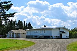
The township maintains a disposal site, a skating rink, basketball court, and a fire station staffed by volunteer fire fighters. The township produces and distributes a newsletter called The Cornerstone.[4]
O'Connor's primary industry is agriculture. Many residents commute to work either to Thunder Bay or the surrounding woodlands.
Geography
[edit]The geography of O'Connor is mainly flat open farmland and rolling hills, with the Whitefish River Valley dominating the southeast corner of the township. The township contains many creeks and rivers. The most notable geographic feature is Kakabeka Falls, located in the northeastern corner of the municipality near the community of Kakabeka Falls, Ontario.
Demographics
[edit]In the 2021 Census of Population conducted by Statistics Canada, O'Connor had a population of 689 living in 274 of its 283 total private dwellings, a change of 3.9% from its 2016 population of 663. With a land area of 108.56 km2 (41.92 sq mi), it had a population density of 6.3/km2 (16.4/sq mi) in 2021.[1]
| 2021 | 2016 | 2011 | |
|---|---|---|---|
| Population | 689 (+3.9% from 2016) | 663 (-3.2% from 2011) | 685 (-4.9% from 2006) |
| Land area | 108.56 km2 (41.92 sq mi) | 108.78 km2 (42.00 sq mi) | 108.65 km2 (41.95 sq mi) |
| Population density | 6.3/km2 (16/sq mi) | 6.1/km2 (16/sq mi) | 6.3/km2 (16/sq mi) |
| Median age | 46.0 (M: 46.8, F: 44.8) | 44.7 (M: 45.4, F: 43.9) | 42.4 (M: 43.1, F: 41.4) |
| Private dwellings | 283 (total) 274 (occupied) | 272 (total) | 274 (total) |
| Median household income | $104,000 | $89,856 |
Historical census populations – O'Connor, Ontario | |||||||||||||||||||||||||||||||||||||||||||||||||||||||||||||||||||||||
|
|
| |||||||||||||||||||||||||||||||||||||||||||||||||||||||||||||||||||||
| Source: Statistics Canada[1][8][9][10] | |||||||||||||||||||||||||||||||||||||||||||||||||||||||||||||||||||||||
Transportation
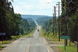
[edit]The municipality is served by highways 590 and 595, which intersect in the northern half of the municipality. Highway 590 connects the community to the Trans-Canada Highway (Highway 11/17) at Kakabeka Falls in neighbouring Oliver Paipoonge.
See also
[edit]References
[edit]- ^ a b c d "O'Connor, Ontario (Code 3558016) Census Profile". 2021 census. Government of Canada - Statistics Canada. Retrieved 2026-01-12.
- ^ F.B. Scollie, Thunder Bay Mayors & Councillors 1873-1945 (Thunder Bay Historical Museum Society, 2000), 121-122
- ^ "Council | O'Connor Township". www.oconnortownship.ca. Retrieved 2025-09-19.
- ^ "O'Connor Newsletter | O'Connor Township". www.oconnortownship.ca. Retrieved 2025-09-19.
- ^ "2021 Community Profiles". 2021 Canadian census. Statistics Canada. February 4, 2022. Retrieved 2022-04-27.
- ^ "2016 Community Profiles". 2016 Canadian census. Statistics Canada. August 12, 2021. Retrieved 2019-07-12.
- ^ "2011 Community Profiles". 2011 Canadian census. Statistics Canada. March 21, 2019. Retrieved 2012-03-29.
- ^ "Census Profile, 2016 Census: O'Connor, Township". Statistics Canada. 2017-02-08. Retrieved July 12, 2019.
- ^ 1996, 2001, 2006, 2011 census
- ^ "1971 Census of Canada - Population Census Subdivisions (Historical)". Catalogue 92-702 Vol I, part 1 (Bulletin 1.1-2). Statistics Canada. July 1973.
External links
[edit]
- Pages using gadget WikiMiniAtlas
- Use Canadian English from January 2023
- All Wikipedia articles written in Canadian English
- Articles with short description
- Short description is different from Wikidata
- Coordinates on Wikidata
- Commons category link from Wikidata
- Official website different in Wikidata and Wikipedia