
You can help expand this article with text translated from the corresponding article in German. (February 2009) Click [show] for important translation instructions.
|
Simonswald | |
|---|---|
|
👁 Coat of arms of Simonswald Coat of arms | |
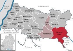
Location of Simonswald
within Emmendingen district | |
Location of Simonswald | |
| Coordinates: 48°6′1″N 8°3′21″E / 48.10028°N 8.05583°E / 48.10028; 8.05583 | |
| Country | Germany |
| State | Baden-Württemberg |
| Admin. region | Freiburg |
| District | Emmendingen |
| Subdivisions | 7 |
| Government | |
| • Mayor (2017–25) | Stephan Schonefeld[1] |
| Area | |
• Total | 74.31 km2 (28.69 sq mi) |
| Elevation | 360 m (1,180 ft) |
| Population (2024-12-31)[2] | |
• Total | 2,936 |
| • Density | 39.51/km2 (102.3/sq mi) |
| Time zone | UTC+01:00 (CET) |
| • Summer (DST) | UTC+02:00 (CEST) |
| Postal codes | 79263 |
| Dialling codes | 07683 |
| Vehicle registration | EM |
| Website | www.simonswald.de |
Simonswald[3] (Low Alemannic: Simeschwald) is a town in the district of Emmendingen in Baden-Württemberg in Germany.
History
[edit]Simonswald was first documented in 1178 as Sigmanswalt and belonged to the holdings of the St. Margarethen convent in Waldkirch. In 1316, Simonswald came into the possession of the Schwarzenberg family of Kastelburg Castle, and in 1805 it was transferred from the Landgraviate of Further Austria (Breisgau) to the Grand Duchy of Baden.[4]
The municipality was formed on April 1, 1970, through the merger of the municipalities of Altsimonswald, Haslachsimonswald, and Untersimonswald. On January 1, 1974, the two previously independent municipalities of Obersimonswald and Wildgutach were incorporated.[5]
Twin towns
[edit]- 👁 United Kingdom
Worthing, United Kingdom
References
[edit]- ^ Aktuelle Wahlergebnisse, Staatsanzeiger, accessed 11 September 2021.
- ^ "Tabellengruppe 12411: Fortschreibung des Bevölkerungsstandes zum 31. Dezember 2024" [Update of the population as of 31 December 2024] (in German). Statistisches Landesamt Baden-Württemberg.
- ^ Simonswald
- ^ "Altsimonswald – Altgemeinde~Teilort". leo-bw.de. Retrieved 2019-06-17.
- ^ . p. 511. ISBN 3-17-003263-1.
{{cite book}}: Missing or empty|title=(help)
Hidden categories:
- Pages using gadget WikiMiniAtlas
- CS1 German-language sources (de)
- CS1 errors: missing title
- Geography articles needing translation from German Wikipedia
- Articles with short description
- Short description is different from Wikidata
- Coordinates on Wikidata
- Pages using infobox settlement with potentially too many maps
- All stub articles
- Pages using the Kartographer extension