
Teaca | |
|---|---|
| 👁 Wooden church in Budurleni Wooden church in Budurleni | |
| 👁 Location in Bistrița-Năsăud County Location in Bistrița-Năsăud County | |
Location in Romania | |
| Coordinates: 46°55′N 24°31′E / 46.917°N 24.517°E / 46.917; 24.517 | |
| Country | Romania |
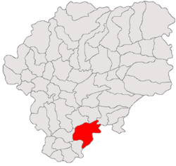
| County | Bistrița-Năsăud |
| Government | |
| • Mayor (2020–2024) | Damian-Iustian Muntean (PSD) |
Area | 140.80 km2 (54.36 sq mi) |
| Elevation | 349 m (1,145 ft) |
| Population (2021-12-01)[1] | 4,991 |
| • Density | 35.45/km2 (91.81/sq mi) |
| Time zone | UTC+02:00 (EET) |
| • Summer (DST) | UTC+03:00 (EEST) |
| Postal code | 427345 |
| Area code | +(40) x59 |
| Vehicle reg. | BN |
Teaca (German: Tekendorf,[2] Hungarian: Teke) is a commune in Bistrița-Năsăud County, Transylvania, Romania. It is composed of six villages: Archiud (Arkeden bei Bistriz, Mezőerked), Budurleni (Budurló), Ocnița (Salzgruben, Mezőakna), Pinticu (Pintak, Szászpéntek), Teaca, and Viile Tecii (Großeidau, Kolozsnagyida).
The commune is situated on the Transylvanian Plateau, in the Nösnerland, a historic region of northeastern Transylvania. Teaca lies at an altitude of 349 m (1,145 ft), on the banks of the river Dipșa and its right tributary, the river Pintic. It is located in the southern part of Bistrița-Năsăud County, 32 km (20 mi) from the county seat, Bistrița, on the border with Mureș County.
Teaca is crossed by national road DN15A [ro] (part of European route E578), which joins Reghin (28 km (17 mi) to the southeast, in Mureș County) to Bistrița.
At the 2021 census, Teaca had a population of 4,991; of those, 60.25% were Romanians, 26.21% Roma, and 5.95% Hungarians.[3]
References
[edit]- ^ "2021 Romanian census". National Institute of Statistics. 1 December 2021.
- ^ Tekendorf in Nordsiebenbürgen : Ortsmonographie; Ilse Schliessleder-Fronius, 1989
- ^ "Populația rezidentă după grupa de vârstă, pe județe și municipii, orașe, comune, la 1 decembrie 2021" (in Romanian). INSSE. 31 May 2023.
-
Saxon Lutheran church in Teaca
.JPG)