
Based at Miami, Queensland on the Gold Coast
Currently Working on
- Adding KML Routes to geographical features (highways, rivers etc)
- Adding images for Gold Coast area to Wikimedia commons
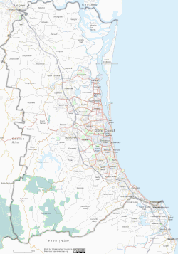
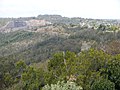
Location of Miami
Projects
[edit]| 👁 Image | This user is a member of WikiProject Australian Roads. |
| 👁 Image | This user participates in WikiProject Australian law. | 👁 Image |
| 👁 Image | This user is a member of the Antarctica Highways WikiProject. |
| This user is a participant in WikiProject Thailand. |
| 👁 Image | This user participates in WikiProject Highways. |
.svg)
| 👁 Image | This user is a member of WikiProject Bridges and Tunnels. |
| 👁 WikiProject Brisbane | This user is a member of WikiProject Brisbane. |
| 👁 Image | This user participates in Map Workshop (watch) |
| 👁 Wikiproject:WikiProject_Rivers | This user is a participant in WikiProject Rivers. |
| 👁 Image | This user participates in WikiProject Australia. |
| 👁 Image | This user contributes to OpenStreetMap. |
Articles Started
[edit]- AH3 (Asian Highway Route 3)
- Bamaga Road
- Brindabella Road
- Cudgen Road Tunnel
- Elizabeth Drive (Motorway)
- Hybrid and Electric Vehicles in Australia
- Law of Thailand
- Mackay Ring Road
- Mount Erlang Tunnel
- Peninsula Developmental Road
- Southern Moreton Bay Islands
- Ted Smout Memorial Bridge
- Toll roads in Australia
- Toowoomba Second Range Crossing
- Western Sydney Airport
Articles Contributing
[edit]Articles with substantial contributions:
Videos and Multimedia
[edit]Map Masterpieces
[edit]
Image Gallery
[edit]-
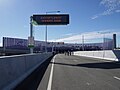
Gateway Bridge Northbound Toll Gantry
-
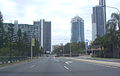
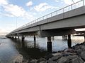
Gold Coast Hwy
-
Muscat, Oman
-
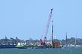
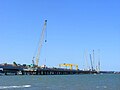
Houghton Hwy Pile Barge
-
Houghton Hwy from Brighton foreshore
-
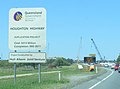
Houghton Hwy Project Sign
-
Eastlink - Wellington Rd Nortbound Toll Gantry
-
Gateway Bridge - Construction view from Paringa Rd
-
Dust Storm at Surfers Paradise beach (looking south)
-
Brindabella Rd Sign
-
Nerong Turn-off on the Karuah to Buladelah upgrade
-
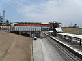
Varsity Lakes Station
-
Gateway Bridge with duplication, on approach from new Gateway Motorway Southbound
-
Tunnel, 60 metres under the Brisbane River, on the Clem7 Community Open Day
-
👁 Tunnel Entrance at Bowen Hills (Clem7 Community Open Day) with the toll gantry and transitional light filters aboveTunnel Entrance at Bowen Hills (Clem7 Community Open Day) with the toll gantry and transitional light filters above
-
👁 Tunnelling works for the Airport Link project at night: Interchange ramp at the Kedron Central siteTunnelling works for the Airport Link project at night: Interchange ramp at the Kedron Central site
-
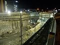
Kedron Interchange tunnelling works at night
-
👁 Eyjafjallajökull in March 2006, viewed from a recreation area on the Sólheimajökull, a glacier on the Katla volcano, IcelandEyjafjallajökull in March 2006, viewed from a recreation area on the Sólheimajökull, a glacier on the Katla volcano, Iceland
-
Bridge Walk, part of opening celebrations on 11 July 2010
-
View of new bridge from Clontarf shore
-
Site of the proposed Mango Hill Railway Station
-
Site of proposed Kippa Ring Railway Station
-
Spillway tower of Hinze Dam following Stage 3 Upgrade (December 2011)
-
Hinze Dam spillway, following Stage 3 Upgrade (December 2011)
-
Open Space at Hinze Dam, following Stage 3 Upgrade (December 2011)
-
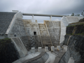
Wall of Hinze Dam, following Stage 3 Upgrade (December 2011)
-
Top of Wall at Hinze Dam, following Stage 3 Upgrade (December 2011)
-
Nerang River below Hinze Dam, following Stage 3 Upgrade (December 2011)
-
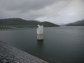
Advancetown Lake at Hinze Dam, following Stage 3 Upgrade (December 2011)
-
Heading northbound toward Southern Portal from Fortitude Valley on ramp (Preview Walk)
-
Brisbane Airportlink - Southern Portal toll gantry taken during opening walkthrough
-
Fortitude Valley On Ramp taken during opening walkthrough ('Bridge and Tunnel Experience')
-
TSRC tunnel site at the Main Range (Sep 2012), looking south from Mount Kynoch
-
👁 Northern Portal of St Helena Tunnel (Under construction as at 23 Feb 2014), part of the Tintenbar to Ewingsdale ProjectNorthern Portal of St Helena Tunnel (Under construction as at 23 Feb 2014), part of the Tintenbar to Ewingsdale Project
-
👁 Looking south from St Helena Hill onto the construction site of the Pacific Highway (Tintenbar to Ewingsdale) Project]]Looking south from St Helena Hill onto the construction site of the Pacific Highway (Tintenbar to Ewingsdale) Project]]
-
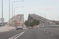
Banora Point Bypass on the Pacific Motorway at Night looking south
-
Eastern Portal of Legacy Way (westbound)
-
Low point sump, about 40 metres underneath Elizabeth Street, Paddington
-
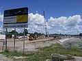
Mango Hill Station under construction (March 2015)
-
Kippa Ring Station under construction, project sign
-
17-04-01 Tweed River Floods from Winchelsea Way Terranora. Aftermath of Cyclone Debbie
.JPG)
.jpg)
.png)
_-_Spillway.png)
.png)
.png)
.png)
.png)
.png)
.jpg)
_taken_on_14-02-23.jpg)
![👁 Looking south from St Helena Hill onto the construction site of the Pacific Highway (Tintenbar to Ewingsdale) Project]]](https://upload.wikimedia.org/wikipedia/commons/thumb/f/f7/St_Helena_Hill_Tunnel_-_Looking_south_-_Under_Construction_on_14-02-23.jpg/120px-St_Helena_Hill_Tunnel_-_Looking_south_-_Under_Construction_on_14-02-23.jpg)
.jpg)
Wiki temp page
[edit]User:Advanstra/work - Bits and Pices for editing
User:Advanstra/kml - KML template
Categories:
- WikiProject Australian Roads participants
- WikiProject Australian law participants
- WikiProject Thailand participants
- WikiProject Highways participants
- Wikipedians interested in highways
- Wikipedians interested in roads
- WikiProject Bridges and Tunnels participants
- WikiProject Brisbane participants
- Wikipedians interested in maps
- WikiProject Maps participants
- Wikipedians interested in mapmaking
- WikiProject Rivers participants
- Wikipedians interested in rivers
- Wikipedians interested in Australia
- WikiProject Australia participants
- Wikipedians who contribute to OpenStreetMap
- Wikipedians in Gold Coast, Queensland