
| Westweg | |
|---|---|
| 👁 Image The Westweg enters the Wolfsschlucht near Kandern | |
| Length | 285 km (177 mi) |
| Location | Black Forest, Germany |
| Trailheads | Pforzheim, Basel |
| Use | Hiking |
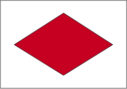
The Westweg ("West Way" or "West Trail") is a long-distance hiking trail in Germany, running north–south through the Black Forest from Pforzheim to Basel. The trail is around 285 km long, and was founded in 1900. It is currently maintained under the auspices of the Black Forest Club. The trail symbol is a red lozenge on a white background. The Westweg is a part of the European Long-distance Trail E1 (North Cape, Norway - Sicily) The route passes through or near numerous villages or small towns, so there is no difficulty in finding overnight accommodation and meals along the route. It would actually require more planning to walk it while staying in youth hostel-type accommodation, or camping. There are a number of services that will transport your luggage to the next accommodation by vehicle, leaving the hikers with only their daypacks for the hike. The route can be accessed at several places along its length by road or public transport, so it is easy to walk part of it or to do day walks along its route.
Route Description
[edit]The Westweg begins in Pforzheim, then leads through the Enz valley to the Dobel, then through wide forests and moors to the Hohloh. After descending into the Murg valley, the trail climbs to the highest point in the northern Black Forest, the Hornisgrinde. The next section follows the Schwarzwaldhochstraße (Black Forest High Street) to Alexanderschanze, and then through the Kinzig valley to Hausach. After a steep climb the Westweg leads from the Martinskapelle (the source of the Breg) to Kalten Herberge, the European continental divide between the Rhine and Danube rivers. At the Feldberg saddle the Westweg forks into an eastern and a western section. The western route (Variation A) runs over the Feldberg, Belchen, and Blauen to Kandern, then through the Wolfschlucht to the Wiese valley, and on to Basel. The eastern section (Variation B) branches southward to the second highest mountain in the Black Forest, the Herzogenhorn, over the pass between the Wehra and Wiese valleys, toward the Hohe Möhr, by Weil am Rhein and down the Rhine valley to Basel.
History
[edit]The current Westweg was created in 1900 by the Baden Section of the Schwarzwaldverein (Black Forest Society). Proposals for the creation of a north–south hiking trail along the crest of the Black Forest go back to 1894.
The Westweg, which was complemented by the Ostweg (East Trail) from Pforzheim to Schaffhausen and the Mittelweg (Middle Trail) from Pforzheim to Waldshut in 1903, has become the model for many other long-distance hiking trails.
On December 15, 2006 the Westweg was awarded the certification of "Qualitätsweg Wanderbares Deutschland".[1] (Quality Trail of Hikable Germany). In order to meet a criterion for this certification, that no more than 20% of the trail could be paved, several stretches of the trail had to be relocated or rebuilt in a more natural setting.
Dayhikes/Stages
[edit]Stages Shared by Variations A and B
[edit]First Stage: Pforzheim–Dobel
[edit]Main Variant
[edit]24 km, c. 6 hours walking time
| Location/Attractions | Distance in km | Elevation in metres | Additional Information |
|---|---|---|---|
| Pforzheim-Kupferhammer | 0 | 254 | Starting point of the three Black Forest long-distance trails, the Westweg (Pforzheim - Basel), Mittleweg (Pforzheim - Waldshut), and the Ostweg (Pforzheim - Schaffhausen) |
| Dillweißenstein | 2.5 | 270 | |
| Schloss Neuenbürg | 9.5 | 390 | |
| Neuenbürg, Marketplace | 0.5 | 323 | |
| Buchberg, Adventure playground | 0.5 | 460 | to Neuenbürg Westweg rejoins the pre-2006 higher variation |
| Schwanner Warte | 3.0 | 480 | to Straubenhardt Glider port |
| Herzogswiesen | 1.0 | 520 | |
| Dreimarkstein (Three March Stone) | 3.5 | 660 | Shelter hut Named because of the boundary stones for the communities of Dobel, Dennach (part of Neuenbürg), and Conweiler (part of Straubenhardt). |
| Volzemer Stein | 1.5 | 660 | Boulder field |
| Dobel | 2.0 | 720 | Observation tower |
Higher Variant
[edit]In 2006 the first stage of the Westweg was relocated. The former stage is now marked as the "High Variation"
| Location/Attractions | Distance in km | Elevation in Meters | Additional Information |
|---|---|---|---|
| Pforzheim-Kupferhammer | 0 | 254 | Starting point of the three Black Forest long-distance trails, the Westweg (Pforzheim - Basel), Mittleweg (Pforzheim - Waldshut), and the Ostweg (Pforzheim - Schaffhausen) |
| Pforzheim-Dillstein | 2.0 | 270 | |
| Sonnenberg | 1.0 | 340 | |
| Birkenfeld | 2.0 | 358 | |
| Wilhelmshöhe | 6.5 | 429 | to Neuenbürg |
| Buchberg–Adventure playground | 0.5 | 460 | to Neuenbürg Higher variation rejoins the Westweg. |
Second Stage: Dobel–Forbach
[edit]25 km, c. 6.5 hours walking time
| Location/Attractions | Distance in km | Elevation in Meters | Additional Information |
|---|---|---|---|
| Dobel | 0 | 720 | Observation tower |
| Weithäusle | 5.0 | 823 | Shelter hut |
| Schweizerkopfhütte | 1.5 | 835 | Observation pavilion |
| Hahnenfalzhütte | 4.0 | 876 | Hut of the Bad Herrenalb ski club |
| Absetze | 1.5 | 917 | |
| Kreuzlehütte | 2.0 | 852 | |
| Hohlohturm | 2.0 | 986 | Kaiser Wilhelm-Turm observation tower, Shelter hut 500m side trip to the Hohlohsee (a bog). |
| Prinzenhütte | 1.5 | 976 | Shelter hut |
| Latschigfelsen | 2.5 | 762 | |
| Gausbach | 3.0 | 306 | Suburb of Forbach |
| Forbach | 1.0 | 303 |
Third Stage: Forbach–Unterstmatt
[edit]19 km, c. 5.5 hours walking time
| Location/Attractions | Distance in km | Elevation in Meters | Additional Information |
|---|---|---|---|
| Forbach | 0 | 303 | |
| Auf Wegscheiden | 5.0 | 751 | |
| Herrenwieser See | 1.5 | 834 | Glacial cirque from the last glacial period, c. 9 m deep, c. 600 m circumference. |
| Bussemer Denkstein (Bussem Monument) | 1.0 | 1003 | Philipp Bussemer |
| Badener Höhe | 2.0 | 1004 | Großherzog-Friedrich-Turm observation tower |
| Herrenwieser Saddle | 1.1 | 879 | |
| Sand | 2.6 | 828 | to Bühl Schwarzwaldhochstraße (B 500) |
| Hundseck | 1.8 | 856 | |
| Hochkopf | 3.0 | 1041 | |
| Unterstmatt | 1.0 | 928 |
Fourth Stage: Unterstmatt–Alexanderschanze
[edit]27.5 km, c. 7 hours walking time
| Location/Attractions | Distance in km | Elevation in Meters | Additional Information |
|---|---|---|---|
| Unterstmatt | 0 | 928 | |
| Ochsenstall | 2.0 | 1036 | Inn for skiers and hikers |
| Hornisgrinde | 1.0 | 1164 | |
| Mummelsee | 2.0 | 1034 | |
| Seibelseckle | 1.5 | 956 | |
| Darmstädter Hütte | 3.0 | 1020 | |
| Seekopf | 0.5 | 1040 | View of the Wildsee and the grave of Orientalist Julius Euting |
| Ruhestein | 2.5 | 915 | Schwarzwaldhochstraße (B 500) |
| Schliffkopf | 4.0 | 1055 | |
| Zuflucht | 7,5 | 963 | Former hotel, then a youth hostel, currently closed |
| Alexanderschanze | 3,5 | 968 | Crosses the B 28 |
Fifth Stage: Alexanderschanze–Auf der Hark
[edit]18 km, c. 4.5 hours walking time
This stage and the next can be completed in one day by experienced hikers.
| Location/Attractions | Distance in km | Elevation in metres | Additional Information |
|---|---|---|---|
| Alexanderschanze | 0 | 968 | |
| Am kalten Haupt | 2.5 | 936 | |
| Hildahütte | 2.0 | 914 | |
| Lettstädter Höhe | 3.0 | 968 | |
| Lake-level above the Glaswaldsee | 1.5 | 960 | Side trip to viewpoint over the Glaswaldsee |
| Freiersbergsattel | 2.0 | 752 | Crosses the pass road Schapbach–Bad Peterstal |
| Littweger Höhe | 2.5 | 843 | Shelter hut. Crosses the Gengenbach–Alpirsbach Black Forest Trail |
| Auf der Hark | 4.5 | 700 | Farm bed and breakfast– to Oberharmersbach |
Sixth Stage: Auf der Hark–Hausach
[edit]16.5 km, c. 4 hours walking time
This stage and the previous one can be completed in one day by experienced hikers.
| Location/Attractions | Distance in km | Elevation in Meters | Additional Information |
|---|---|---|---|
| Auf der Hark | 0 | 700 | |
| Kreuzsattelhütte | 3.0 | 738 | |
| Trail forks to Brandenkopf | 0.2 | 735 | Marked variant: The Brandenkopf is about 3.5 km from the Westweg. |
| Hirzwasen | 1.8 | 735 | Crosses the Great Hansjokob Path |
| Ebenacker | 2.0 | 620 | |
| Hohenlochen-Hütte | 2.5 | 689 | Simple hiker's hut |
| Käppelehof | 0.3 | 640 | Farm bed and breakfast |
| Weißes Kreuz | 0.2 | 570 | |
| Spitzfelsen | 2.0 | 580 | Schutzhütte |
| Hausach | 4.5 | 237 |
Seventh Stage: Hausach–Wilhelmshöhe (above Schonach)
[edit]21.5 km, c. 5.5 hours walking time
| Location/Attractions | Distance in km | Elevation in Meters | Additional Information |
|---|---|---|---|
| Hausach | 0 | 237 | |
| Husen Castle ruins | 0.5 | 288 | |
| Farrenkopf / Hasemann Hut | 5.5 | 790 | Shelter hut named after artist, Wilhelm Hasemann |
| Büchereck | 3.0 | 651 | |
| Haselberg | 2.0 | 760 | Crosses the Rottweil–Lahr Black Forest Trail |
| Prechtaler Schanze | 0.5 | 820 | |
| Huberfelsen | 1.0 | 745 | Viewpoint |
| Fährlefelsen | 0.5 | 755 | Crosses the Rottweil–Lahr Black Forest Trail |
| Karlstein | 1.5 | 970 | also: Hauenstein Named for the visit of Karl, Duke of Württemberg in 1770 |
| Schöne Aussicht | 1,0 | 915 | Inn |
| Rensberg | 3,0 | 940 | |
| Wilhelmshöhe | 3,0 | 980 | to Schonach |
Eighth Stage: Wilhelmshöhe–Kalte Herberge
[edit]23.5 km, c. 6 hours walking time
| Location/Attractions | Distance in km | Elevation in metres | Additional Information |
|---|---|---|---|
| Wilhelmshöhe | 0 | 976 | |
| Wolfsbauernhof | 1.5 | 1023 | |
| Blindensee | 1.5 | 1000 | Bog |
| Weißenbacher Höhe | 2.5 | 1016 | |
| Martinskapelle | 3.5 | 1094 | The continental divide between the North Sea and the Black Sea. Near St. Martin's Chapel is the spring of the Breg, one of the sources of the Danube, and the Elz, one of the tributaries of the Rhine. |
| Brend | 3.0 | 1149 | Highest point in the Central Black Forest. Observation tower |
| Alte Ecke | 2.5 | 1075 | |
| Winkel / Südlicher Staatsberg | 2.0 | 1045 | Beginning of a section shared with the Black Forest–Kaiserstuhl–Rhine Trail. |
| Beim Staatsberghof | 1.0 | 990 | End of the section shared with the Black Forest-Kaiserstuhl-Rhine Trail |
| Neueck | 0.5 | 988 | Saddle between Furtwangen and Glottertal |
| Hausebene-Hof | 2.0 | 940 | |
| Kalte Herberge | 3.5 | 1029 | Inn (on the continental divide: water flows off the roof in both directions.) |
After the ninth stage these descriptions follow the pre-2006 route. Since then the fork between the eastern and western variations has moved to Titisee. The western branch leads from there over the ridge between Titisee and Hinterzarten toward Oberzarten. From there it follows the Emil Thomas Path to the peak of the Feldberg, where it rejoins its former route. After Kandern the trail now goes through the Wolfschlucht to Wollbach. The eastern variation follows its former path through the Bärental, the Zweiseenblick, the Cartitasheim, and then on toward Herzogenhorn
Ninth Stage: Kalte Herberge–Bärental (Pre-2006)
[edit]26.5 km, c. 6.5 hours walking time
| Location/Attractions | Distance in km | Elevation in Meters | Additional Information |
|---|---|---|---|
| Kalte Herberge | 0 | 1029 | |
| Lachenhäusle | 3.0 | 1080 | |
| Schweizerhof | 3.5 | 1040 | Inn |
| Fürsatzhöhe | 9.5 | 1071 | |
| Geigershof | 1.5 | 940 | |
| Titisee | 2.5 | 823 | Crosses the Freiburg-Lake Constance Black Forest Trail |
| Bärental | 6.5 | 967 | Highest Deutsche Bahn station on the trail |
Variation A - Western Route
[edit]Tenth Stage: Bärental–Wiedener Eck (pre-2006)
[edit]24.5 km, c. 6 hours walking time
| Location/Attractions | Distance in km | Elevation in Meters | Additional Information |
|---|---|---|---|
| Bärental | 0 | 967 | |
| Zweiseenblick | 3.0 | 1284 | Viewpoint over the Titisee and Schluchsee |
| Feldberg-Caritasheim | 2.5 | 1230 | Plan time to stop at Feldsee (lake)! |
| Feldbergerhof | 1.5 | 1279 | |
| Bismarck-Denkmal | 1.0 | 1448 | View over the Feldsee |
| Feldberg- Peak | 2.0 | 1495 | Highest point of the Westweg and the entire Black Forest. |
| Stübenwasen | 3.5 | 1241 | Inn; incredible view about 1km toward Notschrei |
| Notschrei | 5.0 | 1121 | Hotel; Nordic training area |
| Am Trubelsmattkopf | 2.5 | 1282 | |
| Wiedener Eck | 3.5 | 1037 | Hotel |
Eleventh Stage: Wiedener Eck–Blauen (pre-2006)
[edit]21 km, c. 5.5 hours walking time
| Location/Attractions | Distance in km | Elevation in Meters | Additional Information |
|---|---|---|---|
| Wiedener Eck | 0 | 1037 | |
| Krinne | 4.0 | 1119 | |
| Belchen | 2.0 | 1414 | Café; view |
| Hohe Kelch | 1.5 | 1266 | |
| Haldenhof | 3.5 | 900 | Inn |
| Sirnitz-Saddle | 1.5 | 1073 | |
| Stühle | 3.0 | 1049 | Shelter hut |
| Egerten-Saddle | 3.0 | 927 | Shelter hut |
| Hochblauen | 2.5 | 1167 |
Twelfth Stage: Blauen–Basel (pre-2006)
[edit]32.5 km, c. 8 hours walking time
| Location/Attractions | Distance in km | Elevation in Meters | Additional Information |
|---|---|---|---|
| Hochblauen | 0 | 1167 | Gasthause; Extensive views[citation needed] |
| Hexenplatz | 2.5 | 845 | |
| Sausenburg | 3.5 | 665 | |
| Kandern | 4.0 | 352 | |
| Egerten-Nebenau | 6.0 | 456 | |
| Burg Rötteln | 5.0 | 417 | Castle; cafe |
| Tüllingen | 6.5 | 422 | Suburb of Lörrach |
| Basel | 5.0 | 260 |
Variation B – Eastern Route
[edit]Tenth Stage: Bärental–Hochkopfhaus (pre-2006)
[edit]26.5 km, c. 7 hours walking time
| Location/Attractions | Distance in km | Elevation in Meters | Additional Information |
|---|---|---|---|
| Bärental | 0 | 967 | |
| Zweiseenblick | 3.0 | 1284 | Viewpoint over the Titisee and the Schluchsee. |
| Feldberg-Caritasheim | 2.5 | 1230 | |
| Feldbergerhof | 1.5 | 1279 | |
| Zeiger | 1.0 | 1231 | |
| Grafenmatt | 1.7 | 1377 | Inn |
| Glockenführe | 0.8 | 1320 | Path up the Herzogenhorn (1415 m) |
| Hof Eck | 3.5 | 1127 | |
| Auf der Wacht | 3.0 | 975 | |
| Blößling | 2.5 | 1309 | Steep climb |
| Präger Eck | 2.0 | 1103 | |
| Leder Tschobenstein | 2.0 | 1212 | |
| Hochkopfhaus | 3.0 | 1087 | Schwarzwaldverein hiking center |
Eleventh Stage: Hochkopfhaus–Schweigmatt (pre-2006)
[edit]18.5 km, c. 5 hours walking time
| Location/Attractions | Distance in km | Elevation in Meters | Additional Information |
|---|---|---|---|
| Hochkopfhaus | 0 | 1081 | |
| St. Antoni | 2.0 | 1064 | |
| Altensteiner Eck | 3.0 | 1090 | |
| Altensteiner Kreuz | 1.5 | 1064 | |
| Sägbaumdumpf | 1.3 | 1040 | |
| Schwellen | 4.2 | 1001 | Gersbach (Südschwarzwald), winner of two village "beauty pageants":Bundesgolddorf in 2004, Europagolddorf in 2007 |
| Hohe Möhr | 4.5 | 985 | Observation tower, the top of which is over 1000 meters above sea level. (The last time above 1000m on the trail) |
| Schweigmatt | 2.0 | 725 |
Twelfth Stage: Schweigmatt–Adelhausen (pre-2006)
[edit]18 km, c. 4.5 hours walking time
| Location/Attractions | Distance in km | Elevation in Meters | Additional Information |
|---|---|---|---|
| Schweigmatt | 0 | 725 | |
| Hasel | 3.5 | 440 | Erdmannshöhle |
| Hohe Flum | 9.5 | 535 | |
| Adelhausen | 5.0 | 459 | Suburb of Rheinfelden |
Thirteenth Stage: Adelhausen–Basel (pre-2006)
[edit]18 km, c. 4.5 hours walking time
| Location/Attractions | Distance in km | Elevation in Meters | Additional Information |
|---|---|---|---|
| Adelhausen | 0 | 459 | |
| Sieben Bannstein | 4.0 | 451 | |
| Rührberg | 6.5 | 510 | Suburb of Grenzach-Wyhlen |
| Basel | 10.0 | 260 | Ending point is the Basel Badischer Bahnhof |
Notes
[edit]External links
[edit]
- Exact Trail Guide
- Detailed Trail Guide
- Description by the Schwarzwaldverein
- Elevation profile und overview map at www.wanderbares-deutschland.de
- Information about the Schwarzwaldverein's hundredth anniversary
- Westweg - Trail description, elevation profile and GPS tracks
- Wanderservice Schwarzwald – Web application of the Schwarzwaldverein: the Westweg in GoogleMaps with various overlays (Trail network, signposts, accommodations, ...)
- Articles with short description
- Short description matches Wikidata
- Pages using infobox mapframe with missing coordinates
- All articles with unsourced statements
- Articles with unsourced statements from July 2025
- Commons category link from Wikidata
- Baden-Württemberg articles missing geocoordinate data
- All articles needing coordinates
- Articles missing coordinates without coordinates on Wikidata