
| 👁 Image | This is an information page. It is not a Wikipedia policy or guideline; rather, its purpose is to explain certain aspects of Wikipedia's norms or practices. It may reflect varying levels of consensus. |
This page has links to templates, workspaces, and categories that can help guide users with the multiple methods of creating and curating maps and legends on Wikipedia.
Requesting maps, map features, and assistance with issues
[edit]- Template:Map requested, a way to request a map be created for an article on its talk page
- Wikipedia:Graphics Lab/Map workshop, a place to request a map be created for a Wikipedia article
- commons:Commons:Graphic Lab/Map workshop, a place to request a map be created for Wikimedia Commons
Places to discuss mapping best practices and issues include the following:
- Wikipedia talk:WikiProject Maps
- Wikipedia talk:WikiProject OpenStreetMap
- Wikipedia talk:WikiProject Geographical coordinates
Legends
[edit]- {{Legend}}
- See Category:Legend templates for derivatives
User-editable maps
[edit]These SVG maps have user-editable sections (any text editor) to allow creation of more maps on more topics. Just paste in a list of states and values. See examples at Commons:Category:English-language SVG maps of the United States made with templates. Feel free to create map templates for other countries too. Cmglee may be able to help with that.
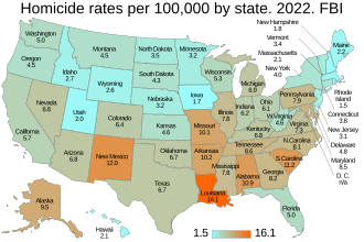
| Version 2: Convert a US list/table to a state-by-state data map. With examples and step-by step instructions. Example: |
| Simple map below with state names and colored states. See its talk page. |
Editing or generating maps
[edit]Automated mapping
[edit]
.jpg)
Templates for making automated maps on Wikipedia include:
- {{Maplink}} – Automated, using OpenStreetMap (OSM) maps
- {{Mapbox}} – Derivation just displaying a link to a map
- {{Infobox mapframe}} – Version with simpler code intended for infobox use
- {{Rapid transit OSM map}} – Version to easily show rapid transit maps
- {{Location map}} – The "pushpin-style" maps requiring a base image and coordinates preset for its corners
- {{Location map+}} – Allows for multiple markers
- {{Location map many}} – Allows multiple markers and labels
- {{Choropleth map}} – Version that creates choropleth maps (i.e. maps with certain regions highlighted)
- {{OSM Location map}} – Combines features from the above two styles, with OSM maps for all scales and locations, onto which pushpin points/shapes/marks/graphics, overlays, images, and text can be added.
Other mapping methods
[edit]
Many maps on Wikipedia use static image files, in which content does not update dynamically. These files are typically in PNG or SVG format, and are listed at Commons:Category:Maps. In order to update or alter such a map, changes must be made manually using an editing program.
See also
[edit]- Wikipedia:WikiProject Maps
- Help:Attached KML
- d:Wikidata:Map data
- mw:Maps
- Collaboration with Wikipedia, a project page at OpenStreetMap
- mw:Extension:Graph/Demo, a graph demonstration which treats maps as graphs. Often there is no distinction.