
ICESat-2 Model featured at the Smithsonian National Air & Space Museum (NASM)
In the DC area? Check out the ICESat-2 scale model featured in NASM's new exhibit.
Launched on September 15, 2018, from the Vandenberg Air Force Base in Lompoc, California, the NASA Ice, Cloud, and land Elevation Satellite 2, or ICESat-2, carries a photon-counting laser altimeter that allows scientists to measure the elevation of ice sheets, glaciers, sea ice, tree canopy height, ocean height, and more - all in unprecedented 3-D detail. ICESat-2 helps scientists investigate why, and how much, our Earth is changing in a warming climate.
News
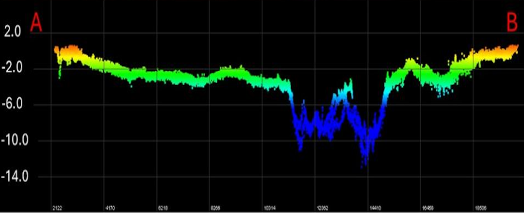
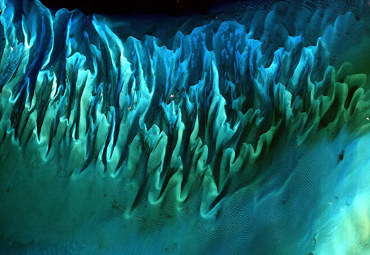
ICESat-2 researchers have developed a new way to measure near-shore bathymetry using satellite observations alone. Read how a new data product from ICESat-2 will allow researchers to study some of the shallow seafloors across the globe.
NASA article on annual sea ice minimum, likely the 7th-lowest in the satellite record. Read about sea ice minimum here.
ICESat-2's Data repository, the National Snow and Ice Data Center (NSIDC), describes the solar storms that affected ICESat-2 and how the satellite got back on track. See how the solar storms affected ICESat-2.
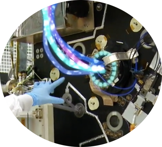
Space Lasers
ICESat-2's laser is split into six beams, to better measure Earth's surface. Find out more about space lasers here.
Meet Your Guides
Hang out with Paige the Penguin and Pho the Photon in the FunZone! Learn all about the ICESat-2 mission through fun features, images, videos, demonstrations, and activities.
Events
Online, Webex
NASA Wallops Flight Facility Visitor Center
Wallops Island, Virginia
Did You Know?
The ICESat-2 laser pulses 10,000 times a second; each pulse releases about 300 trillion photons. Only about a dozen photons hit Earth’s surface and return to the satellite.