La NASA refuerza Artemis: añade una misión y perfecciona su arquitectura general
article1 month ago
Landsat
The NASA/USGS Landsat program provides the longest continuous space-based record of Earth’s land in existence. Landsat data are essential for making informed decisions about our planet’s resources and environment.
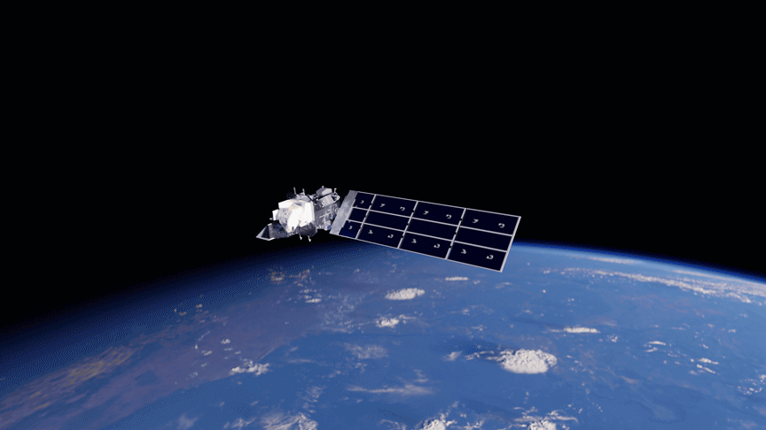
Landsat has been a cornerstone of global land imaging for more than 50 years. Since 1972, consistent and reliable data from Landsat satellites have been used by scientists, policy-makers, and decision-makers to understand and manage Earth’s changing surface.
Mission Objective
Earth Observation
Type
Orbiter
First Launch
July 23, 1972
Successful Launches
8 satellites
Overview
The Landsat program consists of a series of Earth-observing satellite missions jointly managed by NASA and the U.S. Geological Survey (USGS). Since 1972, Landsat satellites have continuously acquired images of the Earth’s land surface and provided an uninterrupted data archive to assist land managers, planners, and policymakers in making more informed decisions about natural resources and the environment. Landsat’s free and publicly accessible data contributed an estimated $25.6 billion to the United States economy in 2023 alone.
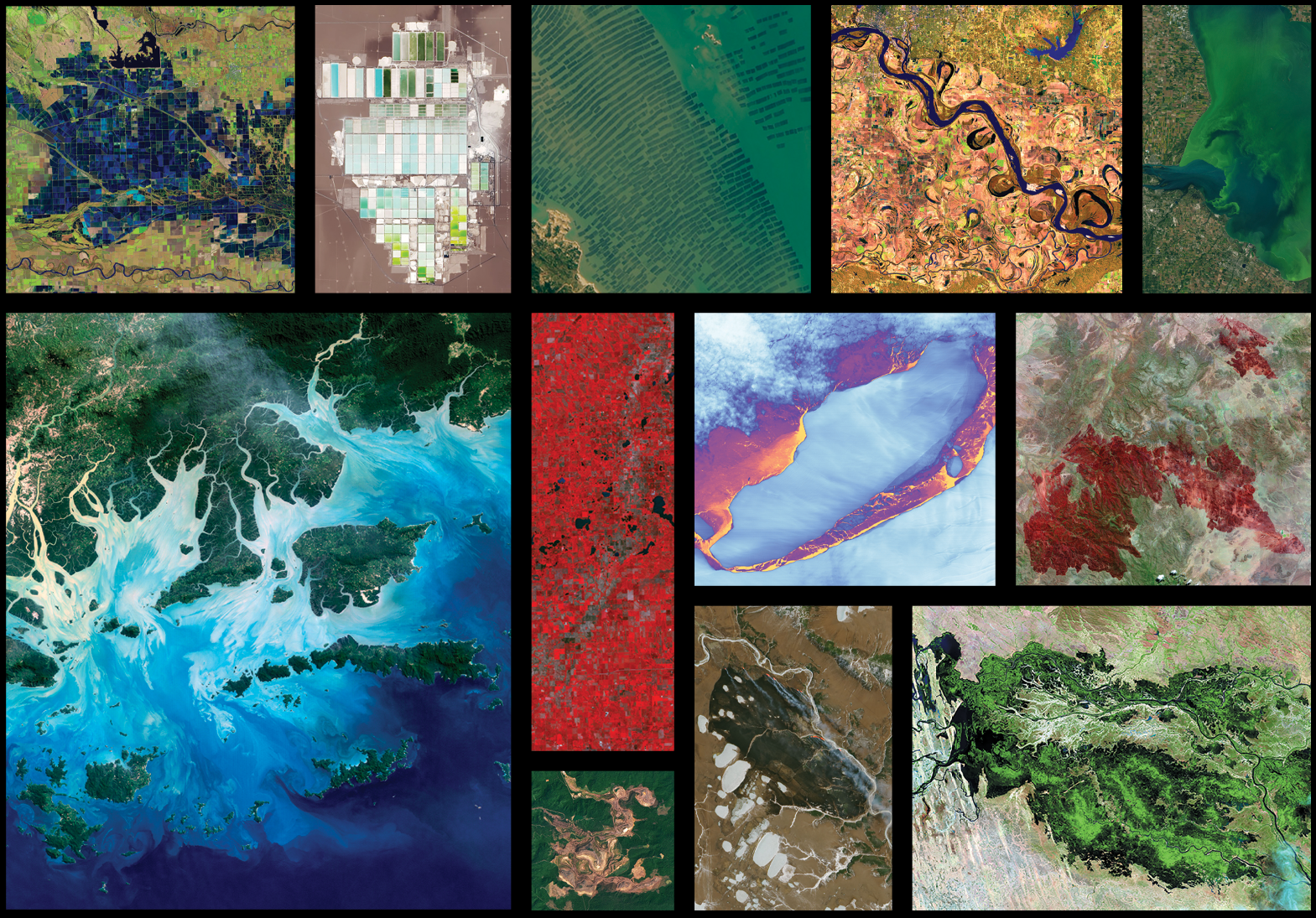
With each new launch, Landsat’s decades-long data record becomes even more valuable. As the longest continuous space-based record of Earth’s surface, Landsat offers a unique resource to scientists studying long-term changes. Researchers have used Landsat’s archive to study how cities have grown, coastlines have shifted, crop cycles have changed, and forests have transformed since the 1970s.
This groundbreaking research is possible because Landsat’s carefully calibrated, science-quality archive is the "gold standard" for satellite data. The program prioritizes science-grade instruments and data, ensuring that researchers can be confident that changes in subsequent Landsat images reflect changes on the ground. All NASA data is free and open to the public, meaning that anyone, anywhere on Earth, can use Landsat data.
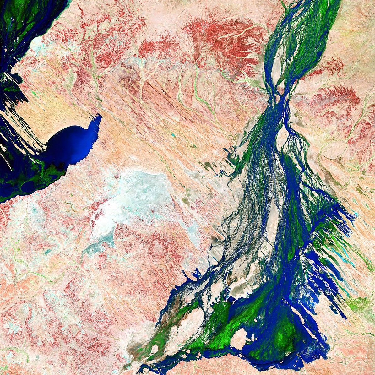
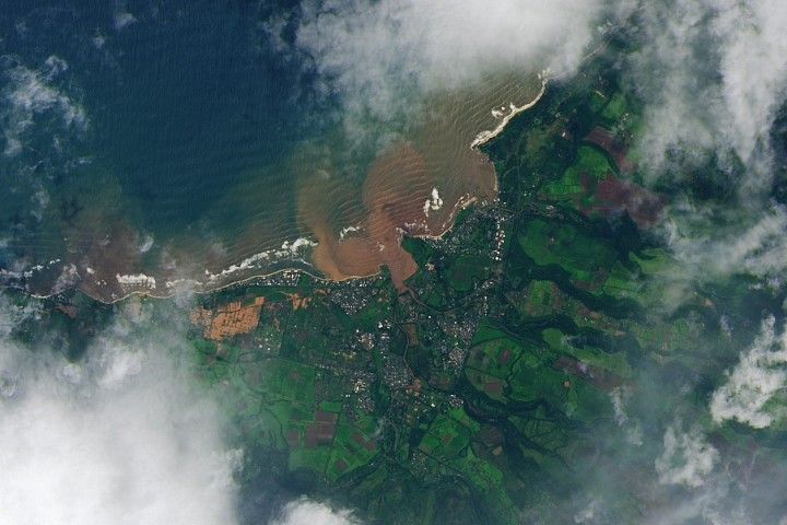
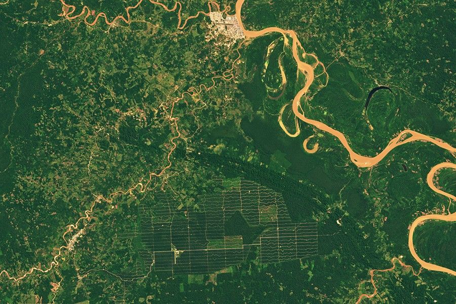
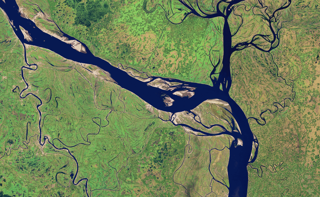
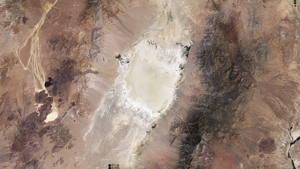
Australia's Diamantina River captured by Landsat 8's Operational Land Imager (OLI) on April 7, 2023, showing floodwaters flowing through the variable river system toward Kati Thanda–Lake Eyre following seasonal rainfall in February and March 2023.
Landsat is a critical tool for decision-making worldwide, delivering substantial economic and environmental benefits. In 2023 alone, Landsat delivered $25.6 billion economic value to the U.S. economy across a range of sectors. The U.S. Department of Agriculture uses Landsat to improve maps, saving $300 million annually in flood insurance premiums for farmers. The U.S. Forest Service and Bureau of Land Management rely on Landsat data for post-wildfire restoration efforts, saving between $2 and $9 million annually.
Landsat also helps monitor critical water resources: the Idaho Department of Water Resources saves nearly $20 million annually for estimating well-water usage, while monitoring water quality with Landsat data saves about $51 million annually in lab costs. To discover more about how Landsat helps researchers and policymakers better understand and sustainably manage Earth’s natural resources, explore the featured societal benefits below.
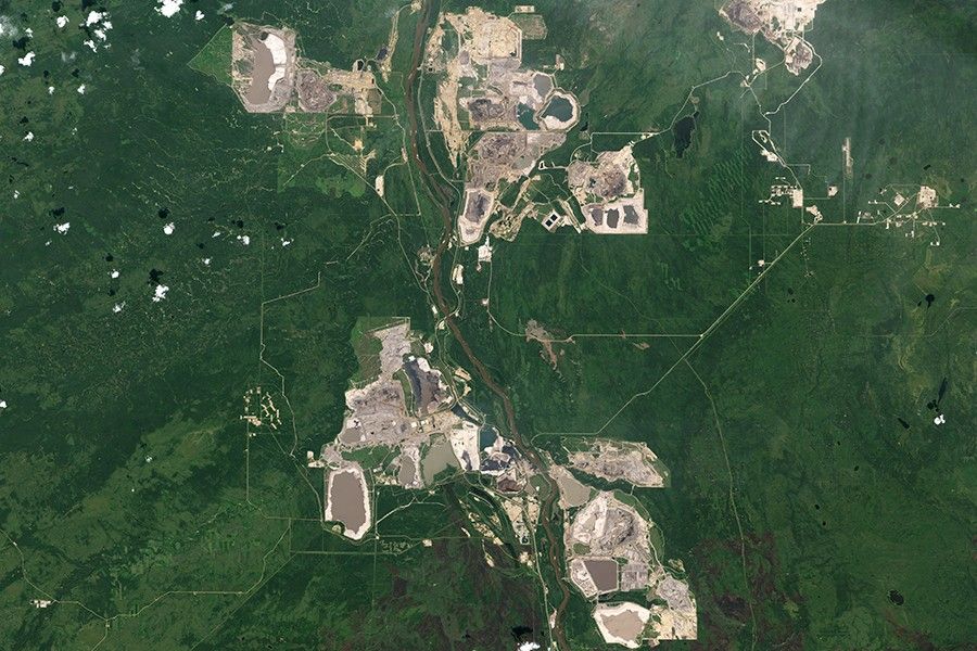
As the global demand for energy grows, Landsat plays a pivotal role in identifying new energy sources while monitoring the environmental impacts of existing operations.
Landsat equips forest managers with the necessary insights to conserve forests for timber production and biodiversity while combating threats like pest infestation and deforestation.
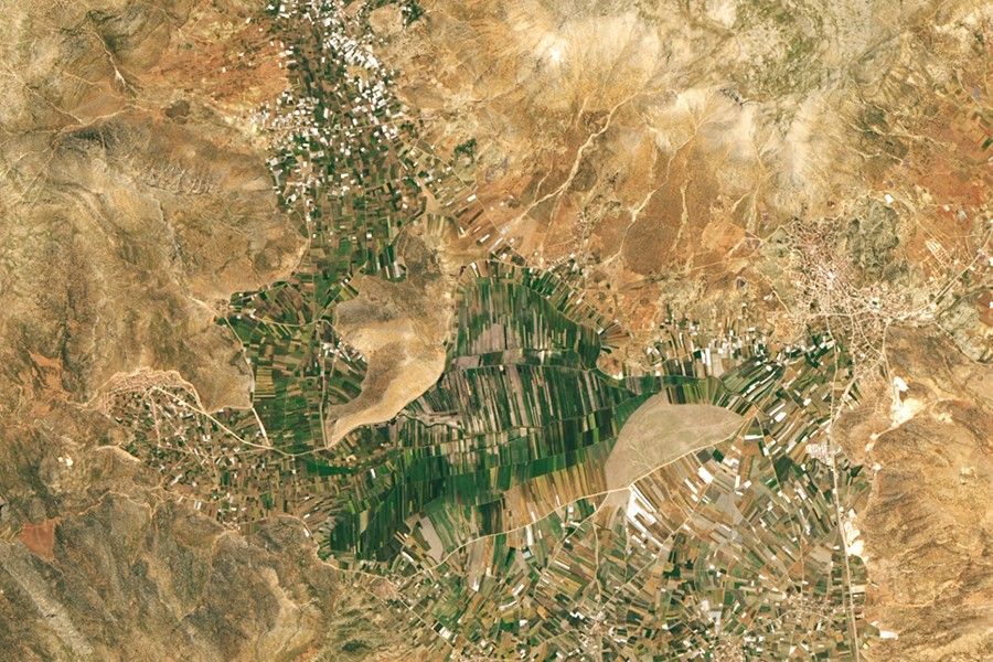
Landsat monitors rangeland vegetation health and forage production across grasslands, shrublands, woodlands, and deserts that cover over half of Earth's land surface.
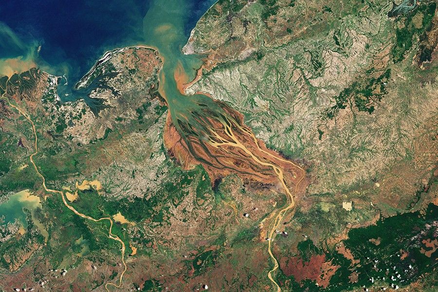
Landsat informs water resources decisions from monitoring agricultural water use to identify reservoir pollution, impacting millions of people’s access to this essential resource.
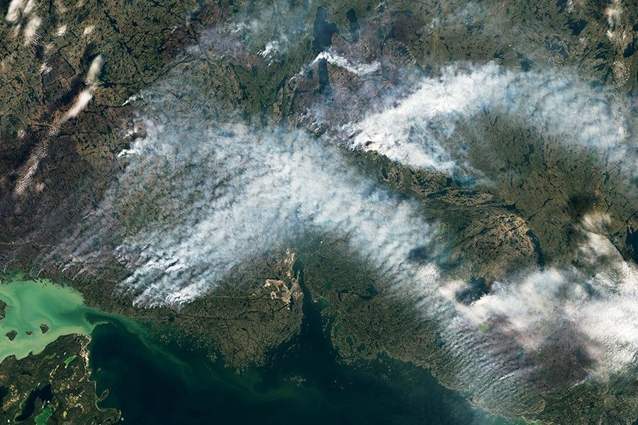
The boreal forest—the world’s largest terrestrial biome—is warming faster than any other forest type. To understand the changing dynamics of boreal forests, Feng et al., 2026 analyzed the biome from 1985 to 2020, leveraging the longest and highest-resolution satellite record of calibrated tree cover to date. The study, published in February in Biogeosciences with four co-authors from NASA Goddard Space Flight Center, confirms a northward shift in boreal forest cover over the past four decades.
Scientific studies rely on science-grade instruments—instruments that record information consistently and accurately. Landsat sensors are carefully calibrated to measure subtle changes on Earth’s surface, allowing scientists to reliably identify short- and long-term trends.
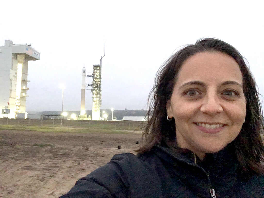
Before those instruments reach orbit, they undergo rigorous testing to measure exactly how they will perform in space. This testing helps scientists ensure that the instruments continue collecting reliable data during the entire operational life of the satellite.
Even with such meticulous preparation, engineers add in another layer of protection: redundancy. Each satellite carries backup systems, such as duplicate detectors, calibration lamps, and electronics, in case the primary equipment fails. This built-in insurance helps minimize gaps in the data, serving the fundamental Landsat mission goal of long-term continuity.
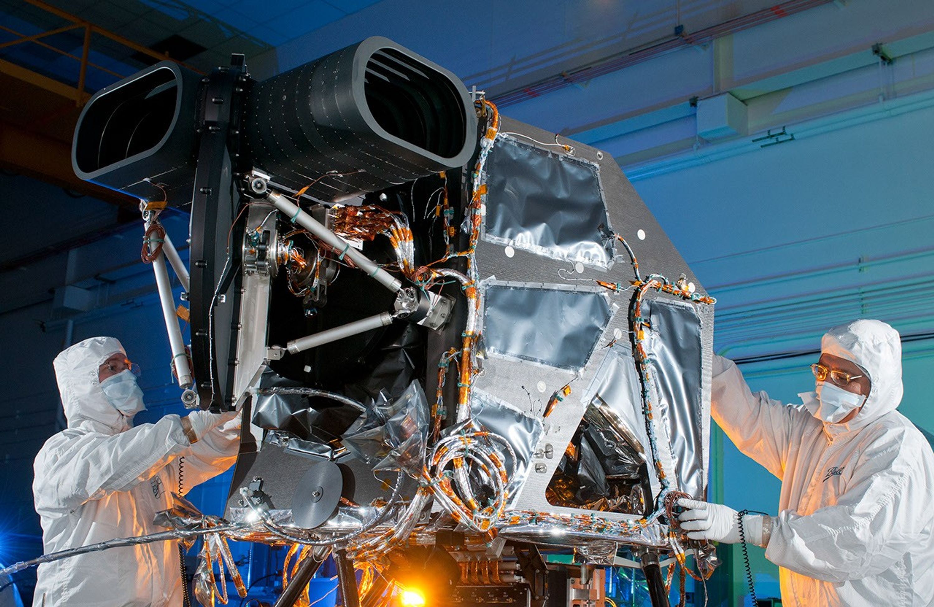
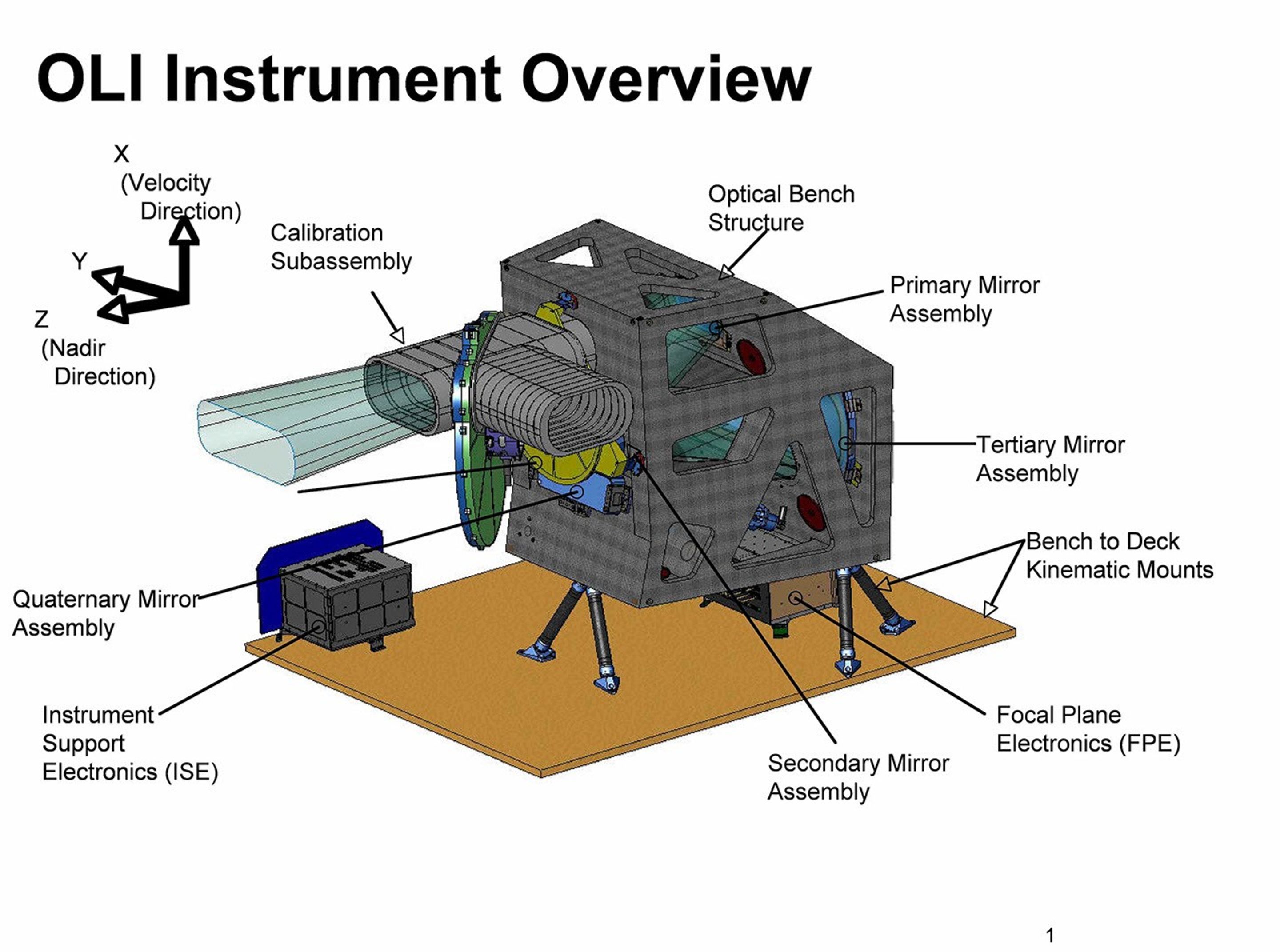
The Operational Land Imager (OLI), built by the Ball Aerospace & Technologies Corporation, measures in the visible, near infrared, and shortwave infrared portions of the spectrum. The opening facing the left of the photo points at the Earth, and the opening on the right towards the sun, to calibrate the instrument.
Ball Aerospace
Calibration and Validation
Landsat is considered the “gold standard” of medium-resolution satellite data because of the program’s tradition of rigorous, independently-verified calibration. Careful calibration ensures that Landsat imagery accurately reflects the conditions on the ground and that those measurements are consistent across time and between sensors. That means that when scientists identify a difference between images, they can be confident that it reflects an actual change on the ground rather than a discrepancy in the data.
Calibration and Validation (Cal/Val) teams from NASA and the U.S. Geological Survey (USGS) collaborate on Landsat calibration throughout the entire life of a mission.
Many commercial satellite companies use Landsat’s free, reliable data to calibrate their own data. Landsat’s careful calibration also makes it possible to fuse data from multiple satellite missions, providing data for new innovative data products, comprehensive global monitoring and informed decision making. With decision-makers around the world increasingly relying on satellite information, calibration is essential—better data power better decisions.
A technician surveys the TIRS instrument and calibration equipment.
NASA/Goddard/Bill Hrybyk
Spectral Coverage
Broad spectral coverage—the ability to sense parts of the electromagnetic spectrum beyond the visible and near-infrared (VNIR)—is essential to accurately study Earth’s surface. In addition to VNIR, Landsats 8 and 9 collect data in three shortwave-infrared bands and two thermal-infrared bands.
These longer wavelength bands play a vital role in measuring evapotranspiration to track water use, detecting fire scars and volcanic lava flows, and calculating spectral indices to monitor vegetation health, soil conditions, and land use. Landsat’s robust spectral coverage enables researchers to study nearly every terrestrial environment on Earth.
A graphic comparing the bands between different Landsat satellites.
NASA/Ross Walter
Data Continuity for Earth Observation
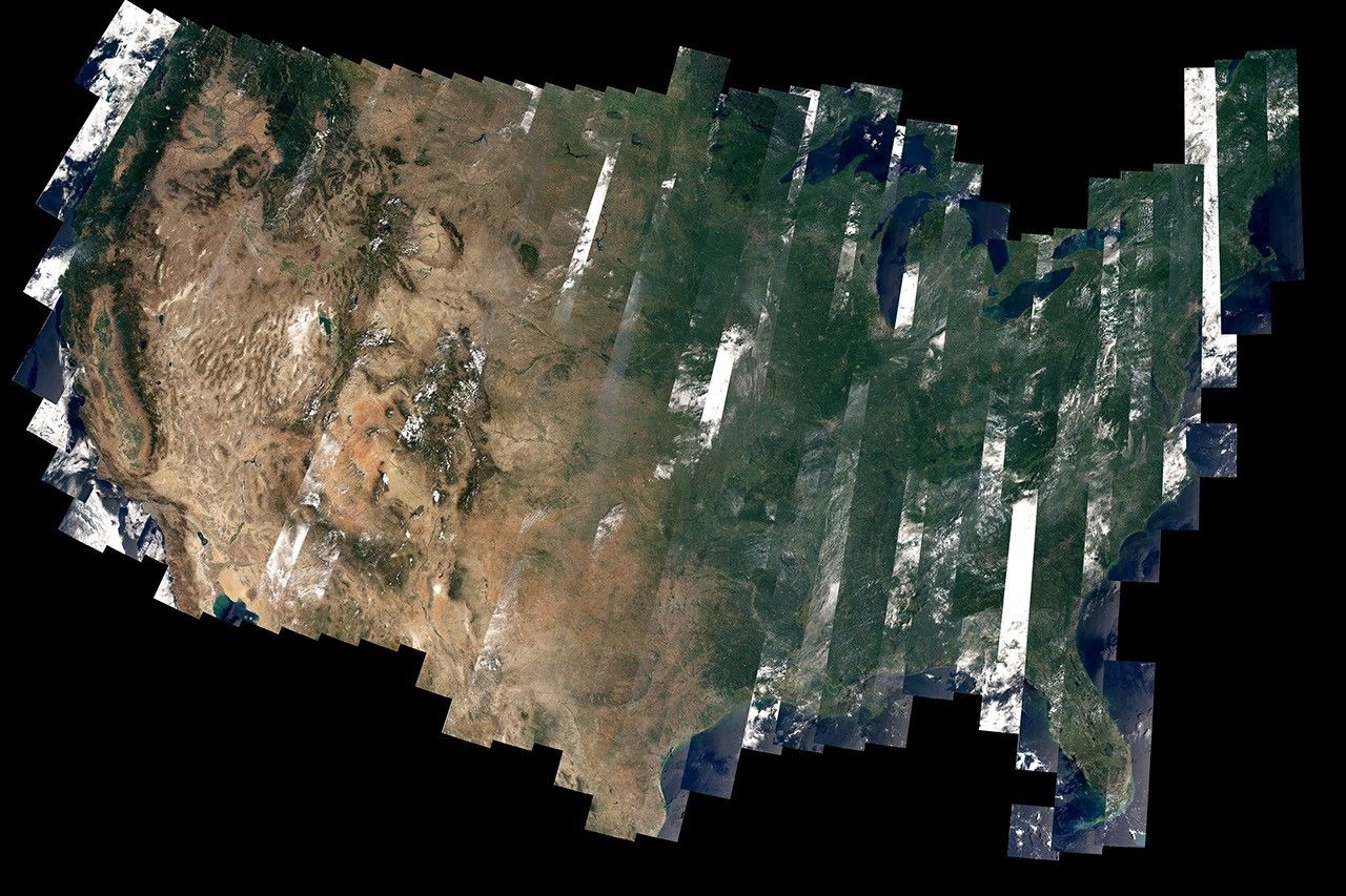
Landsat is the longest continuous space-based record of Earth’s land surface. The program has provided scientists with visible and near-infrared imagery since 1972, and added data for longer wavelengths (shortwave and thermal-infrared) in 1982. While technology improved with each mission, data remained compatible with previous missions to support both existing and evolving user needs. Researchers can use decades of gap-free, reliable, carefully-calibrated data to analyze how land has changed over time.
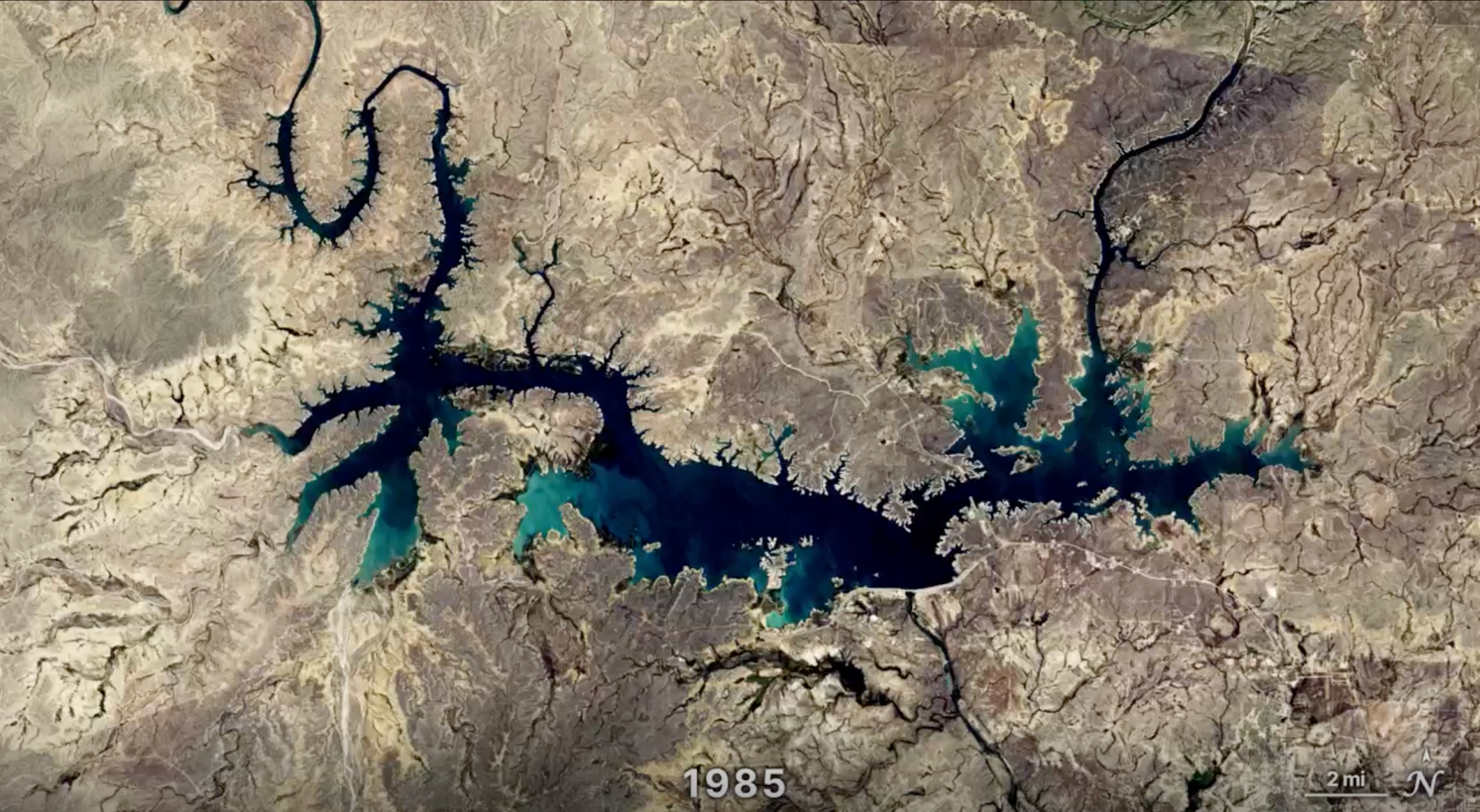
This uninterrupted record of Earth’s land surface allows scientists to study long-term trends including urbanization, coastline change, glacial retreat, and forest dynamics. The future success of the Landsat program—and its many societal and economic benefits—relies on the ongoing collection of science-grade data.
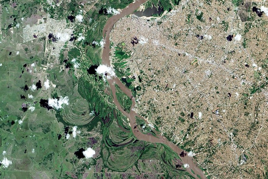
A timeseries showing the meandering Padma River from 1988 to 2018.
NASA
Landsat is Foundational
Landsat is a powerhouse for scientific discovery. In the decades since the program’s inception, Landsat data have helped scientists monitor large-scale processes like glacial retreat and coastline change, train machine learning algorithms to detect change over time, and even discover a previously uncharted island.
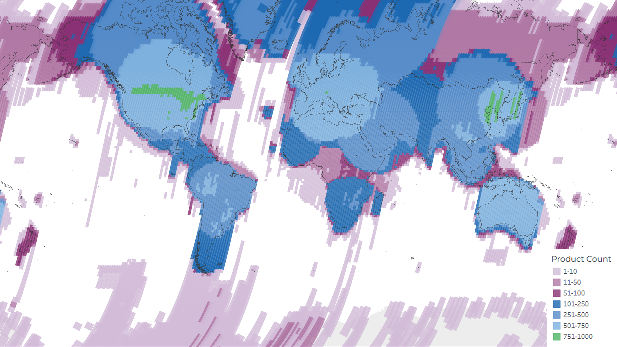
Access to Landsat data became free and open in 2008. Since then, the number of publications citing Landsat data has steadily increased, including many articles in major journals such as Science and Nature. Landsat forms the basis of widely-used products including the National Land Cover Database (NLCD), OpenET, and more. Explore the groundbreaking research that Landsat makes possible.
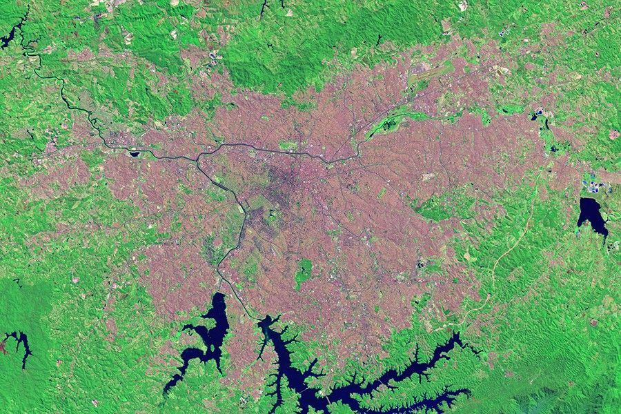
A natural-color time series of the Chaco region in Paraguay, spanning 1985 to 2025, showing extensive deforestation and land cover changes over four decades.
NASA/Ross Walter
Featured Video
Harnessing Machine Learning with Landsat Data
Over the past few years, machine learning techniques have been increasingly used to analyze the vast amount of data collected by the Landsat mission, which has been circling the globe for over 50 years. The data has been used to classify different types of land cover, detect changes to landscapes over time, and map the impact of human activity on the environment.
Over the past 50 years, eight Landsat satellites have circled the planet, which have helped to save and improve lives and support our economy. NASA will continue to work with the USGS to improve access to Landsat's unprecedented 50-year record and build upon the program's legacy.
A NASA/USGS technical analysis detailing how the open-access Landsat data policy has expanded global use of moderate-resolution land imagery from 1972 to the Landsat 9 era.
Landsat 9 and the Sustainable Land Imaging Program
A Congressional Research Service report detailing how the Sustainable Land Imaging Program (SLIP) manages Landsat 9 through coordinated roles between NASA and the U.S. Geological Survey.
Federal policy that established U.S. management and distribution of civil land remote sensing data, ensuring continued Landsat operations and open data access.

.png?w=1600&h=812&fit=clip&crop=faces%2Cfocalpoint)