
Na mapach: 53°41′00″N 2°15′00″W/53,683333 -2,250000
| dystrykt niemetropolitalny | |||
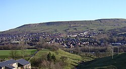
| 👁 Ilustracja Rawtenstall | |||
| Państwo | |||
|---|---|---|---|
| Kraj | |||
| Region | |||
| Hrabstwo | |||
| Siedziba | |||
| Powierzchnia |
138 km² | ||
| Populacja (2016) • liczba ludności |
| ||
| • gęstość |
506 os./km² | ||
| Położenie na mapie Lancashire 👁 Położenie na mapie | |||
| |||
| Strona internetowa | |||
Rossendale – dystrykt w hrabstwie Lancashire w Anglii.
Miasta
[edytuj | edytuj kod]Inne miejscowości
[edytuj | edytuj kod]Acre, Balladen, Bent Gate, Chatterton, Cloughfold, Cowpe, Crawshawbooth, Edenfield, Goodshaw, Helmshore, Irwell Vale, Newchurch, Sharneyford, Shawforth, Stacksteads, Strongstry, Stubbins, Turn Village, Waterfoot, Weir.
Przypisy
[edytuj | edytuj kod]- ↑ Population Estimates for UK, England and Wales, Scotland and Northern Ireland - Office for National Statistics [online], www.ons.gov.uk [dostęp 2017-10-21] (ang.).
Kontrola autorytatywna (dystrykt niemetropolitalny):