
APRS Links
Automatic Packet Reporting System for amateur radio operators
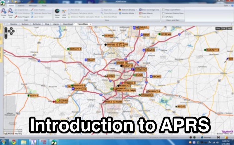
The Automatic Packet Reporting System, or APRS, is a real-time digital communications system used by ham radio operators for exchanging tactical information. It allows stations to transmit their position, weather data, telemetry, and short messages over radio, often using VHF bands. This data is then relayed by digipeaters and I-gates to the internet, making it accessible to a wider audience and other operators.
Hams interested in APRS can find resources for setting up their stations, including firmware for TNCs like UIDIGI, and software for mapping and tracking. There are also web-based tools such as APRSearch and N2RWE's Real-time APRS Maps for visualizing station activity and weather data from programs like the Citizen Weather Observer Program (CWOP). Operators can also find information on local digipeater networks and servers, like DB0ANF, to get their packets on the air and into the APRS-IS system.
Subcategories
- APRS in USA (4)
-
FindU.com is a database archiving weather, position, telemetry, and message data primarily from APRS and the Citizen Weather Observer Program.Intermediate Operating Modes Intermediate ArticleMultiband
-
APRS inforsmation hosted at Miami Museum of Science
-
Australian website about APRS
-
First Turkish APRS web site. Many TA APRS Maps for UI-Wiev
-
List of APRS server worlwide mantained by ae5pl
-
APRS related links and resources by KA9VNV
-
Interface APRS to a weather station
-
provide reliable access to the APRS Internet Service for users around the world
-
A search engine containing web sites that are maintained by APRS software authors and other keepers of large and unique APRS related documentation
-
A private-public partnership with three main goals to collect weather data contributed by citizens; to make these data available for weather services and homeland security; and to provide feedback to the data contributors so that they have the tools to check and improve their data quality
-
DB0ANF APRS Digi & Server in South Germany
-
Db0anf APRS server for nuernberg / fuerth area, providing online access to the aprs station database
-
Local APRS info & Tracking
-
APRS web map with weather, telemetry, messaging and a bulletin board. Google Maps and Google Earth views update automatically in real time. 14 languages.
-
A Swiss amateur radio operator's resource detailing APRS operation, local digipeater information, and software links. Features real-time maps.Intermediate Operating Modes Intermediate Article2m
-
Findu lookup interface, by station, position and prefix, Wap interface is availbale
-
This group is for users of the APRS-IS server software, javAPRSSrvr. Membership is by invitation only.
-
A Yahoo Groups discussion forum dedicated to Automatic Packet Reporting System (APRS) operations and development within Argentina.Intermediate Operating Modes Intermediate Article2m
-
A real-time, responsive map view of APRS (Automatic Packet Reporting System) information, CWOP (Citizens Weather Observer Program), and other APRS-IS sources across the world. The N2RWE Real-time APRS Map leverages cutting-edge technologies and custom software to present a dynamic and user-friendly platform for visualizing Automatic Packet Reporting System (APRS) data. This web application aggregates real-time station locations from various public sources, offering a comprehensive view of APRS activity. It caters to both novice and experienced users by providing features like Maidenhead Grid maps, station lists, license plate searches, and advanced tools for geolocation, address lookup, and data analysis. Additionally, the platform integrates with Summits on the Air (SOTA) information, enhancing the experience for SOTA enthusiasts. By actively supporting the #APRSThursday net, the N2RWE Real-time APRS Map fosters a collaborative environment for the APRS community.
-
Home discussion group for NIAN
-
This site is dedicated to co-ordinating the APRS activities in Ottawa, Ontario, Canada and the surrounding region.
-
APRS-Webserver, that presents aprs-data and maps for free using Google Maps api. The position data is imported from aprs.org, winlink.org and echolink.org. The map data are partially commercial and free. This server is for amateur radio purposes only.
-
PSK63 APRS mobile tracker for HF, FreeTrak63 - APRS PSK63 Tracker
-
Web page by SV2BZQ about aprs, and weather in Greece.
-
Home page about ham radio generally, but with info about APRS and Packet.
-
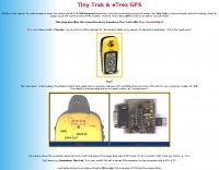
Tiny Trak is a simple choice for tracking, simply by using a usual VHF and TinyTrak as APRS modem.
-
promote exchange of technical infomation and help with the setup and operation of the UIDIGI firmware.
-
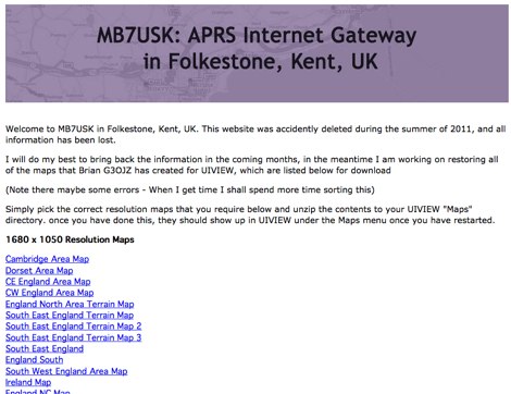
Download uiview maps by G3OJZ mostly for APRS UK region
-
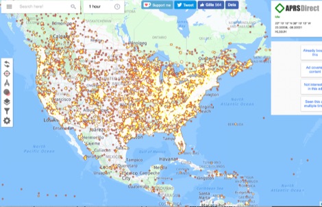
APRS Direct is a website that brings you global real-time APRS tracking and weather data (including CWOP). Our goal is to bring you a fast and easy-to-use map with the latest APRS activity.
-
APRS-DE operating APRS in Germany
-
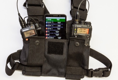
For a lightweight portable station, all you need is a handheld transceiver, a tiny packet TNC, and an Android smartphone.
-
Official Automatic Packet Reporting System by Bob Bruninga, WB4APR
-
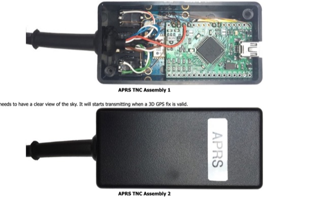
A basic introductionto APRS on HF Bands for radioamateurs and how to setup an APRS tracker using Argent Data Systems T3 Mini TNC device, configured and assemble ready for portable operations.
-
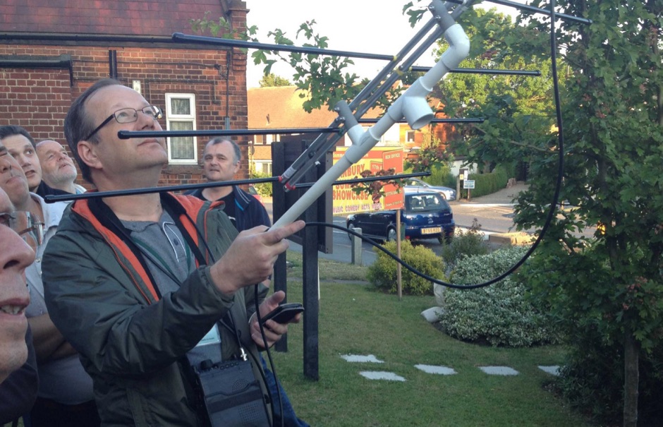
An interesting guide about APRS (Automatic Position Reporting System) and to Digipeating through the International Space Station - ISS
-
A construction guide for Tiny Track-I, a compact, transmit-only APRS tracker. It details the PCB layout, schematic, and component placement for mobileIntermediate Digital Modes Intermediate Article2m
-
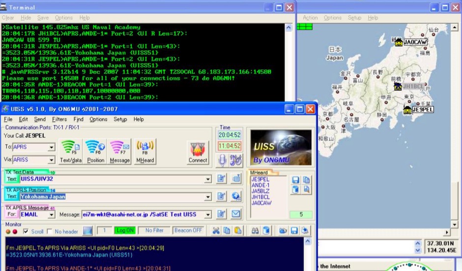
An Easy Guide to UI-View32 and UISS produced by Mineo Wakita, from installing UI-View32, setting up and configuring software and using the UISS
-
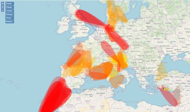
VHF – Based on realtime APRS reports. This map shows real-time radio propagation from stations operated near 144 MHz. It uses data gathered by Automatic Packet Reporting System-Internet Service (APRS-IS) from packet stations in the amateur radio service. The map shows activity from the past hour. Paths are smoothed to create a color-coded footprint indicating the distance VHF signals are likely to be traveling.
-
How to work the ISS using APRS Packet Radio