|
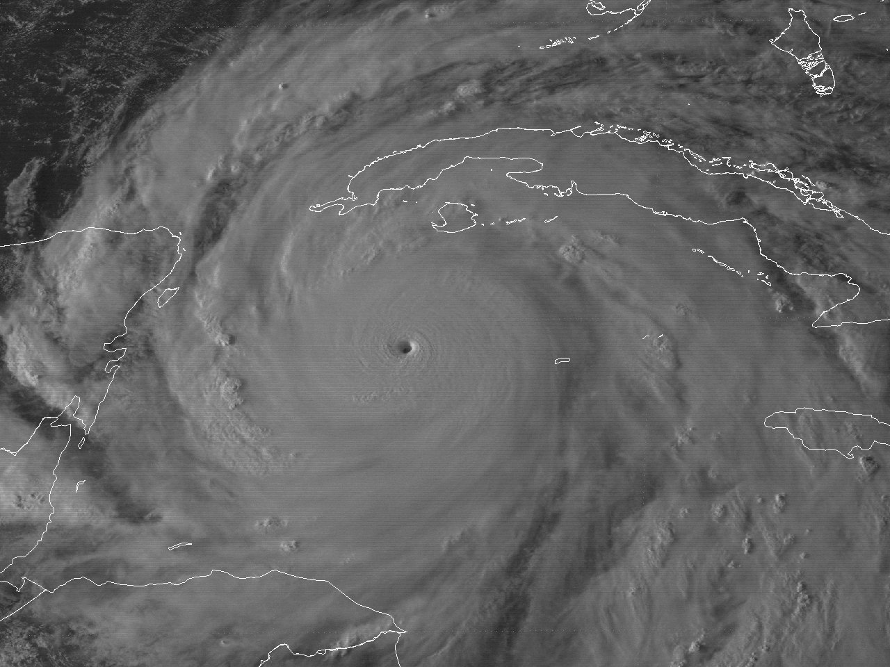
👁 GOES-7Â visible satellite image of Hurricane Gilbert at 6:01Â PM EDT September 13, 1988Â at peak intensity of 185 mph (160 knots) and minimum central pressure of 888 millibars (26.22Â inches).
Above: GOES-7 visible satellite image of Hurricane Gilbert at 6:01 PM EDT September 13, 1988 at peak intensity of 185 mph (160 knots) and minimum central pressure of 888 millibars (26.22 inches).
Gilbert originated from a tropical wave that moved off the African coast across the Eastern Atlantic on September 3rd. The wave moved west the next several days, gradually developing a very broad low-pressure area, with ship reports reporting the circulation extended nearly to the equator. Increased organization commenced on September 8th as the system approached the Lesser Antilles, and was classified as Tropical Depression #12 by the afternoon located about 400 miles east of Barbados.
The depression moved to the west northwest around 17 mph as it approached the Lesser Antilles. Satellite and reconnaissance reports that Tropical Depression #12 strengthened, and was upgraded to Tropical Storm Gilbert around 2 PM AST September 9th. Gilbert moved over Martinique shortly thereafter and entered the Eastern Caribbean Sea later that evening.
The large Atlantic ridge of high pressure to the north of Gilbert moved westward in tandem with Gilbert, essentially steering the tropical cyclone on a steady west-northwest track around 15 mph for most of its time across the Caribbean and eventually the Gulf. This also provided an excellent moist atmosphere with very low wind shear. As a result, Tropical Storm Gilbert continued to organize and strengthen, as well as grow larger in size, across the Caribbean Sea. Gilbert would strengthen to hurricane status the evening of September 10th.
Hurricane Gilbert began the first period of rapid intensification early on September 11th while passing south of the Dominican Republic, reaching category three status by early afternoon. Hurricane Gilbert would continue to strengthen at a slower rate for the remainder of the evening through the morning hours of September 12th.
Hurricane Gilbert made its first landfall near Kinston, Jamaica around 1 PM EDT September 12th as a category four hurricane with maximum sustained winds of 130 mph (115 knots) and a minimum central pressure of 960 millibars (28.35 inches). Hurricane Gilbert’s eye traversed the entire island of Jamaica, only weakening back to 125 mph (110 knots) by the time it emerged from its western coast by the late afternoon hours.
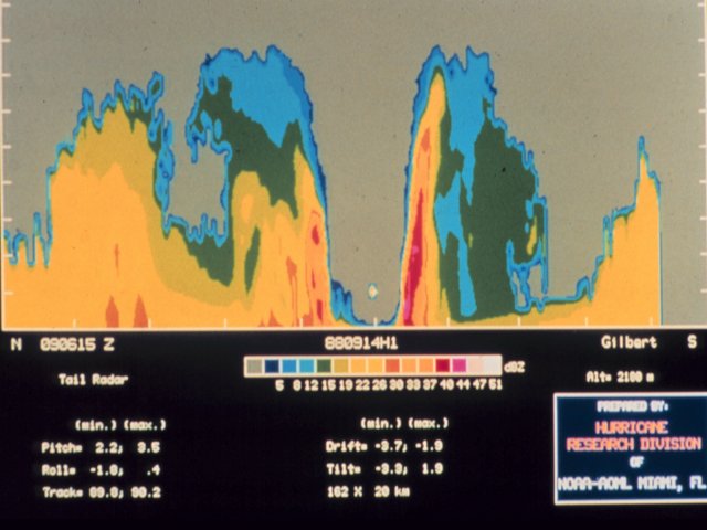
Following its passage over Jamaica, Hurricane Gilbert began the second and more remarkable period of rapid intensification across the Western Caribbean Sea from the late afternoon of September 12th through the afternoon of September 13th. Hurricane Gilbert also continued to grow in size, with the diameter of tropical storm force winds around 450 miles wide, and hurricane force winds around 170 miles wide. At 5:52 PM EDT (2152Z) September 13th, a NOAA Reconnaissance Aircraft observed Hurricane Gilbert at maximum intensity with maximum sustained winds of 185 mph (160 knots) and minimum central pressure of 888 millibars (26.22 inches), the lowest sea level pressure ever recorded in the Western Hemisphere. A GOES-7 visible satellite image at 6:01 PM EDT September 13th shows Hurricane Gilbert at peak intensity. Note: The pressure record stood until October 19, 2005 when Hurricane Wilma was observed with a minimum sea level pressure of 882 millibars (26.05 inches). The pressure record was surpassed again on October 23, 2015 when East Pacific Hurricane Patricia was observed with a minimum sea level pressure of 872 millibars (25.75 inches).
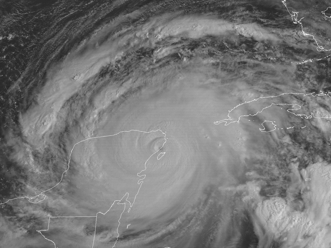
Hurricane Gilbert only weakened slightly the evening of September 13th through September 14th. Hurricane Gilbert made its second landfall near Cozumel & Playa del Carmen, Mexico after daybreak September 14th with maximum sustained winds of 160 mph (140 knots) and minimum central pressure of 900 millibars (26.58 inches). Hurricane Gilbert was the first category five hurricane to strike land in the Atlantic Basin since Hurricane Camille in 1969, and the strongest hurricane to strike Mexico in modern history. A GOES-7 visible satellite image of Hurricane Gilbert at 10:01 AM EDT September 14th shows Hurricane Gilbert at the Yucatán landfall. Traversing the Yucatán Peninsula for most of the day on September 14th, Hurricane Gilbert weakened significantly to a category two hurricane by the time it entered the Southwest Gulf later that evening through the early morning hours of September 15th.
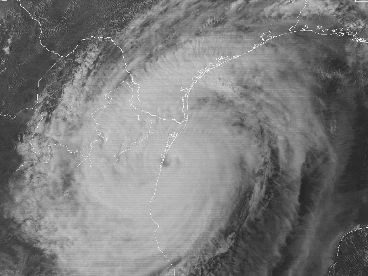
With a mid to upper level high pressure ridge continuing across the Northern Gulf, Hurricane Gilbert continued to move on a west-northwest course around 10 to 15 mph. Hurricane Gilbert began to strengthen once again, re-attaining category three status by the evening of September 15th, and category four status by daybreak on September 16th. Hurricane Gilbert's size also continued to grow. At one point across the Western Gulf, Gilbert's diameter of tropical storm force winds reached 550 miles wide, with hurricane force winds around 260 miles wide, making Gilbert the largest tropical cyclone observed in modern times. Only weakening slightly, Hurricane Gilbert made its final landfall just north of La Pesca in Northeast Mexico around 5 PM CDT September 16th as a category three hurricane with maximum sustained winds of 125 mph (110 knots) and a minimum central pressure of 955 millibars (28.20 inches). A GOES-7 visible satellite image of Hurricane Gilbert at 4:01 PM CDT September 16th shows Hurricane Gilbert shortly before the final landfall.
Once inland, Hurricane Gilbert weakened rapidly over the mountains of Northern Mexico, downgraded to a tropical storm by the early morning hours of September 17th, and a tropical depression by that afternoon. A digging mid to upper level trough over the Western United States turned Tropical Depression Gilbert north and northeast over West Texas and Oklahoma on September 18th, eventually merging with the front over the Midwest September 19th. Click here for an interactive track of Hurricane Gilbert.
WIND & PRESSURE:
Winds of 20 to 30 mph were observed across Southeast Texas. No reports of tropical storm force winds were observed across our region west of the Atchafalaya River. The highest winds associated with Gilbert were confined to the south Texas coast with sustained tropical storm force winds observed from Corpus Christi to Brownsville. For complete meteorological statistics, see the Wind and Pressure section.
STORM SURGE:
Tides around 4 feet above normal were observed along coastal Jefferson County in Southeast Texas, with Sabine Pass recording a maximum tide of 4.6 feet MSL. This flooded Highway 87 between High Island and Sabine Pass, Texas, with minor beach erosion noted. For other storm surge and high-water marks, see the Storm Surge section.
RAINFALL:
Rainfall was fairly light across the region with most areas receiving between a quarter to a little over one inch of rainfall with the outer rain bands of Gilbert. The highest total of 1.38 inches was reported at Sulphur, Louisiana. For complete rainfall totals reported across our region, see the Rainfall section.
TORNADOES:
Hurricane Gilbert produced the largest tornado outbreak associated with a tropical cyclone across Texas since Hurricane Allen in 1980 and Hurricane Alicia in 1983. No tornadoes were observed across Louisiana west of the Atchafalaya River or Southeast Texas. For complete details on all the tornadoes reported across Texas and Louisiana, see the Tornadoes section.
👁 GOES-7Â visible satellite image of Hurricane Gilbert at 10:01Â AM EDT September 14, 1988 at landfall near Cozumel & Playa del Carmen, Mexico.
Above: GOES-7 visible satellite image of Hurricane Gilbert at 10:01 AM EDT September 14, 1988 at landfall near Cozumel & Playa del Carmen, Mexico.
👁 GOES-7Â visible satellite image of Hurricane Gilbert at 4:01 PM CDT September 16, 1988 at final landfall across Northeast Mexico.
Above: GOES-7 visible satellite image of Hurricane Gilbert at 4:01 PM CDT September 16, 1988 at final landfall across Northeast Mexico.
|
