
|
👁 Image | |
| Melumat | |
| Dewlete | Qraliya Yewbiyayiye |
| Merkezê idarey | Aberdeen City, Aberdeen, Aberdeenshire û Grampian |
| Ware | Aberdeen City |
| Erd | 65,1 km2 |
| Nıfus | 200680 |
| Kodê têlefoni | 1224 |
| Letey saete | Greenwich Mean Time |
| Kodê postey | AB10-AB13 (parte), AB15, AB16, AB22-AB25 |
| Sazbiyayış | Lua error Xetay pele Modul:Wikidata dı rêza 1004 de ya: attempt to call field 'between' (a nil value). |
| Geokod | 2657832 |
| Website | www.aberdeencity.gov.uk |
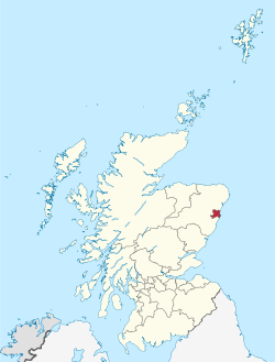
| Xerita | |
|
👁 Image | |
| Wikidata sera bıvurne | |
Aberdeen (bıwane: Aberdin) yew sûka dewleta İskoçyaya.
Coğrafya
[bıvurne | çımeyi bıvurne]İklım
[bıvurne | çımeyi bıvurne]| Heway Aberdeen (Craibstone)[lower-alpha 1], elevation: 102m (335ft), 1981–2010 normals, extremes 1958–present | |||||||||||||
|---|---|---|---|---|---|---|---|---|---|---|---|---|---|
| Aşmi/Mengi | Çel | Şbt | Adr | Nsn | Gln | Hzr | Tmz | Tbx | Kşk | Tşv | Tşp | Kan | Serre |
| Tewr vêşi germ °C (°F) | 16.0 (60.8) |
16.3 (61.3) |
21.2 (70.2) |
23.4 (74.1) |
23.8 (74.8) |
26.8 (80.2) |
28.8 (83.8) |
28.6 (83.5) |
25.9 (78.6) |
21.1 (70) |
18.3 (64.9) |
15.4 (59.7) |
28.8 (83.8) |
| Tewr nızm germ °C (°F) | 6.1 (43) |
6.4 (43.5) |
8.4 (47.1) |
10.5 (50.9) |
13.2 (55.8) |
15.6 (60.1) |
18.0 (64.4) |
17.8 (64) |
15.4 (59.7) |
12.0 (53.6) |
8.6 (47.5) |
6.2 (43.2) |
11.5 (52.7) |
| Roce de werteyınine °C (°F) | 3.4 (38.1) |
3.5 (38.3) |
5.0 (41) |
6.8 (44.2) |
9.2 (48.6) |
11.9 (53.4) |
14.2 (57.6) |
14.0 (57.2) |
11.9 (53.4) |
8.9 (48) |
5.8 (42.4) |
3.5 (38.3) |
8.1 (46.6) |
| Tewr nızm honık °C (°F) | 0.6 (33.1) |
0.6 (33.1) |
1.6 (34.9) |
3.0 (37.4) |
5.2 (41.4) |
8.1 (46.6) |
10.3 (50.5) |
10.1 (50.2) |
8.4 (47.1) |
5.7 (42.3) |
2.9 (37.2) |
0.8 (33.4) |
4.8 (40.6) |
| Tewr vêşi honık °C (°F) | -13.5 (7.7) |
-12.2 (10) |
-11.7 (10.9) |
-6.7 (19.9) |
-3.0 (26.6) |
0.3 (32.5) |
1.7 (35.1) |
2.5 (36.5) |
-0.5 (31.1) |
-4.0 (24.8) |
-10.8 (12.6) |
-12.6 (9.3) |
−13.5 (7.7) |
| Vartış mm (inches) | 71.2 (2.803) |
59.3 (2.335) |
63.8 (2.512) |
62.2 (2.449) |
59.6 (2.346) |
65.6 (2.583) |
65.7 (2.587) |
66.1 (2.602) |
71.9 (2.831) |
102.9 (4.051) |
98.1 (3.862) |
79.8 (3.142) |
866.2 (34.102) |
| Rocê vartışıni (≥ 1.0 mm) | 12.6 | 10.6 | 11.5 | 10.5 | 10.4 | 10.5 | 11.3 | 11.2 | 10.1 | 13.6 | 13.7 | 12.3 | 138.3 |
| Saeta tici | 60.6 | 84.9 | 120.3 | 151.5 | 194.1 | 163.8 | 159.3 | 160.4 | 124.6 | 100.0 | 65.4 | 47.7 | 1,432.6 |
| Source no. 1: Met Office[1] | |||||||||||||
| Source no. 2: KNMI[2] | |||||||||||||
| Heway Dyce-Aberdeen (ABZ)[lower-alpha 2], elevation: 65m (213ft), 1981–2010 normals, extremes 1960–present | |||||||||||||
|---|---|---|---|---|---|---|---|---|---|---|---|---|---|
| Aşmi/Mengi | Çel | Şbt | Adr | Nsn | Gln | Hzr | Tmz | Tbx | Kşk | Tşv | Tşp | Kan | Serre |
| Tewr vêşi germ °C (°F) | 17.2 (63) |
17.2 (63) |
21.6 (70.9) |
23.7 (74.7) |
24.4 (75.9) |
26.7 (80.1) |
29.8 (85.6) |
29.7 (85.5) |
26.0 (78.8) |
22.1 (71.8) |
18.8 (65.8) |
15.1 (59.2) |
29.8 (85.6) |
| Tewr nızm germ °C (°F) | 6.5 (43.7) |
6.8 (44.2) |
8.8 (47.8) |
10.9 (51.6) |
13.6 (56.5) |
16.1 (61) |
18.5 (65.3) |
18.3 (64.9) |
15.8 (60.4) |
12.4 (54.3) |
8.9 (48) |
6.6 (43.9) |
12.0 (53.6) |
| Roce de werteyınine °C (°F) | 3.6 (38.5) |
3.8 (38.8) |
5.4 (41.7) |
7.2 (45) |
9.7 (49.5) |
12.4 (54.3) |
14.7 (58.5) |
14.4 (57.9) |
12.2 (54) |
9.2 (48.6) |
5.9 (42.6) |
3.7 (38.7) |
8.5 (47.3) |
| Tewr nızm honık °C (°F) | 0.6 (33.1) |
0.8 (33.4) |
1.9 (35.4) |
3.4 (38.1) |
5.7 (42.3) |
8.6 (47.5) |
10.8 (51.4) |
10.5 (50.9) |
8.6 (47.5) |
5.9 (42.6) |
2.9 (37.2) |
0.7 (33.3) |
5.1 (41.2) |
| Tewr vêşi honık °C (°F) | -19.3 (-2.7) |
-18.2 (-0.8) |
-15.8 (3.6) |
-6.8 (19.8) |
-4.2 (24.4) |
-0.3 (31.5) |
0.1 (32.2) |
-0.2 (31.6) |
-2.4 (27.7) |
-4.4 (24.1) |
-15.6 (3.9) |
-18.1 (-0.6) |
−19.3 (−2.7) |
| Vartış mm (inches) | 67.6 (2.661) |
55.1 (2.169) |
59.8 (2.354) |
58.8 (2.315) |
56.9 (2.24) |
61.2 (2.409) |
61.6 (2.425) |
60.5 (2.382) |
67.9 (2.673) |
96.2 (3.787) |
93.3 (3.673) |
76.1 (2.996) |
814.9 (32.083) |
| %Hitiye | 83 | 81 | 79 | 78 | 78 | 78 | 78 | 80 | 81 | 83 | 83 | 83 | 80.4 |
| Rocê vartışıni (≥ 1.0 mm) | 12.3 | 10.5 | 11.6 | 10.8 | 10.6 | 10.4 | 11.4 | 10.7 | 10.5 | 13.6 | 13.8 | 12.3 | 138.6 |
| Rocê vewrıni | 8 | 7 | 6 | 4 | 0 | 0 | 0 | 0 | 0 | 0 | 3 | 6 | 34 |
| Saeta tici | 58.3 | 81.3 | 121.8 | 149.4 | 199.4 | 166.4 | 165.3 | 157.8 | 123.7 | 99.8 | 66.2 | 46.1 | 1,435.7 |
| Source no. 1: Met Office[3] NOAA (Relative humidity and snow days 1961–1990)[4] | |||||||||||||
| Source no. 2: KNMI[5] | |||||||||||||
Sûkê bıray
[bıvurne | çımeyi bıvurne]Stavanger, Atyrau, Regensburg, Clermont-Ferrand, Bulawayo, Houston, Homieĺ, Bakı û Barranquilla
Nıfus
[bıvurne | çımeyi bıvurne]Lua error Xetay pele Modul:Nıfus dı rêza 37 de ya: attempt to call field 'newFromWikidataValue' (a nil value).
Çıme
[bıvurne | çımeyi bıvurne]- ↑ "Craibstone 1981–2010 averages".Met Office.Archivedfrom the originalon 31 October 2012.https://web.archive.org/web/20121031164323/http://www.metoffice.gov.uk/climate/uk/averages/19812010/sites/craibstone.html.Retrieved 21 March 2019. Archived 31 Tışrino Verên 2012 at the Wayback Machine
- ↑ "Indices Data - Craibstone Station 1629".KNMI.Archivedfrom the originalon 9 July 2018.https://web.archive.org/web/20180709010608/https://eca.knmi.nl//download/millennium/millennium.php.Retrieved 21 March 2019.
- ↑ "Aberdeen Airport 1981–2010 averages".Met Office.https://www.metoffice.gov.uk/public/weather/climate/gfnmmyh91.Retrieved 21 March 2019.
- ↑ "Aberdeen Airport climate normals 1961–1990".Met Office.ftp://ftp.atdd.noaa.gov/pub/GCOS/WMO-Normals/RA-VI/UK/03091.TXT.Retrieved 2 April 2019.
- ↑ "Indices Data - Aberdeen Dyce Station 1825".KNMI.Archivedfrom the originalon 9 July 2018.https://web.archive.org/web/20180709010608/https://eca.knmi.nl//download/millennium/millennium.php.Retrieved 21 March 2019.
| ||||
- ↑ Weather station is located 5 miles (8km) from the Aberdeen city centre.
- ↑ Weather station is located 6 miles (10km) from the Aberdeen city centre.
<ref> Pê namey "lower-alpha" ya yew etiketê grube esto, lakin dustê cı de etiketê <references group="lower-alpha"/> nêvineyaRetrieved from "https://diq.wikipedia.org/w/index.php?title=Aberdeen&oldid=506903"