
Herny | |
|---|---|
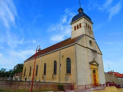
| 👁 The church in Herny The church in Herny | |
|
👁 Coat of arms of Herny Coat of arms | |
Location of Herny | |
| Coordinates: 48°59′59″N 6°28′57″E / 48.9997°N 6.4825°E / 48.9997; 6.4825 | |
| Country | France |
| Region | Grand Est |
| Department | Moselle |
| Arrondissement | Forbach-Boulay-Moselle |
| Canton | Faulquemont |
| Intercommunality | CC du District Urbain de Faulquemont |
| Government | |
| • Mayor (2020–2026) | Dominique Lerond[1] |
Area 1 | 9.64 km2 (3.72 sq mi) |
| Population (2023)[2] | 515 |
| • Density | 53.4/km2 (138/sq mi) |
| Time zone | UTC+01:00 (CET) |
| • Summer (DST) | UTC+02:00 (CEST) |
| INSEE/Postal code | 57319 /57580 |
| Elevation | 225–303 m (738–994 ft) (avg. 250 m or 820 ft) |
| 1 French Land Register data, which excludes lakes, ponds, glaciers > 1 km2 (0.386 sq mi or 247 acres) and river estuaries. | |
.svg)
Herny (French pronunciation: [ɛʁni]; German: Herlingen) is a commune in the Moselle department in Grand Est in north-eastern France.
See also
[edit]References
[edit]- ^ "Répertoire national des élus: les maires". data.gouv.fr, Plateforme ouverte des données publiques françaises (in French). 2 December 2020.
- ^ "Populations de référence 2023" (in French). National Institute of Statistics and Economic Studies. 18 December 2025.
External links
[edit]- 👁 Wikimedia Commons logo
Media related to Herny at Wikimedia Commons
Retrieved from "https://en.wikipedia.org/w/index.php?title=Herny&oldid=1252494626"
Hidden categories:
- Pages using gadget WikiMiniAtlas
- CS1 French-language sources (fr)
- Use dmy dates from August 2023
- Articles with short description
- Short description is different from Wikidata
- Coordinates on Wikidata
- Pages with French IPA
- Articles containing German-language text
- Commons category link from Wikidata
- All stub articles
- Pages using the Kartographer extension