 |
VOOZH | about |
|
VOOZH | about |
| 👁 Image |
| توضیحات |
|---|
| تگ highway تگ اصلی برای انواع خیابان یا جاده است. Error creating thumbnail: Error creating thumbnail: |
| گروه: معابر |
| روی این عنصرها بهکار میرود |
| مقادیر مستند: 71 |
| نتیجه میدهد |
| ترکیبات مفید |
| وضعیت: پذیرفته👁 Page for proposal |
| ابزارهای مفید برای این برچسب |
تگ =* تگ اصلی مورد استفاده برای توصیف انواع جاده، خیابان یا راه است. مقدار این کلید کمک میکند تا بهطور کلی اهمیت معبر را در شبکه جادهای نشان دهیم. در جدول زیر فهرست مرتبی از مهمترین (motorway=*) تا کماهمیتترین (service=*) مقادیر را مشاهده میکنید.
برای پی بردن به چگونگی استفاده از این تگها با توجه به تفاوت شبکه راهها در کشورهای مختلف Highway:International equivalence را ببینید.
این تگ همچنین برای عارضههایی مانند ایستگاه اتوبوس، مجتمعهای خدماتی رفاهی، گذرگاههای پیاده و سایر چیزهای مربوط به معابر استفاده میشود.
در زیر جزئیات رایجترین مقدارها را میبینید:
این تگ برای توصیف جادهها و راههای پیاده استفاده میشود. برای آشنایی با کاربرد آن به صفحهٔ Fa:معابر مراجعه کنید. همچنین برای آشنایی با محدودیتهای دسترسی بر اساس وسیلهٔ نقلیه، زمان، روز، میزان بار، هدف و... به صفحهٔ Restrictions مراجعه کنید. جدول زیر ترجمهٔ مستقیم نسخهٔ انگلیسی است و هنوز بهطور دقیق دربارهٔ ویژگیهای راهها در ایران صحبت نمیکند. یک نسخهٔ در حال استفاده برای راههای ایران در صفحهٔ قواعد تگگذاری ایران آمده است.
| کلید | مقدار | عنصر | توضیح | نمایش در carto | عکس | |
|---|---|---|---|---|---|---|
راهها | ||||||
|
تگهای اصلی برای شبکهٔ راهها. از اهمیت زیاد به کم مرتب شدهاند. | ||||||
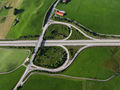
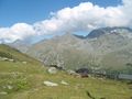
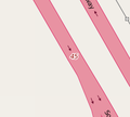
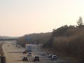
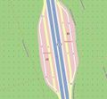
| motorway | 👁 way |
یک راه اصلی که خطوط رفت و برگشت آن مجزاست و دسترسی آن محدود است و اغلب، ۲ خط عبور یا بیشتر بعلاوهٔ شانه اضطراری آسفالته در هر جهت دارد. همارز آزادراه، اتوبان و... است. | ||||
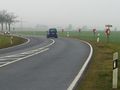
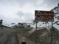
| highway | trunk | 👁 way |
مهمترین راهها در شبکهٔ جادهای یک کشور که آزادراه نباشد (لازم نیست حتماً دوبانده باشد) |
| ||
| highway | primary | 👁 way |
راه مهم بعدی در شبکهٔ جادهای یک کشور (معمولاً شهرهای بزرگتر را به هم متصل میکند). |
| ||
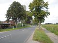
| highway | secondary | 👁 way |
راه مهم بعدی در شبکهٔ جادهای یک کشور (معمولاً شهرها را به هم متصل میکند). |
| ||
| highway | tertiary | 👁 way |
راه مهم بعدی در شبکهٔ جادهای یک کشور (معمولاً شهرهای کوچکتر و روستاها را به هم متصل میکند). |
| ||
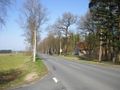
| highway | unclassified | 👁 way |
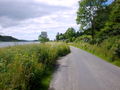
کماهمیتترین راه ارتباطی در شبکهٔ جادهای یک کشور این درجه را میگیرد؛ یعنی راههای فرعی با درجهبندی کمتر از tertiary که بهمنظوری غیر از دسترسی به املاک استفاده میشوند (معمولاً روستاها و آبادیها را به هم متصل میکند). واژهٔ unclassified اصطلاحی قدیمی در شبکهٔ جادهای انگلستان است و به این معنی نیست که درجهبندی نامشخص است؛ برای درجهبندی نامشخص از =road استفاده نمایید.
|
| ||
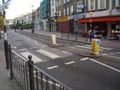
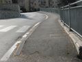
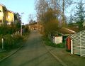
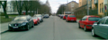
| highway | residential | 👁 way |
راههایی که برای دسترسی به منازل مسکونی استفاده میشود و کارکرد ارتباطدهندگی مناطق مسکونی را ندارند. بیشتر، در امتداد منازل مسکونی هستند. |
| ||
راههای اتصالدهنده (Link) | ||||||
| highway | motorway_link | 👁 way |
The link roads (sliproads/ramps) leading to/from a motorway from/to a motorway or lower class highway. Normally with the same motorway restrictions. | |||
| highway | trunk_link | 👁 way |
The link roads (sliproads/ramps) leading to/from a trunk road from/to a trunk road or lower class highway. | |||
| highway | primary_link | 👁 way |
The link roads (sliproads/ramps) leading to/from a primary road from/to a primary road or lower class highway. | |||
| highway | secondary_link | 👁 way |
The link roads (sliproads/ramps) leading to/from a secondary road from/to a secondary road or lower class highway. | |||
| highway | tertiary_link | 👁 way |
The link roads (sliproads/ramps) leading to/from a tertiary road from/to a tertiary road or lower class highway. | |||
راههای خاص | ||||||
| highway | living_street | 👁 way |
For living streets, which are residential streets where pedestrians have legal priority over cars, speeds are kept very low and where children are allowed to play on the street. | |||
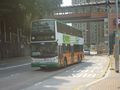
| highway | service | 👁 way 👁 area |
برای جادههای دسترسی به و یا درون منطقه صنعتی، اردوگاه، پارک کسب و کار، پارک خودرو، کوچهها و غیره. میتواند به منظور نشان دادن نوع استفاده همراه با service=* و برای نشان دادن اینکه چه کسانی و در چه شرایطی میتوانند از آن استفاده کننده همراه با access=* مورد استفاده قرار بگیرد.
|
|||
| highway | pedestrian | 👁 way 👁 area |
For roads used mainly/exclusively for pedestrians in shopping and some residential areas which may allow access by motorised vehicles only for very limited periods of the day. To create a 'square' or 'plaza' create a closed way and tag as pedestrian and also with area=yes.
|
|||
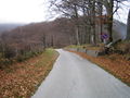
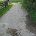
| highway | track | 👁 way |
جادههایی که عمدتا کاربرد کشاورزی و جنگلی دارند. برای توصیف کیفیت یک مسیر track از tracktype=* استفاده کنید. توجه: هرچند ها معمولا دارای سطح ناصاف و کوبیدهنشده هستند، این برچسب کیفیت مسیر را توصیف میکند و فقط به کاربرد آن اشاره دارد. در نتیجه، اگر میخواهید یک جاده با کاربرد عمومی را برچسب بزنید، به جای از general values استفاده کنید.
|
|||
| highway | bus_guideway | 👁 way |
busway یا اتوبوسراه، سوارهروِ مخصوصی است که وسیلهٔ نقلیه در امتداد آن هدایت میشود (ریل نیست) و برای سایر وسایل نقلیه مناسب نیست. توجه: این مسیر، یک خط اتوبوس معمولی نیست؛ از access=no و psv=yes استفاده کنید!
|
|||
| highway | escape | 👁 way |
For runaway truck ramps, runaway truck lanes, emergency escape ramps, or truck arrester beds. It enables vehicles with braking failure to safely stop. | |||
| highway | raceway | 👁 way |
میدان یا مسیر مسابقه (موتوری) | |||
| highway | road | 👁 way |
A road/way/street/motorway/etc. of unknown type. It can stand for anything ranging from a footpath to a motorway. This tag should only be used temporarily until the road/way/etc. has been properly surveyed. If you do know the road type, do not use this value, instead use one of the more specific =* values.
|
|||
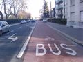
| highway | busway | 👁 way |
A dedicated roadway for bus rapid transit systems | |||
راهچهها (Paths) | ||||||
| footway | 👁 way 👁 area |
For designated footpaths; i.e., mainly/exclusively for pedestrians. This includes walking tracks and gravel paths. If bicycles are allowed as well, you can indicate this by adding a bicycle=yes tag. Should not be used for paths where the primary or intended usage is unknown. Use =pedestrian for pedestrianised roads in shopping or residential areas and =track if it is usable by agricultural or similar vehicles.
|
||||
| highway | bridleway | 👁 way |
برای سوارکاران. همارز =path + horse=designated است.
|
|||
| highway | steps | 👁 way |
برای مسیرهای پلهای عابرین پیاده است. به منظور مشخص کردن تعداد پلهها، به همراه برچسب step_count=* استفاده کنید.
|
|||
| highway | corridor | 👁 way |
For a hallway inside of a building. | |||
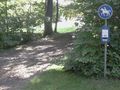
| highway | path | 👁 way |
A non-specific path. Use =footway for paths mainly for walkers, =cycleway for one also usable by cyclists, =bridleway for ones available to horse riders as well as walkers and =track for ones which is passable by agriculture or similar vehicles.
|
|||
| highway | via_ferrata | 👁 way |
A via ferrata is a route equipped with fixed cables, stemples, ladders, and bridges in order to increase ease and security for climbers. These via ferrata require equipment : climbing harness, shock absorber and two short lengths of rope, but do not require a long rope as for climbing. | |||
When sidewalk/crosswalk is tagged as a separate way | ||||||
| footway | sidewalk | 👁 way |
Sidewalk that runs typically along residential road. Use in combination with =footway or =path
|
|||
| footway | crossing | 👁 way |
A.k.a. crosswalk. Pedestrians can cross a street here; e.g., zebra crossing | |||
| footway | traffic_island | 👁 way |
The way between two crossings, safespot for pedestrians, has micromapping characteristics as a detailed alternative to =*. Use in combination with =footway or =path.
|
|||
هنگامی که پیادهرو را با تگگذاری معبر اصلی مشخص میکنیم (Sidewalks را ببینید) | ||||||
| sidewalk | both | left | right | no | 👁 way |
Specifies that the highways has sidewalks on both sides, on one side or no sidewalk at all | |||
هنگامی که راه دوچرخه را بهطور مجزا رسم میکنیم (Bicycle را ببینید) | ||||||
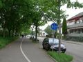
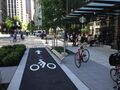
| highway | cycleway | 👁 way |
For designated cycleways. Add foot=* only if default-access-restrictions do not apply.
|
|||
هنگامی که راه دوچرخه را با تگگذاری معبر اصلی/خط عبور مشخص میکنیم (Bicycle را ببینید) | ||||||
| cycleway | lane | 👁 way |
A lane is a route that lies within the roadway | |||
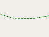
| cycleway | 👁 way |
Used on ways with oneway=yes where it is legally permitted to cycle in both directions. Used together with oneway:bicycle=no.
|
||||
| cycleway | 👁 way |
Used on ways with oneway=yes that have a cycling lane going the opposite direction of normal traffic flow (a "contraflow" lane). Used together with oneway:bicycle=no.
|
||||
| cycleway | track | 👁 way |
A track provides a route that is separated from traffic. In the United States, this term is often used to refer to bike lanes that are separated from lanes for cars by pavement buffers, bollards, parking lanes, and curbs. Note that a cycle track may alternatively be drawn as a separate way next to the road which is tagged as =cycleway.
|
|||
| cycleway | 👁 way |
Used on ways with oneway=yes that have a cycling track going the opposite direction of normal traffic flow. Used together with oneway:bicycle=no.
|
||||
| cycleway | share_busway | 👁 way |
There is a bus lane that cyclists are permitted to use. | |||
| cycleway | 👁 way |
Used on ways with oneway=yes that have a bus lane that cyclists are also permitted to use, and which go in the opposite direction to normal traffic flow (a "contraflow" bus lane). Used together with oneway:bicycle=no.
|
||||
| cycleway | shared_lane | 👁 way |
Cyclists share a lane with motor vehicles, but there are markings indicating that they should share the lane with motorists. In some places these markings are known as "sharrows" ('sharing arrows') and this is the tag to use for those. | |||
Busways tagged on the main roadway or lane (see Bus lanes) | ||||||
| lane | 👁 way |
Bus lane on both sides of the road. | ||||
| opposite | 👁 way |
Deprecated variant for ways with oneway=yes where buses are legally permitted to travel in both directions. Replaced by oneway:bus=no
|
||||
| opposite_lane | 👁 way |
Deprecated variant for ways with oneway=yes that have a bus lane which go in the opposite direction to normal traffic flow (a "contraflow" bus lane). Replaced by oneway:bus=no and lanes:bus=* / lanes:psv=*) / bus:lanes=* / psv:lanes=*
|
||||
Street parking tagged on the main roadway (see Street parking) | ||||||
parking:left / :right / :both(hereafter: ) |
lane | street_side | on_kerb | half_on_kerb | shoulder | no | separate | yes | 👁 way |
Primary key to record parking along the street. Describes the parking position of parked vehicles in the street. | |||
orientation=*
|
parallel | diagonal | perpendicular | 👁 way |
To specify the orientation of parked vehicles if there is street parking. | |||
چرخهٔ ساخت (see also lifecycle prefixes) | ||||||
| highway | proposed | 👁 way |
For planned roads, use with proposed=* and a value of the proposed highway value.
|
|||
| highway | construction | 👁 way |
For roads under construction. Use construction=* to hold the value for the completed road.
|
|||
خصوصیتها | ||||||
| abutters | commercial/ industrial/ mixed/ residential/ retail etc. | 👁 way |
برای جزئیات بیشتر Key:abutters را ببینید. | |||
| bicycle_road | yes | 👁 way |
یک راه دوچرخه راهی است که مخصوص دوچرخهها باشد. اگر خیابانهای مسکونی با نصب علائم ویژه کارکرد راه دوچرخه پیدا کنند آمدوشد وسایل نقلیهٔ موتوری با محدودیت در سرعت، و معمولاً فقط برای ساکنان، مجاز است. | |||
| bus_bay | both | left | right | 👁 way |
A bus bay outside the main carriageway for boarding/alighting | |||
| change | yes | no | not_right | not_left | only_right | only_left | 👁 way |
Specify the allowed/forbidden lane changes | |||
| destination | <place name of destination> | 👁 way |
Destination when following a linear feature | |||
| embankment | yes | dyke | 👁 way |
A dyke or a raised bank to carry a road, railway, or canal across a low-lying or wet area. | |||
| embedded_rails | yes | <type of railway> | 👁 way |
A highway on which non-railway traffic is also allowed has railway tracks embedded in it but the rails are mapped as separate ways. | |||
| ford | yes | 👁 node 👁 way |
The road crosses through stream or river, vehicles must enter any water. | |||
| frontage_road | yes | 👁 way |
A frontage road. | |||
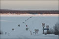
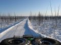
| ice_road | yes | 👁 way |
A highway is laid upon frozen water basin, definitely doesn't exist in summer. | |||
| incline | Number %/° | 👁 node 👁 way |
Incline steepness as percents ("5%") or degrees ("20°"). Positive/negative values indicate movement upward/downwards in the direction of the way. | |||
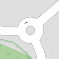
| junction | roundabout | 👁 way 👁 closed way |
This automatically implies oneway=yes, the oneway direction is defined by the sequential ordering of nodes within the Way. This applies on a way, tagged with =* already.
|
|||
| lanes | number | 👁 way |
The number of traffic lanes for general purpose traffic, also for buses and other specific classes of vehicle. | |||
| lane_markings | yes | no | 👁 way |
Specifies if a highway has painted markings to indicate the position of the lanes. | |||
| lit | yes/no | 👁 node 👁 way 👁 area |
Street lighting | |||
| maxspeed | <number> | 👁 way |
Specifies the maximum legal speed limit on a road, railway or waterway. | |||
| motorroad | yes/no | 👁 way 👁 node |
The motorroad tag is used to describe highways that have motorway-like access restrictions but that are not a motorway. | |||
| mountain_pass | yes | 👁 node |
The highest point of a mountain pass. | |||
| mtb:scale | 0-6 | 👁 way |
Applies to =path and =track. A classification scheme for mtb trails (few inclination and downhill).
|
|||
| mtb:scale:uphill | 0-5 | 👁 way |
A classification scheme for mtb trails for going uphill if there is significant inclination. | |||
| mtb:scale:imba | 0-4 | 👁 way |
The IMBA Trail Difficulty Rating System shall be used for bikeparks. It is adapted to mtb trails with artificial obstacles. | |||
| mtb:description | Text | 👁 way |
Applies to =path and =track. A key to input variable infos related to mtbiking on a way with human words
|
|||
| oneway | yes | no | reversible | 👁 way |
Oneway streets are streets where you are only allowed to drive in one direction. | |||
| oneway:bicycle | yes | no | | 👁 way |
Used on ways with oneway=yes where it is legally permitted to cycle in both directions.
|
|||
| overtaking | yes/ no/ caution/ both/ forward/ backward | 👁 way |
Specifying sections of roads where overtaking is legally forbidden. Use overtaking:forward=yes/no/caution and overtaking:backward=yes/no/caution when it depends on driving direction.
|
|||
| 👁 way |
Specifying the parking space. See parking:lane=* for more details.
|
|||||
| 👁 way |
Specifying the parking conditions (terms). See parking:condition=* for more details.
|
|||||
| passing_places | yes | 👁 way |
A way which has frequent passing places | |||
| priority | forward | backward | 👁 way |
Traffic priority for narrow parts of roads, e.g. narrow bridges. | |||
| priority_road | designated | yes_unposted | end | 👁 way |
Specifying roads signposted as priority roads. | |||
| sac_scale | hiking / mountain_hiking / demanding_mountain_hiking / alpine_hiking / demanding_alpine_hiking / difficult_alpine_hiking | 👁 way |
Applies to =path and =footway. A classification scheme for hiking trails.
|
|||
| service | alley / driveway / parking_aisle etc. | 👁 way |
برای جزئیات بیشتر Key:service را ببینید. | |||
| shoulder | no | yes | right | both | left | 👁 way |
Presence of shoulder in highway | |||
| side_road | yes | 👁 way |
A side road. | |||
| smoothness | excellent / good / intermediate / bad / very_bad / horrible / very_horrible / impassable | 👁 way 👁 area |
See Key:smoothness for more details. | |||
| surface | paved / unpaved / asphalt / concrete / paving_stones / sett / cobblestone / metal / wood / compacted / fine_gravel / gravel / pebblestone / plastic / grass_paver / grass / dirt / earth / mud / sand / ground | 👁 way |
See Key:surface for more details. | |||
| tactile_paving | yes / no | 👁 node 👁 way 👁 area |
A paving in the ground to be followed with a blindman's stick. | |||
| tracktype | grade1/ grade2/ grade3/ grade4/ grade5 | 👁 way |
To describe the quality of the surface. See Key:tracktype for more information. | |||
| traffic_calming | yes / bump / hump / cushion / table etc. | 👁 node 👁 way |
See Key:traffic calming for more details. | |||
| trail_visibility | excellent / good / intermediate / bad / horrible / no | 👁 way |
Applies to =path, =footway, =cycleway and =bridleway. A classification for hiking trails visibility
|
|||
| trailblazed | yes | no | poles | cairns | symbols | 👁 way |
Applies to =*. Describing trail blazing and marking. See Key:trailblazed for more information.
|
|||
| trailblazed:visibility | excellent | good | intermediate | bad | horrible | no | 👁 way |
Applies to trailblazed=*. A classification for visibility of trailblazing. See Key:trailblazed:visibility for more information.
|
|||
| turn | left / slight_left / through / right / slight_right / merge_to_left / merge_to_right / reverse | 👁 way |
The key turn can be used to specify the direction in which a way or a lane will lead. | |||
| width | <number> | 👁 way |
The width of a feature. | |||
| winter_road | yes | 👁 way |
A highway functions during winter, probably can't be driven in summer. | |||
سایر عارضهها با کلید highway | ||||||
| bus_stop | 👁 node |
یک ایستگاه اتوبوس کوچک. با استفاده از تگ public_transport=stop_position (محل ایست اتوبوس) و تگ public_transport=platform (محل انتظار مسافران) میتوانیم آن را دقیقتر نقشهکشی کنیم. برای جزئیات بیشتر public_transport=* را ببینید.
|
||||
| highway | crossing | 👁 node |
A.k.a. crosswalk. Pedestrians can cross a street here; e.g., zebra crossing | |||
| highway | cyclist_waiting_aid | 👁 node |
Street furniture for cyclists that are intended to make waiting at esp. traffic lights more comfortable. | |||
| highway | elevator | 👁 node 👁 way |
An elevator or lift, used to travel vertically, providing passenger and freight access between pathways at different floor levels. | |||
| highway | emergency_bay | 👁 node 👁 way |
An area beside a highway where you can safely stop your car in case of breakdown or emergency. | |||
| highway | emergency_access_point | 👁 node |
Sign number which can be used to define your current position in case of an emergency. Use with ref=NUMBER_ON_THE_SIGN
|
|||
| highway | give_way | 👁 node |
A "give way," or "Yield" sign | |||
| emergency | phone | 👁 node |
A calling device can be used to tell on your current position in case of an emergency. Use with ref=NUMBER_ON_THE_SIGN
|
|||
| hitchhiking | 👁 node |
Like a bus_stop but for free, uncertain, spontaneous rides with strangers. | ||||
| highway | ladder | 👁 node 👁 way |
A vertical or inclined set of steps or rungs intended for climbing or descending of a person with the help of hands. | |||
| highway | milestone | 👁 node |
Highway location marker | |||
| highway | mini_roundabout | 👁 node |
Similar to roundabouts, but at the center there is either a painted circle or a fully traversable island. In case of an untraversable center island, junction=roundabout should be used.
Rendered as anti-clockwise by default |
|||
| highway | motorway_junction | 👁 node |
Indicates a junction (UK) or exit (US). ref=* should be set to the exit number or junction identifier. (Some roads – e.g., the A14 – also carry junction numbers, so the tag may be encountered elsewhere despite its name)
|
|||
| highway | passing_place | 👁 node |
The location of a passing space | |||
| highway | platform | 👁 node 👁 way 👁 area |
A platform at a bus stop or station. | |||
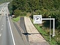
| highway | rest_area | 👁 node 👁 area |
Place where drivers can leave the road to rest, but not refuel. | |||
| highway | services | 👁 node 👁 area |
A service station to get food and eat something, often found at motorways | |||
| highway | speed_camera | 👁 node |
A fixed road-side or overhead speed camera. | |||
| highway | speed_display | 👁 node |
A dynamic electronic sign that displays the speed of the passer-by motorist. | |||
| highway | stop | 👁 node |
A stop sign | |||
| highway | street_lamp | 👁 node |
A street light, lamppost, street lamp, light standard, or lamp standard is a raised source of light on the edge of a road, which is turned on or lit at a certain time every night | |||
| highway | toll_gantry | 👁 node |
A toll gantry is a gantry suspended over a way, usually a motorway, as part of a system of electronic toll collection. For a toll booth with any kind of barrier or booth see: barrier=toll_booth
|
|||
| highway | traffic_mirror | 👁 node |
Mirror that reflects the traffic on one road when direct view is blocked. | |||
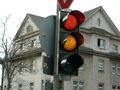
| highway | traffic_signals | 👁 node |
Lights that control the traffic | |||
| highway | trailhead | 👁 node |
Designated place to start on a trail or route | |||
| highway | turning_circle | 👁 node |
A turning circle is a rounded, widened area usually, but not necessarily, at the end of a road to facilitate easier turning of a vehicle. Also known as a cul de sac. | |||
| highway | turning_loop | 👁 node |
A widened area of a highway with a non-traversable island for turning around, often circular and at the end of a road. | |||
| highway | تعریف کاربر | 👁 node 👁 way |
همهٔ مقادیر رایج بر اساس Taginfo | |||
فقط از highway=motorway/motorway_link میتوان دربارهٔ کیفیت جاده نتیجهگیری کرد. سایر انواع جاده، از highway=trunk گرفته تاhighway=tertiary و highway=residential/service یا highway=path/footway/cycleway/track چیزی دربارهٔ کیفیت راه به ما نمیگویند.
در منطقه ای با زیرساخت جادهای ضعیف، بااهمیتترین جاده باید highway=trunk تگگذاری شود بدون توجه به اینکه آیا یک جادهٔ باکیفیت، پهن و آسفالته است یا یک جادهٔ باریک و کمکیفیت که حتی از highway=service در برخی مناطق نیز بدتر است. در بعضی از کشور های آفریقایی جادههای اصلی روسازی نشده است.
در غیاب surface، tracktype و دیگر تگهایی که کیفیت راه را توصیف میکنند، ممکن است کسی تلاش کند این اطلاعات را از مقدار تگ highway به دست آورد. توجه داشته باشید که این کار در مناطق مختلف نیاز به تنظیم دارد. جادهٔ نوعی highway=primary ممکن است در سرتاسر زمین در مناطق مختلف بهشدت متفاوت باشد.
بسیار توصیه میشود تگهای توصیفی کیفیت راه را اضافه کنید؛ مثل surface. در یک منطقه ممکن است واضح باشد که همهٔ highway=tertiaryها هموار آسفالت هستند و همهٔ highway=trackها غیرهموار و آسفالت نشده. ولی این را نمیتوان به سراسر جهان تعمیم داد. همچنین با افزودن برخی تگهای مشترک و رایج بین جادهها میتوانیم بهطور خودکار مجموعهای از مفروضات را برای هر منطقه ایجاد کنیم.
.jpg)
_-_geo-en.hlipp.de_-_11914.jpg)
.jpg)
.svg)
_heading_NW.jpg)
.jpg)
.jpg)