 |
VOOZH | about |
|
VOOZH | about |
OpenStreetMap represents physical features on the ground (e.g., roads or buildings) using tags attached to its basic data structures (its nodes, ways, and relations). Each tag describes a geographic attribute of the feature being shown by that specific node, way or relation.
OpenStreetMap's free tagging system allows the map to include an unlimited number of attributes describing each feature. The community agrees on certain key and value combinations for the most commonly used feature tags, which act as informal standards. However, users can create new tags to improve the style of the map or to support analyses that rely on previously unmapped attributes of the features. Short descriptions of tags that relate to particular topics or interests can be found using the feature pages.
Most features can be described using only a small number of tags, such as a path with a classification tag such as highway=footway, and perhaps also a name using name=*. But, since this is a worldwide, inclusive map, there can be many different feature types in OpenStreetMap, almost all of them described by tags.
There are proposed changes to existing tags, inactive features and deprecated features. If you do not find a suitable tag in this list then feel free to make something suitable up as long as the tag values will be verifiable. Over time, you may find that the tag name is changed to fit with some wider consensus. However, many good tags were used first and documented later. For the latest updates of tagging schemes see Changelog.
This is used to tag different forms of transportation for people or goods by using aerial wires. For example these may include cable-cars, chair-lifts and drag-lifts. See the page Aerialway for more information on the usage of these tags.
This table is a wiki template with a default description in English. Editable here.
These are mainly related to aerodromes, airfields other ground facilities that support the operation of airplanes and helicopters. See the page Aeroways for an introduction on mapping these features.
This table is a wiki template with a default description in English. Editable here.
Used to map facilities used by visitors and residents. For example: toilets, telephones, banks, pharmacies, cafes, parking and schools. See the page Amenities for an introduction on its usage.
| Key | Value | Element | Comment | Carto rendering | Photo | |
|---|---|---|---|---|---|---|
Sustenance | ||||||
| amenity | bar | 👁 node 👁 area |
Bar is a purpose-built commercial establishment that sells alcoholic drinks to be consumed on the premises. They are characterised by a noisy and vibrant atmosphere, similar to a party and usually don't sell food. See also the description of the tags amenity=pub;bar;restaurant for a distinction between these.
|
|||
| amenity | biergarten | 👁 node 👁 area |
Biergarten or beer garden is an open-air area where alcoholic beverages along with food is prepared and served. See also the description of the tags amenity=pub;bar;restaurant. A biergarten can commonly be found attached to a beer hall, pub, bar, or restaurant. In this case, you can use biergarten=yes additional to amenity=pub;bar;restaurant.
|
|||
| amenity | cafe | 👁 node 👁 area |
Cafe is generally an informal place that offers casual meals and beverages; typically, the focus is on coffee or tea. Also known as a coffeehouse/shop, bistro or sidewalk cafe. The kind of food served may be mapped with the tags cuisine=* and diet:*=*. See also the tags amenity=restaurant;bar;fast_food.
|
|||
| amenity | fast_food | 👁 node 👁 area |
Fast food restaurant (see also amenity=restaurant). The kind of food served can be tagged with cuisine=* and diet:*=*.
|
|||
| amenity | food_court | 👁 node 👁 area |
An area with several different restaurant food counters and a shared eating area. Commonly found in malls, airports, etc. | |||
| amenity | ice_cream | 👁 node 👁 area |
Ice cream shop or ice cream parlour. A place that sells ice cream and frozen yoghurt over the counter | |||
| amenity | pub | 👁 node 👁 area |
A place selling beer and other alcoholic drinks; may also provide food or accommodation (UK). See description of amenity=bar and amenity=pub for distinction between bar and pub
|
|||
| amenity | restaurant | 👁 node 👁 area |
Restaurant (not fast food, see amenity=fast_food). The kind of food served can be tagged with cuisine=* and diet:*=*.
|
|||
Education | ||||||
| amenity | college | 👁 node 👁 area |
Campus or buildings of an institute of Further Education (aka continuing education) | |||
| amenity | dancing_school | 👁 node 👁 area |
A dancing school or dance studio | |||
| amenity | driving_school | 👁 node 👁 area |
Driving School which offers motor vehicle driving lessons | |||
| amenity | first_aid_school | 👁 node 👁 area |
A place where people can go for first aid courses. | |||
| amenity | kindergarten | 👁 node 👁 area |
For children too young for a regular school (also known as preschool, playschool or nursery school), in some countries including afternoon supervision of primary school children. | |||
| amenity | language_school | 👁 node 👁 area |
Language School: an educational institution where one studies a foreign language. | |||
| amenity | library | 👁 node 👁 area |
A public library (municipal, university, …) to borrow books from. | |||
| amenity | surf_school | 👁 node 👁 area |
A surf school is an establishment that teaches surfing. | |||
| amenity | toy_library | 👁 node 👁 area |
A place to borrow games and toys, or play with them on site. | |||
| amenity | research_institute | 👁 node 👁 area |
An establishment endowed for doing research. | |||
| amenity | training | 👁 node 👁 area |
Public place where you can get training. | |||
| amenity | music_school | 👁 node 👁 area |
A music school, an educational institution specialized in the study, training, and research of music. | |||
| amenity | school | 👁 node 👁 area |
School and grounds - primary, middle and secondary schools | |||
| amenity | traffic_park | 👁 node 👁 area |
Juvenile traffic schools | |||
| amenity | university | 👁 node 👁 area |
A university campus: an institute of higher education | |||
Transportation | ||||||
| amenity | bicycle_parking | 👁 node 👁 area |
Parking for bicycles | |||
| amenity | bicycle_repair_station | 👁 node 👁 area |
General tools for self-service bicycle repairs, usually on the roadside; no service | |||
| amenity | bicycle_rental | 👁 node 👁 area |
Rent a bicycle | |||
| amenity | bicycle_wash | 👁 node 👁 area |
Clean a bicycle | |||
| amenity | boat_rental | 👁 node 👁 area |
Rent a Boat | |||
| amenity | boat_storage | 👁 node 👁 area |
A place to store boats out of the water. | |||
| amenity | boat_sharing | 👁 node 👁 area |
Share a Boat | |||
| amenity | bus_station | 👁 node 👁 area |
May also be tagged as public_transport=station.
|
|||
| amenity | car_rental | 👁 node 👁 area |
Rent a car | |||
| amenity | car_sharing | 👁 node 👁 area |
Share a car | |||
| amenity | car_wash | 👁 node 👁 area |
Wash a car | |||
| amenity | compressed_air | 👁 node 👁 area |
A device to inflate tires/tyres (e.g. motorcar, bicycle) | |||
| amenity | vehicle_inspection | 👁 node 👁 area |
Government vehicle inspection | |||
| amenity | charging_station | 👁 node |
Charging facility for electric vehicles | |||
| amenity | driver_training | 👁 node 👁 area |
A place for driving training on a closed course | |||
| amenity | ferry_terminal | 👁 node 👁 area |
Ferry terminal/stop. A place where people/cars/etc. can board and leave a ferry. | |||
| amenity | fuel | 👁 node 👁 area |
Petrol station; gas station; marine fuel; … Streets to petrol stations are often tagged highway=service.
|
|||
| amenity | grit_bin | 👁 node |
A container that holds grit or a mixture of salt and grit. | |||
| amenity | motorcycle_parking | 👁 node 👁 area |
Parking for motorcycles | |||
| amenity | parking | 👁 node 👁 area |
Parking area for vehicles. Streets on car parking are often tagged highway=service and service=parking_aisle.
|
|||
| amenity | parking_entrance | 👁 node |
An entrance or exit to an underground or multi-storey parking facility. Group multiple parking entrances together with a relation using the tags type=site and site=parking
|
Underground |
||
| amenity | parking_space | 👁 node 👁 area |
A single parking space within a car park. Parking spaces should be mapped within an amenity=parking area. Group multiple parking spaces together with a relation using the tags type=site and site=parking
|
|||
| amenity | taxi | 👁 node 👁 area |
A place where taxis wait for passengers. | |||
| amenity | weighbridge | 👁 node 👁 area |
A large weight scale to weigh vehicles and goods | |||
Financial | ||||||
| amenity | atm | 👁 node |
Automated teller machine (ATM) or cashpoint: a device that provides the clients of a financial institution with access to financial transactions. | |||
| amenity | payment_terminal | 👁 node |
Self-service payment kiosk/terminal | |||
| amenity | bank | 👁 node 👁 area |
Bank or credit union: a financial establishment where customers can deposit and withdraw money, take loans, make investments and transfer funds. | |||
| amenity | bureau_de_change | 👁 node 👁 area |
Bureau de change, money changer, currency exchange, Wechsel, cambio – a place to change foreign bank notes and travellers cheques. | |||
| amenity | money_transfer | 👁 node 👁 area |
A place that offers money transfers, especially cash to cash | |||
| amenity | payment_centre | 👁 node 👁 area |
A non-bank place, where people can pay bills of public and private services and taxes. | |||
Healthcare | ||||||
| amenity | baby_hatch | 👁 node 👁 area |
A place where a baby can be, out of necessity, anonymously left to be safely cared for and perhaps adopted. | |||
| amenity | clinic | 👁 node 👁 area |
A medium-sized medical facility or health centre. | |||
| amenity | dentist | 👁 node 👁 area |
A dentist practice / surgery. | |||
| amenity | doctors | 👁 node 👁 area |
A doctor's practice / surgery. | |||
| amenity | hospital | 👁 node 👁 area |
A hospital providing in-patient medical treatment. Often used in conjunction with emergency=* to note whether the medical centre has emergency facilities (A&E (brit.) or ER (am.))
|
|||
| amenity | nursing_home | 👁 node 👁 area |
Discouraged tag for a home for disabled or elderly persons who need permanent care. Use amenity=social_facility + social_facility=nursing_home now.
|
|||
| amenity | pharmacy | 👁 node 👁 area |
Pharmacy: a shop where a pharmacist sells medicationsdispensing=yes/no - availability of prescription-only medications
|
|||
| amenity | social_facility | 👁 node 👁 area |
A facility that provides social services: group & nursing homes, workshops for the disabled, homeless shelters, etc. | |||
| amenity | veterinary | 👁 node 👁 area |
A place where a veterinary surgeon, also known as a veterinarian or vet, practices. | |||
Entertainment, Arts & Culture | ||||||
| amenity | arts_centre | 👁 node 👁 area |
A venue where a variety of arts are performed or conducted | |||
| amenity | brothel | 👁 node 👁 area |
An establishment specifically dedicated to prostitution | |||
| amenity | casino | 👁 node 👁 area |
A gambling venue with at least one table game(e.g. roulette, blackjack) that takes bets on sporting and other events at agreed upon odds. | |||
| amenity | cinema | 👁 node 👁 area |
A place where films are shown (US: movie theater) | |||
| amenity | community_centre | 👁 node 👁 area |
A place mostly used for local events, festivities and group activities; including special interest and special age groups. . | |||
| amenity | conference_centre | 👁 node 👁 area |
A large building that is used to hold a convention | |||
| amenity | events_venue | 👁 node 👁 area |
A building specifically used for organising events | |||
| amenity | exhibition_centre | 👁 node 👁 area |
An exhibition centre | |||
| amenity | fountain | 👁 node 👁 area |
A fountain for cultural / decorational / recreational purposes. | |||
| amenity | gambling | 👁 node 👁 area |
A place for gambling, not being a shop=bookmaker, shop=lottery, amenity=casino, or leisure=adult_gaming_centre.
Games that are covered by this definition include bingo and pachinko. |
|||
| amenity | love_hotel | 👁 node 👁 area |
A love hotel is a type of short-stay hotel operated primarily for the purpose of allowing guests privacy for sexual activities. | |||
| amenity | music_venue | 👁 node 👁 area |
An indoor place to hear contemporary live music. | |||
| amenity | nightclub | 👁 node 👁 area |
A place to drink and dance (nightclub). The German word is "Disco" or "Discothek". Please don't confuse this with the German "Nachtclub" which is most likely amenity=stripclub. | |||
| amenity | planetarium | 👁 node 👁 area |
A planetarium. | |||
| amenity | public_bookcase | 👁 node 👁 area |
A street furniture containing books. Take one or leave one. | |||
| amenity | social_centre | 👁 node 👁 area |
A place for free and not-for-profit activities. | |||
| amenity | stage | 👁 node 👁 area |
A raised platform for performers. | |||
| amenity | stripclub | 👁 node |
A place that offers striptease or lapdancing (for sexual services use amenity=brothel). | |||
| amenity | studio | 👁 node 👁 area |
TV radio or recording studio | |||
| amenity | swingerclub | 👁 node 👁 area |
A club where people meet to have a party and group sex. | |||
| amenity | theatre | 👁 node 👁 area |
A theatre or opera house where live performances occur, such as plays, musicals and formal concerts. Use amenity=cinema for movie theaters.
|
|||
Public Service | ||||||
| amenity | courthouse | 👁 node 👁 area |
A building home to a court of law, where justice is dispensed | |||
| amenity | fire_station | 👁 node 👁 area |
A station of a fire brigade | |||
| amenity | police | 👁 node 👁 area |
A police station where police officers patrol from and that is a first point of contact for civilians | |||
| amenity | post_box | 👁 node |
A box for the reception of mail. Alternative mail-carriers can be tagged via operator=*
|
|||
| amenity | post_depot | 👁 node 👁 area |
Post depot or delivery office, where letters and parcels are collected and sorted prior to delivery. | |||
| amenity | post_office | 👁 node 👁 area |
Post office building with postal services | |||
| amenity | prison | 👁 node 👁 area |
A prison or jail where people are incarcerated before trial or after conviction | |||
| amenity | ranger_station | 👁 node 👁 area |
National Park visitor headquarters: official park visitor facility with police, visitor information, permit services, etc | |||
| amenity | townhall | 👁 node 👁 area |
Building where the administration of a village, town or city may be located, or just a community meeting place | |||
Facilities | ||||||
| amenity | bbq | 👁 node |
BBQ or Barbecue is a permanently built grill for cooking food, which is most typically used outdoors by the public. For example these may be found in city parks or at beaches. Use the tag fuel=* to specify the source of heating, such as fuel=wood;electric;charcoal. For mapping nearby table and chairs, see also the tag tourism=picnic_site. For mapping campfires and firepits, instead use the tag leisure=firepit.
|
|||
| amenity | bench | 👁 node 👁 way |
A bench to sit down and relax a bit | |||
| amenity | check_in | 👁 node 👁 way 👁 area |
Place where passengers can get their boarding passes before travel (typically found in airports). | |||
| amenity | dog_toilet | 👁 node 👁 area |
Area designated for dogs to urinate and excrete. | |||
| amenity | dressing_room | 👁 node 👁 area |
Area designated for changing clothes. | |||
| amenity | drinking_water | 👁 node |
Drinking water is a place where humans can obtain potable water for consumption. Typically, the water is used for only drinking. Also known as a drinking fountain or bubbler. | |||
| amenity | give_box | 👁 node 👁 area |
A small facility where people drop off and pick up various types of items in the sense of free sharing and reuse. | |||
| amenity | lounge | 👁 node 👁 area |
A comfortable waiting area for customers, usually found in airports and other transportation hubs. Typically has extra amenities or sustenance. | |||
| amenity | mailroom | 👁 node 👁 area |
A mailroom for receiving packages or letters. | |||
| amenity | parcel_locker | 👁 node 👁 area |
Machine for picking up and sending parcels | |||
| amenity | shelter | 👁 node 👁 area |
A small shelter against bad weather conditions. To additionally describe the kind of shelter use shelter_type=*.
|
|||
| amenity | shower | 👁 node 👁 area |
Public shower. | |||
| amenity | telephone | 👁 node |
Public telephone | |||
| amenity | toilets | 👁 node 👁 area |
Public toilets (might require a fee) | |||
| amenity | water_point | 👁 node |
Place where you can get large amounts of drinking water | |||
| amenity | watering_place | 👁 node |
Place where water is contained and animals can drink | |||
Waste Management | ||||||
| amenity | sanitary_dump_station | 👁 node 👁 area |
A place for depositing human waste from a toilet holding tank. | |||
| amenity | recycling | 👁 node 👁 area |
Recycling facilities (bottle banks, etc.). Combine with recycling_type=container for containers or recycling_type=centre for recycling centres.
|
|||
| amenity | waste_basket | 👁 node |
A single small container for depositing garbage that is easily accessible for pedestrians. | |||
| amenity | waste_disposal | 👁 node |
A medium or large disposal bin, typically for bagged up household or industrial waste. | |||
| amenity | waste_transfer_station | 👁 node 👁 area |
A waste transfer station is a location that accepts, consolidates and transfers waste in bulk. | |||
Others | ||||||
| amenity | animal_boarding | 👁 node 👁 area |
A facility where you, paying a fee, can bring your animal for a limited period of time (e.g. for holidays) |
| ||
| amenity | animal_breeding | 👁 node 👁 area 👁 relation |
A facility where animals are bred, usually to sell them |
| ||
| amenity | animal_shelter | 👁 node 👁 area |
A shelter that recovers animals in trouble | |||
| amenity | animal_training | 👁 node 👁 area |
A facility used for non-competitive animal training | |||
| amenity | baking_oven | 👁 node |
An oven used for baking bread and similar, for example inside a building=bakehouse.
|
|||
| amenity | clock | 👁 node |
A public visible clock | |||
| amenity | crematorium | 👁 node 👁 area |
A place where dead human bodies are burnt | |||
| amenity | dive_centre | 👁 node 👁 area |
A dive center is the base location where sports divers usually start scuba diving or make dive guided trips at new locations. | |||
| amenity | funeral_hall | 👁 node 👁 area |
A place for holding a funeral ceremony, other than a place of worship. | |||
| amenity | grave_yard | 👁 node 👁 area |
A (smaller) place of burial, often you'll find a church nearby. Large places should be landuse=cemetery instead.
|
|||
| amenity | hunting_stand | 👁 node 👁 area |
A hunting stand: an open or enclosed platform used by hunters to place themselves at an elevated height above the terrain | |||
| amenity | internet_cafe | 👁 node 👁 area |
A place whose principal role is providing internet services to the public. | |||
| amenity | kitchen | 👁 node 👁 area |
A public kitchen in a facility to use by everyone or customers | |||
| amenity | kneipp_water_cure | 👁 node 👁 area |
Outdoor foot bath facility. Usually this is a pool with cold water and handrail. Popular in German speaking countries. | |||
| amenity | lounger | 👁 node |
An object for people to lie down. | |||
| amenity | marketplace | 👁 node 👁 area |
A marketplace where goods and services are traded daily or weekly. | |||
| amenity | monastery | 👁 node 👁 area |
Monastery is the location of a monastery or a building in which monks and nuns live. | |||
| amenity | mortuary | 👁 node 👁 area |
A morgue or funeral home, used for the storage of human corpses. | |||
| amenity | photo_booth | 👁 node |
A stand to create instant photos. | |||
| amenity | place_of_mourning | 👁 node 👁 area |
A room or building where families and friends can come, before the funeral, and view the body of the person who has died. | |||
| amenity | place_of_worship | 👁 node 👁 area |
A church, mosque, or temple, etc. Note that you also need religion=*, usually denomination=* and preferably name=* as well as amenity=place_of_worship. See the article for details.
|
👁 Image 👁 Image 👁 Image 👁 Image 👁 Image 👁 Image 👁 Image 👁 Image 👁 Image |
||
| amenity | public_bath | 👁 node 👁 area |
A location where the public may bathe in common, etc. japanese onsen, turkish bath, hot spring | |||
| 👁 node 👁 area |
A generic public building. Don't use! See office=government.
|
|||||
| amenity | refugee_site | 👁 node 👁 area |
A human settlement sheltering refugees or internally displaced persons | |||
| amenity | vending_machine | 👁 node |
A machine selling goods – food, tickets, newspapers, etc. Add type of goods using vending=*
|
|||
| amenity | hydrant | 👁 node |
Similar to a fire_hydrant=*, but for gardening and other municipal purposes other than fire extinction
|
|||
| amenity | user defined | 👁 node 👁 area |
All commonly used values according to Taginfo | |||
This table is a wiki template with a default description in English. Editable here.
These are used to describe barriers and obstacles that are usually involved by traveling. See the page Barriers for an introduction on its usage.
This table is a wiki template with a default description in English. Editable here.
This table is a wiki template with a default description in English. Editable here.
These are used to describe administrative and other boundaries. See the page Boundaries for an introduction on its usage.
| Key | Value | Element | Comment | Rendering example | Photo | |
|---|---|---|---|---|---|---|
Boundary types | ||||||
| boundary | aboriginal_lands | 👁 area 👁 relation |
A boundary representing official reservation boundaries of recognized aboriginal / indigenous / native peoples. | |||
| boundary | administrative | 👁 area |
An administrative boundary. Subdivisions of areas/territories/jurisdictions recognised by governments or other organisations for administrative purposes. These range from large groups of nation states right down to small administrative districts and suburbs, as indicated by the admin_level=* combo tag.
|
|||
| boundary | border_zone | 👁 area 👁 relation |
A border zone is an area near the border where special restrictions on movement apply. Usually a permit is required for visiting. | |||
| boundary | 👁 area 👁 relation |
A census-designated boundary delineating a statistical area, not necessarily observable on the ground. | ||||
| boundary | forest | 👁 area 👁 relation |
A delimited forest is a land which is predominantly wooded and which is, for this reason, given defined boundaries. It may cover different tree stands, non-wooded areas, highways… but all the area within the boundaries are considered and managed as a single forest. | |||
| boundary | forest_compartment | 👁 area 👁 relation |
A forest compartment is a numbered sub-division within a delimited forest, physically materialized with visible, typically cleared, boundaries. | |||
| boundary | hazard | 👁 area |
A designated hazardous area, with a potential source of damage to health, life, property, or any other interest of value. | |||
| boundary | health | 👁 area 👁 relation |
Health division boundaries. Some mappers use health_level=* instead of admin_level=* to specify level in the health system hierarchy.
|
|||
| boundary | historic | 👁 area 👁 relation |
A historic administrative boundary (use judiciously). | |||
| boundary | limited_traffic_zone | 👁 area 👁 relation |
Describes an officially designated area that requires authorization for the entry of certain vehicles. | |||
| boundary | local_authority | 👁 relation |
Describes the territory of a local authority. | |||
| boundary | low_emission_zone | 👁 area 👁 relation |
A geographically defined area which seeks to restrict or deter access by certain polluting vehicles with the aim of improving the air quality. | |||
| boundary | maritime | 👁 area |
Maritime boundaries which are not administrative boundaries: the Baseline, Contiguous Zone and EEZ (Exclusive Economic Zone). | |||
| boundary | marker | 👁 node |
A boundary marker, border marker, boundary stone, or border stone is a robust physical marker that identifies the start of a land boundary or the change in a boundary, especially a change in direction of a boundary. See also historic=boundary_stone
|
|||
| boundary | national_park | 👁 area |
Area of outstanding natural beauty, set aside for conservation and for recreation (Other languages). | |||
| boundary | place | 👁 way 👁 relation |
boundary=place is commonly used to map the boundaries of a place=*, when these boundaries can be defined but these are not administrative boundaries.
|
|||
| boundary | political | 👁 area |
Electoral boundaries | |||
| boundary | postal_code | 👁 relation |
Postal code boundaries. Some mappers use postal_code_level=* instead of admin_level=* to specify level in the postal hierarchy.
|
|||
| boundary | protected_area | 👁 area |
Protected areas, such as for national parks, marine protection areas, heritage sites, wilderness, cultural assets and similar. | |||
| boundary | religious_administration | 👁 relation |
A religious administration boundary, eg. of a catholic diocese or parish. Use religion=* and denomination=* to specify the church to which the boundary applies. Some mappers use religious_level=* instead of admin_level=* to specify level in the church hierarchy.
|
|||
| boundary | special_economic_zone | 👁 area |
A government-defined area in which business and trade laws are different. | |||
| boundary | statistical | 👁 area 👁 relation |
An official boundary recognised by government for statistical purposes. |
| ||
| boundary | disputed | 👁 area 👁 relation |
An area of landed claimed by two or more parties (use with caution). See also Disputed territories. | |||
| boundary | timezone | 👁 relation |
Boundaries of time zone | |||
| boundary | public_transport | 👁 area 👁 relation |
An operating area of a transit authority. | |||
| boundary | user defined | 👁 node 👁 way |
All commonly used values according to Taginfo | |||
Attributes | ||||||
| admin_level | (number) | 👁 area |
Defines level of the division described by the boundary in the hierarchy system to which the division belongs. Usually in the range 1 to 10 (except for several countries, where it is in the range 1 to 11 – Bolivia, Germany, Mozambique, Netherlands, Philippines, Poland, Turkmenistan, Venezuela – see boundary). | |||
| religious_level | (number) | 👁 relation |
Used by some mappers instead of admin_level=* in conjunction with boundary=religious_administration and is usually in the range 1 to 10.
|
|||
| border_type | * | 👁 way 👁 area |
To distinguish between types of boundary where admin_level isn't enough. Used in several different ways e.g in maritime contexts. | |||
| start_date | (date) | 👁 area |
Useful if the boundary is very recent (or if it will become effective in a near future). | |||
This table is a wiki template with a default description in English. Editable here.
This is used to identify individual buildings or groups of connected buildings. See the page Buildings for further details on the usage of this tag and man_made=* for tagging of various other structures. The building tags are intended for the physical description of a building. For functions in the building (e.g. police station, church, townhall, museum) you should add object with tags like amenity=*, tourism=*, shop=* etc must exist.
For example mapping building=supermarket is not enough to mark place as having an active supermarket shop, it just marks that building has form typical for supermarket buildings. shop=supermarket must be mapped to indicate an active supermarket shop. On the other hand shop=*/amenity=* is not indicating building by itself, building must be mapped with building=* tag.
| Key | Value | Comment | Photo |
|---|---|---|---|
Accommodation | |||
| building | apartments | A building arranged into individual dwellings, often on separate floors. May also have retail outlets on the ground floor. | |
| building | barracks | Buildings built to house military personnel or laborers. | |
| building | bungalow | A single-storey detached small house, Dacha. | |
| building | cabin | A cabin is a small, roughly built house usually with a wood exterior and typically found in rural areas. | |
| building | detached | A detached house, a free-standing residential building usually housing a single family. | |
| building | annexe | An annexe is a small self contained apartments, collages, or small residential building on the same property as the main residential unit. | |
| building | dormitory | A shared building intended for college/university students (not a share room for multiple occupants as implied by the term in British English). Alternatively, use building=residential plus residential=university and loose the information that it is for students.
|
|
| building | farm | A residential building on a farm (farmhouse). For other buildings see below building=farm_auxiliary, building=barn, … If in your country farmhouse looks same as general residential house then you can tag as building=house as well. See also landuse=farmyard for the surrounding area
|
|
| building | ger | A permanent or seasonal round yurt or ger. | |
| building | hotel | A building designed with separate rooms available for overnight accommodation. Normally used in conjunction with tourism=hotel for the hotel grounds including recreation areas and parking.
|
|
| building | house | A dwelling unit inhabited by a single household (a family or small group sharing facilities such as a kitchen). Houses forming half of a semi-detached pair, or one of a row of terraced houses, should share at least two nodes with joined neighbours, thereby defining the party wall between the properties. | |
| building | houseboat | A boat used primarily as a home | |
| building | residential | A general tag for a building used primarily for residential purposes. Where additional detail is available consider using 'apartments', 'terrace', 'house', 'detached' or 'semidetached_house'. | |
| building | semidetached_house | A residential house that shares a common wall with another on one side. Typically called a "duplex" in American English. | |
| building | static_caravan | A mobile home (semi)permanently left on a single site | |
| building | stilt_house | A building raised on piles over the surface of the soil or a body of water | |
| building | terrace | A single way used to define the outline of a linear row of residential dwellings, each of which normally has its own entrance, which form a terrace ("row-house" or "townhouse" in North American English). Consider defining each dwelling separately using 'house'. | |
| building | tree_house | An accommodation, often designed as a small hut, sometimes also as a room or small apartment. Built on tree posts or on a natural tree. A tree house has no contact with the ground. Access via ladders, stairs or bridgeways. | |
| building | trullo | A stone hut with a conical roof. | |
Commercial | |||
| building | commercial | A building for non-specific commercial activities, not necessarily an office building. Consider tagging the surrounding area using landuse=commercial if there is such use. Use 'retail' if the building consists primarily of shops.
|
|
| building | industrial | A building for industrial purposes. Use warehouse if the purpose is known to be primarily for storage/distribution. Consider using landuse=industrial for the surrounding area and appropriate tags like man_made=works to describe the industrial activity.
|
|
| building | kiosk | A small one-room retail building. | |
| building | office | An office building. Use office=* where applicable for the business(es) that use the building. Consider tagging the surrounding area using landuse=commercial if it applies. Prefer landuse=retail if the building consists primarily of shops.
|
|
| building | retail | A building primarily used for selling goods that are sold to the public; use shop=* to identify the sort of goods sold or an appropriate amenity=* (pub, cafe, restaurant, etc.). Consider use landuse=retail for the surrounding area.
|
|
| building | supermarket | A building constructed to house a self-service large-area store. | |
| building | warehouse | A building primarily intended for the storage or goods or as part of a distribution system. | |
Religious | |||
| building | religious | Unspecific building related to religion. Prefer more specific values if possible. | |
| building | cathedral | A building that was built as a cathedral. Used in conjunction with amenity=place_of_worship, religion=*, denomination=* and landuse=religious for the cathedral grounds where it is in current use.
|
|
| building | chapel | A building that was built as a chapel. Used in conjunction with amenity=place_of_worship, religion=*, denomination=* and landuse=religious for the chapel grounds where it is in current use.
|
|
| building | church | A building that was built as a church. Used in conjunction with amenity=place_of_worship, religion=* , denomination=* and landuse=religious for the church grounds where it is in current use.
|
|
| building | kingdom_hall | A building that was built as a Error creating thumbnail: Kingdom Hall. Often used in conjunction with amenity=place_of_worship, religion=christian, denomination=jehovahs_witness and landuse=religious for the grounds where it is in current use.
|
|
| building | monastery | A building constructed as Error creating thumbnail: monastery. Often, monasteries consist of several distinct buildings with specific functions. For active monasteries (communities), use amenity=monastery, for the grounds of a former monastery, have a look at historic=monastery
|
|
| building | mosque | A building errected as mosque. Used in conjunction with amenity=place_of_worship, religion=*, denomination=* and landuse=religious for the grounds where it is in current use.
|
|
| building | presbytery | A building where priests live and work. | |
| building | shrine | A building that was built as a shrine. Used in conjunction with amenity=place_of_worship, religion=*, denomination=* and landuse=religious for the grounds where it is in current use. Small structures should consider historic=wayside_shrine.
|
|
| building | synagogue | A building that was built as a synagogue. Used in conjunction with amenity=place_of_worship, religion=*, denomination=* and landuse=religious for the grounds where it is in current use.
|
|
| building | temple | A building that was built as a temple. Used in conjunction with amenity=place_of_worship, religion=*, denomination=* and landuse=religious for the grounds where it is in current use.
|
|
Civic/amenity | |||
| building | bakehouse | A building that was built as a bakehouse (i.e. for baking bread). Often used in conjunction with another node amenity=baking_oven and oven=wood_fired.
|
|
| building | bridge | A building used as a bridge (skyway). To map a gatehouse use building=gatehouse. See also bridge=yes for highway=*. Don't use this tag just for marking bridges (their outlines). For such purposes use man_made=bridge.
|
|
| building | civic | A generic tag for a building created to house some civic amenity, for example amenity=community_centre, amenity=library, amenity=toilets, leisure=sports_centre, leisure=swimming_pool, amenity=townhall etc. Use amenity=* or leisure=* etc. to provide further details. See building=public and more specific tags like building=library as well.
|
|
| building | clock_tower | Clock towers are very high towers, visible from its surroundings, usually in central parts of town and squares, housing a turret clock with one or more clock faces, most often four. They are freestanding structures but can also be adjoined or located on top of another building. | |
| building | college | A college building. Use amenity=college on the whole college area to represent the college as an institution.
|
|
| building | fire_station | A building constructed as fire station, i.e. to house fire fighting equipment and officers, regardless of current use. Add amenity=fire_station on the grounds for an active fire station.
|
|
| building | government | For government buildings in general, including municipal, provincial and divisional secretaries, government agencies and departments, town halls, (regional) parliaments and court houses. | |
| building | gatehouse | An entry control point building, spanning over a highway that enters a city or compound. | |
| building | hospital | A building errected for a hospital. Use amenity=hospital for the hospital grounds.
|
|
| building | kindergarten | For any generic kindergarten buildings. Buildings for specific uses (sports halls etc.) should be tagged for their purpose. If there is currently a kindergarten in the building, use amenity=kindergarten on the perimeter of the kindergarten grounds.
|
|
| building | museum | A building which was designed as a museum. | |
| building | public | A building constructed as accessible to the general public (a town hall, police station, court house, etc.). | |
| building | school | A building errected as school. Buildings for specific uses (sports halls etc.) should be tagged for their purpose. If there is currently a school, use amenity=school on the perimeter of the school grounds.
|
|
| building | toilets | A toilet block. | |
| building | train_station | A building constructed to be a train station building, including buildings that are abandoned and used nowadays for a different purpose. | |
| building | transportation | A building related to public transport. You will probably want to tag it with proper transport related tag as well, such as public_transport=station. Note that there is a special tag for train station buildings - building=train_station.
|
|
| building | university | A university building. Use amenity=university for the university as an institution.
|
|
Agricultural/plant production | |||
| building | barn | An agricultural building that can be used for storage and as a covered workplace. | |
| building | conservatory | A building or room having glass or tarpaulin roofing and walls used as an indoor garden or a sunroom (winter garden). | |
| building | cowshed | A cowshed (cow barn, cow house) is a building for housing cows, usually found on farms. | |
| building | farm_auxiliary | A building on a farm that is not a dwelling (use 'farm' or 'house' for the farm house). | |
| building | greenhouse | A greenhouse is a glass or plastic covered building used to grow plants. Use landuse=greenhouse_horticulture for an area containing multiple greenhouses
|
|
| building | slurry_tank | A circular building built to hold a liquid mix of primarily animal excreta (also known as slurry). | |
| building | stable | A building constructed as a stable for horses. | |
| building | sty | A sty (pigsty, pig ark, pig-shed) is a building for raising domestic pigs, usually found on farms. | |
| building | livestock | A building for housing/rising other livestock (apart from cows, horses or pigs covered above), or when the livestock changes. | |
Sports | |||
| building | grandstand | The main stand, usually roofed, commanding the best view for spectators at racecourses or sports grounds. | |
| building | pavilion | A sports pavilion usually with changing rooms, storage areas and possibly an space for functions & events. Avoid using this term for other structures called pavilions by architects (see Error creating thumbnail: Pavilion) | |
| building | riding_hall | A building that was built as a riding hall. | |
| building | sports_hall | A building that was built as a sports hall. | |
| building | sports_centre | A building that was built as a sports centre. | |
| building | stadium | A building constructed to be a stadium building, including buildings that are abandoned and used nowadays for a different purpose. | |
Storage | |||
| building | allotment_house | A small outbuilding for short visits in a allotment garden. | |
| building | boathouse | A boathouse is a building used for the storage of boats. | |
| building | hangar | A hangar is a building used for the storage of airplanes, helicopters or space-craft. Consider adding aeroway=hangar, when appropriate.
|
|
| building | hut | A hut is a small and crude shelter. Note that this word has two meanings - it may be synonym of building=shed, it may be a residential building of low quality.
|
|
| building | shed | A shed is a simple, single-storey structure that is used for storage, hobbies, or as a workshop. | |
Cars | |||
| building | carport | A carport is a covered structure used to offer limited protection to vehicles, primarily cars, from the elements. Unlike most structures a carport does not have four walls, and usually has one or two. | |
| building | garage | A garage is a building suitable for the storage of one or possibly more motor vehicle or similar. See building=garages for larger shared buildings. For an aircraft garage, see building=hangar.
|
|
| building | garages | A building that consists of a number of discrete storage spaces for different owners/tenants. See also building=garage.
|
|
| building | parking | Structure purpose-built for parking cars. | |
Power/technical buildings | |||
| building | digester | A digester is a bioreactor for the production of biogas from biomass. | |
| building | service | Service building usually is a small unmanned building with certain machinery (like pumps or transformers). | |
| building | tech_cab | Small prefabricated cabin structures for the air-conditioned accommodation of different technology. | |
| building | transformer_tower | A transformer tower is a characteristic tall building comprising a distribution transformer and constructed to connect directly to a medium voltage overhead power line. Quite often the power line has since been undergrounded but the building may still serve as a substation. If the building is still in use as a substation it should additionally be tagged as power=substation + substation=minor_distribution.
|
|
| building | water_tower | A water tower. | |
| building | storage_tank | Storage tanks are containers that hold liquids | |
| building | silo | A silo is a building for storing bulk materials | |
Other buildings | |||
| building | beach_hut | A small, usually wooden, and often brightly coloured cabin or shelter above the high tide mark on popular bathing beaches. | |
| building | bunker | A hardened military building. Also use military=bunker.
|
|
| building | castle | A building constructed as a castle. Can be further specified with historic=castle + castle_type=*.
|
|
| building | construction | Used for buildings under construction. Use construction=* to hold the value for the completed building.
|
|
| building | container | For a container used as a permanent building. Do not map containers placed temporarily, for example used in shipping or construction. | |
| building | guardhouse | Poste de garde. | |
| building | military | A military building. Also use military=*.
|
|
| building | outbuilding | A less important building near to and on the same piece of land as a larger building. | |
| building | pagoda | A building constructed as a pagoda. | |
| building | quonset_hut | A lightweight prefabricated structure in the shape of a semicircle. | |
| building | roof | A structure that consists of a roof with open sides, such as a rain shelter, and also gas stations | |
| building | ruins | Frequently used for a house or other building that is abandoned and in poor repair. However, some believe this usage is incorrect, and the tag should only be used for buildings constructed as fake ruins (for example sham ruins in an English landscape garden). See also lifecycle tagging. | |
| building | ship | A decommissioned ship/submarine which stays in one place. | |
| building | tent | For a permanently placed tent. Do not map tents placed temporarily. | |
| building | tower | A tower-building. Best combined with tower:type=*. See also man_made=tower for a tag with a similar definition.
|
|
| building | triumphal_arch | A free-standing monumental structure in the shape of an archway with one or more arched passageways. | |
| building | windmill | A building constructed as a traditional windmill, historically used to mill grain with wind power. | |
| building | [[ Too many Data Items entities accessed. | yes ]] | Use this value where it is not possible to determine a more specific value. | |
| building | user defined | All commonly used values according to Taginfo, generally building types | |
| Key | Value | Element | Comment | Photo |
|---|---|---|---|---|
| building:architecture | <architectural style> | 👁 node 👁 area |
Architectural style of a building | |
| building:colour | <RGB hex triplet> | <W3C colour name> | 👁 area |
Indicates colour of the building | |
| building:fireproof | yes | no | 👁 node 👁 area |
Fire-resistance information. | |
| building:flats | <number> | 👁 node 👁 area |
The number of residential units (flats, apartments) in an apartment building (building=apartments), residential building (building=residential), house (building=house), detached house (building=detached) or similar building. | |
| building:levels | <number> | 👁 node 👁 area |
The number of visible levels (floors) in the building as used in the Simple 3D buildings scheme | |
| building:material | <material type> | 👁 area |
Outer material for the building façade | |
| building:min_level | <number> | 👁 area |
For describing number of values, "filling" space between ground level and bottom level of building or part of building | |
| building:part | As building | 👁 area |
To mark a part of a building, which has attributes, different from such ones at other parts | |
| building:soft_storey | yes | no | reinforced | 👁 node 👁 area |
A building where any one level is significantly more flexible (less stiff) than those above and below it | |
| construction_date | <date> | 👁 node 👁 area |
The (approximated) date when the building was finished. | |
| entrance | yes | main | exit | service | emergency | 👁 node |
An entrance in a building. Replaces the deprecated tag building=entrance.
|
|
| height | <number> | 👁 node 👁 area |
The height of the building in meters. | |
| max_level | <number> | 👁 area |
Maximum indoor level (floor) in the building as used in the Simple Indoor Tagging scheme | |
| min_level | <number> | 👁 area |
Minimum indoor level (floor) in the building as used in the Simple Indoor Tagging scheme | |
| non_existent_levels | <number> | 👁 area |
List of indoor levels (floors) that do not exists in the building as used in the Simple Indoor Tagging scheme | |
| start_date | <date> | 👁 node 👁 area |
The (approximated) date when the building was finished. |
This table is a wiki template with a default description in English. Editable here.
This is used as a place that produces or processes customised goods. See the page Crafts for more information on the usage of these tags.
This table is a wiki template with a default description in English. Editable here.
This is used to describe the location of emergency facilities and equipment. See the page Emergency for an introduction on its usage.
This table is a wiki template with a default description in English. Editable here.
See also amenity=fire_station.
This table is a wiki template with a default description in English. Editable here.
This table is a wiki template with a default description in English. Editable here.
This table is a wiki template with a default description in English. Editable here.
This table is a wiki template with a default description in English. Editable here.
This is used to describe the geological makeup of an area. See the page Geological for an introduction on its usage.
This table is a wiki template with a default description in English. Editable here.
Healthcare features
Also see Map features#Healthcare which includes healthcare features under amenity=*. There is a full list of healthcare features at Healthcare.
See additional details at Key:healthcare such as healthcare:speciality=* and healthcare:counselling=*.
| Key | Value | Description |
|---|---|---|
| healthcare [en] | alternative [en] | Someone practising Error creating thumbnail: alternative or complementary medicine but is not a Error creating thumbnail: medical practitioner or a place where alternative or complementary medicine is practices that does not fit into the other categories (except healthcare=yes)
|
| healthcare | audiologist [en] | Error creating thumbnail: Audiologist; if linked with a shop please use shop=hearing_aids instead
|
| healthcare | birthing_centre [en] | A non-clinical Error creating thumbnail: birthing centre operated by midwives. |
| healthcare | blood_bank [en] | Error creating thumbnail: Blood bank |
| healthcare | blood_donation [en] | A facility where you can donate blood, plasma and/or platelets, and possibly have stem cell samples taken. |
| healthcare | counselling [en] | Healthcare counselling, e.g. an addiction centre, a nutritionist, or a sex therapist. Also see healthcare=nutrition_counselling
|
| healthcare | dialysis [en] | A clinic for day patients to get a haemodialysis Error creating thumbnail: Dialysis |
| healthcare | hospice [en] | A Hospice which provides palliative care to terminal ill people and support to their relatives. |
| healthcare | laboratory [en] | Medical laboratory also called (analytical, diagnostic) is a place that analyses body fluids such as blood, urine, faeces etc . |
| healthcare | midwife [en] | A Error creating thumbnail: Midwife, a health professional who cares for mothers and newborns around childbirth. |
| healthcare | nurse [en] | Error creating thumbnail: Nursing. A facility where some nurses may receive their patients. |
| healthcare | occupational_therapist [en] | Someone who practices Error creating thumbnail: occupational therapy but is not a Error creating thumbnail: medical practitioner. |
| healthcare | optometrist [en] | Error creating thumbnail: Optometrist; If linked with a shop please use shop=optician instead.
|
| healthcare | physiotherapist [en] | Someone who practices Error creating thumbnail: physical therapy (or Error creating thumbnail: kinesiotherapy in French-speaking countries) but is not a Error creating thumbnail: medical practitioner. |
| healthcare | podiatrist [en] | Someone who practices Error creating thumbnail: podiatry but is not a Physician on Wikipedia. |
| healthcare | psychotherapist [en] | Someone who practices Error creating thumbnail: psychotherapy but is not a Physician on Wikipedia. |
| healthcare | rehabilitation [en] | Error creating thumbnail: Medical rehabilitation facility; should not be used for a wellness clinic or hotel. |
| healthcare | sample_collection [en] | Site or dedicated healthcare facility where samples of blood/urine/etc are obtained or collected for purpose of analysing them for healthcare diagnostics. |
| healthcare | speech_therapist [en] | Someone who practices Error creating thumbnail: speech and language therapy. |
| healthcare | vaccination_centre [en] | a healthcare facility specifically dedicated to administering vaccinations to individuals, to provide immunisation against infectious diseases. |
This table is a wiki template with a default description in English. Editable here.
This is used to describe roads and footpaths. For an introduction on its usage see the page titled Highways. See the page titled Restrictions for an introduction on access limitations by vehicles type, time, day, load and purpose, etc.
| Key | Value | Element | Comment | Rendering carto | Examples | |
|---|---|---|---|---|---|---|
Roads | ||||||
|
This group lists the 7 main tags for the road network, from most to least functionally important for motor vehicle traffic. | ||||||
| highway | motorway | 👁 way |
A restricted access major divided highway, normally with 2 or more running lanes plus emergency hard shoulder. Equivalent to the Freeway, Autobahn, etc.. | |||
| highway | trunk | 👁 way |
The most important roads in a country's system that aren't motorways. (Need not necessarily be a divided highway.) |
| ||
| highway | primary | 👁 way |
The next most important roads in a country's system. (Often link larger towns.) |
| ||
| highway | secondary | 👁 way |
The next most important roads in a country's system. (Often link towns.) |
| ||
| highway | tertiary | 👁 way |
The next most important roads in a country's system. (Often link smaller towns and villages) |
| ||
| highway | unclassified | 👁 way |
The least important through roads in a country's system – i.e. minor roads of a lower classification than tertiary, but which serve a purpose other than access to properties. (Often link villages and hamlets.)
The word 'unclassified' is a historical artefact of the UK road system and does not mean that the classification is unknown; you can use |
| ||
| highway | residential | 👁 way |
Roads which serve as an access to housing, without function of connecting settlements. Often lined with housing. |
| ||
Link roads | ||||||
| highway | motorway_link | 👁 way |
The link roads (sliproads/ramps) leading to/from a motorway from/to a motorway or lower class highway. Normally with the same motorway restrictions. | |||
| highway | trunk_link | 👁 way |
The link roads (sliproads/ramps) leading to/from a trunk road from/to a trunk road or lower class highway. | |||
| highway | primary_link | 👁 way |
The link roads (sliproads/ramps) leading to/from a primary road from/to a primary road or lower class highway. | |||
| highway | secondary_link | 👁 way |
The link roads (sliproads/ramps) leading to/from a secondary road from/to a secondary road or lower class highway. | |||
| highway | tertiary_link | 👁 way |
The link roads (sliproads/ramps) leading to/from a tertiary road from/to a tertiary road or lower class highway. | |||
Special road types | ||||||
| highway | living_street | 👁 way |
For living streets, which are residential streets where pedestrians have legal priority over cars, speeds are kept very low. | |||
| highway | service | 👁 way 👁 area |
For access roads to, or within an industrial estate, camp site, business park, car park, alleys, etc. Can be used in conjunction with service=* to indicate the type of usage and with access=* to indicate who can use it and in what circumstances.
|
|||
| highway | pedestrian | 👁 way 👁 area |
For roads used mainly/exclusively for pedestrians in shopping and some residential areas which may allow access by motorised vehicles only for very limited periods of the day. To create a 'square' or 'plaza' create a closed way and tag as pedestrian and also with area=yes.
|
|||
| highway | track | 👁 way |
Roads for mostly agricultural or forestry uses. To describe the quality of a track, see tracktype=*. Note: Although s are often rough with unpaved surfaces, this tag is not describing the quality of a road but its use. Consequently, if you want to tag a general use road, use one of the general values instead of .
|
|||
| highway | bus_guideway | 👁 way |
A busway where the vehicle guided by the way (though not a railway) and is not suitable for other traffic. Please note: this is not a normal bus lane, use access=no, psv=yes instead! If the buses are not guided, consider highway=busway.
|
|||
| highway | escape | 👁 way |
For runaway truck ramps, runaway truck lanes, emergency escape ramps, or truck arrester beds. It enables vehicles with braking failure to safely stop. | |||
| highway | raceway | 👁 way |
A course or track for (motor) racing | |||
| highway | road | 👁 way |
A road/way/street/motorway/etc. of unknown type. It can stand for anything ranging from a footpath to a motorway. This tag should only be used temporarily until the road/way/etc. has been properly surveyed. If you do know the road type, do not use this value, instead use one of the more specific highway=* values.
|
|||
| highway | busway | 👁 way |
A dedicated roadway for bus rapid transit systems | |||
Paths | ||||||
| highway | footway | 👁 way 👁 area |
For designated footpaths; i.e., mainly/exclusively for pedestrians. This includes walking tracks and gravel paths. If bicycles are allowed as well, you can indicate this by adding a bicycle=yes tag. Should not be used for paths where the primary or intended usage is unknown. Use highway=pedestrian for pedestrianised roads in shopping or residential areas and highway=track if it is usable by agricultural or similar vehicles. For ramps (sloped paths without steps), combine this tag with incline=*.
|
|||
| highway | bridleway | 👁 way |
For horse riders. Pedestrians are usually also permitted, cyclists may be permitted depending on local rules/laws. Motor vehicles are forbidden. | |||
| highway | steps | 👁 way |
For flights of steps (stairs) on footways. Use with step_count=* to indicate the number of steps
|
|||
| highway | corridor | 👁 way |
For a hallway inside of a building. | |||
| highway | path | 👁 way |
A non-specific path. Use highway=footway for paths mainly for walkers, highway=cycleway for one also usable by cyclists, highway=bridleway for ones available to horse riders as well as walkers and highway=track for ones which is passable by agriculture or similar vehicles.
|
|||
| highway | via_ferrata | 👁 way |
A via ferrata is a route equipped with fixed cables, stemples, ladders, and bridges in order to increase ease and security for climbers. These via ferrata require equipment : climbing harness, shock absorber and two short lengths of rope, but do not require a long rope as for climbing. | |||
When sidewalk/crosswalk is tagged as a separate way | ||||||
| footway | sidewalk | 👁 way |
Sidewalk that runs typically along residential road. Use in combination with highway=footway or highway=path
|
|||
| footway | crossing | 👁 way |
Crosswalk that connects two sidewalks on the opposite side of the road. Often recognized by painted markings on the road, road sign or traffic lights. Use in combination with highway=footway or highway=path. Useful information is presence of tactile_paving=*, wheelchair=* suitability and kerb=* represented as a node on the crosswalk way.
|
|||
| footway | traffic_island | 👁 way |
The way between two crossings, safespot for pedestrians, has micromapping characteristics as a detailed alternative to =*. Use in combination with highway=footway or highway=path.
|
|||
When sidewalk (or pavement) is tagged on the main roadway (see Sidewalks) | ||||||
| sidewalk | both | left | right | no | 👁 way |
Specifies that the highways has sidewalks on both sides, on one side or no sidewalk at all | |||
When cycleway is drawn as its own way (see Bicycle) | ||||||
| highway | cycleway | 👁 way |
For designated cycleways. Add foot=*, though it may be avoided if default-access-restrictions do apply.
|
|||
Cycleway tagged on the main roadway or lane (see Bicycle) | ||||||
| cycleway | lane | 👁 way |
A lane is a route that lies within the roadway | |||
| cycleway | 👁 way |
Deprecated variant for ways with oneway=yes where it is legally permitted to cycle in both directions. Replaced by oneway:bicycle=no.
|
||||
| cycleway | 👁 way |
Deprecated variant for ways with oneway=yes that have a cycling lane going the opposite direction of normal traffic flow (a "contraflow" lane). Replaced by oneway:bicycle=no + cycleway:left=lane/cycleway:right=lane + cycleway:left:oneway=-1/cycleway:right:oneway=-1.
|
||||
| cycleway | track | 👁 way |
A track provides a route that is separated from traffic. In the United States, this term is often used to refer to bike lanes that are separated from lanes for cars by pavement buffers, bollards, parking lanes, and curbs. Note that a cycle track may alternatively be drawn as a separate way next to the road which is tagged as highway=cycleway.
|
|||
| cycleway | 👁 way |
Deprecated variant for ways with oneway=yes that have a cycling track going the opposite direction of normal traffic flow. Replaced by oneway:bicycle=no + cycleway:left=track/cycleway:right=track + cycleway:left:oneway=-1/cycleway:right:oneway=-1.
|
||||
| cycleway | share_busway | 👁 way |
There is a bus lane that cyclists are permitted to use. | |||
| cycleway | 👁 way |
Deprecated variant for ways with oneway=yes that have a bus lane that cyclists are also permitted to use, and which go in the opposite direction to normal traffic flow (a "contraflow" bus lane). Replaced by oneway:bicycle=no + cycleway:left=share_busway/cycleway:right=share_busway + cycleway:left:oneway=-1/cycleway:right:oneway=-1.
|
||||
| cycleway | shared_lane | 👁 way |
Cyclists share a lane with motor vehicles, there are markings reminding about this. In some places these markings are known as "sharrows" ('sharing arrows') and this is the tag to use for those. | |||
Busways tagged on the main roadway or lane (see Bus lanes) | ||||||
| lane | 👁 way |
Deprecated variant to tag bus lanes. Replaced by bus/psv lane tagging lanes:bus=* / lanes:psv=*) / bus:lanes=* / psv:lanes=*
|
||||
| opposite | 👁 way |
Deprecated variant for ways with oneway=yes where buses are legally permitted to travel in both directions. Replaced by oneway:bus=no
|
||||
| opposite_lane | 👁 way |
Deprecated variant for ways with oneway=yes that have a bus lane which go in the opposite direction to normal traffic flow (a "contraflow" bus lane). Replaced by oneway:bus=no and lanes:bus=* / lanes:psv=*) / bus:lanes=* / psv:lanes=*
|
||||
Street parking tagged on the main roadway (see Street parking) | ||||||
parking:left / :right / :both(hereafter: ) |
lane | street_side | on_kerb | half_on_kerb | shoulder | no | separate | yes | 👁 way |
Primary key to record parking along the street. Describes the parking position of parked vehicles in the street. | |||
orientation=*
|
parallel | diagonal | perpendicular | 👁 way |
To specify the orientation of parked vehicles if there is street parking. | |||
Lifecycle (see also lifecycle prefixes) | ||||||
| highway | proposed | 👁 way |
For planned roads, use with proposed=* and a value of the proposed highway value.
|
|||
| highway | construction | 👁 way |
For roads under construction. Use construction=* to hold the value for the completed road.
|
|||
Attributes | ||||||
| abutters | commercial | industrial | mixed | residential | retail etc. | 👁 way |
See Key:abutters for more details. | |||
| bicycle_road | yes | 👁 way |
A bicycle road is a road designated for bicycles. If residential streets get the status of bicycle roads, normally, by special signs, motor traffic is admitted with limited speed, often only for residents. | |||
| bus_bay | both | left | right | 👁 way |
A bus bay outside the main carriageway for boarding/alighting | |||
| change | yes | no | not_right | not_left | only_right | only_left | 👁 way |
Specify the allowed/forbidden lane changes | |||
| destination | <place name of destination> | 👁 way |
Destination when following a linear feature | |||
| embankment | yes | dyke | 👁 way |
A dyke or a raised bank to carry a road, railway, or canal across a low-lying or wet area. | |||
| embedded_rails | yes | <type of railway> | 👁 way |
A highway on which non-railway traffic is also allowed has railway tracks embedded in it but the rails are mapped as separate ways. | |||
| ford | yes | 👁 node 👁 way |
The road crosses through stream or river, vehicles must enter any water. | |||
| frontage_road | yes | 👁 way |
A frontage road. | |||
| ice_road | yes | 👁 way |
A highway is laid upon frozen water basin, definitely doesn't exist in summer. | |||
| incline | Number % | ° | up | down | 👁 node 👁 way |
Incline steepness as percents ("5%") or degrees ("20°"). Positive/negative values indicate movement upward/downwards in the direction of the way. | |||
| junction | roundabout | 👁 way 👁 closed way |
This automatically implies oneway=yes, the oneway direction is defined by the sequential ordering of nodes within the Way. This applies on a way, tagged with highway=* already.
|
|||
| lanes | <number> | 👁 way |
The number of traffic lanes for general purpose traffic, also for buses and other specific classes of vehicle. | |||
| lane_markings | yes | no | 👁 way |
Specifies if a highway has painted markings to indicate the position of the lanes. | |||
| lit | yes | no | 👁 node 👁 way 👁 area |
Street lighting | |||
| maxspeed | <number> | 👁 way |
Specifies the maximum legal speed limit on a road, railway or waterway. | |||
| motorroad | yes | no | 👁 way 👁 node |
The motorroad tag is used to describe highways that have motorway-like access restrictions but that are not a motorway. | |||
| mountain_pass | yes | 👁 node |
The highest point of a mountain pass. | |||
| mtb:scale | 0-6 | 👁 way |
Applies to highway=path and highway=track. A classification scheme for mtb trails (few inclination and downhill).
|
|||
| mtb:scale:uphill | 0-5 | 👁 way |
A classification scheme for mtb trails for going uphill if there is significant inclination. | |||
| mtb:scale:imba | 0-4 | 👁 way |
The IMBA Trail Difficulty Rating System shall be used for bikeparks. It is adapted to mtb trails with artificial obstacles. | |||
| mtb:description | Text | 👁 way |
Applies to highway=path and highway=track. A key to input variable infos related to mtbiking on a way with human words
|
|||
| oneway | yes | no | reversible | 👁 way |
Oneway streets are streets where you are only allowed to drive in one direction. | |||
| oneway:bicycle | yes | no | | 👁 way |
Used on ways with oneway=yes where it is legally permitted to cycle in both directions.
|
|||
| overtaking | yes | no | caution | both | forward | backward | 👁 way |
Specifying sections of roads where overtaking is legally forbidden. Use overtaking:forward=yes/no/caution and overtaking:backward=yes/no/caution when it depends on driving direction.
|
|||
| parallel | diagonal | perpendicular | marked | no_parking | no_stopping | fire_lane. | 👁 way |
Deprecated variant to map parking along streets. See section on street parking above or the street parking page for more details. | ||||
| free | ticket | disc | residents | customers | private | 👁 way |
Deprecated variant to map parking conditions along streets. See section on street parking above or the street parking page for more details. | ||||
| passing_places | yes | 👁 way |
A way which has frequent passing places (See also: highway=passing_place)
|
|||
| priority | forward | backward | 👁 way |
Traffic priority for narrow parts of roads, e.g. narrow bridges. | |||
| priority_road | designated | yes_unposted | end | 👁 way |
Specifying roads signposted as priority roads. | |||
| sac_scale | strolling | hiking | mountain_hiking | demanding_mountain_hiking | alpine_hiking | demanding_alpine_hiking | difficult_alpine_hiking | 👁 way |
Applies to highway=path and highway=footway. A classification scheme for hiking trails.
|
|||
| service | alley | driveway | parking_aisle etc. | 👁 way |
See Key:service for more details. | |||
| shoulder | no | yes | right | both | left | 👁 way |
Presence of shoulder in highway | |||
| side_road | yes | 👁 way |
A side road. | |||
| smoothness | excellent | good | intermediate | bad | very_bad | horrible | very_horrible | impassable | 👁 way 👁 area |
Specifies the physical usability of a way for wheeled vehicles due to surface regularity/flatness. See Key:smoothness for more details. | |||
| surface | paved | unpaved | asphalt | concrete | paving_stones | sett | cobblestone | metal | wood | compacted | fine_gravel | gravel | pebblestone | plastic | grass_paver | grass | dirt | earth | mud | sand | ground | 👁 way |
See Key:surface for more details. | |||
| tactile_paving | yes | no | 👁 node 👁 way 👁 area |
A paving in the ground to be followed with a blindman's stick. | |||
| tracktype | grade1 | grade2 | grade3 | grade4 | grade5 | 👁 way |
To describe the quality of the surface. See Key:tracktype for more information. | |||
| traffic_calming | bump | hump | table | island | cushion | yes | etc. | 👁 node 👁 way |
Features used to slow down traffic. See Key:traffic calming for more details. | |||
| trail_visibility | excellent | good | intermediate | bad | horrible | no | 👁 way |
Applies to highway=path, highway=footway, highway=cycleway and highway=bridleway. A classification for hiking trails visibility
|
|||
| trailblazed | yes | no | poles | cairns | symbols | 👁 way |
Applies to highway=*. Describing trail blazing and marking. See Key:trailblazed for more information.
|
|||
| trailblazed:visibility | excellent | good | intermediate | bad | horrible | no | 👁 way |
Applies to trailblazed=*. A classification for visibility of trailblazing. See Key:trailblazed:visibility for more information.
|
|||
| turn | left | slight_left | through | right | slight_right | merge_to_left | merge_to_right | reverse | 👁 way |
The key turn can be used to specify the direction in which a way or a lane will lead. | |||
| width | <number> | 👁 way |
The width of a feature. | |||
| winter_road | yes | 👁 way |
A highway functions during winter, probably can't be driven in summer. | |||
Other highway features | ||||||
| highway | bus_stop | 👁 node |
A small bus stop. Optionally one may also use public_transport=stop_position for the position where the vehicle stops and public_transport=platform for the place where passengers wait.
|
|||
| highway | crossing | 👁 node |
A.k.a. crosswalk. Pedestrians can cross a street here; e.g., zebra crossing | |||
| highway | cyclist_waiting_aid | 👁 node |
Street furniture for cyclists that are intended to make waiting at esp. traffic lights more comfortable. | |||
| highway | elevator | 👁 node 👁 way |
An elevator or lift, used to travel vertically, providing passenger and freight access between pathways at different floor levels. | |||
| highway | emergency_bay | 👁 node 👁 way |
An area beside a highway where you can safely stop your car in case of breakdown or emergency. | |||
| highway | emergency_access_point | 👁 node |
Sign number which can be used to define your current position in case of an emergency. Use with ref=NUMBER_ON_THE_SIGN. See also emergency=access_point
|
|||
| highway | give_way | 👁 node |
A "give way," or "Yield" sign | |||
| emergency | phone | 👁 node |
A calling device can be used to tell on your current position in case of an emergency. Use with ref=NUMBER_ON_THE_SIGN
|
|||
| highway | hitchhiking | 👁 node |
Like a bus_stop but for free, uncertain, spontaneous rides with strangers. | |||
| highway | ladder | 👁 node 👁 way |
A vertical or inclined set of steps or rungs intended for climbing or descending of a person with the help of hands. | |||
| highway | milestone | 👁 node |
Highway location marker | |||
| highway | mini_roundabout | 👁 node |
Similar to roundabouts, but at the center there is either a painted circle or a fully traversable island. In case of an untraversable center island, junction=roundabout should be used.
Rendered as anti-clockwise by default |
|||
| highway | motorway_junction | 👁 node |
Indicates a junction (UK) or exit (US). ref=* should be set to the exit number or junction identifier. (Some roads – e.g., the A14 – also carry junction numbers, so the tag may be encountered elsewhere despite its name)
|
|||
| highway | passing_place | 👁 node |
The location of a passing space | |||
| highway | platform | 👁 node 👁 way 👁 area |
A platform at a bus stop or station. | |||
| highway | rest_area | 👁 node 👁 area |
Place where drivers can leave the road to rest, but not refuel. | |||
| highway | services | 👁 node 👁 area |
A service station to get food and eat something, often found at motorways | |||
| highway | speed_camera | 👁 node |
A fixed road-side or overhead speed camera. | |||
| highway | speed_display | 👁 node |
A dynamic electronic sign that displays the speed of the passer-by motorist. | |||
| highway | stop | 👁 node |
A stop sign | |||
| highway | street_lamp | 👁 node |
A street light, lamppost, street lamp, light standard, or lamp standard is a raised source of light on the edge of a road, which is turned on or lit at a certain time every night | |||
| highway | toll_gantry | 👁 node |
A toll gantry is a gantry suspended over a way, usually a motorway, as part of a system of electronic toll collection. For a toll booth with any kind of barrier or booth see: barrier=toll_booth
|
|||
| highway | traffic_mirror | 👁 node |
Mirror that reflects the traffic on one road when direct view is blocked. | |||
| highway | traffic_signals | 👁 node |
Lights that control the traffic | |||
| highway | trailhead | 👁 node |
Designated place to start on a trail or route | |||
| highway | turning_circle | 👁 node |
A turning circle is a rounded, widened area usually, but not necessarily, at the end of a road to facilitate easier turning of a vehicle. Also known as a cul de sac. | |||
| highway | turning_loop | 👁 node |
A widened area of a highway with a non-traversable island for turning around, often circular and at the end of a road. | |||
| highway | User Defined | 👁 node 👁 way |
All commonly used values according to Taginfo | |||
This is used to describe various historic places. For example: archaeological sites, wrecks, ruins, castles and ancient buildings. See the page titled Historic for an introduction on its usage.
This table is a wiki template with a default description in English. Editable here.
This is used to describe the purpose for which an area of land is being used. See the page Landuse for an introduction on its usage.
| Key | Value | Element | Description | Rendering | Photo | |
|---|---|---|---|---|---|---|
Common landuse key values - developed land | ||||||
| landuse | commercial | 👁 node 👁 area |
Predominantly commercial businesses and their offices. Commercial businesses which sell goods should be categorised as landuse=retail. Commercial businesses can sell services on site and may include private Doctor's Surgeries, and those non-government services for mental and physical health, such as a Counselor's or Physiotherapist's practice or Veterinary. Commercial businesses can also include office buildings and business parks which have limited interface with the public and sell their services either on site, or externally. Commercial businesses have low amounts of public foot traffic.
|
|||
| landuse | construction | 👁 node 👁 area |
A site which is under active development and construction of a building or structure, including any purposeful alteration to the land or vegetation upon it. Abandoned construction projects and sites should not use this tag. | |||
| landuse | education | 👁 node 👁 area |
An area predominately used for educational purposes/facilities. | |||
| landuse | fairground | 👁 node 👁 area |
A site where a fair takes place | |||
| landuse | industrial | 👁 node 👁 area |
Predominantly industrial landuses such as workshops, factories, or warehouses. | |||
| landuse | residential | 👁 node 👁 area |
Land where people reside; predominantly residential detached (single houses, grouped dwellings), or attached (apartments, flats, units) dwellings. For "Mixed-Use" areas where more than half of the land is residential, tag as residential. | |||
| landuse | retail | 👁 node 👁 area |
Predominantly retail businesses such as shops. Retail businesses sell physical goods such as food (prepared or grocery), clothing, medicine, stationary, appliances, tools, or other similar physical items. Retail businesses have high amounts of public foot traffic. Retail businesses do not exclusively provide or sell their services. For businesses which sell services see landuse=commercial.
Generally a member of the public could freely walk into and access a retail business. Retail is a subset of commercial, but should be used and treated as mutually exclusive in OpenStreetMap. |
|||
| landuse | institutional | 👁 node 👁 area |
Land used for institutional purposes, see Error creating thumbnail: Institution (disambiguation). Institutional land may contain one or more buildings like an office=government, office=ngo, office=association, amenity=social_facility and their associated infrastructure (car parks, service roads, yards and so-on) inside the area. |
|||
| Key | Value | Element | Description | Rendering | Photo | |
Common landuse key values - rural and agricultural land | ||||||
| landuse | aquaculture | 👁 node 👁 area |
Error creating thumbnail: Aquaculture is the farming of freshwater and saltwater organisms such as finfish, molluscs, crustaceans and aquatic plants.
Warning: currently, there is no convention on the exact meaning of this tag. Therefore, it makes sense to treat it like "boundary of aquaculture" (without implication of water body), which means, water body should be tagged by its own, using |
|||
| landuse | allotments | 👁 node 👁 area |
A piece of land given over to local residents for growing vegetables and flowers. | |||
| landuse | farmland | 👁 area |
An area of farmland used for tillage (cereals, vegetables, oil plants, flowers). | |||
| landuse | farmyard | 👁 area |
An area of land with farm buildings like farmhouse, dwellings, farmsteads, sheds, stables, barns, equipment sheds, feed bunkers, etc. plus the open space in between them and the shrubbery/trees around them. | |||
| landuse | animal_keeping | 👁 area |
An area of land that is used to keep animals, particularly horses and livestock. | |||
| landuse | flowerbed | 👁 area |
An area designated for flowers | |||
| landuse | forest | 👁 node 👁 area |
Managed forest or woodland plantation (Other languages). Some use this to map an area of trees rather than the use of the land. See Forest. | |||
| landuse | logging | 👁 area |
An area where some or all trees have been cut down | |||
| landuse | greenhouse_horticulture | 👁 area |
Area used for growing plants in greenhouses | |||
| landuse | meadow | 👁 node 👁 area |
A meadow or pasture: land primarily vegetated by grass and non-woody plants, mainly used for hay or grazing | |||
| landuse | orchard | 👁 node 👁 area |
intentional planting of trees or shrubs maintained for food production | |||
| landuse | plant_nursery | 👁 area |
intentional planting of plants maintaining for the production of new plants | |||
| landuse | vineyard | 👁 node 👁 area |
A piece of land where grapes are grown. | |||
| Key | Value | Element | Description | Rendering | Photo | |
Common landuse key values - traffic and transportation | ||||||
| landuse | depot | 👁 area |
An area used as a depot for e.g. vehicles (trains, buses or trams). Consider using rather standard landuse tags like landuse=railway, landuse=commercial, landuse=industrial, with subtag like industrial=depot.
|
|||
| landuse | garages | 👁 area |
One level buildings with boxes commonly for cars, usually made of brick and metal. Usually this area belong to garage cooperative with own name, chairman, budget, rules, security, etc. | |||
| landuse | highway | 👁 area |
Area of land used for a highway, including all auxiliary areas like associated footways, verges and ditches. | |||
| landuse | port | 👁 area |
coastal industrial area where commercial traffic is handled. Consider using landuse=industrial + industrial=port for this type of industrial area.
|
|||
| landuse | railway | 👁 area |
Area for railway use | |||
| Key | Value | Element | Description | Rendering | Photo | |
Common landuse key values - waterbody | ||||||
| landuse | basin | 👁 node 👁 area |
An area artificially graded to hold water.
Together with |
|||
| 👁 node 👁 area |
A reservoir on Wikipedia. Deprecated variant of natural=water + water=reservoir. See Proposed features/Reservoir for details.
|
|||||
| landuse | salt_pond | 👁 area |
A place where salt (saline) water is evaporated to extract its salt. | |||
| Key | Value | Element | Description | Rendering | Photo | |
Other landuse key values | ||||||
| landuse | brownfield | 👁 node 👁 area |
Describes land scheduled for new development where old buildings have been demolished and cleared | |||
| landuse | cemetery | 👁 node 👁 area |
Place for burials. You can add religion=* (values listed in the place of worship page). Smaller places (e.g. with a church nearby) may use amenity=grave_yard instead.
|
|||
| 👁 area |
Protected areas (deprecated) Alternate tagging of same thing: boundary=protected_area, protected_area=*
|
|||||
| landuse | grass | 👁 node 👁 area |
An area of mown and managed grass not otherwise covered by a more specific tag. Some view this as not a landuse, see the main page landuse=grass for discussion.
|
|||
| landuse | greenfield | 👁 node 👁 area |
Describes land scheduled for new development where there have been no buildings before. A greenfield is scheduled to turn into a construction site |
| ||
| landuse | landfill | 👁 node 👁 area |
Place where waste is dumped. | |||
| landuse | military | 👁 node 👁 area |
For land areas owned/used by the military for whatever purpose | |||
| landuse | quarry | 👁 node 👁 area |
Surface mineral extraction | |||
| landuse | recreation_ground | 👁 node 👁 area |
An open green space for general recreation, which may include pitches, nets and so on, usually municipal but possibly also private to colleges or companies | |||
| landuse | religious | 👁 node 👁 area |
An area used for religious purposes | |||
| landuse | village_green | 👁 node 👁 area |
A village green is a distinctive area of grassy public land in a village centre. Not a generic tag for urban greenery. It is a typical English term – defined separately from 'common land' under the Commons Registration Act 1965 and the Commons Act 2006. | |||
| landuse | greenery | 👁 area |
Used for any area covered with landscaping or decorative greenery, regardless of it being on a roundabout, along a street or in a park/garden, This tag has been used for vegetation that is hard to classify, either because its kind or because its diversity. | |||
| landuse | winter_sports | 👁 node 👁 area |
An area dedicated to winter sports (e.g. skiing) | |||
| landuse | user defined | 👁 node 👁 area |
All commonly used values according to Taginfo | |||
This table is a wiki template with a default description in English. Editable here.
This is used to tag leisure and sports facilities. See the page titled Leisure for an introduction on its usage.
| Key | Value | Element | Comment | Rendering | Photo |
|---|---|---|---|---|---|
| leisure | adult_gaming_centre | 👁 node 👁 area |
A venue with gambling machines, usually with a minimum age requirement. | ||
| leisure | amusement_arcade | 👁 node 👁 area |
A venue with pay-to-play games. | ||
| leisure | beach_resort | 👁 node 👁 area |
A managed beach, including within the boundary any associated facilities. Entry may also require payment of a fee. | ||
| leisure | bandstand | 👁 node 👁 area |
A bandstand is an open structure where musical bands can perform concerts. | ||
| leisure | bird_hide | 👁 node 👁 area |
A place that is used to observe wildlife, especially birds. | ||
| leisure | common | 👁 node 👁 area |
Identify land over which the public has general rights of use for certain leisure activities. | ||
| leisure | dance | 👁 node 👁 area |
A dance venue or dance hall. | ||
| leisure | disc_golf_course | 👁 node 👁 area |
A place to play disc golf. | ||
| leisure | dog_park | 👁 node 👁 area |
A designated area, with or without a fenced boundary, where dog-owners are permitted to exercise their pets unrestrained. | ||
| leisure | escape_game | 👁 node 👁 area |
A physical adventure game in which players solve a series of puzzles using clues, hints and strategy to complete the objectives at hand. | ||
| leisure | firepit | 👁 node 👁 area |
A fire ring or fire pit, often at a campsite or picnic site. | ||
| leisure | fishing | 👁 node 👁 area |
A public or private place for fishing. | ||
| leisure | fitness_centre | 👁 node 👁 area |
Fitness centre, health club or gym with exercise machines, fitness classes or both, for exercise. | ||
| leisure | fitness_station | 👁 node 👁 area |
An outdoor facility where people can practise typical fitness exercises. | ||
| leisure | garden | 👁 node 👁 area |
A place where flowers and other plants are grown in a decorative and structured manner or for scientific purposes. | ||
| leisure | hackerspace | 👁 node 👁 area |
A place where people with common interests (science, technology, ...) meet. | ||
| leisure | horse_riding | 👁 node 👁 area |
A facility where people practise horse riding, usually in their spare time, e.g. a riding centre. For a riding arena use leisure=pitch + sport=equestrian.
|
||
| leisure | ice_rink | 👁 node 👁 area |
A place where you can skate and play bandy or ice hockey. | ||
| leisure | marina | 👁 node 👁 area |
A facility for mooring leisure yachts and motor boats. | ||
| leisure | miniature_golf | 👁 node 👁 area |
A place or area where you can play miniature golf. | ||
| leisure | nature_reserve | 👁 node 👁 area |
A protected area of importance for wildlife, flora, fauna or features of geological or other special interest. | ||
| leisure | paddling_pool [en] | 👁 node 👁 area |
A paddling pool is a shallow pool, typically less than 30cm (1 ft.) deep, for children to play in. | ||
| leisure | park | 👁 node 👁 area |
A park, usually in an urban (municipal) setting, created for recreation and relaxation. | ||
| leisure | picnic_table | 👁 node 👁 area |
A table with benches for food and rest. | ||
| leisure | pitch | 👁 node 👁 area |
An area designed for practising a particular sport, normally designated with appropriate markings. | ||
| leisure | playground | 👁 node 👁 area |
A playground: an area designed for children to play. | ||
| leisure | slipway | 👁 node 👁 area |
A slipway: a ramp for launching a boat into water. | ||
| leisure | sports_centre | 👁 node 👁 area |
A sports centre is a distinct facility where sports take place within an enclosed area. | ||
| leisure | stadium | 👁 node 👁 area |
A major sports facility with substantial tiered seating. | ||
| leisure | summer_camp | 👁 node 👁 area |
A place for supervised camps for children or teenagers conducted during the summer months. | ||
| leisure | swimming_area | 👁 node 👁 area |
An area for swimming within a larger body of water (such as a river, lake or the sea) that is marked by a rope, buoys or similar. | ||
| leisure | swimming_pool | 👁 node 👁 area |
A swimming pool (water area only). | ||
| leisure | track | 👁 node 👁 area |
A track for running, cycling and other non-motorised racing such as horses, greyhounds. | ||
| leisure | water_park | 👁 node 👁 area |
An amusement park with features like water slides, recreational pools (e.g. wave pools) or lazy rivers. |
This table is a wiki template with a default description in English. Editable here.
A tag for identifying man made (artificial) structures that are added to the landscape. See man_made=* for an introduction on its usage.
This table is a wiki template with a default description in English. Editable here.
This is used for facilities and on land used by the military. These may include the Navy, Army, Air Force and Marines. See the page titled Military for an introduction on its usage.
This table is a wiki template with a default description in English. Editable here.
This is used to describe natural and physical land features. These also include features that have been modified by humans.
This table is a wiki template with a default description in English. Editable here.
This table is a wiki template with a default description in English. Editable here.
This table is a wiki template with a default description in English. Editable here.
An office is a place of business where administrative or professional work is carried out.
This table is a wiki template with a default description in English. Editable here.
This is used mainly to give details about settlements. See the page titled Places for an introduction on its usage.
This table is a wiki template with a default description in English. Editable here.
This table is a wiki template with a default description in English. Editable here.
This table is a wiki template with a default description in English. Editable here.
This table is a wiki template with a default description in English. Editable here.
This table is a wiki template with a default description in English. Editable here.
These are used to map electrical power generation and distributions systems. See Power for an introduction on its usage.
This table is a wiki template with a default description in English. Editable here.
This is used for features related to public transport. For example: railway stations, bus stops and services. See the page titled Public transport for an introduction on its usage.
This table is a wiki template with a default description in English. Editable here.
This key includes all kinds of railways ranging from heavily used mainline railways to an abandoned rail line.
| Key | Value | Element | Comment | Rendering carto | Photo | |
|---|---|---|---|---|---|---|
Tracks | ||||||
| railway | abandoned | 👁 way |
The course of a former railway which has been abandoned and the track removed. The course is still recognized through embankments, cuttings, tree rows, bridges, tunnels, remaining track ties, building shapes and rolling or straight ways. Demolished rails that are no longer identifiable are better mapped in OpenHistoricalMap (they are controversial in OSM).[1] | |||
| railway | construction | 👁 way |
Railway under construction. | |||
| railway | proposed | 👁 way |
Railway being proposed but haven't started construction. Please see the proposed page regarding verifiability on the ground of this value. | |||
| railway | disused | 👁 way |
A section of railway which is no longer used but where the track and infrastructure remains in place. The track is likely overgrown with endemic vegetation, but could be brought back into useful service with only minor effort. | |||
| railway | funicular | 👁 way |
Cable driven inclined railways on a steep slope, with a pair of cars connected by one cable | |||
| railway | light_rail | 👁 way |
A higher-standard tram system, normally in its own right-of-way. Often it connects towns and thus reaches a considerable length (tens of kilometres). | |||
| railway | miniature | 👁 way |
Miniature railways are narrower than narrow gauge and carry passengers, frequently at an exact scale of "standard-sized" rail (for example "1/4 scale"). They can often be found in parks. | |||
| railway | monorail | 👁 way |
A railway with only a single rail. A monorail can run above the rail like in Las Vegas and Disneyland or can suspend below the rail like the Wuppertal Schwebebahn (Germany). | |||
| railway | narrow_gauge | 👁 way |
Narrow-gauge passenger or freight train tracks. Narrow gauge railways can have mainline railway service like the Rhaetian Railway in Switzerland or can be a small light industrial railway. Use gauge=* to specify the actual width of rails in mm.
|
|||
| 👁 way |
This is the old tag for historic trains. Use railway:preserved=yes for historical railway instead.
|
|||||
| railway | rail | 👁 way |
Full sized passenger or freight train tracks in the standard gauge for the country or state. | |||
| railway | subway | 👁 way |
A city passenger rail service running mostly grade separated (see Wikipedia:rapid transit). Often a significant portion of the line or its system/network is underground. | |||
| railway | tram | 👁 way |
One or two carriage rail vehicle tracks, usually sharing motor road, sometimes called "street running" (Other languages). | |||
Additional track features or attributes | ||||||
| bridge | yes | 👁 way |
If the railway goes over a street, waterway or other railway on an elevated structure. | |||
| cutting | yes | 👁 way |
A section where the railway is significantly lower than ground level, but not underground. | |||
| electrified | contact_line rail yes no |
👁 way |
contact_line: a power line over the train head rail: a third rail near the track supplying the train with power yes: electrified track, but no details available no: track with no power supply. |
|||
| embankment | yes | 👁 way |
A section where the railway is raised significantly higher than ground level. | |||
| embedded_rails | yes / <type of railway> | 👁 way |
Specifies that a highway on which non-railway traffic is also allowed has railway tracks embedded in it but the rails are mapped as separate ways. | |||
| frequency | <number> [Hz] | 👁 way |
The frequency with which a line is electrified. Use 0 for DC. Also see the voltage tag. | |||
| passenger_lines | <number> | 👁 way |
Used to describe number of tracks of the railway line a certain track segment belongs to. | |||
| railway:track_ref | <number> | 👁 way |
Track number | |||
| service | crossover | 👁 way |
Relatively short lengths of track which switch traffic from one parallel line to another | |||
| service | siding | 👁 way |
Relatively short lengths of track, running parallel to (and connected to) a main route | |||
| service | spur | 👁 way |
Relatively short lengths of track, built to give one company or entity access to a main or branch line. | |||
| service | yard | 👁 way |
Tracks within railway company operated marshalling or maintenance yards. | |||
| tunnel | yes | 👁 way |
If the railway goes below ground. Most subways have this tag. | |||
| tracks | <number> | 👁 way |
Number of parallel tracks in close proximity when mapped as one single way representing all tracks. If not given means unknown and defaults to 1. In many parts of the world the tracks are being drawn out separately so that there is more detail, in which case this tag isn't used. | |||
| usage | main branch industrial military tourism scientific test |
👁 way |
main line: heavy traffic branch line: connecting places with a mainline industrial: servicing large plants (iron, chemical etc.), surface mining, … military: servicing military area tourism: most mountain rails (rack-rails, funicular) and preserved railways scientific: rail transport at spaceports, large array telescopes, etc. test: track for testing new wheels, rails, tracks and rail technologies. |
|||
| voltage | <number> | 👁 way |
The voltage with which a line is electrified. Also see the frequency tag. | |||
Stations and stops | ||||||
| railway | halt | 👁 node |
A small station without switches | |||
| public_transport | stop_position | 👁 node |
The position on the railway track where the train (its centre) stops at a platform. This is useful for routing on long platforms where also short trains stop and on long platforms where multiple trains stop behind each other. See also public_transport=stop_area.
|
|||
| public_transport | platform | 👁 node 👁 way 👁 area |
This is parallel to the rail line for showing where the actual platforms are. It is also to know where you can change platform and enter the station, so use footpaths to connect them. This is really useful for routing too. Use only if the platform is served by public transport. | |||
| railway | platform | 👁 way 👁 area |
This is parallel to the rail line for showing where the actual platforms are. It is also to know where you can change platform and enter the station, so use footpaths to connect them. This is really useful for routing too. Use in addition to public_transport=platform.
|
|||
| public_transport | station | 👁 node 👁 area |
Railway passenger-only station. | |||
| railway | station | 👁 node 👁 area |
Railway passenger and/or cargo station. Use in addition to public_transport=station.
|
|||
| railway | stop | 👁 node |
Marks the position where trains stop at a station. It should be added as a node on a railway=rail way. | |||
| railway | subway_entrance | 👁 node |
The entrance to a subway station, usually going from surface to underground. | |||
| railway | tram_stop | 👁 node |
A tram stop is a place where a passenger can embark / disembark a tram. | |||
Infrastructure | ||||||
| landuse | railway | 👁 area |
Ground used around railways and railwaystations. | 👁 Image |
||
| railway | buffer_stop | 👁 node |
Stops the train at the end of a track. See buffer stop. | |||
| railway | crossing | 👁 node |
A point where pedestrians may cross. | |||
| railway | derail | 👁 node |
A device used to prevent fouling of a rail track by unauthorized movements of trains or unattended rolling stock. See Derail (railroad). | |||
| railway | level_crossing | 👁 node |
A point where rails and roads cross. | |||
| railway | railway_crossing | 👁 node |
Crossing rails with no interconnection. | |||
| railway | roundhouse | 👁 area |
A semicircular building with many stalls for servicing engines. | |||
| railway | signal | 👁 node |
Any kind of railway signal. | |||
| railway | switch | 👁 node |
Full connections between railways (aka 'points'). | |||
| railway | tram_level_crossing | 👁 node |
A point where trams and roads cross. | |||
| railway | traverser | 👁 node 👁 area |
These are used for changing trains between railways. Also known as transfer table. | |||
| railway | turntable | 👁 node 👁 area |
These are used for changing the direction that part of a train is pointing in. | 👁 node : — |
||
| railway | ventilation_shaft | 👁 node 👁 way |
A structure that allows ventilation in underground tunnels | |||
| railway | wash | 👁 node 👁 area |
A railroad carriage/car wash | |||
| railway | water_crane | 👁 node |
A structure to deliver water to steam locomotives | |||
| railway | workshop | 👁 area |
Repair shop' for (rail) rolling stock' is a place where maintenance or overhaul of these vehicles (rail vehicles, metro, tram, light rail, monorail) is carried out. It should be added as a area on a building=yes. | |||
| railway | user defined | 👁 node 👁 way |
All commonly used values according to Taginfo | |||
This table is a wiki template with a default description in English. Editable here.
This is used to describe routes of all different kinds.
| Key | Value | Element | Comment | Rendering | Photo |
|---|---|---|---|---|---|
| route | bicycle | 👁 relation |
Cycle routes or bicycles route are named, numbered or otherwise signed. May go along roads, trails or dedicated cycle paths | ||
| route | bus | 👁 relation |
The route a public bus service takes. See Buses. | ||
| route | canoe | 👁 relation |
Signed route for canoeing through a waterway. | ||
| route | detour | 👁 relation |
Route for fixed detour routes. Examples are Bedarfsumleitung in Germany and uitwijkroute in the Netherlands | File:Zeichen 463 - Bedarfsumleitung (rechts), StVO 1970.svg | |
| route | ferry | 👁 way 👁 relation |
The route a ferry takes from terminal to terminal Please make sure to add at least one node per tile (zoom level 12), better at least one every few km, so offline editors catch it with bbox requests. | ||
| route | fitness_trail | 👁 relation |
Fitness trails consist of a path or course equipped with obstacles or stations distributed along its length for exercising the human body. | ||
| route | foot | 👁 relation |
Walking Route - is used for routes which are walkable without any limitations regarding fitness, equipment or weather conditions. | ||
| route | hiking | 👁 relation |
Hiking explains how to tag hiking routes. | ||
| route | horse | 👁 relation |
Riding routes | ||
| route | inline_skates | 👁 relation |
Inline has more information on the subject. | ||
| route | light_rail | 👁 relation |
Route of a light rail line. | ||
| route | mtb | 👁 relation |
Mountain biking explains how to tag mtb routes. | ||
| route | piste | 👁 way 👁 relation |
Route of a piste (e.g., snowshoe or XC-Ski trails) in a winter sport area. | ||
| route | railway | 👁 relation |
A sequence of railway ways, often named (e.g., Channel Tunnel). See Railways. | ||
| route | road | 👁 relation |
Can be used to map various road routes/long roads. | ||
| route | running | 👁 relation |
For running (jogging) routes. | ||
| route | ski | 👁 relation |
For ski tracks (e.g., XC-Ski Trails User:Langläufer/Loipemap). | ||
| route | subway | 👁 relation |
Route of a metro service | ||
| route | train | 👁 relation |
Train services (e.g., London-Paris Eurostar) See Railways. | ||
| route | tracks | 👁 relation |
Railroad track as rail infrastructure. | ||
| route | tram | 👁 relation |
See Trams for more information on tagging tram services. | ||
| route | trolleybus | 👁 relation |
The route of a trolleybus service. | ||
| route | User defined | 👁 relation |
All commonly used values according to Taginfo. |
This table is a wiki template with a default description in English. Editable here.
The shop tag is used as a place of business that has stocked goods for sale or sells services. See the page titled Shop for an introduction on its usage.
| Key | Value | Comment | Rendering on default layer (osm-carto) | Photo | ||
|---|---|---|---|---|---|---|
Food, beverages | ||||||
| shop | alcohol | Shop selling alcohol to take away | ||||
| shop | bakery | Shop focused on selling bread | ||||
| shop | beverages | Shop focused on selling alcoholic and non-alcoholic beverages. See also shop=alcohol.
|
||||
| shop | brewing_supplies | Shop focused on selling supplies for home brewing of beer, wine and spirits (where permitted). | ||||
| shop | butcher | Shop focused on selling meat | ||||
| shop | cheese | Shop focused on selling cheese. | ||||
| shop | chocolate | Shop focused on selling chocolate. | ||||
| shop | coffee | Shop focused on selling coffee. | ||||
| shop | confectionery | Shop focused on selling sweets or candy | ||||
| shop | convenience | A small local shop carrying a small subset of the items you would find in a supermarket | ||||
| shop | dairy | Shop focused on selling dairy products. | ||||
| shop | deli | Shop focused on selling delicatessen (fine foods, gourmet foods), possibly also fine wine. Not to be confused with the US delis. | ||||
| shop | farm | Shop or roadside stand focused on selling freshly harvested farm produce | ||||
| shop | food | Shop focused on selling food, more specific value should be used if possible.
|
||||
| shop | frozen_food | Shop focused on selling frozen food. | ||||
| shop | greengrocer | Shop focused on selling vegetables and fruits. | ||||
| shop | health_food | A health food shop; selling wholefoods, vitamins, nutrition supplements and meat and dairy alternatives. | ||||
| shop | ice_cream | Shop selling ice cream. See also amenity=ice_cream.
|
||||
| shop | nuts | Shop selling dried nuts/fruits, edible seeds, etc. Not to be confused with shop=spices.
|
||||
| shop | pasta | Shop focused on selling (fresh) pasta, ravioli, etc. | ||||
| shop | pastry | Shop focused on selling baked sweets like cakes, biscuits, strudel and pies. | ||||
| shop | seafood | Shop focused on selling fish/seafood. | ||||
| shop | spices | Shop focused on selling spices. | ||||
| shop | tea | Shop focused on selling tea. | ||||
| shop | tortilla | Shop focused on selling tortillas. | ||||
| shop | water | Shop focused on selling drinking water. | ||||
| shop | wine | Shop selling wine. | ||||
General store, department store, mall | ||||||
| shop | department_store | A single large store – often multiple storeys high – selling a large variety of goods (see also shop=mall)
|
||||
| shop | general | A store that carries a general line of merchandise. (see also shop=convenience if it sells food).
|
||||
| shop | kiosk | A small shop on the pavement that sells magazines, tobacco, newspapers, sweets and stamps. | ||||
| shop | mall | A shopping mall – multiple stores under one roof (also known as a shopping centre) | ||||
| shop | supermarket | Supermarket – a large store with groceries and other items | ||||
| shop | wholesale | Wholesale/warehouse club or cash and carry – a store that sells items in bulk to retailers. The branch of industry can be defined with wholesale=*.
|
||||
Clothing, shoes, accessories | ||||||
| shop | baby_goods | Shop focused on selling objects for babies (clothes, prams, cots, toys). | ||||
| shop | bag | Shop focused on selling bags. | ||||
A small shopping outlet, especially one that specializes in elite and fashionable items. This is deprecated, please use shop=clothes
|
||||||
| shop | clothes | Shop focused on selling clothes and/or underwear | ||||
| shop | fabric | Shop focused on selling fabric and other materials for the purpose of making clothes and other products, eg dress making. | ||||
Shop focused on selling fashion. This is deprecated, please use shop=clothes.
|
||||||
| shop | fashion_accessories | Shop focused on selling fashion accessories. | ||||
| shop | jewelry | Jewellers shops. | ||||
| shop | leather | Shop focused on selling products made out of leather. | ||||
| shop | sewing | A shop that sells sewing supplies (fabric, thread, yarn, knitting needles, sewing machines, etc.) | ||||
| shop | shoes | Shop focused on selling shoes. | ||||
| shop | shoe_repair | Shop focused on repairing shoes. | ||||
| shop | tailor | A place where clothing is made, repaired, or altered professionally, especially suits and men's clothing | ||||
| shop | watches | Shop focused on selling watches. | ||||
| shop | wool | Shop selling wool for making of clothes or other products. | ||||
Discount store, charity | ||||||
| shop | charity | A charity shop is a shop operated by a charity, for the purposes of fundraising. | ||||
| shop | second_hand | A shop buying and selling used clothes and other things. See also shop=pawnbroker
|
||||
| shop | variety_store | A variety store retailer is a retail store that sells inexpensive items, sometimes with a single price point for all items in the store. | ||||
Health and beauty | ||||||
| shop | beauty | A non-hairdresser beauty shop, spa, nail salon, etc.. See also shop=hairdresser.
|
||||
| shop | chemist | Shop focused on selling articles of personal hygiene, cosmetics, and household cleaning products (for a shop that potentially dispenses prescription drugs, cf. pharmacy. U.S. drug store, see amenity=pharmacy)
|
||||
| shop | cosmetics | Shop focused on selling cosmetics | ||||
| shop | erotic | Shop focused on selling erotic toys, -clothes or other erotic stuff. | ||||
| shop | hairdresser | Here you can get your hair cut, coloured, … See also shop=beauty
|
||||
| shop | hairdresser_supply | A shop, where you can buy hairdressing supplies. | ||||
| shop | hearing_aids | Shop focused on selling hearing aids devices | ||||
| shop | herbalist | Shop focused on selling herbs, often for medical purposes. (See also: healthcare:speciality=herbalism and healthcare=alternative).
|
||||
| shop | massage | A massage shop | ||||
| shop | medical_supply | Shop focused on selling medical supplies. | ||||
| shop | nutrition_supplements | Shops that sells one or more nutritional supplements (of vitamins, minerals and/or herbs) | ||||
| shop | optician | Shop focused on selling eyeglasses, contact lenses (may also check your eyes). | ||||
| shop | perfumery | Shop focused on selling perfumery | ||||
| shop | piercing | A piercing studio. | ||||
| shop | tattoo | A tattoo parlour. | ||||
Do-it-yourself, household, building materials, gardening | ||||||
| shop | agrarian | Shop focused on selling agrarian products, like seeds, agricultural machinery, animal feed, etc. | ||||
| shop | appliance | Shop focused on selling large electrical items (aka white goods) washing machines, fridges, cookers, ovens, fans, etc. | ||||
| shop | bathroom_furnishing | Shop focused on selling bathroom furniture and accessories | ||||
| shop | country_store | Shop focused on selling rural supplies – a range of goods specifically aimed at country dwellers | ||||
| shop | doityourself | Shop focused on selling tools and supplies to do-it-yourself householders, gardening, … | ||||
| shop | electrical | Shop focused on selling electrical supplies and devices | ||||
| shop | energy | Shop focused on selling energy | ||||
| shop | fireplace | Shop focused on selling electric fireplaces, stoves or masonry heaters and required fuels | ||||
| shop | florist | Shop focused on selling bouquets of flowers (see shop=garden_centre for potted flowers).
|
||||
| shop | garden_centre | Shop focused on selling potted flowers, maybe even trees (see also shop=florist for flower bouquets).
|
||||
| shop | garden_furniture | Shop focused on selling garden furniture (sheds, outdoor tables, gates, fences, ...). See shop=garden_centre if also plants are sold.
|
||||
| shop | gas | Shop focused on selling technical gas, such as argon, oxygen, acetylene, nitrogen, carbon dioxide, etc. in pressurized containers | ||||
| shop | glaziery | Shop focused on selling and installing glazing for windows and doors. | ||||
| shop | groundskeeping | Shop focused on selling outdoor groundskeeping equipment (lawnmowers, chainsaws, small tractors, ... | ||||
| shop | hardware | Shop focused on selling building supplies including screws, bolts & paints, … See also shop=doityourself
|
||||
| shop | houseware | Shop focused on selling crockery, cutlery, kitchenware, small household appliances. | ||||
| shop | locksmith | Shop focused on selling keys, see also craft=locksmith and craft=key_cutter
|
||||
| shop | paint | Shop focused on selling paints. | ||||
| shop | pottery | Shop focused on selling earthenware, stoneware and porcelain and other ceramic ware. | ||||
| shop | security | Shop focused on selling security items like burglar alarms, vaults, locking systems, video surveillance cameras, firefighting equipment, alarm systems, warning systems, etc. | ||||
| shop | tool_hire | Shop hiring out tools | ||||
| shop | trade | A place of business that sells to a particular trade or trades, but normally also retails to normal consumers. See also shop=doityourself
|
||||
Furniture and interior | ||||||
| shop | antiques | Shop focused on selling antiques. | ||||
| shop | bed | Shop focused on selling beds, mattresses and other bedding products. | ||||
| shop | candles | Shop focused on selling candles and candle accessories (holders, etc) | ||||
| shop | carpet | Shop focused on selling carpets | ||||
| shop | curtain | Shop focused on selling curtains or drapes (see also shop=fabric)
|
||||
| shop | doors | Shop focused on selling doors | ||||
| shop | flooring | Shop focused on selling floorings | ||||
| shop | furniture | Shop focused on selling furniture, might range from small decorational items to a whole flat interior | ||||
| shop | household_linen | Shop focused on selling household linen. | ||||
| shop | interior_decoration | Shop focused on selling interior decorations. | ||||
| shop | kitchen | A shop where you can plan and buy your kitchen. (Sometimes called "kitchen studio" and the like, but plain kitchen is the most frequently used tag so far.) | ||||
| shop | lighting | A shop selling lighting fixtures and lamps. | ||||
| shop | tiles | Shop focused on selling tiles. | ||||
| shop | window_blind | Shop focused on selling window blinds. | ||||
Electronics | ||||||
| shop | computer | Shop focused on selling computers, peripherals, software, … | ||||
| shop | electronics | Shop focused on selling consumer electronics (TV, radio, …). Larger ones may also sell computers, fridges, … | ||||
| shop | hifi | Shop focused on selling High Fidelity or High End environment to listen music or watch films at home | ||||
| shop | mobile_phone | Shop focused on selling mobile phones and accessories | ||||
| shop | printer_ink | A shop that sells or refills printer ink cartridges. | ||||
| shop | radiotechnics | Shop focused on selling electronic components, electrical products, radio measuring devices, supplies for radio and electronics. | ||||
| shop | telecommunication | Shop selling internet, television or similar services, and related hardware. | ||||
| shop | vacuum_cleaner | Shop focused on selling vacuum cleaners and associated products. | ||||
Outdoors and sport, vehicles | ||||||
| shop | atv | Shop focused on selling Error creating thumbnail: atvs (quads), atv equipment and may rent or repair them | ||||
| shop | [[ Too many Data Items entities accessed. | bicycle ]] | Shop focused on selling bicycles, bicycle equipment and may rent or repair them | ||||
| shop | boat | Shop focused on selling boats, boat equipment and may rent or repair them | ||||
| shop | car | Car store – a place primarily to buy cars or to additionally get your car repaired | ||||
| shop | car_parts | Shop focused on selling auto parts, auto accessories, motor oil, car chemicals, etc. | ||||
| shop | car_repair | Shop focused on repairing cars. | ||||
| shop | caravan | A shop for caravans, motorhomes & similar recreational vehicles. | ||||
| shop | fishing | Shop focused on selling fishing equipment. | ||||
| shop | fuel | Shop selling fuels (motor fuel, wood, coal, gas) that can't be considered a amenity=fuel (fuel station). Use fuel:*=yes/no to indicate which fuels are available.
|
||||
| shop | golf | Shop focused on selling golf equipment. | ||||
| shop | hunting | Shop focused on selling gun and hunting equipment. | ||||
| shop | military_surplus | Shop selling used military equipment | ||||
| shop | motorcycle | Shop focused on selling motorcycles and/or related accessories, clothes, parts, and rental services. | ||||
| shop | motorcycle_repair | Shop focused on motorcycle repair. | ||||
| shop | outdoor | Shop focused on selling camping, walking, climbing, and other outdoor sports equipment (GPSes, etc.) | ||||
| shop | scooter | Shop focused on selling scooters (small 2 wheeled, low platformed motorcycles). | ||||
| shop | scuba_diving | Shop focused on selling scuba diving equipment. | ||||
| shop | ski | Shop focused on selling skis, ski equipment and may rent or repair them | ||||
| shop | snowmobile | Shop focused on selling snowmobiles, snowmobile equipment and may rent or repair them | ||||
| shop | sports | Shop focused on selling sporting goods. | ||||
| shop | surf | Shop selling surfboards, sailboards, wakeboards, and other types of surf style boards. and/or related accessories, clothes, parts, repair and rental services. | ||||
| shop | swimming_pool | A store that sells swimming pool equipment and supplies. | ||||
| shop | trailer | Shop focused on selling trailers and parts and/or repairing / renting them | ||||
| shop | truck | Shop focused on selling trucks and other commercial vehicles | ||||
| shop | tyres | Shop focused on selling tyres. | ||||
Art, music, hobbies | ||||||
| shop | art | Shop which sells works of art. May be paintings, sculpture, or other types of art | ||||
| shop | camera | A shop mainly selling cameras and lenses | ||||
| shop | collector | A shop for different collector's items like stamps, coins, action figures, etc. | ||||
| shop | craft | An arts and crafts supply store. Commonly sold items are paper, canvas, paint, pencils, crafting wood, crafting tools, etc. – look at craft=*
|
||||
| shop | frame | Shop focused on selling frames. | ||||
| shop | games | Shop focused on selling board games, card games and/or role-playing games. | ||||
| shop | model | Shop specialising in the sale of scale models. | ||||
| shop | music | Shop focused on selling recorded music (vinyl/CDs/...) | ||||
| shop | musical_instrument | Shop focused on selling musical instruments, lyrics, scores. If focused on a specific instrument, specify with musical_instrument=* | ||||
| shop | photo | Shop focused on selling products or services related with photography. | ||||
| shop | trophy | Store selling trophies, awards, plaques etc. | ||||
| shop | video | Shop focused on selling or renting out videos/DVDs. | ||||
| shop | video_games | Shop focused on selling video games. | ||||
Stationery, gifts, books, newspapers | ||||||
| shop | anime | Shop focused on selling anime stuff. | ||||
| shop | books | Shop focused on selling books (for a library that lends books, see amenity=library)
|
||||
| shop | gift | Shop focused on selling gifts, greeting cards, or tourist gifts (souvenirs) | ||||
| shop | lottery | A shop of which the main or only purpose is the sale of lottery tickets. | ||||
| shop | newsagent | Shop focused on selling newspapers, cigarettes, other goods | ||||
| shop | stationery | Shop focused on selling office supplies | ||||
| shop | ticket | Shop focused on selling tickets for concerts, events, public transport, … | ||||
Others | ||||||
| shop | bookmaker | A shop that takes bets on sporting and other events at agreed upon odds. | ||||
| shop | cannabis | a shop primarily and legally selling non-medical cannabis products | ||||
| shop | copyshop | Shop focused on selling photocopying and printing services. | ||||
| shop | dry_cleaning | Shop or kiosk offering a clothes dry cleaning service. The actual cleaning may be done elsewhere. | ||||
| shop | e-cigarette | Shop focused on selling electronic cigarettes. | ||||
| shop | funeral_directors | Providing services related to funeral arrangements, may also be known as a "funeral parlour" or "undertakers". | ||||
| shop | laundry | A shop to get your normal clothes washed. Might be self service coin operated, with service staff for drop off, … | ||||
| shop | money_lender | A money lender offers small personal loans at high rates of interest. | ||||
| shop | outpost | Shop primarily used to pick-up items ordered online. | ||||
| shop | party | A shop for party and festival supplies, like costumes, etc. | ||||
| shop | pawnbroker | A pawnbroker (or pawnshop) is an individual or business that offers secured loans to people. See also shop=second_hand
|
||||
| shop | pest_control | Shop selling pest control goods to exterminate rats, insects etc. | ||||
| shop | pet | A shop for pets, animals and toys or food for them. | ||||
| shop | pet_grooming | A shop offering grooming services for pets (most frequently dogs) | ||||
| shop | pyrotechnics | Store of pyrotechnics: fireworks, firecrackers, sparklers etc. | ||||
| shop | religion | Shop focused on selling religious articles, church shop. See also religion=*
|
||||
| shop | rental | Shop that rents different kinds of vehicles or (sport) equipment | ||||
| shop | storage_rental | self storage | ||||
| shop | tobacco | Shop focused on selling tobacco, cigarettes and their related accessories. Often called a "smoke shop". | ||||
| shop | toys | Shop focused on selling toys. | ||||
| shop | travel_agency | Shop focused on selling tickets for travelling. Also known as a tour operator. | ||||
| shop | vacant | An unused vacant shop. Can be used for an empty or abandoned retail space that seems to be available for lease or purchase where a retail store (or similar businesses) may be opened. No store is being operated in a vacant shop, and neither goods nor services are being offered. This tag can be used after a store was closed or for a newly built shop before any busisness was operated in the shop. | ||||
| shop | vending_machine | Shop with multiple vending machines in a room, usually without employees | ||||
| shop | weapons | Shop focused on selling weapons like knives, guns etc. | ||||
| shop | A shop of unspecified type – it is always better to use another value that gives info about shop type, if possible. Used also as indicator that feature such as fuel station has a shop. | |||||
| shop | user defined | Category:Tag descriptions for key "shop" listing also values not presented here, only widely used shop tags are added to this page. All commonly used values according to Taginfo | ||||
This table is a wiki template with a default description in English. Editable here.
These are used to map telecommunication systems.
This table is a wiki template with a default description in English. Editable here.
This is used to map places and things of specific interest to tourists. For example these may be places to see, places to stay and things and places providing support. See the page titled Tourism for an introduction on its usage.
This table is a wiki template with a default description in English. Editable here.
This is used to describe type of water body and is only used together with natural=water.
This table is a wiki template with a default description in English. Editable here.
This is used to described different types of waterways. When mapping the way of a river, stream, drain, canal, etc. these need to be aligned in the direction of the water flow. See the page titled Waterways for an introduction on its usage.
This table is a wiki template with a default description in English. Editable here.
This table is a wiki template with a default description in English. Editable here.
This table is a wiki template with a default description in English. Editable here.
This table is a wiki template with a default description in English. Editable here.
This table is a wiki template with a default description in English. Editable here.
This is used to provide postal information for a building or facility. See the pages titled Addresses and addr:*=* for an introduction on its usage.
| Key | Value | Element | Comment | Rendering | Photo | |
|---|---|---|---|---|---|---|
Tags for individual houses | ||||||
| addr:housenumber | user defined | 👁 node 👁 area |
The house number (may contain letters, dashes or other characters). Addresses describes ways to tag a single building with multiple addresses. Please do not only tag addr:housenumber=*, but also add at least addr:street=* or addr:place=* for places without streets (or map the belonging to a street with a relation using associatedStreet relation or street relation.)
|
👁 Image |
||
| addr:housename | user defined | 👁 node 👁 area |
The name of a house. This is sometimes used in some countries like England, Spain, Portugal, Latvia instead of (or in addition to) a house number. |
|||
| addr:flats | user defined | 👁 node |
The unit numbers (a range or a list) of the flats or apartments located behind a single entrance door. | 👁 Image |
👁 Image | |
| addr:conscriptionnumber | user defined | 👁 node 👁 area |
This special kind of housenumber relates to a settlement instead of a street. Conscription numbers were introduced in the Austro-Hungarian Empire and are still in use in some parts of Europe, sometimes together with street-related housenumbers which are also called orientation numbers. | |||
| addr:street | user defined | 👁 node 👁 area |
The name of the respective street. If the street name is very long or nonexistent, the ref of the respective street. A way with highway=* or a square with place=square and the corresponding name should be found nearby. The belonging to a street can alternatively be represented by a associatedStreet relation or street relation. The keys addr:housenumber=* and addr:street=* in principle are the only necessary ones if there are valid border polygons. If you are not sure if it is so, just add addr:city=*, addr:postcode=* and addr:country=*.
|
|||
| addr:place | user defined | 👁 node 👁 area |
This is part of an address which refers to the name of some territorial zone (usually a place=* like island, square or very small village) instead of a street (highway=*). Should not be used together with addr:street=*.
|
|||
| addr:postcode | user defined | 👁 node 👁 area |
The postal code of the building/area. Some mappers prefer to rely on boundary=postal_code
|
|||
| addr:city | user defined | 👁 node 👁 area |
The name of the city as given in postal addresses of the building/area. (In some places the city in the address corresponds to the post office that serves the area rather than the actual city, if any, in which the building is located.) Some mappers assume it can be derived from a boundary=administrative relation.
|
|||
| addr:country | user defined | 👁 node 👁 area |
The ISO 3166-1 alpha-2 two letter country code in upper case. Example: "DE" for Germany, "CH" for Switzerland, "AT" for Austria, "FR" for France, "IT" for Italy. Caveat: The ISO 3166-1 code for Great Britain is "GB" and not "UK". More or less favoured in different national communities. |
|||
| addr:postbox | user defined | 👁 node 👁 area |
Use this for addressing postal service Post Office Box (PO Box, BP - Boîte Postale, CP - Case Postale, Поштански преградак, Поштански фах, Поштански претинац) as alternative to addressing using street names. Example: "PO Box 34" | |||
| addr:full | user defined | 👁 node 👁 area |
Use this for a full-text, often multi-line, address if you find the structured address fields unsuitable for denoting the address of this particular location. Examples: "Fifth house on the left after the village oak, Smalltown, Smallcountry", or addresses using special delivery names or codes (possibly via an unrelated city name and post code), or PO Boxes. Beware that these strings can hardly be parsed by software: "1200 West Sunset Boulevard Suite 110A" is still better represented as addr:housenumber=1200 + addr:street=West Sunset Boulevard + addr:unit=110A.
|
|||
For countries using hamlet, subdistrict, district, province, state, county | ||||||
| addr:hamlet | user defined | 👁 node 👁 area |
The hamlet of the object. In France, some addresses use hamlets instead of street names, use the generic addr:place=* instead.
|
|||
| addr:suburb | user defined | 👁 node 👁 area |
If an address exists several times in a city. You have to add the name of the settlement. See Australian definition of suburb. | |||
| addr:subdistrict | user defined | 👁 node 👁 area |
The subdistrict of the object. | |||
| addr:district | user defined | 👁 node 👁 area |
The district of the object. | |||
| addr:province | user defined | 👁 node 👁 area |
The province of the object. For Canada, uppercase two-letter postal abbreviations (BC, AB, ON, QC, etc.) are used. In Russia a synonym {{{key:addr:region}}} is widely used | |||
| addr:state | user defined | 👁 node 👁 area |
The state of the object. For the US, uppercase two-letter postal abbreviations (AK, CA, HI, NY, TX, WY, etc.) are used. | |||
| addr:county | user defined | 👁 node 👁 area |
The county of the object. | |||
Tags for interpolation ways | ||||||
| addr:interpolation | all/even/odd/ alphabetic | 👁 way |
How to interpolate the house numbers belonging to the way along the respective street. See detailed description. |
|||
| addr:interpolation | Number n | 👁 way |
Every nth house between the end nodes is represented by the interpolation way. | |||
| addr:inclusion | actual/estimate/potential | 👁 way |
Optional tag to indicate the accuracy level of survey used to create the address interpolation way. See detailed description. |
|||
Providing further information about tag values for other mappers and in some cases also for users. See the page titled Annotations for an introduction on its usage.
This table is a wiki template with a default description in English. Editable here.
The name=* tag is the primary tag used for mapping the name of an element. See the page titled Names for an introduction on its usage.
| Key | Element | Comment |
|---|---|---|
name=*
|
👁 node 👁 way 👁 area |
The common default name. Notes:
For details refer to Names#Good_practice. |
name[:✕✕]=*
|
👁 node 👁 way 👁 area |
Name in different language; e.g., name:fr=Londres. Note that all key variants below can use a language suffix. See: Multilingual names.
|
name:left=*, name:right=*
|
👁 way |
Used when a way has different names for different sides (e.g., a street that's forming the boundary between two municipalities). |
int_name=*
|
👁 node 👁 way 👁 area |
International name. Consider using language specific names instead; e.g., name:en=.... International does not (necessarily) mean English. It is used to give the name transliterated to Latin script in Belarus, Bulgaria, Greece, Kazakhstan and North Macedonia
|
loc_name=*
|
👁 node 👁 way 👁 area |
Local name. |
nat_name=*
|
👁 node 👁 way 👁 area |
National name. |
official_name=*
|
👁 node 👁 way 👁 area |
Official name. Useful where there is some elaborate official name, while a different one is a common name typically used. Example: official_name=Principat d'Andorra (where "name" is name=Andorra).
|
old_name=*
|
👁 node 👁 way 👁 area |
Historical/old name, still in some use. |
ref_name=*
|
👁 node 👁 way 👁 area |
Unique, human-readable name of this object in an external data management system. |
reg_name=*
|
👁 node 👁 way 👁 area |
Regional name. |
short_name=*
|
👁 node 👁 way 👁 area |
Should be a recognizable commonly-used short version of the name, not an altogether different name (use alt_name for that), useful for searching (recognized by Nominatim). |
full_name=*
|
👁 node 👁 way 👁 area |
|
sorting_name=*
|
👁 node 👁 way 👁 area |
Name, used for correct sorting of names — This is only needed when sorting names cannot be based only on their orthography (using the Unicode Collation Algorithm with collation tables tailored by language and script, or when sorted lists of names are including names written in multiple languages and/or scripts) but requires ignoring some parts such as:
all of them being ignored at the primary sort level and not easily inferable by a preprocessing algorithm. |
alt_name=*
|
👁 node 👁 way 👁 area |
Alternative name by which the feature is known. If there is a name that does not fit in any of the above keys, alt_name can be used; e.g., name=Field Fare Road and alt_name=Fieldfare Road, or name=University Centre and alt_name=Grad Pad. In rare cases, the key is used for multiple semicolon-separated names; e.g. alt_name=name1;name2;name3, but this usage is not preferred.
|
nickname=*
|
👁 node 👁 way 👁 area |
Nickname (e.g. "Warschauer Allee" for BAB 2 in Germany 3140168👁 relation 3140168). |
proposed:name=*
|
👁 node 👁 way 👁 area |
Proposed / future name for an element. |
name_1=*name_2=* |
Do not use this tag, suffixed name tagging for multiple values is deprecated. | |
bridge:name=*
|
👁 way |
Used to specify the name of a bridge where key:name is already used for the road on the bridge. |
tunnel:name=*
|
👁 way |
Used to specify the name of a tunnel where key:name is already used for the road through the tunnel. |
This table is a wiki template with a default description in English. Editable here.
Properties are those keys and tags which, in contrast to top-level tags, are used to give additional information of a general nature about another element.
| Key | Value | Element | Comment | Photo |
|---|---|---|---|---|
| area | yes | 👁 area |
Means a feature that is normally linear is an area. You should not add this to features that are already defined as an area type. | |
| brand | user defined | 👁 node 👁 area |
Brand of the feature. | |
| bridge | yes / aqueduct / viaduct / cantilever / movable / covered / … | 👁 way |
A bridge, use together with the tag layer=*. Value yes is generic, or you can specialize.
|
|
| capacity | amount | 👁 Image 👁 Image |
Used for specifying capacity of a facility. | |
| charge | amount | 👁 Image 👁 Image 👁 Image |
Used for specifying how much is charged for use/access to a facility. See toll=* or fee=*.
|
|
| clothes | see key's page | 👁 Image 👁 Image |
Tagged on shops and other features to denote if they sell clothes or not and what type of clothes they sell. | |
| covered | yes | 👁 Image 👁 Image 👁 Image |
Used to denote that a node, way or area is covered by another entity (or in some cases the ground), when the use of layers is inappropriate, or additional clarification is needed. | |
| crossing | no / traffic_signals / uncontrolled / island / unmarked | 👁 Image |
Further refinement for nodes already tagged with highway=crossing or railway=crossing
|
|
| crossing:island | yes / no | 👁 Image 👁 Image 👁 Image |
Specifies whether a pedestrian crossing has a refuge island | |
| cutting | yes / left / right | 👁 Image |
A cut in the land to carry a road or tram. Mostly in hilly landscape. See Cutting on Wikipedia | |
| disused | yes | 👁 Image 👁 Image 👁 Image |
For features that are useful for navigation, yet are unused. See abandoned=* if infrastructure is removed.
|
|
| drinking_water | yes / no | 👁 Image 👁 Image |
Describes whether a drinking water is available | |
| drive_through | yes / no | 👁 Image 👁 Image |
Used to indicate if a pharmacy, bank, atm, or fast_food, or post_box offers drive_thru service. drive_through=* is different than drive_in=*
|
|
| drive_in | yes / no | 👁 Image 👁 Image |
Used to indicate if a cinema is a drive-in cinema or a restaurant offers drive-in service. drive_in=* is different than drive_through=*
|
|
| electrified | contact_line / rail | 👁 Image |
Indicates infrastructure to supply vehicles with electricity on rail tracks | |
| ele | Number | 👁 Image 👁 Image |
Elevation (also known as altitude or height) above mean sea level in metre, based on geoid model EGM 96 which is used by WGS 84 (GPS). (see also Altitude) | |
| embankment | yes | 👁 Image |
A raised bank to carry a road, railway, or canal across a low-lying or wet area. See Embankment on Wikipedia | |
| end_date | Date | 👁 Image |
Date feature was removed | |
| energy_class [en] | code | 👁 Image 👁 Image |
An energy class of the feature | |
| est_width | Number | 👁 Image |
A rough guess of the width of way in metres | |
| fee | yes / no | 👁 Image 👁 Image |
Used for specifying whether fee is charged for use/access to a facility. See also toll=*.
|
|
| fire_object:type | poo / szo | 👁 Image 👁 Image 👁 Image |
Potentially dangerous and socially significant objects | |
| fire_operator | Name | 👁 Image 👁 Image 👁 Image |
Fire station, which serves the object | |
| fire_rank | 1bis / 2 to 5 | 👁 Image 👁 Image 👁 area |
Rank fire, defined for a particular object | |
| frequency | Number | 👁 Image 👁 Image 👁 Image |
Frequency in Hz | |
| gutter [en] | yes/no | 👁 Image |
Presence of the gutter | |
| hazard | see hazard | 👁 Image 👁 Image 👁 Image |
Indicates of the hazards. | |
| hot_water | yes / no | 👁 Image 👁 Image |
Describes whether a hot water is available | |
| inscription | User Defined | 👁 Image 👁 Image 👁 Image |
The full text of inscriptions, which can be found on buildings, memorials and other objects. | |
| internet_access | yes / wired / wlan / terminal / no | 👁 Image 👁 Image |
This tag is for indication that a map entity such as a building, a shop, restaurant, etc. offers internet access to the public, either as a paid service or even for free. | |
| layer | -5 to 5 | 👁 Image |
0: ground (default); -1..-5:under ground layer; 1..5 (not +1):above ground layer This is intended to indicate actual physical separation, shouldn't be used just to influence rendering order. |
|
| leaf_cycle | evergreen / deciduous / semi_evergreen / semi_deciduous / mixed | 👁 Image 👁 Image 👁 Image |
Describes the phenology of leaves | |
| leaf_type | broadleaved / needleleaved / mixed / leafless | 👁 Image 👁 Image 👁 area |
Describes the type of leaves | |
| location | underground / overground / underwater / roof / indoor | 👁 Image 👁 Image 👁 Image |
Location | |
| narrow | yes | 👁 Image |
Relative indication that a way (waterway, highway, cycleway) gets narrower. | |
| nudism | yes / obligatory / designated / no / customary / permissive | 👁 Image 👁 Image |
Indicates if the described object provides the possibility of nudism | |
| opening_hours | 24/7 or mo md hh:mm-hh:mm. (read described syntax) | 👁 Image 👁 Image 👁 Image |
opening_hours describes when something is open. | |
| opening_hours:drive_through | 24/7 or mo md hh:mm-hh:mm. (read described syntax) | 👁 Image 👁 Image |
opening_hours describes when something is open for drive-through services. | |
| operator | User Defined | 👁 Image 👁 Image 👁 Image |
The operator tag can be used to name a company or corporation who's responsible for a certain object or who operates it. | |
| power_supply | yes / no | 👁 Image 👁 Image |
Describes whether a power supply is available | |
| produce | User Defined | 👁 Image 👁 Image 👁 relation |
Describes a feature's agricultural output produced though a natural process of growing or breeding. | |
| rental | see key's page | 👁 Image 👁 Image |
Tagged on shops and other features to denote if they rent something or not and what they rent. | |
| sauna | yes / no | 👁 Image 👁 Image |
Describes whether a sauna is available | |
| service_times | see opening_hours | 👁 Image 👁 Image |
Times of service of a given feature e.g. church service | |
| shower | yes / no | 👁 Image 👁 Image |
Describes whether a shower is available | |
| sport | soccer / tennis / basketball / baseball / multi / ... | 👁 Image 👁 Image 👁 Image |
Describes which sports are placed on a facility such as a pitch or stadium. | |
| start_date | Date | 👁 Image 👁 Image 👁 Image 👁 relation |
Date feature was created | |
| tactile_paving | yes /no | 👁 Image 👁 Image 👁 Image |
Indicate if a specific place can be detected or followed with a blindman's stick. | |
| tidal | yes | 👁 area |
Area is flooded by the tide | |
| toilets | yes / no | 👁 Image 👁 Image |
Describes whether a toilets is available | |
| topless | yes / no | 👁 Image 👁 Image |
Indicates if the described object provides the possibility of female topless practice | |
| tunnel | yes | 👁 way |
A tunnel, use together with a tag layer=*.
|
|
| toilets:wheelchair | yes / no | 👁 Image 👁 Image |
States if a location has a wheelchair accessible toilet or not. | |
| wheelchair | yes / no / limited | 👁 Image 👁 Image 👁 Image |
Indicates if a place is accessible using a wheelchair. | |
| width | Number | 👁 Image |
Width of way in metres | |
| 👁 Image 👁 Image |
Applies to landuse=forest and natural=wood detailing the sort of trees found within each landuse. Makes most sense when applied to areas. Be careful : this tag is now deprecated, please use instead leaf_cycle=*
|
This is used to add reference information for an element.
This table is a wiki template with a default description in English. Editable here.
This is used to define restrictions that apply to the associated element. See the page titled Restrictions for an introduction on its usage.
| Key | Value | Element | Comment | Image | ||
|---|---|---|---|---|---|---|
| Vehicle types | ||||||
| access | agriculturaldeliverydesignateddestinationforestrynoofficialpermissiveprivateyes
|
👁 way |
General access permission.
|
|||
| agricultural | yes / no | 👁 way |
Access permission for agricultural vehicles, e.g. tractors. | |||
| atv | For values see access above | 👁 way |
Access restricted to wheeled vehicles 1.27m (50 inches) or less in width, for example Error creating thumbnail: ATV | |||
| bdouble | For values see access above | 👁 way 👁 area |
Access permission for Error creating thumbnail: Road Train B-double. A B-double (B-Train) consists of a prime mover towing a specialised trailer (known as a "lead" or "A"-trailer) that has a fifth-wheel mounted on the rear towing another semi-trailer, resulting in two articulation points. | |||
| bicycle | For values see access above + dismount | 👁 way |
Access permission for bicycles. Usage of bicycle=dismount and bicycle=no will vary in different countries. If according to local traffic rules a bicycle is no longer seen as a bicycle when there's no one driving it, then there's no need for using bicycle=dismount. If the local legislation still sees an undriven bicycle as a bicycle then you may need to use both bicycle=dismount and bicycle=no.
|
|||
| boat | For values see access above | 👁 way 👁 area |
Access permission for small boats and pleasure crafts, including yachts | |||
| bus | For values see access above | 👁 way 👁 area |
Access permission for buses acting as public transport vehicles | |||
| carriage | For values see access above | 👁 way 👁 area |
Access permission for carriage drawn by horse(s) or other animals | |||
| cycle_rickshaw | For values see access above | 👁 way 👁 area |
Access permission for two-tracked human powered pedal vehicles | |||
| electric_bicycle | For values see access above | 👁 way 👁 node 👁 area |
Access permission for electric bicycles (mostly defined as having a maximum speed of 25 km/h) | |||
| emergency | yes | 👁 way |
Access permission for emergency motor vehicles; e.g., ambulance, fire truck, police car | |||
| foot | For values see access above | 👁 way |
Access permission for pedestrians. | |||
| forestry | yes / no | 👁 way |
Access permission for forestry vehicles, e.g. tractors. | |||
| golf_cart | For values see access above | 👁 way |
Access permission for golf carts and similar small, low-speed electric vehicles | |||
| goods | For values see access above | 👁 way |
Access permission for Error creating thumbnail: light commercial vehicles (LCV) or goods vehicles of category N1 with a maximum allowed mass of up to 3.5 tonnes. In the USA, combined weight 26,000 lbs or less. | |||
| hand_cart | For values see access above | 👁 way 👁 area |
Access permission for human-pulled/pushed hand carts | |||
| hazmat | For values see access above | 👁 way |
Access permission for vehicles carrying hazardous materials. | |||
| hgv | For values see access above | 👁 way |
Access permission for Error creating thumbnail: Heavy Goods Vehicles (HGV) (UK), e.g. for goods vehicles of category N2 and N3 (trucks, lorries) with a maximum allowed mass over 3.5 tonnes. In the USA, combined weight 26,001 lbs or greater. | |||
| horse | For values see access above | 👁 way |
Access permission for horse riders. | |||
| hov | For values see access above | 👁 way |
Access permission for high-occupancy vehicles | |||
| inline_skates | yes / no | 👁 way 👁 node 👁 area |
Access permission for Error creating thumbnail: Inline Skates | |||
| lhv | For values see access above | 👁 way |
Access permission for Error creating thumbnail: Longer Heavier Vehicle (LHV), e.g. for vehicles with 6 axles and can carry up to 44 metric tons | |||
| mofa | For values see access above | 👁 way |
Access permission for Error creating thumbnail: mofas | |||
| moped | For values see access above | 👁 way |
Access permission for Error creating thumbnail: mopeds | |||
| motorboat | For values see access above | 👁 way 👁 area |
Access permission boats and yachts using motor | |||
| motorcar | For values see access above | 👁 way |
Access permission for (motor) cars | |||
| motorcycle | For values see access above | 👁 way |
Access permission for motorcycles | |||
| motor_vehicle | For values see access above | 👁 way |
Access permission for any motorized vehicle | |||
| psv | For values see access above | 👁 way |
Access permission for public service vehicles (UK) - buses, taxis, minibuses and share taxis | |||
| roadtrain | For values see access above | 👁 way 👁 area |
Access permission for Error creating thumbnail: Road train, A road train consists of a relatively conventional tractor unit, but instead of pulling one trailer or semi-trailer, the road train pulls two or more of them. | |||
| ski | For values see access above | 👁 way 👁 area |
Access permission for Error creating thumbnail: skiers | |||
| speed_pedelec | For values see access above | 👁 way 👁 node 👁 area |
Access permission for electric bicycles (mostly defined as having a maximum speed of 45 km/h) | |||
| tank | For values see access above | 👁 way 👁 area |
Access permission for (military) tanks | |||
| taxi | For values see access above | 👁 way |
Access permission for taxis | |||
| trailer | For values see access above | 👁 way 👁 area |
Access permission for vehicles with trailers | |||
| tourist_bus | For values see access above | 👁 way 👁 area |
Access permission for buses that are not acting as public transport vehicles | |||
| vehicle | For values see access above | 👁 way |
Access permission for all vehicles | |||
| 4wd_only | yes | 👁 way |
A road signed as only suitable for 4WD (offroad) vehicles | |||
| Other | ||||||
| alcohol | yes / no | 👁 node 👁 area |
Whether alcohol is allowed, or what type of alcohol may be served, at a location. | |||
| dog | yes / no | 👁 node 👁 way 👁 area 👁 relation |
Describes if dogs are allowed. | |||
| drinking_water:legal | yes / no | 👁 node 👁 area |
Indication whether a feature is officially considered as a drinking water. | |||
| female | yes | 👁 node 👁 area |
Female-only or gender segregated (with male=yes) feature
|
|||
| gender_segregated | yes/no | 👁 node 👁 area |
Used for indicating whether a feature has separated male and female facilities. | |||
| male | yes | 👁 node 👁 area |
Male-only or gender segregated (with female=yes) feature
|
|||
| max_age | age | 👁 node 👁 area |
The legal maximum age | |||
| maxaxleload | Weight | 👁 way |
The legal maximum axleload – units other than tonnes should be explicit | |||
| maxheight | Height | 👁 way |
Height limit – units other than metres should be explicit | |||
| maxlength | Length | 👁 way |
Length limit – units other than metres should be explicit | |||
| maxspeed | Speed | 👁 way |
Maximum speed – units other than km/h should be explicit | |||
| maxstay | Duration | 👁 way |
Maximum stay – units other than minutes should be explicit | |||
| maxweight | Weight | 👁 way |
Weight limit – units other than tonnes should be explicit | |||
| maxwidth | Width | 👁 way |
Width limit – units other than metres should be explicit | |||
| min_age | age | 👁 node 👁 area |
The legal minimum age | |||
| minspeed | Speed | 👁 way |
Minimum speed – units other than km/h should be explicit | |||
| noexit | yes | 👁 node 👁 way |
A dead end road/cul de sac with only one access road | |||
| oneway | yes / no / -1 | 👁 way |
oneway=yes for traffic direction same as the sequence of nodes of the way.oneway=no for bidirectional traffic.oneway=-1 for traffic direction opposite to the sequence of nodes of the way (if the way cannot be reversed).Some road types are assumed to be one-way (e.g. highway=motorway), others are assumed to be two-way (most others).
|
|||
| openfire | yes / no | 👁 node 👁 area 👁 relation |
This property specifies whether open fires are allowed at a feature. | |||
| Relation:restriction | 👁 relation |
Used for a set of tags and members to represent a turn restriction. | ||||
| smoking | yes / no | 👁 node 👁 area 👁 relation |
For marking applicable smoking rules. However, if a law mandates a given smoking rule, that need not be mapped. | |||
| toll | yes | 👁 node |
Toll or fee must be paid to access way. See also barrier=toll_booth
|
|||
| traffic_sign | city_limit | 👁 node |
Start/end sign of city limits, in most countries implies a specific "city maxspeed". | |||
| unisex | yes | 👁 node 👁 area |
Unisex feature | |||
This table is a wiki template with a default description in English. Editable here.
.jpg)
.jpg)
._(9196267787).jpg)
.jpg)
.JPG)
.jpg)
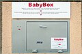
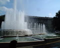
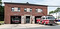
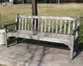
.jpg)
.jpg)
.jpg)
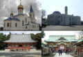
.JPG)
_-_crop.jpg)
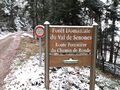
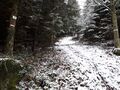
.svg)
.png)
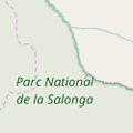
.jpg)
.jpg)
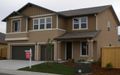
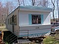
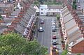
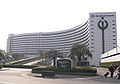
.jpg)
Hornsby_TAFE.jpg)
_2014.JPG)
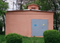
_-_The_Noun_Project.svg)
_12.JPG)
.jpg)
_(14595684550).jpg)
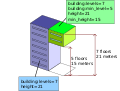
.jpg)
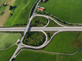
_-_geo-en.hlipp.de_-_11914.jpg)
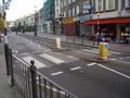
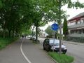
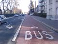
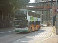
.jpg)
.svg)
_heading_NW.jpg)
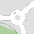
.jpg)
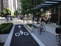
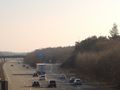
.jpg)
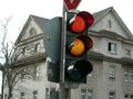
.jpg)
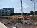
.JPG)
.jpg)
.jpg)
.jpg)
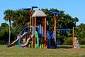
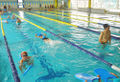
.jpg)
.jpg)
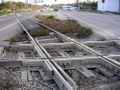
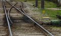
.jpg)
,_StVO_1970.svg)
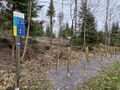
.jpg)
-01.jpg)
,_October_2009.JPG)
_74.jpg)
.jpg)
.jpg)
.jpg)
.JPG)
.jpg)
,_September_2009.JPG)
,_Lotto.jpg)
.jpg)
.JPG)
,_October_2009.JPG)
.jpg)
.png)
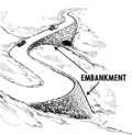
.jpg)
_(4749426050).jpg)
.jpg)
.jpg)
_Service_times_2012.jpg)
_-_The_Noun_Project.svg)