👁 Image
| Harlan, Stephen S., Vielreicher, Richard M., Mortensen, James M., Bradley, Dwight C., Goldfarb, Richard J., Snee, Lawrence W., Till, Allison B. (2017) Geology and Timing of Ore Formation in the Willow Creek Gold District, Talkeetna Mountains, Southern Alaska. Economic Geology, 112 (5) 1177-1204 doi:10.5382/econgeo.2017.4506 | Journal (article/letter/editorial) | | Geology and Timing of Ore Formation in the Willow Creek Gold District,
Talkeetna Mountains, Southern Alaska*...and Geology, Golden, Colorado 80401
Abstract
The Willow Creek mining district was the third-largest...third-largest lode gold district in Alaska in the 20th century, having
produced 19 metric tons (t) of gold from vein...t of gold from associated placer deposits. The district is located in the southern Talkeetna Mountains...quartz veins hosted by granitic rocks of the Willow Creek
pluton. A geochronologic study of granitic rocks | 👁 Image
| Silberman, Miles L., O'Leary, R. M., Csejtey, Bela, Smith, James G., Connor, C.L. (1978) Geochemical anomolies and isotopic ages in the Willow Creek mining district, southwestern Talkeetna Mountains, Alaska. Open-File Report Vol. 1978 (78-233) US Geological Survey doi:10.3133/ofr78233 | Report (issue) | | Geochemical anamolies and Isotopic ages in the Willow Creek mining
district, southwestern Talkeetna Mts., Alaska...�Geochemical anamolies and Isotopic ages in the Willow Creek mining
district, southwestern Talkeetna Mts., Alaska...Smith,
and C.L. Connor
Introduction
The Willow Creek mining district, in southern Alaska, is in the
southwestern...elevations
in the Willow Creek area between 300 and 2200 meters. The mining
district produced nearly $18...rocks in the mining district and similarities of the
geologic environment at Willow Creek with that in | 👁 Image
| | Report (issue) | | and geologic relationships In the Willow Creek gold mining
district, southwestern Talkeetna Mountains...rocks, and
mineralized veins in the Willow Creek gold mining district,
Anchorage quadrangie...............the Willow Creek gold mining district.............................. 12
�INTRODUCTION
The Willow Creek...Creek gold mining district is in the Peninsular terrane, on
the southwestern margin of the Talkeetna Mountains...Mountains batholith (fig. 1). The
mining district exposes two plutons of the batholith, a tonalite (unit | 👁 Image
| | Report (issue) | | Hydrocarbons may be
present in upper Cook Inlet. Mining of placer gold deposits between 1895 and 1906 preceded...874
ounces (17.7 million grams) from the Willow Creek district between 1909 and 1950; production continued...continued into
the 1980's. The Willow Creek mining district contributed
substantially to the development of...come from the Wishbone Hill district; between 1916 and 1952 the district produced 3,284,723 short tons...military bases converted to natural gas in 1967;
coal mining ceased until the late 1980's and early 1990's, | 👁 Image
| | Report (issue) | | consists of
alkalic rocks ranging from gabbro to granite. Radioactivity is lowest in
the gabbro, norite...56
alphas per mg per hr in samples of biotite granite. The radioactivity of
individual rock specimens...of Late Devonian (?) age
range from diorite to granite. The radioactivity increases 4.24 times from
the...hr) was detected in samples of
the Long Mountain granite. There are not enough data on the percentages
of...quartz
diorite, granodiorite, quartz monzonite, and granite. The average radioactivity increases from 1.04 | 👁 Image
| | Report (issue) | | Geology and
-Ore Deposits of the
: Willow Creek Mining
District, Alaska
GEOLOGICAL
SURVEY
BULLETIN...1004
��Geology and
Ore Deposits of the
Willow Creek Mining
District, Alaska
By RICHARD G. RAY
GEOLOGICAL...general and economic
geology of a lode gold mining district
in southern Alaska, with particular
emphasis..._.------._.------_---.---..--_-.---------------Granite.._--_----_-__----.--------_----------------------...-________________-____---____---___---_-_-_.:_
Kelly-Willow prospect--._______________________________________ | 👁 Image
| | Report (issue) | | Radioactive pegmatite minerals in the Willow Creek mining district
By R. M. Moxham and A. E. Nelson
Part..................
Nizina district.................
Mineral deposits and
mining ..................
Radioactivity..................
Bremner district ..............
Mineral deposits and
mining ..................
Radioactivity...Radioactivity studies ......
Klutina district................
Mineral deposits and
mining ..................
Radioactivity...Radioactivity .............
Valdez district ................
Mineral deposits and
mining ..................
Radioactivity | 👁 Image
| | Report (issue) | | Survey, Box 25046, Denver Federal Center,
Denver, Colorado 80225 U.S.A.
�CONTENTS
MINERALOGY/PETROLOGY
...a Fault-Controlled Cave in
Precambrian Gneiss, Colorado Front Range
by Peter J.
Mbdreski, Earl R. Verbeek...Ages, and Isotopic Data from
the Willow Creek Gold Mining District, Southern Alaska
by
Dawn J. Madden-McGuire..............................
Reconnaissance of Colorado Front Range Bogs for Uranium and
Other Elements................
A Post-Tectonic Rare-Metal-Rich Granite in the Southern
Complex, Upper Penninsula, Michigan | 👁 Image
| | Report (issue) | | 1 uranium mine, Seven Mile
Canyon area, Grand County, Utah: TEI-287, Jan. 11, 1954. GJ, SL.
Fischer...exploration at the
Old Leyden coal mine, Jefferson County, Colo.: TEM-292, Mar. 30,
1953. D, GJ.
Hinrichs...The pegmatites of the Errington-Thiel mine, Elko
County, Nevada: TEI-71, Dec. 28, 1949. Office of Director...Ridge, and West End claims
near Clancy, Jefferson County, Mont.: TEM-31, Oct. 19, 1951.
D, SL, T. (332,...Geology of the Small Horn Canyon, Daly's Spur, Cedar
Creek and Dell areas, southwestern Montana: Dec. 8, 1949 | 👁 Image
| | Journal (article/letter/editorial) | | and
Chichagof district in southeastern Alaska, and
mines of the Willow Creek district and Chugach/
Kenai...Geanticline
U
I,
Lode Gold Districts
1. Fairbanks
2. Willow Creek
3. Kenai/Chugach Mountains
a. Port Valdez
b...from lode sources.
LODEGOLD
Juneau
Chichagof
Willow Creek
Fairbanks
Chugach/Kenai
Mountains
Apollo
PLACERGOLD...Innoko
Forty Mile
Hot Springs
Tolvana
Ruby
Va{dez Creek
Koyukuk
Nyak
Chistochina
Nizina
Chugach/Kenai
Mountains...Kuskokwim Basin
f. Iditarod/Flat
g. Innoko
6. Valdez Creek
\
~" 9
,5
Koy0kuk ....
~oa
: o,
Tintina fault | 👁 Image
| | Report (issue) | | description of the geology, mining history,
and production of the major gold-mining
districts in 21 States...relations ---------------------------History of gold mining and trends in production_
J\labama -----------...--------------Cleburne County ----------~-----------------
Tallapoosa County --------------------------Alaska...------------------Cochise County -----------------------------Gila County --------------------------------Greenlee...ee County ----------------------------R[aricopa County ----------------------------R[ohave County -- | 👁 Image
| | Book (edition) | | - Temecula, CA 92589
(909) 699-4749
��-
1994
Mining Guide
TABLE OF CONTENTS
INrRoDUCI'ION ••••••••........................................ CAl 119
Colorado .............................. ...................... .
�1994
Mining Guide
INTRODUCTION
IMPORTANT - PLEAsE READ!
The 1994 GPM Mining Guide is designed...(normally listed from north to south), directions and mining
commen ts; gold-producing areas, general prospecting...under 18 years of age. After purchasing a current Mining
Guide, GPAA members may take family members with | 👁 Image
| | Report (issue) | | MINING DEVELOPMENTS IN THE MATANUSKA COAL
FIELD.
By THEODORE CHAPIN.
INTRODUCTION.
The following report...material. Anchorage was at
first known as Ship Creek, the name of the stream on which it is
built. It...Anchorage in May,
1915. Steel was laid to Moose Creek in August, 1916, and was completed to Chickaloon...Sumner S. Smith, and the writer regarding coal-mining
problems.
The purpose of this report is to describe...subdivision of the field into leasing units and
to coal-mining operations. Detailed geologic information on the | 👁 Image
| | Report (issue) | | Location description and accuracy:
West of Fishhook Creek, marked with an adit symbol and labeled 'Independence...Geologic description:
Three quartz veins - the Granite Mountain, Independence, and Skyscraper - cut Late...Cretaceous quartz diorite of the Willow Creek Pluton. The Willow Creek Pluton is a
zoned pluton: the outer...alteration zone chloritization is present (Ray, 1954).
Granite Mountain vein as Capps (1915) described averages...SW. A few inches of
gouge bounds the vein. The Granite Mountain vein contains free gold, pyrite, chalcopyrite | 👁 Image
| | Report (issue) | | Seward Peninsula-Kobuk region ............
York district ..................
Lost River area ................
Uranium possibilities of the York district .
Nome district ..................
. Uranium- possibilities...possibilities ...........
Council district ................
Uranium possibilities- ...........
Pairhaven and...' Kantlshna district .............
Nenana district ..............
Valdez Creek district ...........
Chulitna...Chulitna district .............
Yentna district ..............
Iliamna Lake~Lake Clark area ........ | 👁 Image
| | Report (issue) | | uranium and rare earth
minerals, prospects, mines, mining, gold placers
General geology
Regional studies...Early Proterozoic metavolcanic rocks in
the Jarvis Creek Glacier tectonostratigraphic terrane, Mount Hayes...contrasts
across the Talkeetna, Totschunda, and Eureka Creek faults versus the lesser
geophysical expression...L., Silberman, M.L., and Christie, J.L., 1978,
Granite on the Barrow arch, northeast NPRA: 772-B, p. B24-B25...Ordovician age reappraisal for the Upper Fossil Creek Volcanics, and
possible significance for glacio-eustasy: | 👁 Image
| | Report (issue) | | Mendenhall, Director
&fj I,
Bulletin 864 B
THE WILLOW CEEEK-KASHWITNA DISTEICT
ALASKA
BY
S. R. CAPPS...in the Willow
Creek-Kashwitna district._____________________________
100
100
�THE WILLOW CREEK-KASHWITNA...CREEK-KASHWITNA DISTRICT
By S. R. CAPPS and RALPH TUCK
INTRODUCTION
LOCATION AND AREA
The Talkeetna Mountains are...part of the
drainage flows to the Susitna.
The district described in this report is a triangular area...Susitna Valley flats the western, and the Willow Creek gold
district, which is in the extreme southwestern | 👁 Image
| | Report (issue) | | geologic map, and a discussion of the
Willow Creek mining district, constitute the latest available information...North American plate.
From the Upper Chulitna district of the west-central Alaska Range,
Clark and others...grade into small irregular bodies of
alaskitic granite and granodiorite.
The late-stage rocks are light...chiefly tonalite, quartz diorite, granodiorite, and granite (K-feldspar s plagioclase), but they include subordinate...The ophiolitic sequence of the Upper Chulitna district, which contains
altered ultramafic bodies, could | 👁 Image
| | Report (issue) | | Mackay stock (center of photograph; is made up of granite, quartz monzonite, leucogranite porphyry, and felsic...rocks, including
the Lower Mississippian McGowan Creek Formation and the Upper Mississippian White
Knob...Director
Published in the Central Region, Denver, Colorado
Manuscript approved for publication November 4...1988),
and on December 7, 1989, at the Northwest Mining Association 95th Annual Convention
and Trade Show...the Mineral Hill and Warm Springs mining districts, Blaine County, Idaho: Idaho Bureau of
Mines and Geology | 👁 Image
| | Report (issue) | | M.E., Mining Geology GeopJiysics ·v. Ann. Mtg., Abs. Tech. PapersAmerican Institute of Mining a d Metallurgical...Metallurgical Engi:peers, :Mining
Geology Geophysics Division Ann I Meeting, Abstracts of Techpical
Papers...Alberta.
Canadian Inst. Mining and Metallurgy Trans.-Canadian Institute of Mining
and Metallurgy Transactions...-Canadian Mining and Metallurgi~al Bulletin.
Montreal, Quebec.
Canadian Min. J our.-Canadian Mining Journal...Proc.-Colorado Scientific Society Proceedings. Denver, Colo.
Colo. Univ. Studies, Gen. Ser.-Colorado University | 👁 Image
| | Report (issue) | | in northern part of Independence mine,
Willow Creek district......_.----------.----_-_---.---.-_
14....Sketch map of Alaska showing location of Willow Creek
district-..-...-..-....-----------_-------_--.---...quartz vein at the Independence mine in the Willow Creek district
is one of several occurring in the quartz...whole problem of mineralization in the Willow Creek district, Alaska. As here presented, some abridgment'has-been...RESOURCES OF ALASKA, 1940
INTRODUCTION
The Willow Creek mining district, in which is situated the Independence | 👁 Image
| | Report (issue) | | Stratiform zinc-lead mineralization, Drenchwater Creek area, Howard Pass quadrangle,
western Brooks Range...Kachadoorian, F. E. Crory, and D. L. Berg _ _ 22
Granite on the Barrow arch, northeast NPRA,
by K. J. Bird...secondary uranium mineral, in alaskite of the Wheeler Creek
pluton, by Thomas P. Miller and Bruce R.
Johnson...mineralization and metamorphism in the Willow Creek mining district, southern
Talkeetna Mountains, Alaska...22
13. Lithology and wireline log response of granite in East Teshekpuk No. 1 ___________________ 24 | 👁 Image
| | Report (issue) | |
Crossroads: Lyons, P. L., 4.
Gilbert H., 10.
Colorado, South Silverton area:
Expanding horizons: Lay..., 3.
Curtis H., 1.
Earth: Vincenz, S. A. , 3.
Granite controversy: Read,
Primitive homogeneous, evidence:...the future: Just, E.
ing: Burwell, E. B., Jr., 4.
Mining geology, retrospect and
Index fossils: Stephenson..., 11.
D. J.
Rocky Mtn. geosyncline in Canada:
Colorado Plateau: Wengerd,
Warren; P. S., 4.
S. A., 6....
Landform interpretation, stereoSearch for new mining districts:
Nolan, T. B., 1.
pairs: Powers, W. E | 👁 Image
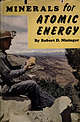
| | Book | | ��MINERALS
FOR ATOMIC ENERGY
�Diamond Drilling on the Colorado Plateau.
Courtesy Union Carbide and Carbon Corp...need a license to mine uranium?"
"How do I stake a mining claim?"
As a result of these inquiries, the Atomic...which have participated hundreds of geologists, mining engi-
the largest
undertaken
in
neers, mineralogists...of Mines and Technical Surveys, Canada.
Eldorado Mining and Refining, Ltd., Canada.
Department of Atomic...Inc., 1953.
Regulations concerning location of mining claims in the Western States in
Appendix X were | 👁 Image
| | Report (issue) | | VIDEOC
Geology of the Colorado Plateau : Grand Junction to Denver, Colorado, June 30July 7, 1989. Washington...deposits and geology of central Colorado : Red Rocks Park to Cripple
Creek, Colorado, July 2-8, 1989. Washington...Michael D. The feasibility of mining in the Valdez Creek Mining
District, Alaska. [Anchorage, Alaska?]...of the Hunting
Hill serpentine mass, Montgomery County, Maryland : Hunting Hill Quarry,
Maryland, July...of the Powhatan 7.
5-minute quadrangle, Johnston County, North Carolina. Raleigh, N.C. : North
Carolina |
|
