👁 Image
| | Report (issue) | | �THE GEOLOGICAL SURVEY OF WYOMING
Gary B. Glass, Executive Director and State Geologist
ADVISORY BOARD...Governor
Terry P. Roark,President, University of Wyoming
Donald B. Basko, Oil and Gas Supervisor
Appointed...Cheyenne, Wyoming.
This and other publications available from: The Geological Survey of Wyoming
P.O. Box...University Station
LaIanlle, Wyoming 82071
(307) 766·2286
Front Cover - Wyoming gold. Gold buttons in the...recovered by Dean Farris from mine dump waste in the Gold Hill district. The
actual diameter of the button | 👁 Image
| | Journal (article/letter/editorial) | | 00:52 01 June 2016
Wyoming Mineral
Locality Index
Figure 1. Index map of Wyoming counties, with
exposures...exposures of Precambrian and volcanic rocks.
1
he Wyoming mineral locality index is designed to provide mineral...interesting mineral
occurrences in the state of Wyoming. Five publications were used extensively in compiling...view of the Tenderfoot mine (about 19131, Esterbrook copper district, Albany County. John
Taylor collection...1 inch equals 4
miles) of the entire state of Wyoming in book form. The
Wwming Atlas and Gazetteer can | 👁 Image
| | Report (issue) | | the State lists
begin with Alabama and end with Wyoming. Under each State the
minerals found there are...it helpful to refer to Survey
Bulletin 507, "The mining districts of the western United States,"
and to...abundant, it may have been completely exhausted by mining or
quarrying. Deposits of minerals of wide distribution...because they occur in sufficient quantity to warrant
mining for their usual products but because they furnish...museum specimens. Some mineral aggregates, as clay, granite, limestone, sand, and sandstone, are included, | 👁 Image
| | Report (issue) | | .......................................
102
District of Columbia .................................................................................
Wyoming..................................................to refer to Geological
Survey Bulletin 507, "The mining districts of the western United
States," and to...abundant it
may have been completely exhausted by mining or quarrying. Deposits of minerals that are widely...because they occur in sufficient quantity to warrant
mining for their usual products, but because they furnish | 👁 Image
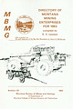
| | Report (issue) | | G. Koch, Director
BULLETIN 46
DIRECTORY
0 F
MINING ENTERPRISES FOR 1
964
Compiled by
Robert D. Geach...ACTIVE COAL MINES, 1964
by Thomas Morgan
State Coal Mine Inspector
and a section on
THE MINERAL INDUSTRY...Vermiculite
Supplemental list of mining enterprises
Part 3, Coal mines
State coal mine inspector's annual report...report
State coal mine inspector's report of coal mines
active in 1964
Part 4, The mineral industry of Montana...Mineral fuels
Index of mines, mine owners and operators
List of mining districts
1
3
3
3
33
33
34
34 | 👁 Image
| | Book | | volume is dedicated is four-fold: (1) To locate
by mine, deposit, or community those mineralized areas of...Co.
Hematite
CALERA, Shelby Co.
Wavkllite
CLAY COUNTY, Sec. 24. T. 19 S R., 7 E.
STATUARY, Coosa Co...Co., (W. border of*
Marble Crystalline
TALLADEGA COUNTY
Marble, (crystalline)
VALLEY HEAD, DeKalb Co.
Hematite...VILLAGE SPRINGS, Blount Co.
Hematite
WOODS COPPER MINE, Cloaburne Co.
Sphalerite
ARIZONA
COVEI.I.ITE...Feldspar
HISSOP, Coosa Co., (near)
Beryl
JACKSON COUNTY
Hematite
KENNEDYS, Clay Co., (near)
Magnetite
MILLERVILLE | 👁 Image
| | Report (issue) | | DIRECTORY OF
MONTANA
MINING
ENTERPRISES
FOR 1985
M
B
M
compiled by
D. C. Lawson
with a section on
the...the Emery mining district by Robert E. Derkey
11
■1111111■1
Emery mill in Powell County.
Bulletin...MONTANA
MINING ENTERPRISES
FOR 1985
compiled by
D. C. Lawson
with a section on the Emery mining district...26
28
DRILL-CORE REPOSITORY
MINE INSPECTION LAW
29
THE EMERY MINING DISTRICT
31
Figure 1—Index map showing...showing location of Emery mining district.
30
Figure 2—Generalized north-south stratigraphy, Deer Lodge | 👁 Image
| | Book (edition) | | YEAR 1687"—DAVID T. DAY, CHIEF OF THE
DIVISION OF MINING STATISTICS AND TECHNOLOGY
WASHINGTON
GOVERNMENT...and consump
tion, or better and cheaper means of mining, extraction, and convey
ance to market, may in...correspondence has been carried on with geologists,
mining engineers, and other local authorities, and various...thickness; mmed at Broken Arrow aud Trout
creek, in Sc. Clair county. The strata in this field are
more faulted...south prong of Canoe
creek, in St. Clair county, to Ha\sop creek, in Bibb
county, a distance of 60 miles | 👁 Image
| | Report (issue) | | ........................
5
5
Distribution of mining districts..........................................
Wyoming.........................................................
PART II. Catalogue of mining districts...............................
Classification of mining districts...........................................
Wyoming.........................................................
Alphabetic index of mining districts...surveys...
III. Map of Arizona, showing location of mining districts...............
IV. Map of northern counties | 👁 Image
| | Journal (article/letter/editorial) | | with its representation of mining tools
clearly proclaim Montana’s mining origins. Montana’s
production...published
describing the occurrence, collecting, mining, and cutting of the two state gemstones.
Figure...Granville Stuart established
Montana’s first mining camp at Gold Creek
in 1860.
Geologic Provinces
The state...view showing the Indian Queen mine ca. 1905 at Farlin, Beaverhead County.
208
ROCKS & MINERALS
�Downloaded... the Rocky
Mountains, and furthest to the northwest, the belt
basin. The Rocky Mountains contain sedimentary | 👁 Image
| Long, Keith R., DeYoung,, John H., Ludington, Stephen (1998) Database of significant deposits of gold, silver, copper, lead, and zinc in the United States. Open-File Report Vol. 1998 (98-206) US Geological Survey doi:10.3133/ofr98206ab | Report (issue) | | deposits of the East Shasta copper-zinc
district, Shasta County, California: U.S. Geological Survey Professional...1972, Geology and mineral deposits of Esmeralda County,
Nevada: Nevada Bureau of Mines and Geology Bulletin...p.
Allsman, P.T., 1940, Reconnaissance of gold mining districts in the Black Hills, South Dakota:
U.S...Nutt Wilderness Study Area
(AZ-020-024), Mohave County, Arizona: U.S. Bureau of Mines Mineral Land Assessment...Summary report (preliminary), Lights Creek Copper Project, Plumas County,
California; Venture 63: San Francisco | 👁 Image
| | Report (issue) | | MONTANA
MINING ENTERPRISES
FOR 1984
compiled by
D. C. Lawson
with a section on the Elk Creek-Coloma
mining...mining district
by
Richard B. Berg
mineral and ground-water research
M
B
M
G
since 1919
1985
�Contents...DRILL-CORE REPOSITORY
MINE INSPECTION LAW
THE ELK CREEK-COLOMA MINING DISTRICT
Figure 1—Index maps showing...locations of Elk Creek and Coloma
Figure 2—Generalized geologic map of the Elk Creek-Coloma district
Figure 3—Veins...3—Veins at Coloma
Figure 4—Sketch of Elk Creek barite vein exposed in cut
References
APPENDIX
Table 1—Nonfuel | 👁 Image
| | Report (issue) | | GEOLOGY
E. G. Koch, Director
Bulletin 25
DIRECTORY
MINING
OF
KNOWN
ENTERPRISES, 1 9 6 1
Compiled by
Frank...ACTIVE COAL MINES, 1961
By Thomas Morgan
State Coal Mine Inspector
And Section on
THE MINERAL INDUSTRY OF...Fergus
14
14
Flathead . . • . , .
Gallatin
15
Granite
15
Jefferson
19
Judith Basin
23
Lewis & Clark
24...Ravalli
Sanders
Silver Bow
Stillwater
Sweet Grass
Toole
Yellowstone
State coal mine inspectors
report
List...coal mines
active in 1961
Supplemental list of mining
enterprises
36
38
39
40
41
44
45
46
47
48
48 | 👁 Image
| | Report (issue) | | ' P~rk Range, which also enters the State from
Wyoming, and running -nearly south terminates in about...Park consists mainly of second.a ry ranges of mountains and hills, alternating
with broad valleys. The...and more or less isolated
mountains, known collectively as the" Elk Mountains" or the" Gunnison Country...ansas River is a high range known as the ''Wet Mountains,'' standing as an outlier east
of the Sangre de...feet. West of San Luis Valley rise the San Juan
Mountains in which head Rio Grande, flowing into the Gulf | 👁 Image
| | Book (volume) | | excavations in the
underlying black, Upper Devonian (New Albany) shales occasionally produces pieces of
silicified...ASHTABULA COUNTY
CONNEAUT, area pits, quarries, rd. cuts, etc.⎯cone-in-cone Calcite.
CLERMONT COUNTY
MILFORD...MILFORD, area creek gravels and alluvial deposits, rare⎯Diamond.
CLINTON COUNTY
WILMINGTON, area of Todd’s...Todd’s Ford, a mineral deposit⎯Hematite.
COSHOCTON COUNTY
AREA, townships of Washington, Virginia, Bedford...Keene, Mill Creek and Tuscarawas, as hard dark gray to black
nodules⎯flint.
CUYAHOGA COUNTY
CHAGRIN FALLS | 👁 Image
| | Report (issue) | | ��Bulletin 121
MONTANA
DIRECTORY OF MONTANA
MINING ENTERPRISES
FOR 1983
compiled by
D. C. Lawson
with...section on the Gold deposits
of the Big Belt Mountains
by
Henry G. McClernan
mineral and ground-water...1919
Prepared in cooperation with the
Montana Mining and Mineral Resources Research Institute.
1984...BIG BELT MOUNTAINS
Figure 1—Location map
Figure 2—Cross section of the Golden Messenger mine vein system...projects
List 2—Supplemental list of mining enterprises
List 3—Mining districts
List 4—Strippable subbituminous | 👁 Image
| | Report (issue) | | .............................................
Wyoming..................................................this report.
11
�ALABAMA
Adams Gap and Shinbone Creek Roadless Areas
Bearce, D. N., 1973, Geology of the...geochemical samples, Adams Gap and Shinbone
Creek Roadless Areas, Clay County, Alabama: U.S. Geological Survey OpenFile...resources of Shinbone
Creek and Adams Gap RARE II Further Planning Area, Clay County, Alabama:
U.S. Bureau...Geologic map of
Adams Gap and Shinbone Creek Roadless Areas, Clay County, Alabama: U.S.
Geological Survey Miscellaneous | 👁 Image
| | Report (issue) | | ........................
Western United States mining districts .......................
World distribution...14
14
15
15
15
15
15
15
15
15
15
15
15
15
15
Wyoming .................................................(21)
(22)
*114
*115
Geology of the Globe copper district, Arizona, by F. L. Ransome, 168 pp., 1903.
The...The mineral resources of the Mount Wrangell district, Alaska, by W. C. Meudenhall and
F. C. Schrader, 71...Encampment district, Wyoming, by A. C. Spencer, 107pp., 1904.
Economic geology of the Bingham mining district | 👁 Image
| | Book (volume) | | Iowa to
3,500’ along the western boundary with Wyoming. In the far western counties of Lawrence,
Meade...Fourche and Cheyenne rivers. These pine covered mountains,
higher than the Alleghenies, culminate in Harney...around the entire mountain system. The
rising granite mass intruded the famed Cretaceous Dakota sandstone...Peak is the crest of the geologically notable granite dome uplift which also
produced a most remarkable...pegmatites are off
shoots of the otherwise barren granite. From then have come some of the world’s most
spectacular | 👁 Image
| | Report (Issue volume) | | of
nonfuel minerals and a chapter on trends in mining and quarrying in the metals and industrial mineral...State mineral production and mineral production by county were prepared in the Division of Statistics and...Geological and Natural History Survey.
Wyoming: Geological Survey of Wyoming.
L. Michael Kaas, Chief, Division.... . . . . . . . . . . . . . . . . . . . . 531
Wyoming, by Rodney J. Minarik, W. Dan Hausel, and R. E...which
329), which placed the collection of min- Mine Safety and Health Administration),
eral statistics | 👁 Image
| Janzer, Victor J., Stanley, G.W., Long, H.K., Farrar, J.W., Brezina, K.A. (1991) Data for gross alpha, gross beta, gross radium as radium-226, and uranium in ground and surface waters in the United States, mid-1954 through 1965. Open-File Report Vol. 1991 (91-70) US Geological Survey doi:10.3133/ofr9170 | Report (issue) | | records, and when available,
includes the state, county, location of point of collection, and date and...pCi/L, picocuries per liter; fluor.. fluorometric;
County
Nearest
community
Location of point of collection...0.1
0.9
2.8
17.0
1.7
1.0
0.9
0.9
1.1
�Table
County
1.~ Sample-site data and radiochemlcal
Location...Gila
Globe
Cochise
Douglas
Yuma
Yuma
Pima
Tucson
S. of Mexican Water
Globe
Douglas
Yuma
SW. of Tucson...Tucson
City of Globe
City of Douglas
City of Yuma
Graham
Cochise
Final
Yuma
Mohave
Clifton
Dragoon
Casa | 👁 Image
| | Book | | stumble over a valuable nugget and
stake your own mining claim? Indeed it
to
and in
is,
author
of
this...prospecting, he points
out,
is
in
abandoned mining
districts,
where valuable mineral ores are present...commercial ores and secondary minerals by
state,
county,
township,
and geologic
range.
For easy identification...RANSOM
1875-1948
An Eastern '‘Schoolmarm”
to the
Mining Camps of the Old West
�I
I
a
s
I
\
h
K
4...�CONTENTS
Preface
ix
PART I
1
Introduction to Mining and Mineralogy
3
2
Preparation for Mineral Collecting | 👁 Image
| | Report (issue) | | vols. 9, 10. Tulsa,
Okla.
American Institute of Mining and Metallurgical Engineers: Transactions,
vols...of American Geographers: Annals, vols. 15, 16. Albany, N. Y.
Bernice Pauahi Bishop Museum: Bulletin,...11, 12. San Francisco, Calif.
California State Mining Bureau: Bulletin, nos. 79, 94-97. San Francisco...39, 40. Ottawa, Ontario.
Canadian Institute of Mining and Metallurgy: Transactions, vols. 27, 28; Bulletin...Bulletin, nos. 153-176. Montreal, Quebec.
Canadian Mining Journal, vols. 46, 47. Toronto and Montreal, Canada | 👁 Image
| | Book (edition) | | TOWNS & MINING
CAMP
SITES
�.
ol
%
\
AND WHERE THEY FOUND IT
A GUIDE
TO GHOST
TOWNS
& MINING
CAMP...that reading about and visiting
Ghost Towns and mining camp sites are becoming
increasingly popular.
Fact...the history of both the famous
and little-known mining booms. This book is particularly valuable because...most important and interesting
Ghost Towns and mining camps, giving specific directions to help you reach...including maps, historic and modern photographs of mining towns, sketches, and pictures of
those who became |
|
