👁 Image
| | Report (issue) | | East Mojave National Scenic Area,
San Bernardino County, California
by
U.S. Geological Survey
1991
Open-File............................................. 10
Granite..................................................and Wild Horse Mesa................... 2 3
Piute Range, Castle Mountains, and Castle Peaks ............................... 3 3
Lanfair Valley and Piute Range...................................................Providence Mountains ........................... 3 5
Granite Mountains..................................... | 👁 Image
| | Report (issue) | | Utah Geological Survey Open-File Report 695 Utah Mining Districts UTAH GEOLOGICAL SURVEY a divison of...Ashbrook (Pb Ag) (Ag Au) (Pb) Park Valley (Au) (Pb Ag) 2018 CACHE BOX ELDER (Au Ag) (Au Ag) Swan...Swan Peak (Ag Pb) Red Butte Beatty Mountain 42°0'0"N Bear Lake Richmond (Ag Pb) Cotton Thomas Basin... (Cu Au Ag) W E B E R Weber Lake Newfoundland (W) Crater Island BASIN AND RANGE (Pb Ag) Stockton...REE) A V CARBON Leamington Drum Mountain (Pb Ag) SANPETE (Au Mn) E Santobar Kings Canyon 39°0'0"N | 👁 Image
| | Report (issue) | | 3/ Menlo Park, CA., 94025
�RE0.1
STARE
Co6;
CouNTY
4004225 04
M003904 04
M030496 04
4800112
M899986...AMOLE DISTRICT
BANNER DISTRICT
BLUE HELL GROUP
19N 215W 101 35-03-A
wA
113-49-A
w W MO 81 PBA
CUA
AG
BORIANA...115W 118 34-56-154 113-54-53W
CATALINA DISTRICT
CATALINA DISTRICT
CHILDS-ALOWINKLE HUN
CINNABAR MINE
02N...MINI
175 16E 28 31-55-314 110-42-30w CU AG MU ZN PB
MU AU AG PB
DOYLEV
VANADul4 1-LINE
V
EAST HELVETIA...114-10-31W AU AG MO V
EMPIRE MINE
ESPERANZA MINE GROUP 185 12E SO.31-52-204 111-08-08W PB ZN CU AG AUV
4
ESPERANZA | 👁 Image
| | Report (issue) | | ......................................... 121
Au-Ag-Te vein deposits, by K.D. Kelley, T.J. Armbrustmacher.................. 214
Sedimentary exhalative Zn-Pb-Ag deposits, by K.D. Kelley, R.R. Seal, II, J.M. Schmidt...mineralized areas prior to
mining, and conditions that result from mining and mineral processing. Other...as
climate, and anthropogenic factors (including mining and mineral processing methods) mostly modify the...geoenvironmental models are immediate and varied; these range from environmental
prediction and mitigation, and | 👁 Image
| | Report (issue) | | Lithium-brine evaporating ponds at Clayton Valley, Nevada. Lithium has many uses, the most
prominent being...than ever before and in an increasingly diverse range of applications—
from telecommunications (cell phones...potential
environmental and health issues caused by the mining and processing of many mineral
commodities may...the environmental
considerations related to the mining of nonfuel mineral resources, including the modern...Chapter B. Environmental Considerations Related to Mining of Nonfuel Minerals
By Robert R. Seal II, Nadine | 👁 Image
| Du, Shengjiang, Wen, Hanjie, Liu, Shirong, Qin, Chaojian, Yan, Yongfeng, Yang, Guangshu, Feng, Pengyu (2020) Mineralogy and Metallogenesis of the Sanbao Mn–Ag (Zn-Pb) Deposit in the Laojunshan Ore District, SE Yunnan Province, China. Minerals, 10 (8) 650 doi:10.3390/min10080650 | Journal (article/letter/editorial) | | Metallogenesis of the Sanbao Mn–Ag (Zn-Pb) Deposit in the Laojunshan Ore District, SE Yunnan Province, China...Abstract: The Sanbao Mn–Ag (Zn-Pb) deposit located in the Laojunshan ore district is one of the most important...important deposits that has produced most Ag and Mn metals in southeastern Yunnan Province, China. Few...concerning the distribution and mineralization of Ag, restricting further resource exploration. In this...geochemistry are examined with the aim of revealing Ag occurrence and its associated primary base-metal and supergene | 👁 Image
| Zhang, Jing, Chen, Yanjing, Yang, Yan, Deng, Jun (2011) Lead isotope systematics of the Weishancheng Au-Ag belt, Tongbai Mountains, central China: implication for ore genesis. International Geology Review, 53 (5) 656-676 doi:10.1080/00206814.2010.496196 | Journal (article/letter/editorial) | |
Lead isotope systematics of the
Weishancheng Au-Ag belt, Tongbai
Mountains, central China: implication...(2011) Lead isotope
systematics of the Weishancheng Au-Ag belt, Tongbai Mountains, central China: implication...
Lead isotope systematics of the Weishancheng Au-Ag belt, Tongbai
Mountains, central China: implication...sericite schist. We conclude that the Weishancheng Au-Ag ore belt can be classified as a stratabound,
orogenic-style...Keywords: lead isotopic systematics; Weishancheng Au-Ag belt; stratabound
orogenic-style mineral systems; | 👁 Image
| | Journal (article/letter/editorial) | | probe micro-analyses have also revealed two un-named Ag-Te-S
phases. Fluid inclusion studies suggest that...(temperature of homogenisation) determinations were in the range 295 °C to 325 °C
and a depth of vein formation ~... ~348 values of + 1.8%0 for galena
from the Au + Ag + Te veins suggest a different (possibly igneous)...data are not conclusive.
It is argued that the Au + Ag mineralization at Tyndrum is due to hydrothermal...Mikrosondenanalysen das
Vorhandensein von zwei unbekannten Ag-Te-S Phasen. Die Untersuchungen von Flfissigkeitseinschlfissen | 👁 Image
| Sidorov, A. A., Volkov, A. V., Belyi, V. F., Alekseev, V. Yu., Kolova, E. E. (2009) The gold-silver Okhotsk-Chukotka volcanic belt. Geology of Ore Deposits, 51 (6) 441-455 doi:10.1134/s1075701509060026 | Journal (article/letter/editorial) | | expect new discoveries, so that the growth in gold
mining can be provided primarily by prospecting of
new...Valunisty, Dvoinoe, Khakandzha, and Kupol deposits,
the mining of even remote high-grade deposits does not
need...advanced to the first three regions of Russia in gold
mining, as was done by Kubaka deposit, which helped
Magadan...12
6
5
14
5
7 10 11 13
0
8 250
500
Fields of Au–Ag deposits
in the OChVB
1
2
15
750
1000
17
16...granodiorite
and associated tonalite, quartz monzonite, granite).
The OChVB formed over 25 Ma (Belyi, 1994) at | 👁 Image
| | Journal (issue) | | ‘
The Engineering and Mining Journal
VOL. LXXXVII.
NEW
YORK,
APRIL
3, 1909.
NO. 14.
Milling and...grinding on a large scale.
El Oro was the pioneer district in Mexico to undertake the cyaniding of a gold...and now in the tailings mill of
the Esperanza Mining Company which is
rapidly approaching completion...filter is at present the only filter
used in the district the Esperanza com-
�THE
684
ENGINEERING
pany...
isfaction and is used quite generally in the
district.
The South African origin of El Oro
cyanide practice | 👁 Image
| | Report (issue) | | . . . . . . . . . . . . . . 15
2.1 History of Mining . . . . . . . . . . . . . . . . . . . . . . . .... . . . . . . . . . . . . . . . . . . . 24
2.6 Mining Districts versus Watersheds versus Ranger Districts...Clark Fork Watershed (including the Plains Ranger District) . . . . . . . . . . . . . . . . . 138
5.1 Johnny.... . . . . . . . . . . . . . 149
6.0 Summary of Mining Impacts on LNF-Administered Land . . . . . . .... . . . . . . . . 21
4.
The Seeley Lake Ranger District . . . . . . . . . . . . . . . . . . . . . . . | 👁 Image
| Parfenov, L. M., Vetluzhskikh, V. G., Gamyanin, G. N., Davydov, Yu. V., Deikunenko, A. V., Kostin, A. V., Nikitin, V. M., Prokop'yev, A. V., Smelov, A. P., Supletsov, V. M., Timofeyev, V. F., Fridovskiy, V. Yu., Kholmogorov, A. I., Yakovlev, Ya. V. (1999) Main Metallogenic Units of the Sakha Republic (Yakutia), Russia. International Geology Review, 41 (5) 425-456 doi:10.1080/00206819909465151 | Journal (article/letter/editorial) | | structural loop
(Zonenshain et al., 1990) (Fig. 1).
Granite belts are a characteristic feature of the
Verkhoyansk-Kolyma...as well.
Longitudinal and transverse belts of granite batholiths have been recognized. The Main longitu-...Terranes of Aldan-Stanovoy shield (WA = West Aldan granite-greenstone; NM = Nimnyr charnockite,
ST = Sutam...(AZ), turbidite basin terranes (BR = Beryozovka, AG = Arga-Tas; NG =
Nagondzha), continental margin Kular-Nera...terranes (PL = Polousnyy, ID = In'yali-Debin)
Granite belts
Longitudinal belts (MB = Main belt dated | 👁 Image
| | Report (issue) | | µm
micrometer
AFRG
alkali-feldspar rhyolite-granite
g/t
gram per metric ton
kg
kilogram
kg CaCO3/t...rhenium produced by mining
rather than through recycling) is as a byproduct of copper
mining, and about 80...80 percent of the rhenium obtained through
mining is recovered from the flue dust produced during the
roasting...the estimated rhenium grades of these deposits range
from less than 0.1 gram per metric ton to about...type) account for most other rhenium
produced by mining. These types of deposits also have large
amounts | 👁 Image
| | Journal (article/letter/editorial) | | is to analyze relationships between epithermal Au-Ag deposits of the hydrothermal
type and related geological...and integrated to produce a map of potential Au and Ag deposits in the Gangreung area, Korea. This
empirical...relationships. A spatial database containing Au and Ag deposits, topographic, geologic, geophysical
and...constructed using a GIS. The factors relating to 103 Au and Ag mineral deposits are
the geological data such as...information for mineral resource development.
Keywords: Au-Ag, GIS, Korea, likelihood ratio, logistic regression | 👁 Image
| Volkov, A. V., Savva, N. E., Sidorov, A. A., Egorov, V. N., Shapovalov, V. S., Prokof’ev, V. Yu., Kolova, E. E. (2006) Spatial distribution and formation conditions of Au-bearing porphyry Cu-Mo deposits in the Northeast of Russia. Geology of Ore Deposits, 48 (6) 448-472 doi:10.1134/s107570150606002x | Journal (article/letter/editorial) | | to clarify the relationships between epithermal Au–Ag and porphyry Cu–Mo ores in the common ore-forming...deposits are the main worldwide source of Cu and Mo; Au, Ag, and platinum group and some other rare metals are...porphyry copper deposits with average grades of 2 g/t Ag and 0.4 g/t Au are located in Arizona; their hypothetical... The Bingham ore district in Utah ranks first in mining copper and second in mining molybdenum. In 1890–1971...31 kt Ag and 300 t Au, including 800 t Ag at a grade of 2 g/t in 1970 alone. As much as 4 kt Ag and 55 | 👁 Image
| | Report (Issue volume) | | Wales Portion)
VOLUME 2
MINERAL OCCURRENCE DATA SHEETS, AND
OCCURRENCE LISTS
R.E. Brown, H.F. Henley..................................... 3
MINERAL OCCURRENCE SYMBOLS ....................................................................................6
MINING HISTORY .........................................deposits are illustrated on Map 1. Details of
each occurrence are summarised on the following
mineral deposit...units
Quartz-rich granitoids
Alkali-feldspar granite, granite
Granodiorite, tonalite
Monzonite, monzodiorite | 👁 Image
| | Report (issue) | | Data.....................13
Effectiveness of Pb-Zn-Ag Deposit Detection Anugi Region.....................of the study area in part of the Fairhaven mining district in
the northeastern Bendeleben quadrangle,...as follows:
°C=(°F-32)/1.8
Chemical Symbols Used
Ag
Silver
Al
Aluminum
Ar
Argon
As
Arsenic
Au...drainages around four main areas—at the Anugi
Pb-Zn-Ag occurrence and in streams upstream of historically
and...and gold. Some observations include (1) elevated Ag, As, Pb,
and Zn concentrations relative to the study | 👁 Image
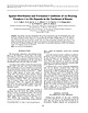
| | Book | | Based upon early field studies within the Macarena range
and the Roraima tepuis, Augusto Gansser documented...Number: 2018940188
© Springer Nature Switzerland AG 2019
This work is subject to copyright. All rights...the registered company Springer Nature Switzerland AG.
The registered company address is: Gewerbestrasse...explorations, including
Gorgona Island, Chocó Arc, Sierra
Nevada de Santa Marta, La Macarena,
and the Guiana Shield:...Beitrag zur Geologie und
Petrographie der Sierra Nevada de Santa
Marta (Kolumbien, Südamarika). Schweiz | 👁 Image
| | Book | |
Contents
4.6.5
Candelaria, Punta Del Cobre District, Chilean Coastal
Belt. . . . . . . . . . . . ...Epithermal Systems in the Northern Great Basin, USA.
5.3.8 The Oldest Epithermal Systems, Archaean Pilbara...Geysers-Clear Lake Geothermal System, California,
USA . . . . . . . . . . . . . . . . . . . . . . . . ...The Yellowstone National Park Geothermal System,
USA . . . . . . . . . . . . . . . . . . . . . . . . .... . . . . . . . . . . . . .
8.6.2 Stratabound Cu-Ag Deposits of the Irumide Belt in
Southern Africa | 👁 Image
| | Book | | Environmental Earth Sciences,
Miami University, Oxford, OH, USA
Franco Pirajno, The University of Western Australia...characteristic aspect of geodynamic processes is the wide range of
spatial and temporal scales involved. An integrated...Mongolian National University, and Ministry of Mining and
Heavy Industry of Mongolia.
Ulaanbaatar, Mongolia...from published book;
special thanks to the Erdenet Mining Corporation (Mr. А. Undrakhtamir) for permission...Gerel (*)
Geoscience Center, School of Geology and Mining, Mongolian University of Science and
Technology | 👁 Image
| | Journal (article/letter/editorial) | | Brooks Range, Alaska: Implications for
the Geologic Evolution of the Anarraaq and Red Dog Zn-Pb-Ag Deposits...central Brooks Range
provides a framework for understanding the complex history of the Brooks Range and northern...extension and Zn-Pb-Ag mineralization, (3) a passive interval, (4) pre-Brooks Range orogeny rock-formation...rock-formation and thermal event, (5) inception of
Brooks Range orogeny, (6) exhumation and the end of main-stage...Anarraaq and Red
Dog Zn-Pb-Ag (+ barite) deposits from the western Brooks Range. The deposits are hosted | 👁 Image
| | Book | | (p . 2) - idiomorphic crystal (9 mm); Thomas Range (USA)
Text by Rudolf Dud'a and Lubos Rejl
Revision...System of mineral classification
8
Origin and occurrence of minerals
8
Associated minerals
11
Properties...Lastly, data on the genesis, associated
minerals, occurrence and application are included.
The tabulated section...Magnus (1193-1280). Later, all
known facts about mInIng, metallurgy,
mineralogy and ores were recorded...complicated, less often pure
elements and alloys (eg C, Au, Ag), which
began through different geological processes | 👁 Image
| Kovacs, Nikolett, Allan, Murray M., Crowley, James L., Colpron, Maurice, Hart, Craig J.R., Zagorevski, Alex, Creaser, Robert A. (2020) Carmacks Copper Cu-Au-Ag Deposit: Mineralization and Postore Migmatization of a Stikine Arc Porphyry Copper System in Yukon, Canada. Economic Geology, 115 (7). 1413-1442 doi:10.5382/econgeo.4756 | Journal (article/letter/editorial) | | 115, no. 7, pp. 1413–1442
Carmacks Copper Cu-Au-Ag Deposit: Mineralization and Postore Migmatization...new data for the enigmatic Carmacks Copper Cu-Au-Ag deposit in south-central Yukon, Canada, which is...metamorphic inliers within the Early Jurassic Granite Mountain batholith. Sulfide mineralization occurs...occurred prior to Granite Mountain batholith emplacement but subsequent to Cu-Au-Ag mineralization of...of the
protolith. An early phase of the Granite Mountain batholith was emplaced at 199.84 ± 0.14 Ma, followed | 👁 Image
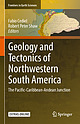
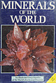
| Parfenov, Leonid M., Badarch, Gombosuren, Berzin, Nikolai A., Hwang, Duk-Hwan, Khanchuk, Alexander I., Kuzmin, Mikhail I., Nokleberg, Warren J., Obolenskiy, Alexander A., Ogasawara, Masatsugu, Prokopiev, Andrei V., Rodionov, Sergey M., Smelov, Alexander P., Yan, Hongquan (2009) Appendix B: Description of Map Units for Northeast Asia Summary Geodynamics Map. Professional Paper Vol. 1765 (1765b) US Geological Survey doi:10.3133/pp1765b | Report (issue) | | to 250 Ma)
ma Main granite belt (Late Jurassic, 144 to 134 Ma)
nb - Northern granite belt (Early Cretaceous...Verkhoyansk granite belt (Late Jurassic through
mid-Cretaceous, 157 to 93 Ma)
tr - Transverse granite belt (Early...that either contains or is favorable for the occurrence of a group of coeval and genetically related...following characteristics: (1) is favorable
for the occurrence of known or inferred mineral deposits of specific...delineation of areas that are favorable for the occurrence of specific deposit
types.
Metamorphic terrane | 👁 Image
| Parfenov, Leonid M., Badarch, Gombosuren, Berzin, Nikolai A., Hwang, Duk-Hwan, Khanchuk, Alexander I., Kuzmin, Mikhail I., Nokleberg, Warren J., Obolenskiy, Alexander A., Ogasawara, Masatsugu, Prokopiev, Andrei V., Rodionov, Sergey M., Smelov, Alexander P., Yan, Hongquan (2010) Introduction, Chapter 1 in Metallogenesis and tectonics of northeast Asia. Professional Paper 1765_1. US Geological Survey doi:10.3133/pp17651 | Report (issue) | | to 250 Ma)
ma Main granite belt (Late Jurassic, 144 to 134 Ma)
nb - Northern granite belt (Early Cretaceous...Verkhoyansk granite belt (Late Jurassic through
mid-Cretaceous, 157 to 93 Ma)
tr - Transverse granite belt (Early...that either contains or is favorable for the occurrence of a group of coeval and genetically related...following characteristics: (1) is favorable
for the occurrence of known or inferred mineral deposits of specific...delineation of areas that are favorable for the occurrence of specific deposit
types.
Metamorphic terrane |
|
