👁 Image
| | Journal (article/letter/editorial) |
| 2014
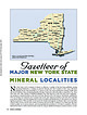
Figure 1. County map of New York State,
prepared by William Besse.
MAJOR NEW YORK STATE
M I N E...E R A L LOC A L I T I E S
N
ew York State is rich in minerals of interest to collectors. A number of...Dana 1877, 1892). Herbert P. Whitlock published a New York State list in 1903. The most recent comprehensive...localities in the state is the book Minerals of New York State by David Jensen, published in
1978. Our...Mode of Occurrence
Most mineral localities in New York can be categorized
into three groups based on |
👁 Image
| | Report (issue) |
| SURVEY
GEOKGE OTIS SMITH, Director
Bulletin 697
GYPSUM DEPOSITS OF THE
UNITED STATES
BY
R. W. STONE.......................
Mineralogy and geology of gypsum, by R. W. Stone.......................
Chemical.....................................
Analyses of gypsum, by R. W. Stone..................................in the chemical analysis of gypsum, by George Steiger............
The gypsum industry, by R. W. Stone.........
Cost of gypsum plaster...... I...................................
Uses of gypsum.............. |
👁 Image
| | Report (issue) |
| Prof. H. E. Gregory, Sheffield Scientific School, New Haven.
Delaware.........Prof. B. L. Miller, Lehigh...Tangier Smith, Berkeley, Cal.
New Jersey...... .Dr. H. B. Kummel, Trenton.
New York.........Mr. D. H. Newland...See Bauxite and Hallpysite.
Asbestos. Tallapoosa County, with corundum deposits near Dudleyville; not
found...commercial quantity or quality.
Asphalt. Colbert County, small quantity has been shipped from near Leighton;...following localities:
Bibb County, Pratts Ferry; Calhoun County, near Tampa; Clay County,
T. 20, Pv. 7 E.; Jefferson |
👁 Image
| | Journal (article/letter/editorial) |
| of Natural History
New York, New York 10024
The Triassic traprock quarries of New Jersey have been a...and supplement previous publications dealing
with New Jersey traprock* minerals, especially those of
Manchester...(1931)
cites more than 40 traprock localities in New Jersey. This
article focuses on the Bergen Hill occurrence...in the First
Watchung Mountain: Upper and Lower New Street quar
ries, Paterson; Warren Brothers quarry...(notably Rocky Hill
and Lambertville) and two Hudson County localities,
Laurel (Snake) Hill quarry, Secaucus |
👁 Image
| | Report (issue) |
| Vegas, Nev., in 1940 and the product
mixed with gypsum for plaster. About 1941, Lee Boyer, an assayer...writer is indebted to Eugene Callaghan, director of New
Mexico Bureau of Mines and Mineral Resources, for...and petrology
of perlite and information on the New Mexico deposits. Special
thanks are also due Aaron...i ~- i J i
TR 73 i
10,82
1. RhyoTitic perlite, 'New Zealand.. ^Washington, 1917, p, 73,')
2.. .Andesltic...(Wilson and Roseveare, 1945,- p.* 5.-)1
Gi*eenlee- County*
Undeveloped gray to black perlite^ associated |
👁 Image
| | Report (issue) |
| __ ........ - - - - ..... - ... - - . - ... .
Fayetteville shale ..... _..................... _..........----- ... ---------- 7 -- -.-·---------------------Gypsum ____________ . _. ___ .- ____ . _______ . _. ___............................. ~ .....•.....
Boone County .....•........... _....... _... _................•••••••••• _ ••••• _ •••••••••••••••••
66
Marion County ..................... __ . _... _.. _.. - .......Description of mines and prospects-Continued.
Marion County-Continued.
Page.
White Eagle _. _............. |
👁 Image
| | Report (issue) |
| ......
New Hampshire...........................................................
190
201
New Jersey............
New Mexico.............................................................
New York. ...........F. C. Schrader: Besides giving several
thousand new localities of mineral deposits and adding more than...especially from those of Arkansas, California, Colorado, New
Mexico, Oregon, South Dakota, Tennessee, and Texas;... S. Geol. Survey Bull. 126, 1895.
Jones, F. A., New Mexico mines and minerals, World's Fair edition, |
👁 Image
| | Report (issue) |
| 23 24 cies 28 23). 37 aero 30 oe ot 92 County. 65 ........ 70 Delaware 74 �CONFERENCE ...the Geological mapping Cherokee others of County. Map the of Oklahoma (1954) Flanks of the Ozark...in southern Delaware County and Hancock and Langton remapped northern Adair County. Their work is as yet...saltgera Thine norihera' exteion in IBN near Mayes County line, HALE PITKIN MISSISSIPPIAN CHESTERIAN ... MERAMECIAN [____]KINDERHOOKIAN SIL. FAYETTEVILLE Setigera,“inomroductus HINDSVILLE OSAGEAN DEV |
👁 Image
| | Report (issue) |
| ..................................
Addition of gypsum .....................................................
116
San Diego County ....................................
116
Orange County........................
117
Los Angeles County ..................................
117.
San Benito County ....................Costa counties......................
118
Sonoma County......................................
119
Bedding...222
222
222
225
226
227
227
229
229
230
230
231
New Jersey ......................................... |
👁 Image
| | Journal (article/letter/editorial) |
| Occurrence in
Carroll County, Georgia" (November/December 1988).
Banks County
184
ROCKS & MINERALS...Bentley provided many of the photographs.
Baldwin County
Milledgeville district—between the State Sanitarium...pit—east of S.R. 243 near the Baldwin-Wilkerson
County line: kaolinite (Martin and Stafford, 1972).
Cheatham...property—Route 3, Commerce, 4.8 km from the
�Jackson County line, 8 km east of Commerce on S.R. 59,
and 0.8...[University of Calgary] at 09:55 07 August 2017
Barrow County
Arnold mine—1.6 km northeast of Statham, near the |
👁 Image
| | Journal (article/letter/editorial) |
| left). Calcite, 5.5
cm high, Elmwood mine, Smith
County. Terry Huizing specimen,
Jeff Scovil photo.
Figure...(above). Fluorite, 13.1
cm wide, Elmwood mine, Smith
County. Francis Benjamin specimen, Jeff Scovil photo....Smith County. Terry Huizing
specimen and photo.
Figure 4 (right). Cumberland
mine, Smith County. Travis...and other nearby orebodies were discovered by the
New Jersey Zinc Company when it was exploring for zinc...earths to make saltpeter, at Nicojack
Cave in Marion County, then nitromagnesite at the same location (Shepard |
👁 Image
| | Report (issue) |
| ................................ 116
San Diego County............................................. 116.... 117
Los Angeles County...:...................................... 117
Kern County.................................................... 117
San Benito County. .......................................... 118..... 118
Sonoma County............................................... 119
Shasta County..................................................... 228
Kemper County. ..................................... 228
Noxubee |
👁 Image
| | Report (issue) |
| ______________________________________________
Gypsum.____________________________________________________...Ark.; B, Sandstone in the
Stanley shale in a railroad cut at Vandervoort, Ark_______
28
8. A, Polished....___-____-68
9. A, Stanley shale in Whitley railroad cut 2K miles south of
Gillham, Ark.; B, Pike gravel...2}^ miles south-southeast of Murfreesboro, Pike
County, Ark._______._____________-_-__-----_-----_-100...; B, Altered
volcanic breccia ("blue ground") in cut of Ozark mine near
Murfreesboro, Ark____________ |
👁 Image
| Gray, Henry H., Dawson, Thomas A., McGregor, Duncan, Jr., Perry, Thomas G., Wayne, William J (1957) Rocks Associated with the Mississippian-Pennsylvanian Unconformity in Southwestern Indiana. Guidebook 9. Indiana Geological Survey | Report (issue) |
| -8
No. 2. State Route 64 and
U. S. 460 east to New Albany--------------35
Saturday, October 5, 1957;...-------------------------- -10
4. Railroad cut at National Gypsum Co. plant near Shoals (Stop 3)----...Figure 1. Profile of west side of railroad cut at National Gypsum Co.
plant near Shoals (Stop 3) ---...14
2. Profile of quarry wall at abandoned Martin County Highway
Department quarry (Stop 5) -----------... 20
3. Profile of northwest side of cut along Southern Railroad
1 mile west of Taswell (Stop 10) --- |
👁 Image
| | Report (issue) |
| period___________________
Sylvania and Lucas submergence
Onondaga submergence
Hamilton submergence
Portage and Chagrin...Ledges on Tinkers Creek just west of Pennsylvania Railroad
bridge.______________________________________________...Berea sandstone on Bedford red shale in cut
on Belt Line Railroad 2 miles southwest of Brooklyn____
56
8...mile below Little York; B, Sharpsville sandstone
on Brandywine Creek at Little York._____________.
56... Geauga County___ ___ _____
56
10. View in road cut a short distance north of the quarry shown in
Plate |
👁 Image
| | Book |
| applied of Murray's observation. time have defined new units, subdivided existing other names which seem...for formations in the states of Michigan, Ohio, New York and Wisconsin. When two names of local and/or...D. R. Burgess, is indebted W. Fisher, New York State Geological Survey; Dr. H. S. McMaster...Lucas Marcellus Norfolk and Pre-Norfolk Olentangy Onondaga Oriskany Petrolia Springvale Sylvania Thunder...recognized resemblance of the fauna found it as Onondaga. (ibid.,p.148) concluded the Devonian) of |
👁 Image
| | Report (issue) |
| place. With the completion of the new Billings and Northern Railroad, which passes near some of the best...observed is situated
in the eastern part of Cascade County, which is located near the center
of Montana. It...corner of the area. The Billings and Northern Railroad extends
diagonally across it, and the Neihart...an exact measurement of its thickness. In a
railroad cut on the north side of Williams Creek near the...described, on the
north side of Otter Creek, another railroad cut exposes a deposit of
slate-colored clay about |
👁 Image
| | Report (issue) |
| Gigantopteris flora in
parts of Texas, Oklahoma, and New Mexico,
equivalent zone of Glenopteris spp. in Kansas...Kansas,
and equivalent zone of the Supaia flora in
New Mexico and Arizona.-----.----------The Supaia fl...region
These are the Supaia flora of Arizona and New Mexico, the
Olenopteris flora of Kansas and the Grigantopteris...Grigantopteris flora of
Texas, Oklahoma, and New Mexico. The third and youngest
zone, containing a modified...into other fields. In 1956, while on a visit to
New Mexico, Dr. Reeside again urged that a report
summarizing |
👁 Image
| | Journal (article/letter/editorial) |
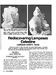
| is 7 cm across.
Rediscovering Lampasas
LAMPASAS COUNTY, TEXAS
During the summer of 1989, the author and...surrounding counties. Since that time, more
than sixty new occurrences have been found.
JOE LOBELL
713 Fifteenth...SURROUNDING the city of Lampasas,
Texas (and the county of the same name), has long been
recognized as...Antonio. Considered in this article are Lampasas County and portions of the nearby
counties of Brown, Mills...
and Williamson.
�1
7
-
I,
Anhydrite and/or gypsum
Pyrite and marcasite
Suggested sequence
of mineralization |
👁 Image
| | Report (issue) |
| GEOLOGY AND COAL, OIL, AND GAS BESOUECES
OF THE NEW KENSINGTON QUADRANGLE
PENNSYLVANIA
BY
G. B. RICHARDSON...region _______________________
Oil and gas in the New Kensington quadrangle--.___.._-__---______
General...--__--_--Records of deep wells in areas adjacent to the New Kensington
quadrangle- _ _____-___---__---_--__-...sands, Dorseyville field....
Records of wells in the New Kensington quadrangle_______________
Index....___________________...ILLUSTRATIONS
Page
PLATE 1. Geologic map of the New Kensington quadrangle __________ In
2. Map showing |
👁 Image
| | Journal (article/letter/editorial) |
| it
includes some world-class localities, such as gypsum crystals
from Ellsworth and flint from Flint Ridge...having
been updated and combined with data from new sites.
306
ROCKS & MINERALS
OCCURRENCES
Concretions...at
mouth of Silver Creek near Edinburg, Portage
County.
Figure 1 (left). Rosanna Carlson sitting in dolostone...septarium, Copperas Mountain near Spargursville,
Ross County. Ernest Carlson photo.
Figure 3. Map showing mineral...indicators of salinity conditions (e.g.,
nodular gypsum forms in waters of high salinity).
Some concretions |
👁 Image
| | Journal (issue) |
| create Lake Arthur in Moraine State Park, Butler County. View
is to the southeast. The future lake bottom...is
most obvious where the Western Allegheny Railroad cut passes
through it, near the center of the photograph...dam sites are located in this photograph. Old and
new (to bypass the future lake) U.S. Route 422, respectively...Department of Energy. We are participating in a new U.S. Geological Survey (USGS) program
called Earth...projects funded through the USGS STATEMAP program. Our new elevation-derived
hydrography program is advancing; |
👁 Image
| | Book |
| of record in New York
sean
a
rT
|
Jurassic
OS
Rc TTRATISTT strata
record in New York
area indicates...A. Liberty
Jaan Terasmae
State University of New York Press
Albany
�A grant from
the University Awards...University
of New
York
and the Research Foundation of State University of New York assisted in paying...by State University of New York Press, Albany
©1981
State University of New York
All rights reserved...
For information, address State University of New York Press, State University Plaza,
Albany, N.Y., |
👁 Image
| | Book |
| CONDITIONS
UNIVEBSITY OF
DEPT. OF RURAL ECONOMICS
FAYETTEVILLE,
BY
JIM G. FERGUSON
COMMISSIONER OF
MINES...Rare and Useful Minerals
Diamond Cave of Newton County
107
108
:
Soils
Surveys
in Arkansas,
and...............
55
Blue Granite Quarry, Pulaski County
58
St.
Bauxite Mine
41
.
Manganese Mine
...Mar* on County
106
Interior Diamond Cave, Newton
........................................
County ......'State
State Geologist, Dr. Gilbert H. Cady, Fayetteville.
State Geological Survey, Thos. C. McRae, Governor |
👁 Image
| Clark, Timothy W., Taylor, Kenneth B., include, Philip J. Bradley Stops (2011) Geology, Natural Gas Potential, and Mineral Resources of Lee, Chatham, and Moore Counties, North Carolina. Field Trip Guidebook. Carolina Geological Society | Report (issue) |
| and small amounts of limestone and
chert (and gypsum in cuttings from several
wells).Bedding generally...investigations included detailed geologic mapping, no new map units were produced.
Hoffman and Gallagher (1989)...well, V. R. Groce #1 well) show nodular
and bedded gypsum associated with light brown to red
shales and conglomerates...lithofacies system in the
southern Durham basin (Cary, New Hill, Cokesbury,
Apex, and Fuquay-Varina 7.5-minute...coarse-grained to gravelly matrix. An arbitrary
cut-off of greater than 50 percent conglomerate distinguishes |
