👁 Image
| | Journal (issue) | | Searles Lake, San Bernardino County. Allan Young collection. Botryoidal Cinnabar, New Idria District, San...Nikolaevskiy Mine, Dalnegorsk, Dalnegorsk Urban District, Primorsky Krai, Russia consisting of a group...Quartz from the Whiteman Creek area, Vernon, British Columbia, Canada. Two specimens of Fluorite with...Quartz from the Whiteman Creek area, Vernon, British Columbia, Canada. 3.5 cm across. Dylan Trevors collection...cm in size, associated with Grossular and Quartz from the Merrill Prospect, Coyote Front Range, Inyo County; | 👁 Image
| | Book | | ��MINERALS of the GRENVILLE PROVINCE New York, Ontario, and Quebec ��George W. Robinson I Jeffrey Chiarenzelli...Uranophanc, Faraday (Madawaska) mine, Bancroft, Ontario. 3 cm tall. Photo by Michael Bainbridge. �CONTENTS...rocks stretching from Labrador to southeastern Ontario, into 1ew York State, and beyond. Because of their...all who haw followed in his footsteps is that the area is extraordinarily rich in minerals, from both an...field guides to mineral localities in southeastern Ontario and Quebec. While these are useful to find specific | 👁 Image
| | Report (issue) | | Olivenite, 1.6-cm cluster, Majuba Hill Mine, Antelope district, Pershing County.
N. Prenn collection. Photograph...Loneliest Road
and Geologic Tours in the Las Vegas Area.
�Digitized by the Internet Archive
In 2022 with... Davis
The Goodsprings (Yellow Pine)
Mining District, Clark County
John C. Kepper
91
References
...Mountain Mine
Quartz, Lovelock area
Acanthite
Grossular, Nightingale district
Quartz epimorph after Calcite...Calcite
Agardite
Grossular, Buena Vista district
Quartz (amethyst) and Calcite
Almandine-Spessartine | 👁 Image
| | Report (issue) | | Olivenite, 1.6-cm cluster, Majuba Hill Mine, Antelope district, Pershing County. N, Prenn collection. Photograph...Loneliest Road and Geologic Tours in the Las Vegas Area. �Digitized by the Internet Archive in 2023 with...A. Davis The Goodsprings (Yellow Pine) Mining District, a Mineral 108 C. Jensen Collectibles Nevada...Quartz, Acanthite Grossular, Nightingale district Quartz epimorph Agardite Grossular, Almandine-Spessartine...Opal Arsenolite Aurichalcite with Buena Vista district Kalinite Hemimorphite Kazakhstanite Azurite | 👁 Image
| | Journal (issue) | | June a heavy rain revealed that this mineralized area contained prehnite balls (exceeding 1 inch in diameter)...of the wall was cracked by the blasting in this
area and was very dangerous. The fault zone lay 1 to...the prehnite tube. The first person to find the area collected some
of the prehnite and was then injured...Arizona mineral museum has
an extensive ‘bruised’ area in the center which resulted from the
specimen falling...quickly got into what appeared to be another pockety area, and after careful blasting opened a pocket of the | 👁 Image
| Theodore, Ted G., Blair, Will N., Nash, J. Thomas, McKee, E.H., Antweiler, J.C., Campbell, W.L. (1987) Geology and gold mineralization of the Gold Basin-Lost Basin mining districts, Mohave County, Arizona, with a section on K-Ar chronology of mineralization and igneous activity, and a section on implications of the compositions of lode and placer gold. Professional Paper 1361. US Geological Survey doi:10.3133/pp1361 | Report (issue) | | from King Tut placer
workings, Lost Basin mining district.
�Geology and Gold Mineralization of the
Gold...103
Composition of lode gold from the Lost Basin district - - - 105
Composition of gold from mines in Gold...Index map showing area of study -------------------------------------2. Sketch map of area of Gold Basin-Lost...reported to contain gold mineralization in the general area of the Black Mountains volcanic
province of Liggett...quartz-cored pegmatite- --------------43. Equal-area projection showing orientation of poles to veins | 👁 Image
| | Report (issue) | | te, r.6-cm cluster, Majuba Hill Mine, Antelope district, Pershing County.
N. Prenn coJlection. Photograph...Loneliest Road
and Geologic Tours in th<' Las Vegas Area.
Mining and the discovery, identification,
and...A. Vavis
The Goodsprings (Yellow Pine)
Mining District, Clark County
John C. Kepper
MINERAL CATALOG...Round Mountain Mine
Grossular, Nightingale district
Grossular, Buena Vista district
Gypsun1
Heterogen ite...Magnesio-axinite
Malachite
Malachite and Azurite,
Robinson district
Malachite after Azurite,
Mount Potosi
Marcasite | 👁 Image
| | Journal (issue) | | December 1984 ROCKHOUSE BASIN WILDERNESS STUDY AREA Understanding California’s Geology - Our Resources...counties. The mineral resource potential of this area is described in an article beginning on p. 263....Cover: View northward toward Rockhouse Basin, an area along the crest Division Headquarters. 1416 Ninth...RESOURCE POTENTIAL OF THE ROCKHOUSE WILDERNESS STUDY AREA ..... SHASTINA — A VOLCANIC CONE OF MOUNT SHASTA...Wilderness KERN AND TULARE COUNTIES by Study Area SEQUOIA GARY C. TAYLOR, Geologist Department of | 👁 Image
| | Book (volume) | | Angeles to Boston, as
well as Toronto and Ottawa in Canada and Paris, France, proved
to be invaluable sources...Sweden, are
more numerous than Maine's, as well. An area smaller than
Oxford County in Murmansk Ob last,... is arguably the most important gem-pegmatite district in North America. Its wealth of
tourmalines, morganites...individuals who have no
experience outside of their home area. The first specimen that
they see is by definition...Canadian Museums of Science
and Nature, Ottawa, Ontario, Canada
Department of Geology, Colby College, Waterville | 👁 Image
| | Book (volume) | | is not common in the metasedimentary rocks of the area
which host these species, but "reasonably good"...Mount Malosa, Chilwa alkaline province, Zomba district.
"Illite" is the name of a series of incompletely...Pezzotta and Zorzi (2008).
ILMENITE
UNITED STATES and CANADA
BRITISH COLUMBIA
Ice River complex. The Ice River...uli11111
of Mi11eml Discm•t•ries, /960--20/ 5
ONTARIO
Bentley Lake Road occurrence, Faraday Township, Hastings...vein-dike digging site
which they called the Bentley Lake Road occurrence, south of
Bancroft. Sharp, flattened | 👁 Image
| | Journal (article/letter/editorial) | | omitted from locality
information. Where lot and district numbers are given, it is
necessary to use topographic...the photographs.
Baldwin County
Milledgeville district—between the State Sanitarium and
the Oconee River:...property—near Commerce: ferrocolumbite (Cook,
1978).
Lula district—Standridge property, about 7.0 km east of
Lula:...sericite, vermiculite (Furcron, 1960c).
Maysville area—T. J . Carr farm (1899), 1.6 km from Maysville:...(chryso
lite, olivine) (Teague, 1956).
Jefferson district—9.7 km southwest of Jefferson on S.R.
11, northwest | 👁 Image
| | Book (volume) | | Canadian Museums of Science
and Nature, Ottawa, Ontario, Canada
Department of Geology, Colby College, Waterville...Department of Mineralogy, Royal Ontario Museum, Toronto,
Ontario, Canada
Department of Mineralogy, Yale...Venetia Frew, Roxbury, Maine
Bob Gait, Toronto, Ontario, Canada
Clyde Galarneau, Casco, Maine
Ann Puls ifer...Jersey
Frank C. Hawthorne, Winnipeg, Manitoba, Canada
Mike Hubinsky, Rochester, New York
Cornelius S...Northfield, Vermont
Willow Wight, Toronto, Ontario, Canada
Leonard Wilson, Minneapolis, Minnesota
Neil | 👁 Image
| | Journal (issue) | | Angeles, CA
Joseph A. Mandarino
Royal Ontario Museum
Toronto, Ontario
Steven R. Morehead
Riverside, CA
Donald...Ann Arbor, Ml
Andrew C. Roberts
Geol. Surv. of Canada
Ottawa
George W. Robinson
Seaman Mineral Museum...Pfenninger-Horvath
594 Main Road
Hudson, Quebec, Canada JOP 1H0
Robert A. Gault
Research Division
Canadian...Ottawa, Ontario, Canada K IP 6P4
Peter Tarassoff
91 Lakeshore Road
Beaconsfield, Quebec, Canada H9W 4H8...River (latitude: 45°39' N; longitude: 73° 17' W; Canada National
Topographic System, Map 31 H /ll , Beloeil) | 👁 Image
| | Journal (article/letter/editorial) | | Mineral Locality Index
300
T
ennessee covers an area of 41,220 square
miles in the southeastern United...City zinc district, the Bumpass Cove iron-zinc-manganese district, the Sweetwater barite district, and the...deposits. The Ducktown copper district represents the most complex mining
district and contains the largest...SW of Oak Ridge: maghemite (Monger 1986).
Moore prospect, 4.5 miles SSE of Norris: calcite, chalcopyrite...sphalerite (Maher and Finlayson
1965).
Oak Ridge area, on Black Oak Ridge: barite; 0.5 mile W
of Bull | 👁 Image
| | Journal (issue) | | Ml
George W. Robinson
Natl. Museums of Canada
Ottawa, Ontario
Abraham Rosenzweig
Tampa PL
Associate Photographers...DeMouthe
Famous mineral localities: The Magdalena
district, Kelly, New Mexico .............................Hammond
Famous mineral localities: The Hansonberg
district, Bingham, New Mexico ...........................covers not just the Kelly mine but the Mag
dalena district as a whole.
This is not to say, of course, that...containing little more than a million people in an area
roughly as large as New England, New York and New | 👁 Image
| | Journal (issue) | | Angeles, CA
Joseph A. Mandarino
Royal Ontario Museum
Toronto, Ontario
Steven R. Morehead
Green Valley, AZ...Ann Arbor, MI
Andrew C. Roberts
Geol. Surv. of Canada
Ottawa
George W. Robinson
Seaman Mineral Museum...Articles
Famous mineral localities: The Bishop copper prospect near Lynch Station,
Campbell County, Virginia...to get a quick image of the entire flatbed
glass area, including your subject. On the Preview screen,...the
plus-shaped cursor at the upper-left of the area immediately around
the subject, then left-click-and-hold | 👁 Image
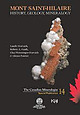
| | Book | | Mineralogical
Association of Canada
Association mineralogique
du canada
14
�Also in this series
Encyclopedia...(1998)
J. Delvigne
Mineral Species Discovered in Canada
and Species Named after Canadians
Special Publication...F. Martin
c 2019 Mineralogical Association of Canada
All rights reserved. No part of this publication...publishers.
Printed in Canada on acid-free paper
Library and Archives Canada Cataloguing in Publication...(1962-)
Published by the Mineralogical Association of Canada
ISBN: 978-0-921294-61-0
1. Mont Saint-Hilaire, | 👁 Image
| | Book (edition) | | only about distance from a
better known town in the area but also about the administrative regional units...dept. (departement),
dept. (departamento), dist. (district). Less common
terms are not abbreviated, e.g....cases of the USA, UK, and the provinces
Ontario and Quebec in Canada, generally well known
to readers. However...gold-bearing "greenstone" in Abitibi
province in northern Ontario and Quebec. Some genetic problems still remain...California, in fine crystals in talc near Wenatchee
Lake, Chelan co., Washington, also at Sulzer, Prince | 👁 Image
| | Book (volume) | | varying depositional environments throughout the district as well as to have the ability to put any listed...unique, among overviews of the mineralogy of an area in that a great percentage is based on personal...collected it -when and where – what else was in the same area – who else owned the rock. All of this he recorded...exploration visit to a formally specimen productive area. And too, one of us (RWG III) had the great good...any mineralogical study and is without doubt the area most subject to error. So often, while studying | 👁 Image
| | Journal (issue) | | Geol. Surv. of Canada
Ottawa
George W. Robinson
Natl. Museums of Canada
Ottawa, Ontario
Abraham Rosenzweig...T. R. Rose & R. E. Holden, Jr.
Minerals of the Prospect Intrusion,
New South Wales, Australia ..........Microminerals
Miscellany from France, the Eifel district,
and Mont Saint-Hilaire ........................could begin capping on a small scale in critical area:
if the collector community does not make itself...octezum a m ine (M ex
ico), Cleaning M inerals, Lake
Baikal (R ussia), T ilasite (Bisb ee), M inas G | 👁 Image
| | Book (edition) | | OF ARIZONA �W:ilftnite. Red Cloud mine, Silver district, Trigo Mountains, La Paz County, Ariv;na. Smithsonian...Hydrothermal Deposits The Bisbee District, Cochise County 64 The Tombstone District, Cochise County 70 The Mammoth-St...80 Monument Valley 81 63 78 =vii �The Cameron Area 85 Breccia Pipes 87 Pegmatites 88 ''l\1ine Fire"...Navajo County 84 Secondary minerals in the Cameron area, Coconino County 86 Arizona minerals found only...augmented; a discussion of the classical Tombstone district has been inserted between those of Bisbee and | 👁 Image
| | Book (edition) | | ARIZONA
•
�Wu!fenite. Red Cloud mine, Si/...Hydrothermal Deposits
63
The Bisbee District, Cochise County
64
The Tombstone District, Cochise County
70
The Mammoth-St...Deposits
80
Monument Valley
81
-
•
Vll
�The Cameron Area
85
Breccia Pipes
87
Pegmatites
88
"Mine Fire" Minerals...Navajo County
84
Secondary minerals in the Cameron area, Coconino County
86
Arizona minerals found only...augmented; a discussion of the classical
Tombstone district has been inserted between those of Bisbee and | 👁 Image
| | Book | | Macmillan of Canada
Division of Canada Publishing Corporation
164 Commander Boulevard
Agincourt, Ontario MIS 3C7...3C7, Canada
15
14
13 12 11
10 9 8 7
6 5 4 3 2 1
The endsheet maps are reprinted from The Mexican...Smithsonian Institution; Royal Ontario Museum; National Museum of Canada; University of Paris; National...square kilometers (760,365 square miles) of land
area of which slightly more than 60 percent is mountainous...Guanajuato and Zimapan in the state of Hidalgo.
The area has good potential for future production of mineral | 👁 Image
| | Book (edition) | | OF ARIZONA
�Wulfenite. Red Cloud mine, Silver district, Trigo Mountains, La Paz County,
Arizona. Smithsonian...her
Conn
pmngertne Pid teente bomen, Ol
sae]
BAY
eas
ett Woe hates Fie he ;
:
f
+A
=
�CONTENTS...Hydrothermal Deposits
The Bisbee District, Cochise County
64
70
The Tombstone District, Cochise County
The Mammoth-St...Monument Valley
81
63
78
il S:
�The Cameron Area
85
Breccia Pipes
87
Pegmatites
88
“Mine Fire”...Navajo County
84
Secondary minerals in the Cameron area, Coconino County
Arizona minerals found only in | 👁 Image
| | Report (issue) | | Gavilanes Tungsten District
Figure 2.
El Antimonio District
Figure 3.
Magdalena District
Figure 4.
Cananea...Cananea District
�Preliminary Deposit-Type Map of Northwestern Mexico
Kenneth R. Leonard
Introduction
The...and the northern part of Chihuahua,
Mexico. The area is important for the evaluation or mineral deposits...or to a group of closely-spaced deposits. Two district records have
been included (MX00018 and MX02161)...or names of individual
orebodies.
DISTRICT/AREA
Informal district name used in the literature. Names |
|
