
Yellowstone Volcano Observatory
Find U.S. Volcano
Learn More
Learn More
Settings
Map Legend
Map Legend
Current Updates and Notifications
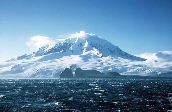
Yellowstone
The Yellowstone Volcano Observatory (YVO) is a consortium of nine state and federal agencies who provide timely monitoring and hazard assessment of volcanic, hydrothermal, and earthquake activity in the Yellowstone Plateau region. The USGS arm of YVO is also responsible for monitoring and reporting on volcanic activity in the intermountain west U.S. states.
Young Volcanoes in AZ, CO, MT, NM, UT and WY
High Threat Potential 1
Yellowstone
Moderate Threat Potential 1
Black Rock Desert Volcanic Field
Dotsero Volcanic Center
San Francisco Volcanic Field
Valles Caldera
Low to Very Low Threat Potential 1
Carrizozo Lava Flow
Markagunt Plateau Volcanic Field
Red Hill-Quemado Volcanic Field
Uinkaret Volcanic Field
Zuni-Bandera Volcanic Field
1. View the threat rankings of US Volcanoes.
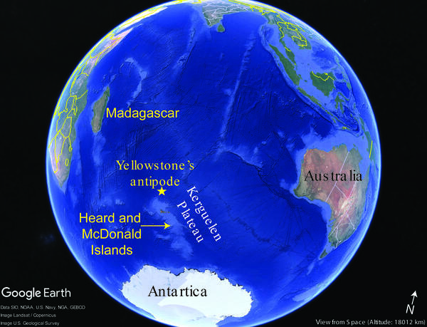
Volcanism on the other side of the world from the Yellowstone Caldera
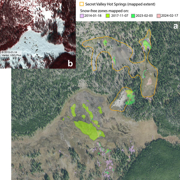
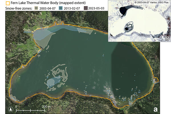
Mapping snow- and ice-free zones to monitor thermal activity in Yellowstone using high-resolution commercial satellite imagery
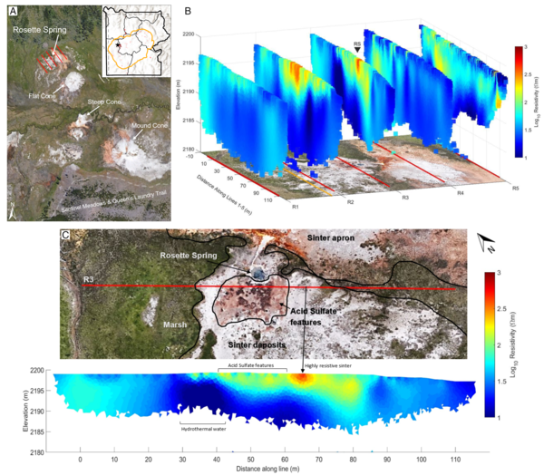
Hot Spring Cleaning!
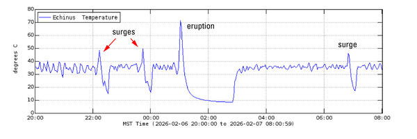
The first instrumentally detected hydrothermal explosion in Yellowstone National Park The first instrumentally detected hydrothermal explosion in Yellowstone National Park
Magmatic volatiles in the Yellowstone Plateau volcanic field: The knowns, the unknowns, and the uncertainties Magmatic volatiles in the Yellowstone Plateau volcanic field: The knowns, the unknowns, and the uncertainties
Lithium from magma to mine in an early Yellowstone hotspot caldera Lithium from magma to mine in an early Yellowstone hotspot caldera
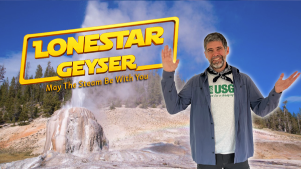
Many with arms raised standing in front of am erupting geyser with forest and blue sky in the background
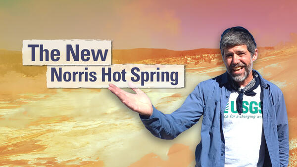
Man gesturing in front of a barren landscape with title "The New Norris Hot Spring"
Thumbnail image of a man standing outside holding up his hands and speaking in front of a forest
Young Volcanoes in AZ, CO, MT, NM, UT and WY
High Threat Potential 1
Yellowstone
Moderate Threat Potential 1
Black Rock Desert Volcanic Field
Dotsero Volcanic Center
San Francisco Volcanic Field
Valles Caldera
Low to Very Low Threat Potential 1
Carrizozo Lava Flow
Markagunt Plateau Volcanic Field
Red Hill-Quemado Volcanic Field
Uinkaret Volcanic Field
Zuni-Bandera Volcanic Field
1. View the threat rankings of US Volcanoes.