
Confins | |
|---|---|
City | |
| 👁 Partial view of Confins Partial view of Confins | |
| 👁 Location in Minas Gerais Location in Minas Gerais | |
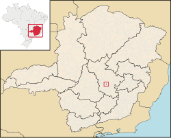
Location in Brazil | |
| Coordinates: 19°37′45″S 43°59′30″W / 19.62917°S 43.99167°W / -19.62917; -43.99167 | |
| Country | 👁 Image Brazil |
| Region | Southeast |
| State | Minas Gerais |
| Mesoregion | Metropolitan of Belo Horizonte |
| Microregion | Belo Horizonte |
| Incorporated | December 21, 1995 |
| Government | |
| • Mayor | Geraldo Gonçalves dos Santos |
| Area | |
• Total | 16,219 sq mi (42,008 km2) |
| Population (2020 [2]) | |
• Total | 6,800 |
| Time zone | UTC−3 (BRT) |
| Area code | 31 |
| HDI (2010) [3] | 0.747 |
| Website | Official Website |
Confins is a Brazilian municipality located in the state of Minas Gerais. Its population as of 2020 is estimated to be 6,800 people. The area of the municipality is 42.008 km2 (16.219 sq mi). The city belongs to the mesoregion Metropolitana de Belo Horizonte and to the microregion of Belo Horizonte. It is home of the international airport of Belo Horizonte, Tancredo Neves International Airport.
See also
[edit]References
[edit]- ^ "Área territorial oficial" [Official Territorial Area] (in Portuguese). Brazilian Institute of Geography and Statistics (IBGE). 2002-10-10. Archived from the original on 2012-01-06. Retrieved 2010-12-05.
- ^ IBGE 2020
- ^ "Ranking decrescente do IDH-M dos municípios do Brasil" [Ranking of HDI-M of Brazilian Municipalities] (PDF) (in Portuguese). United Nations Development Programme (UNDP). 2010. Retrieved 2013-08-03.
External links
[edit]
Retrieved from "https://en.wikipedia.org/w/index.php?title=Confins&oldid=1326378460"
Hidden categories:
- Pages using gadget WikiMiniAtlas
- CS1 Portuguese-language sources (pt)
- Articles with short description
- Short description is different from Wikidata
- Coordinates on Wikidata
- All articles with dead external links
- Articles with dead external links from July 2020
- Articles with permanently dead external links
- All stub articles