
Garmsar County
Persian: شهرستان گرمسار | |
|---|---|
| 👁 Alborz Mountains Alborz Mountains | |
| 👁 Location of Garmsar County in Semnan Province (left, yellow) Location of Garmsar County in Semnan Province (left, yellow) | |
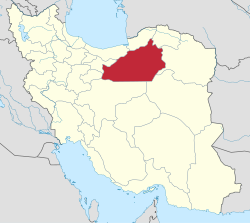
| 👁 Location of Semnan province in Iran Location of Semnan province in Iran | |
| Coordinates: 35°00′N 52°11′E / 35.000°N 52.183°E / 35.000; 52.183[1][2] | |
| Country | 👁 Image Iran |
| Province | Semnan |
| Capital | Garmsar |
| Districts | Central, Eyvanki |
| Population (2016)[3] | |
• Total | 77,421 |
| Time zone | UTC+3:30 (IRST) |
| Garmsar County can be found at GEOnet Names Server, at this link, by opening the Advanced Search box, entering "9206418" in the "Unique Feature Id" form, and clicking on "Search Database". | |
Garmsar County (Persian: شهرستان گرمسار) is in Semnan province, Iran. Its capital is the city of Garmsar.[4]
History
[edit]In 2011, Aradan District was separated from the county in the establishment of Aradan County.[5]
Demographics
[edit]Languages
[edit]The main languages of the county are Persian (Central District) and Tati (Eyvanki District).[6]
Population
[edit]At the time of the 2006 National Census, the county's population was 77,676 in 21,706 households.[7] The following census in 2011 counted 81,324 people in 24,858 households.[8] The 2016 census measured the population of the county as 77,421 in 25,585 households.[3]
Administrative divisions
[edit]Garmsar County's population history and administrative structure over three consecutive censuses are shown in the following table.
| Administrative Divisions | 2006[7] | 2011[8] | 2016[3] |
|---|---|---|---|
| Central District | 49,071 | 50,892 | 60,258 |
| Howmeh RD | 3,285 | 3,554 | 4,072 |
| Lajran RD | 6,895 | 6,353 | 7,514 |
| Garmsar (city) | 38,891 | 40,985 | 48,672 |
| Aradan District[a] | 15,418 | 15,575 | |
| Kohanabad RD | 4,745 | 3,768 | |
| Yateri RD | 5,714 | 6,181 | |
| Aradan (city) | 4,959 | 5,626 | |
| Eyvanki District | 13,187 | 14,857 | 17,163 |
| Eyvanki RD | 2,791 | 2,862 | 3,645 |
| Eyvanki (city) | 10,396 | 11,995 | 13,518 |
| Total | 77,676 | 81,324 | 77,421 |
| RD = Rural District | |||
See also
[edit]👁 Wikimedia Commons logo
Media related to Garmsar County at Wikimedia Commons
Notes
[edit]- ^ Transferred to Aradan County[5]
References
[edit]- ^ OpenStreetMap contributors (27 January 2026). "دهستان لجران, بخش مرکزی گرمسار [Lajran Rural District, Central District of Garmsar], Garmsar County, Semnan Province, Iran" (Map). OpenStreetMap (in Persian). Retrieved 27 January 2026.
- ^ "8H7J252M+28" (Map). Google Maps. Retrieved 27 January 2026.
- ^ a b c سرشماري عمومي نفوس و مسكن 1395 : استان سمنان [General Population and Housing Census 2016: Semnan Province]. مرکز آمار ایران [Statistical Centre of Iran] (in Persian). Archived from the original (Excel) on 17 November 2020. Retrieved 19 December 2022.
- ^ Habibi, Hassan (12 September 1990) [تاریخ تصویب (Approval date) 1369/06/21 (Iranian Jalali calendar)]. تصویب سازمان و سلسله تابعیت عناصر و واحدهای تقسیمات کشوری استان سمنان به مرکزیت شهر سمنان [Approval of the organization and chain of citizenship of the elements and units of the national divisions of Semnan province, centered in Semnan city]. لام تا کام [Lam ta Kam] (in Persian). وزارت کشور [Ministry of the Interior]. کمیسیون سیاسی دفاعی هیأت دولت [Political Defense Commission of the Government Board]. شناسه [ID] 6E990373-75CA-4068-833E-25F3268CCDCE. شماره دوره [Course number] 69, شماره جلد [Volume number] 3. Archived from the original on 2 January 2024. Retrieved 24 January 2026.
- ^ a b Rahimi, Mohammad Reza (7 August 2011) [تاریخ تصویب (Approval date) 16/5/1390 (Iranian Jalali calendar)]. تصویبنامه در خصوص ایجاد شهرستان آرادان به مرکزیت شهر آرادان در تابعیت استان سمنان [Approval decree regarding the establishment of Aradan County with the city of Aradan as its center in Semnan province]. مرکز پژوهشهای مجلس شورای اسلامی ایران [Research Center of the Islamic Consultative Assembly of Iran] (in Persian). وزارت کشور [Ministry of the Interior]. هیات وزیران [Council of Ministers]. پیشنهاد شماره [Proposal No.] 50184/42/4/1. Archived from the original on 16 September 2011. Retrieved 24 January 2026.
- ^ Eyvanki area: Tati language (in Persian)
- ^ a b سرشماري عمومي نفوس و مسكن 1385 : استان سمنان [General Population and Housing Census 2006: Semnan Province]. مرکز آمار ایران [Statistical Centre of Iran] (in Persian). Archived from the original (Excel) on 20 September 2011. Retrieved 25 September 2022.
- ^ a b سرشماري عمومي نفوس و مسكن 1390 : استان سمنان [General Population and Housing Census 2011: Semnan Province]. Iran Data Portal—Syracuse University (in Persian). مرکز آمار ایران [Statistical Centre of Iran]. Archived from the original (Excel) on 20 January 2023. Retrieved 19 December 2022.
- Pages using gadget WikiMiniAtlas
- CS1 Persian-language sources (fa)
- Articles containing Persian-language text
- CS1 uses Persian-language script (fa)
- Articles with short description
- Short description matches Wikidata
- Use dmy dates from January 2023
- Short description is different from Wikidata
- Coordinates on Wikidata
- Commons category link from Wikidata