 |
VOOZH | about |
|
VOOZH | about |
| 👁 Image |
| Description |
|---|
| Used for roads and road-related facilities. 👁 Show/edit corresponding data item. |
| Group: highways |
| Used on these elements |
| Documented values: 71 |
| Status: approved👁 Page for proposal |
| Tools for this tag |
The key =* is the main key used for identifying any kind of road, street or path. The value of the key helps indicate the importance of the highway within the road network as a whole. See the table below for an ordered list from most important (motorway) to least important (service).
See the international highway classification equivalence for how different countries apply these tags to their own road networks.
Note that =* distinguishes roads by function and importance rather by their physical characteristic and legal classification. Usually these things are highly correlated, but OSM is not obligated to copy official road classifications.
This key is also used for features like bus stops, service areas, pedestrian crossings and other highway related things (see below).
Note that while it can be confusing this key is also used for tagging paths, lamp posts, bus stops, not only major roads.
We have about a dozen-and-a-half examples for urban road tagging, with photos.
See below for details of commonly used values:
| Key | Value | Element | Comment | Rendering carto | Examples | |
|---|---|---|---|---|---|---|
Roads | ||||||
|
This group lists the 7 main tags for the road network, from most to least functionally important for motor vehicle traffic. | ||||||
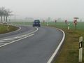
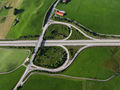
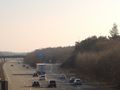
| motorway | 👁 way |
A restricted access major divided highway, normally with 2 or more running lanes plus emergency hard shoulder. Equivalent to the Freeway, Autobahn, etc.. | ||||
| highway | trunk | 👁 way |
The most important roads in a country's system that aren't motorways. (Need not necessarily be a divided highway.) |
| ||
| highway | primary | 👁 way |
The next most important roads in a country's system. (Often link larger towns.) |
| ||
| highway | secondary | 👁 way |
The next most important roads in a country's system. (Often link towns.) |
| ||
| highway | tertiary | 👁 way |
The next most important roads in a country's system. (Often link smaller towns and villages) |
| ||
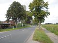
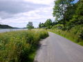
| highway | unclassified | 👁 way |
The least important through roads in a country's system – i.e. minor roads of a lower classification than tertiary, but which serve a purpose other than access to properties. (Often link villages and hamlets.)
The word 'unclassified' is a historical artefact of the UK road system and does not mean that the classification is unknown; you can use |
| ||
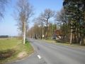
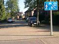
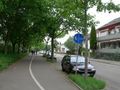
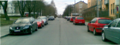
| highway | residential | 👁 way |
Roads which serve as an access to housing, without function of connecting settlements. Often lined with housing. |
| ||
Link roads | ||||||
| highway | motorway_link | 👁 way |
The link roads (sliproads/ramps) leading to/from a motorway from/to a motorway or lower class highway. Normally with the same motorway restrictions. | |||
| highway | trunk_link | 👁 way |
The link roads (sliproads/ramps) leading to/from a trunk road from/to a trunk road or lower class highway. | |||
| highway | primary_link | 👁 way |
The link roads (sliproads/ramps) leading to/from a primary road from/to a primary road or lower class highway. | |||
| highway | secondary_link | 👁 way |
The link roads (sliproads/ramps) leading to/from a secondary road from/to a secondary road or lower class highway. | |||
| highway | tertiary_link | 👁 way |
The link roads (sliproads/ramps) leading to/from a tertiary road from/to a tertiary road or lower class highway. | |||
Special road types | ||||||
| highway | living_street | 👁 way |
For living streets, which are residential streets where pedestrians have legal priority over cars, speeds are kept very low. | |||
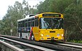
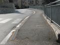
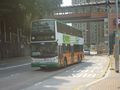
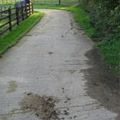
| highway | service | 👁 way 👁 area |
For access roads to, or within an industrial estate, camp site, business park, car park, alleys, etc. Can be used in conjunction with service=* to indicate the type of usage and with access=* to indicate who can use it and in what circumstances.
|
|||
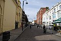
| highway | pedestrian | 👁 way 👁 area |
For roads used mainly/exclusively for pedestrians in shopping and some residential areas which may allow access by motorised vehicles only for very limited periods of the day. To create a 'square' or 'plaza' create a closed way and tag as pedestrian and also with area=yes.
|
|||
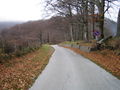
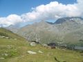
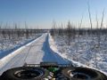
| highway | track | 👁 way |
Roads for mostly agricultural or forestry uses. To describe the quality of a track, see tracktype=*. Note: Although s are often rough with unpaved surfaces, this tag is not describing the quality of a road but its use. Consequently, if you want to tag a general use road, use one of the general values instead of .
|
|||
| highway | bus_guideway | 👁 way |
A busway where the vehicle guided by the way (though not a railway) and is not suitable for other traffic. Please note: this is not a normal bus lane, use access=no, psv=yes instead! If the buses are not guided, consider =busway.
|
|||
| highway | escape | 👁 way |
For runaway truck ramps, runaway truck lanes, emergency escape ramps, or truck arrester beds. It enables vehicles with braking failure to safely stop. | |||
| highway | raceway | 👁 way |
A course or track for (motor) racing | |||
| highway | road | 👁 way |
A road/way/street/motorway/etc. of unknown type. It can stand for anything ranging from a footpath to a motorway. This tag should only be used temporarily until the road/way/etc. has been properly surveyed. If you do know the road type, do not use this value, instead use one of the more specific =* values.
|
|||
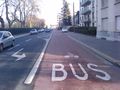
| highway | busway | 👁 way |
A dedicated roadway for bus rapid transit systems | |||
Paths | ||||||
| footway | 👁 way 👁 area |
For designated footpaths; i.e., mainly/exclusively for pedestrians. This includes walking tracks and gravel paths. If bicycles are allowed as well, you can indicate this by adding a bicycle=yes tag. Should not be used for paths where the primary or intended usage is unknown. Use =pedestrian for pedestrianised roads in shopping or residential areas and =track if it is usable by agricultural or similar vehicles. For ramps (sloped paths without steps), combine this tag with incline=*.
|
||||
| highway | bridleway | 👁 way |
For horse riders. Pedestrians are usually also permitted, cyclists may be permitted depending on local rules/laws. Motor vehicles are forbidden. | |||
| highway | steps | 👁 way |
For flights of steps (stairs) on footways. Use with step_count=* to indicate the number of steps
|
|||
| highway | corridor | 👁 way |
For a hallway inside of a building. | |||
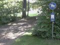
| highway | path | 👁 way |
A non-specific path. Use =footway for paths mainly for walkers, =cycleway for one also usable by cyclists, =bridleway for ones available to horse riders as well as walkers and =track for ones which is passable by agriculture or similar vehicles.
|
|||
| highway | via_ferrata | 👁 way |
A via ferrata is a route equipped with fixed cables, stemples, ladders, and bridges in order to increase ease and security for climbers. These via ferrata require equipment : climbing harness, shock absorber and two short lengths of rope, but do not require a long rope as for climbing. | |||
When sidewalk/crosswalk is tagged as a separate way | ||||||
| footway | sidewalk | 👁 way |
Sidewalk that runs typically along residential road. Use in combination with =footway or =path
|
|||
| footway | crossing | 👁 way |
Crosswalk that connects two sidewalks on the opposite side of the road. Often recognized by painted markings on the road, road sign or traffic lights. Use in combination with =footway or =path. Useful information is presence of tactile_paving=*, wheelchair=* suitability and kerb=* represented as a node on the crosswalk way.
|
|||
| footway | traffic_island | 👁 way |
The way between two crossings, safespot for pedestrians, has micromapping characteristics as a detailed alternative to =*. Use in combination with =footway or =path.
|
|||
When sidewalk (or pavement) is tagged on the main roadway (see Sidewalks) | ||||||
| sidewalk | both | left | right | no | 👁 way |
Specifies that the highways has sidewalks on both sides, on one side or no sidewalk at all | |||
When cycleway is drawn as its own way (see Bicycle) | ||||||
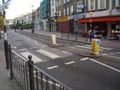
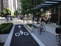
| highway | cycleway | 👁 way |
For designated cycleways. Add foot=*, though it may be avoided if default-access-restrictions do apply.
|
|||
Cycleway tagged on the main roadway or lane (see Bicycle) | ||||||
| cycleway | lane | 👁 way |
A lane is a route that lies within the roadway | |||
| cycleway | 👁 way |
Deprecated variant for ways with oneway=yes where it is legally permitted to cycle in both directions. Replaced by oneway:bicycle=no.
|
||||
| cycleway | 👁 way |
Deprecated variant for ways with oneway=yes that have a cycling lane going the opposite direction of normal traffic flow (a "contraflow" lane). Replaced by oneway:bicycle=no + cycleway:left=lane/cycleway:right=lane + cycleway:left:oneway=-1/cycleway:right:oneway=-1.
|
||||
| cycleway | track | 👁 way |
A track provides a route that is separated from traffic. In the United States, this term is often used to refer to bike lanes that are separated from lanes for cars by pavement buffers, bollards, parking lanes, and curbs. Note that a cycle track may alternatively be drawn as a separate way next to the road which is tagged as =cycleway.
|
|||
| cycleway | 👁 way |
Deprecated variant for ways with oneway=yes that have a cycling track going the opposite direction of normal traffic flow. Replaced by oneway:bicycle=no + cycleway:left=track/cycleway:right=track + cycleway:left:oneway=-1/cycleway:right:oneway=-1.
|
||||
| cycleway | share_busway | 👁 way |
There is a bus lane that cyclists are permitted to use. | |||
| cycleway | 👁 way |
Deprecated variant for ways with oneway=yes that have a bus lane that cyclists are also permitted to use, and which go in the opposite direction to normal traffic flow (a "contraflow" bus lane). Replaced by oneway:bicycle=no + cycleway:left=share_busway/cycleway:right=share_busway + cycleway:left:oneway=-1/cycleway:right:oneway=-1.
|
||||
| cycleway | shared_lane | 👁 way |
Cyclists share a lane with motor vehicles, there are markings reminding about this. In some places these markings are known as "sharrows" ('sharing arrows') and this is the tag to use for those. | |||
Busways tagged on the main roadway or lane (see Bus lanes) | ||||||
| lane | 👁 way |
Deprecated variant to tag bus lanes. Replaced by bus/psv lane tagging lanes:bus=* / lanes:psv=*) / bus:lanes=* / psv:lanes=*
|
||||
| opposite | 👁 way |
Deprecated variant for ways with oneway=yes where buses are legally permitted to travel in both directions. Replaced by oneway:bus=no
|
||||
| opposite_lane | 👁 way |
Deprecated variant for ways with oneway=yes that have a bus lane which go in the opposite direction to normal traffic flow (a "contraflow" bus lane). Replaced by oneway:bus=no and lanes:bus=* / lanes:psv=*) / bus:lanes=* / psv:lanes=*
|
||||
Street parking tagged on the main roadway (see Street parking) | ||||||
parking:left / :right / :both(hereafter: ) |
lane | street_side | on_kerb | half_on_kerb | shoulder | no | separate | yes | 👁 way |
Primary key to record parking along the street. Describes the parking position of parked vehicles in the street. | |||
orientation=*
|
parallel | diagonal | perpendicular | 👁 way |
To specify the orientation of parked vehicles if there is street parking. | |||
Lifecycle (see also lifecycle prefixes) | ||||||
| highway | proposed | 👁 way |
For planned roads, use with proposed=* and a value of the proposed highway value.
|
|||
| highway | construction | 👁 way |
For roads under construction. Use construction=* to hold the value for the completed road.
|
|||
Attributes | ||||||
| abutters | commercial | industrial | mixed | residential | retail etc. | 👁 way |
See Key:abutters for more details. | |||
| bicycle_road | yes | 👁 way |
A bicycle road is a road designated for bicycles. If residential streets get the status of bicycle roads, normally, by special signs, motor traffic is admitted with limited speed, often only for residents. | |||
| bus_bay | both | left | right | 👁 way |
A bus bay outside the main carriageway for boarding/alighting | |||
| change | yes | no | not_right | not_left | only_right | only_left | 👁 way |
Specify the allowed/forbidden lane changes | |||
| destination | <place name of destination> | 👁 way |
Destination when following a linear feature | |||
| embankment | yes | dyke | 👁 way |
A dyke or a raised bank to carry a road, railway, or canal across a low-lying or wet area. | |||
| embedded_rails | yes | <type of railway> | 👁 way |
A highway on which non-railway traffic is also allowed has railway tracks embedded in it but the rails are mapped as separate ways. | |||
| ford | yes | 👁 node 👁 way |
The road crosses through stream or river, vehicles must enter any water. | |||
| frontage_road | yes | 👁 way |
A frontage road. | |||
| ice_road | yes | 👁 way |
A highway is laid upon frozen water basin, definitely doesn't exist in summer. | |||
| incline | Number % | ° | up | down | 👁 node 👁 way |
Incline steepness as percents ("5%") or degrees ("20°"). Positive/negative values indicate movement upward/downwards in the direction of the way. | |||
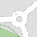
| junction | roundabout | 👁 way 👁 closed way |
This automatically implies oneway=yes, the oneway direction is defined by the sequential ordering of nodes within the Way. This applies on a way, tagged with =* already.
|
|||
| lanes | <number> | 👁 way |
The number of traffic lanes for general purpose traffic, also for buses and other specific classes of vehicle. | |||
| lane_markings | yes | no | 👁 way |
Specifies if a highway has painted markings to indicate the position of the lanes. | |||
| lit | yes | no | 👁 node 👁 way 👁 area |
Street lighting | |||
| maxspeed | <number> | 👁 way |
Specifies the maximum legal speed limit on a road, railway or waterway. | |||
| motorroad | yes | no | 👁 way 👁 node |
The motorroad tag is used to describe highways that have motorway-like access restrictions but that are not a motorway. | |||
| mountain_pass | yes | 👁 node |
The highest point of a mountain pass. | |||
| mtb:scale | 0-6 | 👁 way |
Applies to =path and =track. A classification scheme for mtb trails (few inclination and downhill).
|
|||
| mtb:scale:uphill | 0-5 | 👁 way |
A classification scheme for mtb trails for going uphill if there is significant inclination. | |||
| mtb:scale:imba | 0-4 | 👁 way |
The IMBA Trail Difficulty Rating System shall be used for bikeparks. It is adapted to mtb trails with artificial obstacles. | |||
| mtb:description | Text | 👁 way |
Applies to =path and =track. A key to input variable infos related to mtbiking on a way with human words
|
|||
| oneway | yes | no | reversible | 👁 way |
Oneway streets are streets where you are only allowed to drive in one direction. | |||
| oneway:bicycle | yes | no | | 👁 way |
Used on ways with oneway=yes where it is legally permitted to cycle in both directions.
|
|||
| overtaking | yes | no | caution | both | forward | backward | 👁 way |
Specifying sections of roads where overtaking is legally forbidden. Use overtaking:forward=yes/no/caution and overtaking:backward=yes/no/caution when it depends on driving direction.
|
|||
| parallel | diagonal | perpendicular | marked | no_parking | no_stopping | fire_lane. | 👁 way |
Deprecated variant to map parking along streets. See section on street parking above or the street parking page for more details. | ||||
| free | ticket | disc | residents | customers | private | 👁 way |
Deprecated variant to map parking conditions along streets. See section on street parking above or the street parking page for more details. | ||||
| passing_places | yes | 👁 way |
A way which has frequent passing places (See also: =passing_place)
|
|||
| priority | forward | backward | 👁 way |
Traffic priority for narrow parts of roads, e.g. narrow bridges. | |||
| priority_road | designated | yes_unposted | end | 👁 way |
Specifying roads signposted as priority roads. | |||
| sac_scale | strolling | hiking | mountain_hiking | demanding_mountain_hiking | alpine_hiking | demanding_alpine_hiking | difficult_alpine_hiking | 👁 way |
Applies to =path and =footway. A classification scheme for hiking trails.
|
|||
| service | alley | driveway | parking_aisle etc. | 👁 way |
See Key:service for more details. | |||
| shoulder | no | yes | right | both | left | 👁 way |
Presence of shoulder in highway | |||
| side_road | yes | 👁 way |
A side road. | |||
| smoothness | excellent | good | intermediate | bad | very_bad | horrible | very_horrible | impassable | 👁 way 👁 area |
Specifies the physical usability of a way for wheeled vehicles due to surface regularity/flatness. See Key:smoothness for more details. | |||
| surface | paved | unpaved | asphalt | concrete | paving_stones | sett | cobblestone | metal | wood | compacted | fine_gravel | gravel | pebblestone | plastic | grass_paver | grass | dirt | earth | mud | sand | ground | 👁 way |
See Key:surface for more details. | |||
| tactile_paving | yes | no | 👁 node 👁 way 👁 area |
A paving in the ground to be followed with a blindman's stick. | |||
| tracktype | grade1 | grade2 | grade3 | grade4 | grade5 | 👁 way |
To describe the quality of the surface. See Key:tracktype for more information. | |||
| traffic_calming | bump | hump | table | island | cushion | yes | etc. | 👁 node 👁 way |
Features used to slow down traffic. See Key:traffic calming for more details. | |||
| trail_visibility | excellent | good | intermediate | bad | horrible | no | 👁 way |
Applies to =path, =footway, =cycleway and =bridleway. A classification for hiking trails visibility
|
|||
| trailblazed | yes | no | poles | cairns | symbols | 👁 way |
Applies to =*. Describing trail blazing and marking. See Key:trailblazed for more information.
|
|||
| trailblazed:visibility | excellent | good | intermediate | bad | horrible | no | 👁 way |
Applies to trailblazed=*. A classification for visibility of trailblazing. See Key:trailblazed:visibility for more information.
|
|||
| turn | left | slight_left | through | right | slight_right | merge_to_left | merge_to_right | reverse | 👁 way |
The key turn can be used to specify the direction in which a way or a lane will lead. | |||
| width | <number> | 👁 way |
The width of a feature. | |||
| winter_road | yes | 👁 way |
A highway functions during winter, probably can't be driven in summer. | |||
Other highway features | ||||||
| bus_stop | 👁 node |
A small bus stop. Optionally one may also use public_transport=stop_position for the position where the vehicle stops and public_transport=platform for the place where passengers wait.
|
||||
| highway | crossing | 👁 node |
A.k.a. crosswalk. Pedestrians can cross a street here; e.g., zebra crossing | |||
| highway | cyclist_waiting_aid | 👁 node |
Street furniture for cyclists that are intended to make waiting at esp. traffic lights more comfortable. | |||
| highway | elevator | 👁 node 👁 way |
An elevator or lift, used to travel vertically, providing passenger and freight access between pathways at different floor levels. | |||
| highway | emergency_bay | 👁 node 👁 way |
An area beside a highway where you can safely stop your car in case of breakdown or emergency. | |||
| highway | emergency_access_point | 👁 node |
Sign number which can be used to define your current position in case of an emergency. Use with ref=NUMBER_ON_THE_SIGN. See also emergency=access_point
|
|||
| highway | give_way | 👁 node |
A "give way," or "Yield" sign | |||
| emergency | phone | 👁 node |
A calling device can be used to tell on your current position in case of an emergency. Use with ref=NUMBER_ON_THE_SIGN
|
|||
| hitchhiking | 👁 node |
Like a bus_stop but for free, uncertain, spontaneous rides with strangers. | ||||
| highway | ladder | 👁 node 👁 way |
A vertical or inclined set of steps or rungs intended for climbing or descending of a person with the help of hands. | |||
| highway | milestone | 👁 node |
Highway location marker | |||
| highway | mini_roundabout | 👁 node |
Similar to roundabouts, but at the center there is either a painted circle or a fully traversable island. In case of an untraversable center island, junction=roundabout should be used.
Rendered as anti-clockwise by default |
|||
| highway | motorway_junction | 👁 node |
Indicates a junction (UK) or exit (US). ref=* should be set to the exit number or junction identifier. (Some roads – e.g., the A14 – also carry junction numbers, so the tag may be encountered elsewhere despite its name)
|
|||
| highway | passing_place | 👁 node |
The location of a passing space | |||
| highway | platform | 👁 node 👁 way 👁 area |
A platform at a bus stop or station. | |||
| highway | rest_area | 👁 node 👁 area |
Place where drivers can leave the road to rest, but not refuel. | |||
| highway | services | 👁 node 👁 area |
A service station to get food and eat something, often found at motorways | |||
| highway | speed_camera | 👁 node |
A fixed road-side or overhead speed camera. | |||
| highway | speed_display | 👁 node |
A dynamic electronic sign that displays the speed of the passer-by motorist. | |||
| highway | stop | 👁 node |
A stop sign | |||
| highway | street_lamp | 👁 node |
A street light, lamppost, street lamp, light standard, or lamp standard is a raised source of light on the edge of a road, which is turned on or lit at a certain time every night | |||
| highway | toll_gantry | 👁 node |
A toll gantry is a gantry suspended over a way, usually a motorway, as part of a system of electronic toll collection. For a toll booth with any kind of barrier or booth see: barrier=toll_booth
|
|||
| highway | traffic_mirror | 👁 node |
Mirror that reflects the traffic on one road when direct view is blocked. | |||
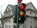
| highway | traffic_signals | 👁 node |
Lights that control the traffic | |||
| highway | trailhead | 👁 node |
Designated place to start on a trail or route | |||
| highway | turning_circle | 👁 node |
A turning circle is a rounded, widened area usually, but not necessarily, at the end of a road to facilitate easier turning of a vehicle. Also known as a cul de sac. | |||
| highway | turning_loop | 👁 node |
A widened area of a highway with a non-traversable island for turning around, often circular and at the end of a road. | |||
| highway | User Defined | 👁 node 👁 way |
All commonly used values according to Taginfo | |||
tertiary road on Highway Tag Africa=track + surface=asphalt + tracktype=grade1Only motorway and motorway_link indicate quality. Other road types, from trunk to tertiary to residential, service, path, footway, cycleway or track, do not imply anything about road quality, only importance and intended main use.
In a region with poor infrastructure, a road of highest importance, forming the main road network there, should be trunk, regardless of being a high-quality wide asphalt road or a low-quality narrow track worse than service in other regions. Examples include the Kolyma Highway (P-504) and the Vilyuy Highway (A-331) in the Russian Far East, and a long stretch of the Trans-Amazonian Highway (BR-230) and BR-319 in the North Region of Brazil.
A typical primary can also vary drastically between different regions on the planet. Some primary roads in parts of Africa, Asia, South America, Canada, Alaska, Australia and Iceland are unpaved. Examples include the Anadyr Highway (A-384) in the Russian Far East and the Juba–Rumbek Road (route 69) in South Sudan.
It is highly recommended to add tags describing road quality, such as surface=*. In one region, it may be obvious that all tertiary roads are paved and all track ways are not paved, but this kind of assumption does not work worldwide. Tagging at least some common values allows building a set of default values for each area.
In the absence of surface=*, tracktype=* and other tags describing road quality, one may try to extrapolate this information from the value of the highway tag. This should be fine-tuned for each region.
road=*🔎
| ||||||||||||||||
.jpg)
.jpg)
_-_geo-en.hlipp.de_-_11914.jpg)
.jpg)
.svg)
_heading_NW.jpg)
.jpg)
.jpg)