Latitude & Longitude (WGS84):
34° 4' 37'' North , 115° 42' 2'' West
Latitude & Longitude (decimal):
Long-form identifier:
mindat:1:2:88268:3
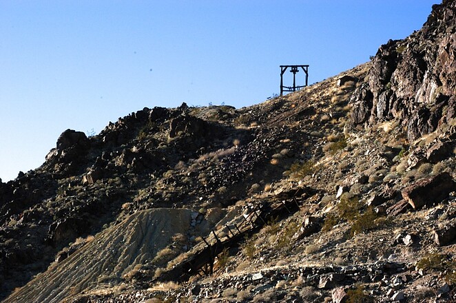
A former Au-Ag-Pb-Bi-Cu-Sb-As occurrence/mine located in sec. 11, T1S, R12E, SBM, 3.5 km (2.2 miles) NNE of New Dale, on private (patented) and federal land. The property is comprised of 8 claims, 4 of which are patented. Operated during the period 1936-1939 by the Carlyle Mining Corporation and during the period 1940 by Camco Mining Company. Last operated in 1941. MRDS database stated accuracy for this location is 10 meters. Detailed descriptions of the workings and ore treatment in the milling plant, see Tucker and Sampson (1943).
Mineralization is hosted in granodiorite and diorite. The ore body is shoots in form, strikes N15E and dips 75W at a thickness of 1.83 meters. Controls for ore emplacement included a fault fissure. The vein is 6 to 12 feet thick along a fault. The ore shoot is 6 feet thick. Local rocks include Mesozoic granitic rocks, unit 3 (Sierra Nevada, Death Valley area, Northern Mojave Desert and Transverse Ranges).
Workings include underground openings comprised of a 1,200 foot adit driven S along thge vein. 5 ore shoots were encountered. One is 100 feet long and 6 feet thick and was stoped to surface, a maximum height of 200 feet. Raises were also driven to surface at 480 feet and 580 feet from the adit portal. A winze was sunk 680 feet from the portal with 200 feet and 250 feet of drifts at the 30 foot and 80 foot levels, respectively.
Production data are found in: Wright (1953).
Production statistics: Year: 1939 (period = 1936-1939) ore mined: 13,046.55 metric tons. Grade (estimated): ^Au, Ag and Pb from 13,256 tons of ore. No other production record was found.
Analytical data results: average of $12 (period values) per ton in Au from an ore shoot 60 feet long and 6 feet thick. Au values on the hanging wall and high-grade Ag ore reported on the footwall. The mill was erected sometime after 1915. Values in Au, Ag & Pb by means of a jig, flotation cells and a concentrating table. Mill heads reported to carry $10-$20 (period values) Au/ton & $3-$6 (period values) Ag/ton.
Select Mineral List Type
Standard
Detailed Gallery
Strunz
Chemical Elements
Mineral List
6 valid minerals.
Gallery:
List of minerals arranged by Strunz 10th Edition classification
List of minerals for each chemical element
Other Databases
Other Regions, Features and Areas containing this locality
This page contains all mineral locality references listed on mindat.org. This does not claim to be a complete list. If you know of more minerals from this site, please
register so you can add to our database. This locality information is for reference purposes only. You should never attempt to
visit any sites listed in mindat.org without first ensuring that you have the permission of the land and/or mineral rights holders
for access and that you are aware of all safety precautions necessary.
References
Mindat.org® is an outreach project of the
Hudson Institute of Mineralogy, a 501(c)(3) not-for-profit organization. Mindat® and mindat.org® are registered trademarks of the Hudson Institute of Mineralogy.
Copyright © mindat.org and the Hudson Institute of Mineralogy 1993-2026, except where stated. Most political location boundaries are
© OpenStreetMap contributors. Mindat.org relies on the contributions of thousands of members and supporters. Founded in 2000 by
Jolyon Ralph and Ida Chau.
To cite: Ralph, J., Von Bargen, D., Martynov, P., Zhang, J., Que, X., Prabhu, A., Morrison, S. M., Li, W., Chen, W., & Ma, X. (2025). Mindat.org: The open access mineralogy database to accelerate data-intensive geoscience research. American Mineralogist, 110(6), 833–844.
doi:10.2138/am-2024-9486.
Privacy Policy -
Terms & Conditions -
Contact Us / DMCA issues -
Report a bug/vulnerability
Current server date and time: April 4, 2026 12:28:39
Page updated: August 15, 2025 13:03:16
